

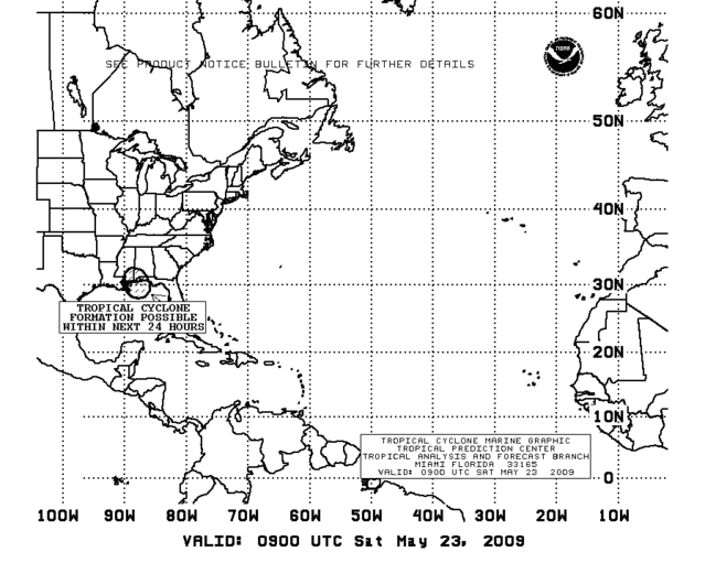
GOM: INVEST 90L
Moderator: S2k Moderators
-
cycloneye

- Admin

- Posts: 139083
- Age: 67
- Joined: Thu Oct 10, 2002 10:54 am
- Location: San Juan, Puerto Rico
Re: GOM: INVEST 90L
The Tafb graphic and Tropical Weather Discussion were made prior to the Special Tropical Weather Outlook and that is why you can see the difference in the information.
0 likes


Re: GOM: INVEST 90L
Looks good to me. I hope they upgrade, even if only a technicality--makes little difference at this point.
0 likes
-
Ed Mahmoud
Re: GOM: INVEST 90L
I think it made either TD or STD. Now we wait until December to see where they spot the ball based on instant replay.
23 to 26 knot winds offshore at the various buoys
23 to 26 knot winds offshore at the various buoys
0 likes
-
wxman57

- Moderator-Pro Met

- Posts: 22482
- Age: 66
- Joined: Sat Jun 21, 2003 8:06 pm
- Location: Houston, TX (southwest)
Re: GOM: INVEST 90L
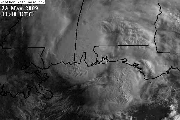
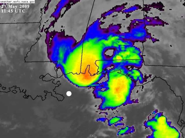
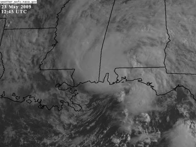
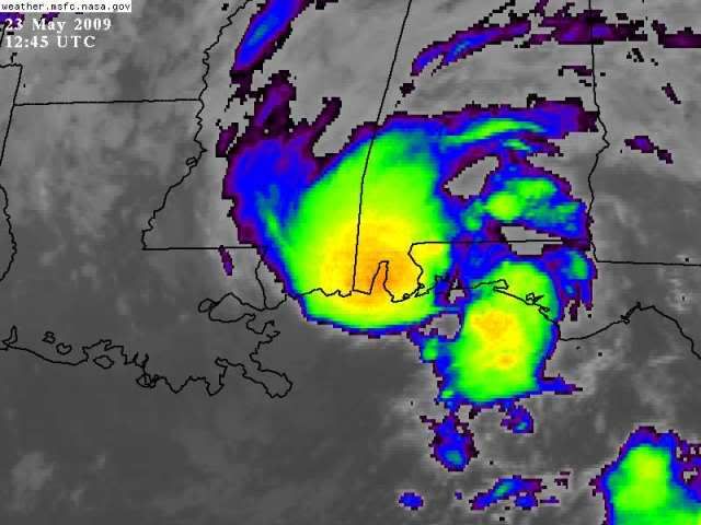
I think some of you are being fooled by a single area of squalls well-removed from a broad, weak low center. There's no low near the area of squalls. The actual low center is a little southeast of the mouth of the Mississippi, about 60 miles south of the storms that moved inland a few hours ago. So no upgrade today, no storms near broad center now, and it's moving ashore.
0 likes

-
cycloneye
- Admin
- Posts: 139083
- Age: 67
- Joined: Thu Oct 10, 2002 10:54 am
- Location: San Juan, Puerto Rico
Re: GOM: INVEST 90L
0 likes
-
wxman57
- Moderator-Pro Met
- Posts: 22482
- Age: 66
- Joined: Sat Jun 21, 2003 8:06 pm
- Location: Houston, TX (southwest)
Re: GOM: INVEST 90L
It's history now. But the NHC does have a history of naming "A" storms after they move inland. 
0 likes
-
tolakram
- Admin
- Posts: 19165
- Age: 60
- Joined: Sun Aug 27, 2006 8:23 pm
- Location: Florence, KY (name is Mark)
Re: GOM: INVEST 90L

Last edited by tolakram on Sat May 23, 2009 7:58 am, edited 1 time in total.
0 likes
-
tolakram
- Admin
- Posts: 19165
- Age: 60
- Joined: Sun Aug 27, 2006 8:23 pm
- Location: Florence, KY (name is Mark)
Re: GOM: INVEST 90L
Fort Morgan:
http://www.wunderground.com/weatherstat ... ?ID=MFMOA1
Dauphin Island (eastern edge):
http://www.wunderground.com/weatherstat ... ?ID=MDILA1
0 likes
-
attallaman
Re: GOM: INVEST 90L
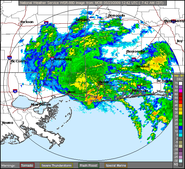
All's quiet here in Biloxi, where's the storm? Can I expect to receive any heavy rain later today or not?
0 likes

-
Dean4Storms
- S2K Supporter

- Posts: 6355
- Age: 61
- Joined: Sun Aug 31, 2003 1:01 pm
- Location: Miramar Bch. FL
BULLETIN - EAS ACTIVATION REQUESTED
SEVERE THUNDERSTORM WARNING
NATIONAL WEATHER SERVICE MOBILE AL
844 AM CDT SAT MAY 23 2009
THE NATIONAL WEATHER SERVICE IN MOBILE HAS ISSUED A
* SEVERE THUNDERSTORM WARNING FOR...
SOUTHWESTERN MOBILE COUNTY IN SOUTHWEST ALABAMA...
* UNTIL 915 AM CDT
* AT 844 AM CDT...THE PUBLIC REPORTED A LINE OF VERY STRONG WINDS
ASSOCIATED WITH A BAND OF SHOWERS AND ISOLATED THUNDERSTORMS
IN EXCESS OF 60 MPH. THE LEADING EDGE OF THESE WINDS WERE LOCATED
ALONG A LINE EXTENDING FROM BAYOU LA BATRE TO SAINT ELMO TO
IRVINGTON...AND MOVING NORTHWEST AT 15 MPH.
* THE DAMAGING WINDS WILL BE NEAR...
I10 AND MCDONALD ROAD BY 845 AM CDT...
GRAND BAY BY 905 AM CDT...
DEES BY 915 AM CDT...
PRECAUTIONARY/PREPAREDNESS ACTIONS...
DAMAGING WINDS ESTIMATED UP TO 60 MPH WERE REPORTED AT ALABAMA PORT
WITH A MACROBURST...AND TORE BARK OF TREES AND THREW AROUND OTHER
UNSECURED ITEMS. THIS IS A DANGEROUS STORM...SEEK SAFE SHELTER AND
STAY AWAY FROM WINDOWS!
0 likes
-
Dean4Storms
- S2K Supporter
- Posts: 6355
- Age: 61
- Joined: Sun Aug 31, 2003 1:01 pm
- Location: Miramar Bch. FL
Who is online
Users browsing this forum: No registered users and 97 guests