After a lull in the invests around the world,finnally a invest to track!
BEGIN
NHC_ATCF
invest_al942009.invest
FSTDA
R
U
040
010
0000
200907041215
NONE
NOTIFY=ATRP
END
INVEST, AL, L, , , , , 94, 2009, DB, O, 2009070412, 9999999999, , , , , , METWATCH, , AL942009
AL, 94, 2009070312, , BEST, 0, 314N, 431W, 30, 1012, EX, 0, , 0, 0, 0, 0,
AL, 94, 2009070318, , BEST, 0, 316N, 419W, 30, 1012, EX, 0, , 0, 0, 0, 0,
AL, 94, 2009070400, , BEST, 0, 317N, 407W, 30, 1011, EX, 0, , 0, 0, 0, 0,
AL, 94, 2009070406, , BEST, 0, 318N, 396W, 35, 1010, EX, 34, NEQ, 90, 90, 0, 0,
AL, 94, 2009070412, , BEST, 0, 319N, 386W, 35, 1009, EX, 34, NEQ, 90, 90, 0, 0,
ftp://ftp.tpc.ncep.noaa.gov/atcf/tcweb/ ... 009.invest
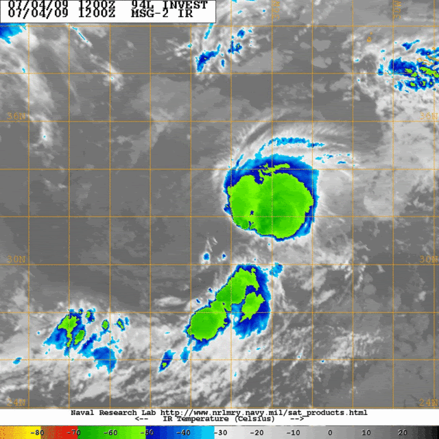
Best Track at 12 UTC:
Position=Latitud,31.9N - Longitud,38.6W.
Winds=35 kts.
Pressure=1009 mbs.
System=Extratropical.
ATL : INVEST 94L
Moderator: S2k Moderators
-
cycloneye

- Admin

- Posts: 139028
- Age: 67
- Joined: Thu Oct 10, 2002 10:54 am
- Location: San Juan, Puerto Rico
ATL : INVEST 94L
0 likes

-
littlevince

- S2K Supporter

- Posts: 768
- Joined: Fri Oct 21, 2005 10:45 am
- Location: Portugal
Re: ATL : INVEST 94L
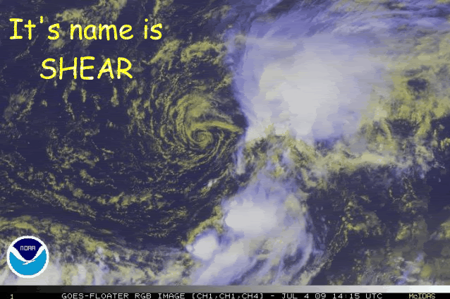
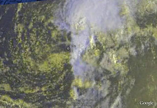
Convection still well organized but completely ripped apart from low level circulation

0 likes


-
tolakram
- Admin
- Posts: 19165
- Age: 60
- Joined: Sun Aug 27, 2006 8:23 pm
- Location: Florence, KY (name is Mark)
Re: ATL : INVEST 94L
http://www.ssd.noaa.gov/goes/flt/t1/flash-vis.html
The circulation appears to be moving toward the south, into warmer waters.
The circulation appears to be moving toward the south, into warmer waters.
0 likes
-
jaxfladude
- Category 5

- Posts: 1246
- Joined: Wed Aug 24, 2005 9:36 pm
- Location: Jacksonville, Fla

-
Annie Oakley

- Category 5
- Posts: 1103
- Joined: Tue Jul 31, 2007 12:54 pm
- Location: Texas
-
HURAKAN

- Professional-Met

- Posts: 46086
- Age: 37
- Joined: Thu May 20, 2004 4:34 pm
- Location: Key West, FL
- Contact:
352
ABNT20 KNHC 041810
TWOAT
TROPICAL WEATHER OUTLOOK
NWS TPC/NATIONAL HURRICANE CENTER MIAMI FL
200 PM EDT SAT JUL 4 2009
FOR THE NORTH ATLANTIC...CARIBBEAN SEA AND THE GULF OF MEXICO...
SHOWERS AND THUNDERSTORMS CONTINUE IN ASSOCIATION WITH A
NON-TROPICAL AREA OF LOW PRESSURE LOCATED ABOUT 725 MILES SOUTHWEST
OF THE AZORES. HOWEVER...UPPER-LEVEL WINDS ARE EXPECTED TO REMAIN
UNFAVORABLE FOR DEVELOPMENT OF THIS SYSTEM AS IT MOVES EASTWARD
NEAR 10 MPH TOWARD COOLER WATERS. THERE IS A LOW CHANCE...LESS
THAN 30 PERCENT...OF THIS SYSTEM BECOMING A TROPICAL OR SUBTROPICAL
CYCLONE DURING THE NEXT 48 HOURS.
ELSEWHERE...TROPICAL CYCLONE FORMATION IS NOT EXPECTED DURING THE
NEXT 48 HOURS.
$$
FORECASTER BEVEN
0 likes

-
george_r_1961

- S2K Supporter
- Posts: 3171
- Age: 62
- Joined: Sat Oct 12, 2002 9:14 pm
- Location: Hampton, Virginia
Re: ATL : INVEST 94L
Of the INVESTS ive seen so far this year, this one IMO has the poorest chance of development.
Five percent would be generous.
Five percent would be generous.
0 likes
Who is online
Users browsing this forum: No registered users and 72 guests