neospaceblue wrote:Also, didn't Polo have a 10-20 mile radius of TS-force winds?
25 miles
http://www.nhc.noaa.gov/archive/2008/POLO.shtml?
Moderator: S2k Moderators


neospaceblue wrote:Also, didn't Polo have a 10-20 mile radius of TS-force winds?


HURAKAN wrote:neospaceblue wrote:Also, didn't Polo have a 10-20 mile radius of TS-force winds?
25 miles
http://www.nhc.noaa.gov/archive/2008/POLO.shtml?
Ptarmigan wrote:HURAKAN wrote:
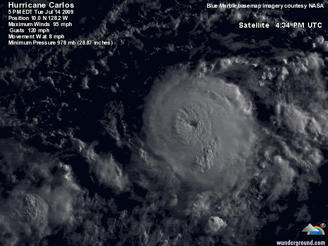
Looking like a major hurricane? "You betcha"
Got a nice eye. It does look like a major hurricane.
CrazyC83 wrote:Too bad there is no Recon anywhere near it to confirm the real intensity. 85 kt is definitely really conservative though...
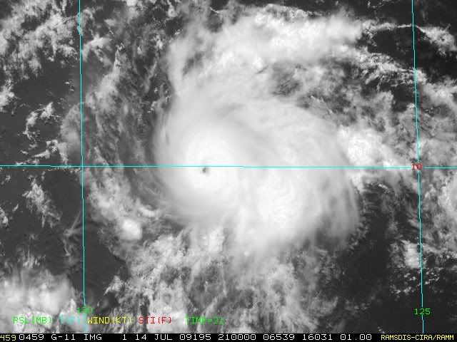


srainhoutx wrote:More than likely this is a major already. I would not be surprised to see an upgrade with the next Advisory.

Users browsing this forum: No registered users and 61 guests