ATL: TROPICAL STORM BILL (03L)

Moderator: S2k Moderators

Message
Author
User avatar
Hybridstorm_November2001
S2K Supporter
S2K Supporter
Posts: 2802
Joined: Sat Aug 21, 2004 2:50 pm
Location: SW New Brunswick, Canada
Contact:

Re: ATL: HURRICANE BILL (03L)

#3861 Postby Hybridstorm_November2001 » Sun Aug 23, 2009 5:13 pm

PTPatrick wrote:Apparently 3 people who were wave watching at the beach in Maine were swept out to sea. Coast gaurd is looking for them. Guess they didnt head the high surf advisory. I see these people splashing around in hurricane churned surf every year when a storm is nearby and every year I think, if they only knew what could happen. This was going on quite a bit in the Ike surf last year. People should have better sense. I hope they are found though.


Indeed I agree 100% with you. If they perish (I pray they do not) than three truly unnecessary Hurricane Bill related fatalities have taken place.
0 likes   

jinftl
Category 5
Category 5
Posts: 4312
Joined: Tue Aug 31, 2004 4:47 pm
Location: fort lauderdale, fl

Re: ATL: HURRICANE BILL (03L)

#3862 Postby jinftl » Sun Aug 23, 2009 5:15 pm

There is no reason any fatalities should have taken place with Bill...esp in an area that was so far from the storm. This makes me mad and sad. But at this moment, let's focus on praying for a miracle.

Hybridstorm_November2001 wrote:
PTPatrick wrote:Apparently 3 people who were wave watching at the beach in Maine were swept out to sea. Coast gaurd is looking for them. Guess they didnt head the high surf advisory. I see these people splashing around in hurricane churned surf every year when a storm is nearby and every year I think, if they only knew what could happen. This was going on quite a bit in the Ike surf last year. People should have better sense. I hope they are found though.


Indeed I agree 100% with you. If they perish (I pray they do not) than three truly unnecessary Hurricane Bill related fatalities have taken place.
0 likes   

User avatar
Hybridstorm_November2001
S2K Supporter
S2K Supporter
Posts: 2802
Joined: Sat Aug 21, 2004 2:50 pm
Location: SW New Brunswick, Canada
Contact:

#3863 Postby Hybridstorm_November2001 » Sun Aug 23, 2009 5:17 pm

BTW Just one big 'ol feederband pushed through my area this morning with moderate rain, heavy at times (0.40 Inch total) and winds gusting to a peak of roughly 30 mph. After about four hours of this, things cleared off and we even had sunny breaks this afternoon with near calm winds.
0 likes   

jinftl
Category 5
Category 5
Posts: 4312
Joined: Tue Aug 31, 2004 4:47 pm
Location: fort lauderdale, fl

Re: ATL: HURRICANE BILL (03L)

#3864 Postby jinftl » Sun Aug 23, 2009 5:25 pm

Newfoundland is going to take a direct hit with a landfalling Cat 1....they are getting blasted with wind and rain already

Image
Last edited by jinftl on Sun Aug 23, 2009 5:26 pm, edited 1 time in total.
0 likes   

User avatar
Cookie
S2K Supporter
S2K Supporter
Posts: 477
Age: 36
Joined: Sun Dec 14, 2008 11:13 am
Location: Isle Of lewis scotland

#3865 Postby Cookie » Sun Aug 23, 2009 5:25 pm

all eyes on this ending up in my back garden.

can anyone tell me what kind of winds we can expect from this and much if any rain?
0 likes   

User avatar
sponger
S2K Supporter
S2K Supporter
Posts: 1516
Joined: Thu Jul 22, 2004 11:26 am
Location: St Augustine

HurrICANE DEATHS

#3866 Postby sponger » Sun Aug 23, 2009 5:32 pm

There is a valuable lesson here. You have to assess your own risk in any dangerous situation. Just beacause 8 people think its safe to sit 5 feet from the waters edge, doesn't mean you should come to the same conclusion. Crowd mentality kills alot of people every year!
0 likes   

User avatar
sponger
S2K Supporter
S2K Supporter
Posts: 1516
Joined: Thu Jul 22, 2004 11:26 am
Location: St Augustine

Re: ATL: HURRICANE BILL (03L)

#3867 Postby sponger » Sun Aug 23, 2009 5:48 pm

Swell update for Jacksonville

The swell from Bill peaked early and didn't last! Late Friday afternoon the surf jumped from 5-6 ft to 10-12 in 4 hours. This was generated while Bill was a Cat 4. The swell on Saturday morning was 8-9 feet and fell of quickly by 9 am to 5-6 feet. By the early afternoon it was hard to find a wave over 5 feet. All in all a let down for Florida surfers but it still provided some fun large surf for those that got on it early.
0 likes   

jinftl
Category 5
Category 5
Posts: 4312
Joined: Tue Aug 31, 2004 4:47 pm
Location: fort lauderdale, fl

Re: ATL: HURRICANE BILL (03L)

#3868 Postby jinftl » Sun Aug 23, 2009 5:53 pm

More details on folks swept out to sea by waves at Acadia park

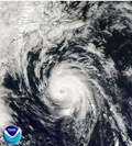
EDGARTOWN, Mass. -- A rogue wave from Hurricane Bill swept spectators out to sea at a Maine park Sunday as the storm-churned surf attracted onlookers and daredevils along the Eastern Seaboard.

Rescue crews were searching for people believed to be lost in the waves near Acadia National Park as a man, a woman and a 7-year-old girl were pulled from the sea, Coast Guard Petty Officer 2nd Class Shane Coxon.

The three were part of an early afternoon crowd that had gathered on some rocks at the park's Thunder Hole, a popular tourist attraction where waves often crash into a crevasse and make a thundering sound while splashing high in the air.

"This is absolutely the effects of Hurricane Bill" coupled with the effect of high tide, park ranger Sonya Berger said.

The girl was unresponsive when she was rescued, the woman appeared to have a broken leg and the man had a previous heart condition that appeared to be acting up, Coxon said. Other people are believed to still be lost in the waves but Coxon did not know how many. The waves were running 10 to 12 feet high with 25-knot winds along the coast, he said.
0 likes   

Brent
S2K Supporter
S2K Supporter
Posts: 37108
Age: 35
Joined: Sun May 16, 2004 10:30 pm
Location: Tulsa Oklahoma
Contact:

Re: ATL: HURRICANE BILL (Advisories)

#3869 Postby Brent » Sun Aug 23, 2009 6:35 pm

BULLETIN
HURRICANE BILL INTERMEDIATE ADVISORY NUMBER 34A
NWS TPC/NATIONAL HURRICANE CENTER MIAMI FL AL032009
800 PM AST SUN AUG 23 2009

...BILL RACING TOWARD NEWFOUNDLAND...

A TROPICAL STORM WARNING REMAINS EFFECT FOR NOVA SCOTIA FROM ECUM
SECUM TO BRULE. A TROPICAL STORM WATCH REMAINS IN EFFECT FROM BRULE
TO MALAGASH.
A TROPICAL STORM WARNING REMAINS IN EFFECT FOR PRINCE EDWARD ISLAND
FROM SAVAGE HARBOUR TO WOOD ISLANDS EAST. A TROPICAL STORM WATCH
REMAINS IN EFFECT FROM VICTORIA TO WOOD ISLANDS EAST AND FROM
SAVAGE HARBOUR TO LOWER DARNLEY.
A TROPICAL STORM WARNING REMAINS IN EFFECT FOR NEWFOUNDLAND FROM
BURGEO EASTWARD AROUND THE AVALON PENINSULA AND NORTHWARD TO FOGO
ISLAND. A TROPICAL STORM WATCH REMAINS IN EFFECT FROM PARSONS POND
TO BURGEO ON THE WEST AND SOUTH COAST AND FROM FOGO ISLAND TO
HARBOUR DEEP ON THE NORTHEAST COAST.

FOR STORM INFORMATION SPECIFIC TO YOUR AREA OUTSIDE OF THE UNITED
STATES...PLEASE MONITOR PRODUCTS ISSUED BY YOUR NATIONAL
METEOROLOGICAL SERVICE.

AT 800 PM AST...0000 UTC...THE CENTER OF HURRICANE BILL WAS LOCATED
NEAR LATITUDE 46.2 NORTH...LONGITUDE 57.9 WEST OR ABOUT 230 MILES...
375 KM...WEST OF CAPE RACE NEWFOUNDLAND.

BILL IS MOVING TOWARD THE NORTHEAST NEAR 35 MPH...56 KM/HR...AND AN
INCREASE IN FORWARD SPEED IS EXPECTED TONIGHT AND MONDAY. ON THE
FORECAST TRACK THE CENTER OF BILL WILL PASS NEAR OR OVER
SOUTHEASTERN NEWFOUNDLAND LATER TONIGHT.

MAXIMUM SUSTAINED WINDS ARE NEAR 75 MPH...120 KM/HR...WITH HIGHER
GUSTS. BILL IS A CATEGORY ONE HURRICANE ON THE SAFFIR-SIMPSON
SCALE. WEAKENING IS FORECAST DURING THE NEXT 24 HOURS AND BILL IS
EXPECTED TO BECOME EXTRATROPICAL ON MONDAY.

HURRICANE FORCE WINDS EXTEND OUTWARD UP TO 60 MILES...95 KM...FROM
THE CENTER...AND TROPICAL STORM FORCE WINDS EXTEND OUTWARD UP TO 290
MILES...465 KM. WITHIN THE LAST TWO HOURS...SABLE ISLAND REPORTED A
SUSTAINED WIND OF 48 MPH...78 KM/HR...AND A PEAK WIND GUST OF 63
MPH...102 KM/HR.

THE ESTIMATED MINIMUM CENTRAL PRESSURE IS 970 MB...28.64 INCHES.

TOTAL RAIN ACCUMULATIONS OF 2 TO 4 INCHES WITH ISOLATED MAXIMUM
AMOUNTS OF 6 INCHES ARE EXPECTED NEAR THE TRACK OF BILL ACROSS
NEWFOUNDLAND. AN ADDITIONAL 1 TO 2 INCHES OF RAIN ARE POSSIBLE
OVER THE EASTERN END OF NOVA SCOTIA AND PRINCE EDWARD ISLAND.

LARGE AND DANGEROUS SWELLS GENERATED BY HURRICANE BILL WILL CONTINUE
TO IMPACT THE ATLANTIC MARITIMES OF CANADA TONIGHT.

...SUMMARY OF 800 PM AST INFORMATION...
LOCATION...46.2N 57.9W
MAXIMUM SUSTAINED WINDS...75 MPH
PRESENT MOVEMENT...NORTHEAST OR 50 DEGREES AT 35 MPH
MINIMUM CENTRAL PRESSURE...970 MB

THE NEXT ADVISORY WILL BE ISSUED BY THE NATIONAL HURRICANE CENTER AT
1100 PM AST.

$$
FORECASTER BRENNAN
0 likes   

kat61
Tropical Depression
Tropical Depression
Posts: 87
Joined: Tue Aug 11, 2009 4:32 pm
Location: Hampstead,NC

ATL: HURRICANE BILL (03L)

#3870 Postby kat61 » Sun Aug 23, 2009 6:46 pm

This news makes me so angry I could cry! :cry:
0 likes   

magnusson_r
Tropical Wave
Tropical Wave
Posts: 9
Joined: Wed Aug 19, 2009 6:35 pm

ATL: HURRICANE BILL (03L)

#3871 Postby magnusson_r » Sun Aug 23, 2009 6:57 pm

These folks at Peggy's Cove (near Halifax) got some excellent photo opportunities today!

http://www.cbc.ca/canada/story/2009/08/ ... ll023.html

A colleague of mine said the surfing was superb, too (for the adventuresome).
0 likes   

User avatar
TMT
S2K Supporter
S2K Supporter
Posts: 23
Joined: Sat Sep 20, 2003 7:32 pm

Re: ATL: HURRICANE BILL (03L)

#3872 Postby TMT » Sun Aug 23, 2009 7:50 pm

Breaking news just in from ABC says that the 7 year old girl has died.
0 likes   

jinftl
Category 5
Category 5
Posts: 4312
Joined: Tue Aug 31, 2004 4:47 pm
Location: fort lauderdale, fl

Re: ATL: HURRICANE BILL (03L)

#3873 Postby jinftl » Sun Aug 23, 2009 8:10 pm

There is a lesson here. Nothing more to say on this subject. There was no need for a death toll with Bill. This news is so disturbing....never seen a 100+ page thread come to a grinding halt so quickly...god bless all those effected.

The three rescued in Maine were part of an early afternoon crowd of thousands who lined the national park's rocky shoreline to watch the high surf and crashing waves.

About 20 people were swept into the ocean and 17 of them got out on their own, Coast Guard Petty Officer 2nd Class Adam Sansoucie. About 10 of those people were taken to the hospital for minor injuries, he said. Others on shore suffered minor injuries after being knocked to the rocks by the waves, Acadia National Park Chief Ranger Stuart West said.

James Kaiser of Bar Harbor was taking photographs when he heard shouts that people had been swept into the 55-degree water at the park's Thunder Hole, a popular tourist attraction where waves often crash into a crevasse and make a thundering sound while splashing high in the air. "I could see two people's heads bobbing in the water," Kaiser said. He said he thought they would be bounced back to shore because the waves were coming in so hard but that instead the current took them away from shore.

Kaiser said many people didn't even move when they were splashed by the waves and instead seemed to laugh it off.
0 likes   

User avatar
george_r_1961
S2K Supporter
S2K Supporter
Posts: 3171
Age: 62
Joined: Sat Oct 12, 2002 9:14 pm
Location: Hampton, Virginia

Re: ATL : BILL (03L) Recon Thread

#3874 Postby george_r_1961 » Sun Aug 23, 2009 8:29 pm

What base were they flying out of?
0 likes   

User avatar
HURAKAN
Professional-Met
Professional-Met
Posts: 46086
Age: 37
Joined: Thu May 20, 2004 4:34 pm
Location: Key West, FL
Contact:

Re: ATL : BILL (03L) Recon Thread

#3875 Postby HURAKAN » Sun Aug 23, 2009 8:46 pm

george_r_1961 wrote:What base were they flying out of?


Image

Andrews AFB, Washington DC
0 likes   

User avatar
Maritimer71
S2K Supporter
S2K Supporter
Posts: 41
Joined: Sun Aug 23, 2009 6:07 am
Location: Nova Scotia - Canada

#3876 Postby Maritimer71 » Sun Aug 23, 2009 9:14 pm

That really bugs me... It's one thing for an adult to be stupid and risk their own life by getting too close to a dangerous situation.. but to risk a child's... All we have heard all day is stay away from the shoreline... Tides are higher than normal and with the hurricane, its making the surf very unpredictable...

It was really weird here how Bill played out... in the City.. it seems like hardly anything at all... but outside of the city... roads were washed out and some buildings were lost to flooding and erosion... The ocean seemed to cause the most damage with this one....

Nothing like Juan was... and that is what most were scared of this one being like...

I have relatives in Newfoundland... South Shore and Port aux Basques... doesn't seem like Bill is affecting them anymore than it affected us...
0 likes   

Derek Ortt

#3877 Postby Derek Ortt » Sun Aug 23, 2009 9:18 pm

Bill has made landfall on Newfoundland
0 likes   

Brent
S2K Supporter
S2K Supporter
Posts: 37108
Age: 35
Joined: Sun May 16, 2004 10:30 pm
Location: Tulsa Oklahoma
Contact:

Re: ATL: HURRICANE BILL (Advisories)

#3878 Postby Brent » Sun Aug 23, 2009 9:36 pm

BULLETIN
HURRICANE BILL ADVISORY NUMBER 35
NWS TPC/NATIONAL HURRICANE CENTER MIAMI FL AL032009
1100 PM AST SUN AUG 23 2009

...BILL APPROACHING SOUTHEASTERN NEWFOUNDLAND...EXPECTED TO BECOME
EXTRATROPICAL ON MONDAY...
AT 1100 PM AST...0300 UTC...ENVIRONMENT CANADA HAS DISCONTINUED ALL
TROPICAL STORM WATCHES AND WARNINGS FOR NOVA SCOTIA AND PRINCE
EDWARD ISLAND.

A TROPICAL STORM WARNING REMAINS IN EFFECT FOR NEWFOUNDLAND FROM
BURGEO EASTWARD AROUND THE AVALON PENINSULA AND NORTHWARD TO FOGO
ISLAND. A TROPICAL STORM WATCH REMAINS IN EFFECT FROM PARSONS POND
TO BURGEO ON THE WEST AND SOUTH COAST AND FROM FOGO ISLAND TO
HARBOUR DEEP ON THE NORTHEAST COAST.

FOR STORM INFORMATION SPECIFIC TO YOUR AREA OUTSIDE OF THE UNITED
STATES...PLEASE MONITOR PRODUCTS ISSUED BY YOUR NATIONAL
METEOROLOGICAL SERVICE.

AT 1100 PM AST...0300 UTC...THE CENTER OF HURRICANE BILL WAS LOCATED
NEAR LATITUDE 47.1 NORTH...LONGITUDE 55.5 WEST OR ABOUT 115 MILES...
190 KM...WEST-NORTHWEST OF CAPE RACE NEWFOUNDLAND.

BILL IS MOVING TOWARD THE EAST-NORTHEAST NEAR 40 MPH...65 KM/HR.
THIS GENERAL MOTION IS EXPECTED TO CONTINUE TONIGHT AND MONDAY. ON
THE FORECAST TRACK THE CENTER OF BILL WILL PASS NEAR OR OVER
SOUTHEASTERN NEWFOUNDLAND OVERNIGHT TONIGHT.

MAXIMUM SUSTAINED WINDS ARE NEAR 75 MPH...120 KM/HR...WITH HIGHER
GUSTS. BILL IS A CATEGORY ONE HURRICANE ON THE SAFFIR-SIMPSON
SCALE. WEAKENING IS FORECAST DURING THE NEXT 24 HOURS AND BILL IS
EXPECTED TO BECOME EXTRATROPICAL ON MONDAY.

HURRICANE FORCE WINDS EXTEND OUTWARD UP TO 60 MILES...95 KM...FROM
THE CENTER...AND TROPICAL STORM FORCE WINDS EXTEND OUTWARD UP TO 275
MILES...445 KM.

THE ESTIMATED MINIMUM CENTRAL PRESSURE IS 975 MB...28.79 INCHES.

TOTAL RAIN ACCUMULATIONS OF 2 TO 4 INCHES WITH ISOLATED MAXIMUM
AMOUNTS OF 6 INCHES ARE EXPECTED NEAR THE TRACK OF BILL ACROSS
NEWFOUNDLAND.

LARGE AND DANGEROUS SWELLS GENERATED BY HURRICANE BILL WILL CONTINUE
TO IMPACT THE ATLANTIC MARITIMES OF CANADA OVERNIGHT.

...SUMMARY OF 1100 PM AST INFORMATION...
LOCATION...47.1N 55.5W
MAXIMUM SUSTAINED WINDS...75 MPH
PRESENT MOVEMENT...EAST-NORTHEAST OR 60 DEGREES AT 40 MPH
MINIMUM CENTRAL PRESSURE...975 MB

AN INTERMEDIATE ADVISORY WILL BE ISSUED BY THE NATIONAL HURRICANE
CENTER AT 200 AM AST FOLLOWED BY THE NEXT COMPLETE ADVISORY AT 500
AM AST.

$$
FORECASTER BRENNAN

HURRICANE BILL FORECAST/ADVISORY NUMBER 35
NWS TPC/NATIONAL HURRICANE CENTER MIAMI FL AL032009
0300 UTC MON AUG 24 2009

AT 1100 PM AST...0300 UTC...ENVIRONMENT CANADA HAS DISCONTINUED ALL
TROPICAL STORM WATCHES AND WARNINGS FOR NOVA SCOTIA AND PRINCE
EDWARD ISLAND.

A TROPICAL STORM WARNING REMAINS IN EFFECT FOR NEWFOUNDLAND FROM
BURGEO EASTWARD AROUND THE AVALON PENINSULA AND NORTHWARD TO FOGO
ISLAND. A TROPICAL STORM WATCH REMAINS IN EFFECT FROM PARSONS POND
TO BURGEO ON THE WEST AND SOUTH COAST AND FROM FOGO ISLAND TO
HARBOUR DEEP ON THE NORTHEAST COAST.

HURRICANE CENTER LOCATED NEAR 47.1N 55.5W AT 24/0300Z
POSITION ACCURATE WITHIN 30 NM

PRESENT MOVEMENT TOWARD THE EAST-NORTHEAST OR 60 DEGREES AT 35 KT

ESTIMATED MINIMUM CENTRAL PRESSURE 975 MB
MAX SUSTAINED WINDS 65 KT WITH GUSTS TO 80 KT.
64 KT....... 50NE 50SE 30SW 40NW.
50 KT....... 90NE 120SE 60SW 75NW.
34 KT.......225NE 240SE 240SW 175NW.
12 FT SEAS..180NE 540SE 660SW 180NW.
WINDS AND SEAS VARY GREATLY IN EACH QUADRANT. RADII IN NAUTICAL
MILES ARE THE LARGEST RADII EXPECTED ANYWHERE IN THAT QUADRANT.

REPEAT...CENTER LOCATED NEAR 47.1N 55.5W AT 24/0300Z
AT 24/0000Z CENTER WAS LOCATED NEAR 46.3N 57.9W

FORECAST VALID 24/1200Z 49.1N 47.9W
MAX WIND 55 KT...GUSTS 65 KT.
50 KT... 75NE 90SE 60SW 60NW.
34 KT...200NE 250SE 300SW 200NW.

FORECAST VALID 25/0000Z 50.8N 36.0W...EXTRATROPICAL
MAX WIND 45 KT...GUSTS 55 KT.
34 KT...150NE 300SE 400SW 250NW.

FORECAST VALID 25/1200Z 52.2N 24.5W...EXTRATROPICAL
MAX WIND 40 KT...GUSTS 50 KT.
34 KT...200NE 350SE 400SW 200NW.

FORECAST VALID 26/0000Z 53.5N 14.7W...EXTRATROPICAL
MAX WIND 35 KT...GUSTS 45 KT.
34 KT...200NE 350SE 350SW 150NW.

FORECAST VALID 27/0000Z 61.0N 2.0W...EXTRATROPICAL
MAX WIND 30 KT...GUSTS 40 KT.

EXTENDED OUTLOOK. NOTE...ERRORS FOR TRACK HAVE AVERAGED NEAR 250 NM
ON DAY 4 AND 325 NM ON DAY 5...AND FOR INTENSITY NEAR 20 KT EACH DAY

OUTLOOK VALID 28/0000Z...DISSIPATED

REQUEST FOR 3 HOURLY SHIP REPORTS WITHIN 300 MILES OF 47.1N 55.5W

NEXT ADVISORY AT 24/0900Z

$$
FORECASTER BRENNAN

HURRICANE BILL DISCUSSION NUMBER 35
NWS TPC/NATIONAL HURRICANE CENTER MIAMI FL AL032009
1100 PM AST SUN AUG 23 2009

BILL STILL HAS STRUCTURAL CHARACTERISTICS OF A TROPICAL CYCLONE...
WITH DEEP CONVECTION NEAR THE CENTER AND A FRAGMENT OF AN EYEWALL
VISIBLE IN MICROWAVE IMAGERY FROM A 2304 UTC SSMIS PASS. BASED ON
THE INNER-CORE STRUCTURE...AND A DVORAK CI NUMBER OF 4.0 FROM TAFB
AT 0000 UTC...BILL IS MAINTAINED AS A 65 KT HURRICANE FOR THIS
ADVISORY.

BILL HAS ACCELERATED TOWARD THE EAST-NORTHEAST OVER THE PAST SEVERAL
HOURS...AND THE INITIAL MOTION ESTIMATE IS 060/35. BILL IS EXPECTED
TO REMAIN ON AN EAST-NORTHEASTWARD HEADING UNDER THE INFLUENCE OF
THE MID-LATITUDE WESTERLIES FOR THE NEXT COUPLE OF DAYS...AND THE
TRACK GUIDANCE REMAINS IN EXCELLENT AGREEMENT ON THIS SCENARIO.
AFTER 48 HOURS...BILL WILL SLOW DOWN AND TURN TOWARD THE NORTH AS
IT COMES UNDER THE INFLUENCE OF A MUCH LARGER EXTRATROPICAL CYCLONE
LOCATED SOUTHWEST OF ICELAND. BILL WILL EVENTUALLY BE ABSORBED INTO
THIS LARGER CIRCULATION BY 96 HOURS. THE NEW OFFICIAL FORECAST IS A
LITTLE FASTER THAN THE PREVIOUS PACKAGE...AND IS CLOSE TO THE
MULTI-MODEL CONSENSUS.

BILL IS BEGINNING TO UNDERGO EXTRATROPICAL TRANSITION...WITH THE
UPPER-LEVEL CLOUD PATTERN EXPANDING NORTH AND EAST OF THE CENTER IN
THE ENTRANCE REGION OF A 140-KT UPPER-LEVEL JET CORE CENTERED ALONG
55N. ALSO...DATA FROM A 2226 UTC QUIKSCAT PASS ALONG WITH NUMEROUS
SURFACE OBSERVATIONS SHOW THAT THE WIND FIELD OF BILL HAS BEGUN TO
EXPAND...PARTICULARLY IN THE SOUTHEASTERN QUADRANT. MOST OF THE
GLOBAL MODEL GUIDANCE INDICATES THAT BILL WILL COMPLETE THE
EXTRATROPICAL TRANSITION PROCESS WITHIN 12 TO 24 HOURS. AFTER THAT
TIME...UPPER-LEVEL DIVERGENCE ASSOCIATED WITH THE JET WILL HELP
MAINTAIN BILL AS AN EXTRATROPICAL CYCLONE...AND THE OFFICIAL
INTENSITY FORECAST SHOWS GRADUAL WEAKENING AS BILL MOVES ACROSS THE
NORTHERN ATLANTIC. AS BILL BECOMES FULLY EXTRATROPICAL...THE WIND
FIELD WILL CONTINUE TO EXPAND...ESPECIALLY IN THE SOUTHERN
SEMICIRCLE.

LARGE AND DANGEROUS SWELLS ASSOCIATED WITH BILL WILL CONTINUE
IMPACTING THE CANADIAN MARITIMES DURING THE NEXT 12 TO 24 HOURS...
WHILE SWELLS ALONG THE EAST COAST OF THE UNITED STATES WILL CONTINUE
TO SUBSIDE OVERNIGHT.

FORECAST POSITIONS AND MAX WINDS

INITIAL 24/0300Z 47.1N 55.5W 65 KT
12HR VT 24/1200Z 49.1N 47.9W 55 KT
24HR VT 25/0000Z 50.8N 36.0W 45 KT...EXTRATROPICAL
36HR VT 25/1200Z 52.2N 24.5W 40 KT...EXTRATROPICAL
48HR VT 26/0000Z 53.5N 14.7W 35 KT...EXTRATROPICAL
72HR VT 27/0000Z 61.0N 2.0W 30 KT...EXTRATROPICAL
96HR VT 28/0000Z...DISSIPATED

$$
FORECASTER BRENNAN
0 likes   

User avatar
drezee
S2K Supporter
S2K Supporter
Posts: 3643
Joined: Mon Jun 09, 2003 12:49 pm
Location: FL

Re:

#3879 Postby drezee » Sun Aug 23, 2009 9:47 pm

Derek Ortt wrote:Bill has made landfall on Newfoundland


Bill refused to be a fish...
0 likes   

User avatar
HURAKAN
Professional-Met
Professional-Met
Posts: 46086
Age: 37
Joined: Thu May 20, 2004 4:34 pm
Location: Key West, FL
Contact:

#3880 Postby HURAKAN » Sun Aug 23, 2009 10:00 pm

Image

Not much is left of the old Bill
0 likes   


Return to “2009”

Who is online

Users browsing this forum: No registered users and 120 guests