ATL : TROPICAL STORM GRACE

Moderator: S2k Moderators

Message
Author
User avatar
DanieleItalyRm
Category 1
Category 1
Posts: 486
Age: 38
Joined: Mon Sep 22, 2008 7:52 am
Location: Rome - Italy - Mediterranean sea

#261 Postby DanieleItalyRm » Mon Oct 05, 2009 5:02 pm

Grace, Vince, Karl egual at many Mediterranean Hurricane (Medicanes):

Image

Image

Image
0 likes   

ozonepete
Professional-Met
Professional-Met
Posts: 4743
Joined: Mon Sep 07, 2009 3:23 pm
Location: From Ozone Park, NYC / Now in Brooklyn, NY

Re:

#262 Postby ozonepete » Mon Oct 05, 2009 6:05 pm

Derek Ortt wrote:looks like this will be touch and go with regards to landfall

if it does make landfall, it would be the second strongest landfall of the season, behind Bill in Newfoundland


Wow, I didn't even realize that it'd be the second storngest. How bizarre.
0 likes   

ozonepete
Professional-Met
Professional-Met
Posts: 4743
Joined: Mon Sep 07, 2009 3:23 pm
Location: From Ozone Park, NYC / Now in Brooklyn, NY

Re:

#263 Postby ozonepete » Mon Oct 05, 2009 6:06 pm

DanieleItalyRm wrote:Grace, Vince, Karl egual at many Mediterranean Hurricane (Medicanes):

Image

Image

Image


Man, you post some incredible stuff, Mr. Daniele. I hope you always keep up the good work.
0 likes   

Dianmu
Tropical Low
Tropical Low
Posts: 16
Joined: Mon Oct 05, 2009 7:55 am

Re: ATL : TROPICAL STORM GRACE

#264 Postby Dianmu » Mon Oct 05, 2009 7:16 pm

It is going to die. The sea surface temperature is too low.
0 likes   

User avatar
breeze
Category 5
Category 5
Posts: 9110
Age: 61
Joined: Sat Feb 08, 2003 4:55 pm
Location: Lawrenceburg, TN

Re: ATL : TROPICAL STORM GRACE

#265 Postby breeze » Mon Oct 05, 2009 7:38 pm

Image

Moving right along...
0 likes   

User avatar
brunota2003
S2K Supporter
S2K Supporter
Posts: 9476
Age: 33
Joined: Sat Jul 30, 2005 9:56 pm
Location: Stanton, KY...formerly Havelock, NC
Contact:

#266 Postby brunota2003 » Mon Oct 05, 2009 7:50 pm

Should TS warnings go up for Ireland, just encase? Could you imagine seeing TS warnings that far NE?
0 likes   

CrazyC83
Professional-Met
Professional-Met
Posts: 33393
Joined: Tue Mar 07, 2006 11:57 pm
Location: Deep South, for the first time!

#267 Postby CrazyC83 » Mon Oct 05, 2009 7:51 pm

AL, 09, 2009100600, , BEST, 0, 487N, 144W, 45, 992, TS, 34, NEQ, 0, 75, 45, 0, 998, 100, 25, 0, 0, L, 0, , 0, 0, GRACE, M,

Should cross 50°N soon. Still looks surprisingly tropical even at that high latitude and about 275 miles from Ireland.
0 likes   

CrazyC83
Professional-Met
Professional-Met
Posts: 33393
Joined: Tue Mar 07, 2006 11:57 pm
Location: Deep South, for the first time!

Re:

#268 Postby CrazyC83 » Mon Oct 05, 2009 7:52 pm

brunota2003 wrote:Should TS warnings go up for Ireland, just encase? Could you imagine seeing TS warnings that far NE?


Personally, I would at least put up a Tropical Storm Watch (precautionary), although there is no real program up there.
0 likes   

User avatar
breeze
Category 5
Category 5
Posts: 9110
Age: 61
Joined: Sat Feb 08, 2003 4:55 pm
Location: Lawrenceburg, TN

Re: ATL : TROPICAL STORM GRACE

#269 Postby breeze » Mon Oct 05, 2009 7:58 pm

Here's the link to Ireland's Met Service:

http://www.met.ie/default.asp

It looks like mostly a heavy rain warning for early Tuesday.
0 likes   

CrazyC83
Professional-Met
Professional-Met
Posts: 33393
Joined: Tue Mar 07, 2006 11:57 pm
Location: Deep South, for the first time!

Re: ATL : TROPICAL STORM GRACE

#270 Postby CrazyC83 » Mon Oct 05, 2009 7:58 pm

Personal Forecast Disclaimer:
The posts in this forum are NOT official forecast and should not be used as such. They are just the opinion of the poster and may or may not be backed by sound meteorological data. They are NOT endorsed by any professional institution or storm2k.org. For official information, please refer to the NHC and NWS products.


Given the short time it has to become extratropical or get absorbed before a potential landfall, I would personally issue the following (totally unofficial):

Tropical Storm Warning - Waterville (51.9N 10.2W) to Glandore (51.6N 9.1W), including Cape Clear Island

Tropical Storm Watch - Smerwick (52.2N 10.4W) to Waterville (including the Blasket Islands) and Glandore to Lispatrick (51.6N 8.5W)
0 likes   

ozonepete
Professional-Met
Professional-Met
Posts: 4743
Joined: Mon Sep 07, 2009 3:23 pm
Location: From Ozone Park, NYC / Now in Brooklyn, NY

Re: ATL : TROPICAL STORM GRACE

#271 Postby ozonepete » Mon Oct 05, 2009 8:13 pm

breeze wrote:Image

Moving right along...


Pretty amazing - hard to believe your eyes on this one. :eek:
0 likes   

leanne_uk
Tropical Storm
Tropical Storm
Posts: 214
Age: 41
Joined: Fri Sep 04, 2009 4:38 pm
Location: Loughborough countryside, Leicestershire, UK

#272 Postby leanne_uk » Mon Oct 05, 2009 8:19 pm

wow ive been asleep for a few hours and little grace is flying thru the north atlantic :)

I really want to see her do the unimaginable and hit at TS strength :)

The met office still aint phased by this at all.... Crazy when she is so close and still strong :)

Anyone got the latest sat images? On the mobile and my usual site is not liking my phone tonight :(
0 likes   

User avatar
breeze
Category 5
Category 5
Posts: 9110
Age: 61
Joined: Sat Feb 08, 2003 4:55 pm
Location: Lawrenceburg, TN

Re: ATL : TROPICAL STORM GRACE

#273 Postby breeze » Mon Oct 05, 2009 8:32 pm

It is amazing - I thought maybe it wouldn't look so good on that latest image, but it still
looks quite healthy, eh? Of course, we know it's closing in on cooler waters...

Wake up for your Tropical Storm, Leanne! LOL! :lol:
0 likes   

ozonepete
Professional-Met
Professional-Met
Posts: 4743
Joined: Mon Sep 07, 2009 3:23 pm
Location: From Ozone Park, NYC / Now in Brooklyn, NY

Re: ATL : TROPICAL STORM GRACE

#274 Postby ozonepete » Mon Oct 05, 2009 8:39 pm

The 5PM NHC Discussion was fascinating:

WTNT44 KNHC 052034
TCDAT4
TROPICAL STORM GRACE DISCUSSION NUMBER 4
NWS TPC/NATIONAL HURRICANE CENTER MIAMI FL AL092009
500 PM AST MON OCT 05 2009

GRACE CONTINUES TO HAVE THE SATELLITE APPEARANCE OF A TROPICAL CYCLONE AND A MODERATE TO DEEP WARM CORE AS INDICATED BY RECENT AMSU PASSES. HOWEVER...CLOUD TOP TEMPERATURES HAVE CONTINUED TO WARM OVER THE PAST FEW HOURS AS THE CYCLONE IS NOW OVER SSTS OF 17-18C. THE INTENSITY IS DECREASED TO 50 KT BASED A SUBTROPICAL CLASSIFICATION OF 3.5 FROM TAFB AND A DVORAK CI-NUMBER OF 3.0 FROM SAB. A QUIKSCAT PASS SHOULD PROVIDE SOME INFORMATION ON THE INTENSITY AND STRUCTURE OF GRACE SOON. THE CENTRAL PRESSURE IS HELD AT 990 MB BASED ON AN 1800 UTC OBSERVATION OF 992 MB AND A WIND OF 20 KT FROM SHIP A8I02 ABOUT 30 NM NORTH OF THE CENTER OF GRACE.

THE INITIAL MOTION ESTIMATE IS 025/26 KT...AS GRACE IS BEING STEERED BY DEEP-LAYER SOUTHWESTERLY FLOW AHEAD OF A MID- TO UPPER-LEVEL TROUGH ALONG 27W. BY TUESDAY MORNING...ALL OF THE GLOBAL MODELS SHOW GRACE BEING ABSORBED BY A FRONT ASSOCIATED WITH A DEEPENING EXTRATROPICAL CYCLONE TO THE NORTHWEST OF THE BRITISH ISLES.

IT IS WORTH NOTING THAT OTHER ATLANTIC TROPICAL STORMS HAVE FORMED FARTHER NORTH THAN GRACE DID. IN 2008 TROPICAL STORM LAURA WAS FIRST CLASSIFIED AS A TROPICAL STORM AT 40.6N....SLIGHTLY FARTHER NORTH THAN THE LATITUDE OF 40.2N WHERE GRACE WAS FIRST CLASSIFIED AS A TROPICAL STORM AT 0000 UTC TODAY. ALSO...IT IS LIKELY THAT POST-STORM ANALYSIS WILL SHOW GRACE BECOMING A TROPICAL STORM EARLIER... AND FARTHER SOUTH...THAN INDICATED OPERATIONALLY.


But wasn't it the farthest NORTHEAST that a TS ever formed? That would be historic, because remember that Fred formed at the farthest point SOUTHEAST ever this season.

And will they also say it was a hurricane? An eye usually never forms below 77 knots - 89mph.
0 likes   

Derek Ortt

#275 Postby Derek Ortt » Mon Oct 05, 2009 8:54 pm

eyes are present routinely in tropical storms with winds of about 50KT. Usually, they are not visible due to cirrus overcast, but are on radar and microwave imagery

We don't have cirrus overcast here; thus, we could see the eye earlier
0 likes   

User avatar
Blown Away
S2K Supporter
S2K Supporter
Posts: 9861
Joined: Wed May 26, 2004 6:17 am

Re: ATL : TROPICAL STORM GRACE

#276 Postby Blown Away » Mon Oct 05, 2009 8:59 pm

Cool little weather system.
0 likes   
Hurricane Eye Experience: David 79, Irene 99, Frances 04, Jeanne 04, Wilma 05...
Hurricane Brush Experience: Andrew 92, Erin 95, Floyd 99, Matthew 16, Irma 17, Ian 22, Nicole 22…

CrazyC83
Professional-Met
Professional-Met
Posts: 33393
Joined: Tue Mar 07, 2006 11:57 pm
Location: Deep South, for the first time!

#277 Postby CrazyC83 » Mon Oct 05, 2009 9:04 pm

Can the NHC issue watches or warnings for areas they do not have direct jurisdiction for?
0 likes   

ozonepete
Professional-Met
Professional-Met
Posts: 4743
Joined: Mon Sep 07, 2009 3:23 pm
Location: From Ozone Park, NYC / Now in Brooklyn, NY

Re:

#278 Postby ozonepete » Mon Oct 05, 2009 9:15 pm

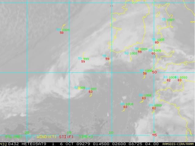
Derek Ortt wrote:eyes are present routinely in tropical storms with winds of about 50KT. Usually, they are not visible due to cirrus overcast, but are on radar and microwave imagery

We don't have cirrus overcast here; thus, we could see the eye earlier


The key phrase you used is cirrus overcast, and the key word left out is "developing." We've all seen hurricanes weakening into a TS that keep their CLEAR eye. But has there ever been a tropical storm DEVELOPING into a hurricane that showed a CLEAR eye BEFORE it made hurricane? I've never seen one in all of the satellite image history we have and all of the storms I've followed. So if Grace was on the upswing, producing a CLEAR eye BEFORE the DEVELOPING TS became a hurricane would be a first. I defer to you on this - you are an expert and I admire your work. But if you have an example I would love to see it.

And of course, a DEVELOPING TS often has an "EYE" detectible by SSMI because the "eye" circulation it shows is a developing area of subsidence that forms from the lower levels up as the radius of maximum winds consolidates. In that DEVELOPMENT situation we'd always expect a cirrus canopy until the winds have reached a critical number (about 89mph) where the cirrus can clear out.
Last edited by ozonepete on Mon Oct 05, 2009 9:25 pm, edited 2 times in total.
0 likes   

User avatar
HURAKAN
Professional-Met
Professional-Met
Posts: 46086
Age: 37
Joined: Thu May 20, 2004 4:34 pm
Location: Key West, FL
Contact:

#279 Postby HURAKAN » Mon Oct 05, 2009 9:17 pm

BATUK00 - MARITIME-ship
Tuesday Oct. 6 - 1:00 UTC
Air Temperature: 62°F
Dewpoint: 60°F
Pressure: 989.2 mb

http://www.ndbc.noaa.gov/radial_search.php?storm=at4

Looks like they need to make a few changes to the official pressure!!!
0 likes   

User avatar
HURAKAN
Professional-Met
Professional-Met
Posts: 46086
Age: 37
Joined: Thu May 20, 2004 4:34 pm
Location: Key West, FL
Contact:

#280 Postby HURAKAN » Mon Oct 05, 2009 9:19 pm

Image

Continues to get closer to England
0 likes   


Return to “2009”

Who is online

Users browsing this forum: No registered users and 127 guests