TROPICAL CYCLONE ADVICE NUMBER 1
Issued by the BUREAU OF METEOROLOGY, DARWIN
at 1:14 pm CST [11:44 am WST] Sunday 3 January 2010
A Cyclone WATCH has been declared for a developing tropical low for coastal
areas from Kalumburu to Cape Don, including Darwin.
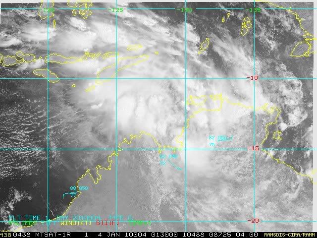
At 9:30 am CST [8:00 am WST] a Tropical Low was estimated to be
130 kilometres southwest of Darwin and
45 kilometres northwest of Daly River Mouth and
moving west northwest at 14 kilometres per hour away from the coast.
The low may develop into a tropical cyclone in the next 36 to 48 hours.
GALES are not expected within coastal areas within the next 24 hours, however
GALES may develop later if the low develops into a Tropical Cyclone.
Details of Tropical Low at 9:30 am CST [8:00 am WST]:
.Centre located near...... 13.1 degrees South 129.9 degrees East
.Location accuracy........ within 45 kilometres
.Recent movement.......... towards the west northwest at 14 kilometres per hour
.Wind gusts near centre... 85 kilometres per hour
.Severity category........ below cyclone intensity
.Central pressure......... 1003 hectoPascals
The next advice will be issued by 5:00 pm CST Sunday 03 January [3:30 pm WST
Sunday 03 January].
This advice is available on telephone NT-1300 659 211 and WA-1300 659 210
DARWIN Tropical Cyclone Warning Centre