ATL: Ex INVEST 93L - Discussion

Moderator: S2k Moderators

Message
Author
User avatar
KWT
Category 5
Category 5
Posts: 31390
Joined: Tue Aug 17, 2004 11:02 am
Location: UK!!!

Re:

#381 Postby KWT » Tue Aug 10, 2010 8:48 am

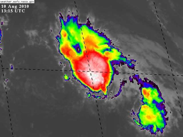
Aquawind wrote:Yep.. While the overall LL cirulation has been excellent for a few days now the actual center has looked pretty ugly at times. It looks like a little eddy has formed momentarily as well. I would imagine this happens often we just don't see it under the UL clouds.


Yep thats probably true, and its not helped that the circulation has been surviving semi naked for a while now, its probably weakening and thats what is allowing these little eddies to get going...though clearly the circulation its had is still the dominant one and any decent convection will help to further establish it.
0 likes   
Personal Forecast Disclaimer:
The posts in this forum are NOT official forecast and should not be used as such. They are just the opinion of the poster and may or may not be backed by sound meteorological data. They are NOT endorsed by any professional institution or storm2k.org. For official information, please refer to the NHC and NWS products

User avatar
MiamiHurricanes10
S2K Supporter
S2K Supporter
Posts: 260
Joined: Mon Jul 19, 2010 7:56 pm
Location: Miami, Florida

Re: ATL: INVEST 93L - Discussion

#382 Postby MiamiHurricanes10 » Tue Aug 10, 2010 9:01 am

To give you an idea how close this is to being a tropical depression, all it needs is to slide the LLC under the convection and persist for another couple of hours.

Image
0 likes   

User avatar
HURAKAN
Professional-Met
Professional-Met
Posts: 46086
Age: 37
Joined: Thu May 20, 2004 4:34 pm
Location: Key West, FL
Contact:

#383 Postby HURAKAN » Tue Aug 10, 2010 9:07 am

Doesn't need to be under but it needs to persist for a few hours. Remember that the center of Danny last year was never under the convection.
0 likes   

User avatar
KWT
Category 5
Category 5
Posts: 31390
Joined: Tue Aug 17, 2004 11:02 am
Location: UK!!!

#384 Postby KWT » Tue Aug 10, 2010 9:10 am

The difference, and the only difference between this system, Colin and Danny is probably the location of the system with recon being able to fly into the other two whilst not flying into this one.

It looks a little better now though.
0 likes   
Personal Forecast Disclaimer:
The posts in this forum are NOT official forecast and should not be used as such. They are just the opinion of the poster and may or may not be backed by sound meteorological data. They are NOT endorsed by any professional institution or storm2k.org. For official information, please refer to the NHC and NWS products

User avatar
HURAKAN
Professional-Met
Professional-Met
Posts: 46086
Age: 37
Joined: Thu May 20, 2004 4:34 pm
Location: Key West, FL
Contact:

#385 Postby HURAKAN » Tue Aug 10, 2010 9:12 am

Image

wait and see, wait and see
0 likes   

User avatar
KWT
Category 5
Category 5
Posts: 31390
Joined: Tue Aug 17, 2004 11:02 am
Location: UK!!!

#386 Postby KWT » Tue Aug 10, 2010 9:15 am

Big convective bursting for sure there Hurakan, but we do need to see the center tuck into the center, if it does then no reason why it can't form....but thats been the problem for a long time now.
0 likes   
Personal Forecast Disclaimer:
The posts in this forum are NOT official forecast and should not be used as such. They are just the opinion of the poster and may or may not be backed by sound meteorological data. They are NOT endorsed by any professional institution or storm2k.org. For official information, please refer to the NHC and NWS products

User avatar
MiamiHurricanes10
S2K Supporter
S2K Supporter
Posts: 260
Joined: Mon Jul 19, 2010 7:56 pm
Location: Miami, Florida

Re:

#387 Postby MiamiHurricanes10 » Tue Aug 10, 2010 9:16 am

HURAKAN wrote:Doesn't need to be under but it needs to persist for a few hours. Remember that the center of Danny last year was never under the convection.

That's true. But since Recon was available the NHC really didn't care, however, out here they have to base it off of satellite agency T-numbers, and if the circulation is nestled within the convection, T-numbers will naturally go up since the cyclone would look more organized.
0 likes   

User avatar
HURAKAN
Professional-Met
Professional-Met
Posts: 46086
Age: 37
Joined: Thu May 20, 2004 4:34 pm
Location: Key West, FL
Contact:

#388 Postby HURAKAN » Tue Aug 10, 2010 9:17 am

Image

even the experimental models like 93L
0 likes   

HurrMark
Category 2
Category 2
Posts: 769
Joined: Tue Aug 12, 2008 10:18 pm
Location: Somerville, MA

#389 Postby HurrMark » Tue Aug 10, 2010 9:32 am

This one is tricky...I still think this should have been a TD a couple of days ago, but it may have degenerated. There is a chance it could regroup, but shear forecasts don't look too favorable. I think 60% is actually a pretty good forecast for TROPICAL CYCLONE development, but that doesn't necessarily mean a TS or hurricane. If it starts pulling away to the northeast as shear increases, it might become a high-latitude storm,...otherwise if it doesn't really move much it will probably just fizzle.
0 likes   

User avatar
MiamiHurricanes10
S2K Supporter
S2K Supporter
Posts: 260
Joined: Mon Jul 19, 2010 7:56 pm
Location: Miami, Florida

Re: ATL: INVEST 93L - Discussion

#390 Postby MiamiHurricanes10 » Tue Aug 10, 2010 10:30 am

Slowly getting better organized...if it can hold its convection, it may beat 94L to tropical depression status.

Image
0 likes   

User avatar
KWT
Category 5
Category 5
Posts: 31390
Joined: Tue Aug 17, 2004 11:02 am
Location: UK!!!

#391 Postby KWT » Tue Aug 10, 2010 10:44 am

I'm not sure whether the NHC will be prepared to upgrade with two fairly obvious circulations rotating around a broader low, at least not in the open Atlantic?
0 likes   
Personal Forecast Disclaimer:
The posts in this forum are NOT official forecast and should not be used as such. They are just the opinion of the poster and may or may not be backed by sound meteorological data. They are NOT endorsed by any professional institution or storm2k.org. For official information, please refer to the NHC and NWS products

supercane
S2K Supporter
S2K Supporter
Posts: 2856
Joined: Wed Sep 16, 2009 8:27 pm

#392 Postby supercane » Tue Aug 10, 2010 11:29 am

Still relatively favorable environment with low shear and anticyclone aloft:

Image

BTW, ASCAT completely missed 93L on its descending pass.
0 likes   

supercane
S2K Supporter
S2K Supporter
Posts: 2856
Joined: Wed Sep 16, 2009 8:27 pm

Re:

#393 Postby supercane » Tue Aug 10, 2010 11:49 am

HURAKAN wrote:Image

even the experimental models like 93L


The FIM does develop 93L, but if you follow the loop it does not look very deep and is dissipated near the 4 day mark (hour 108). The picture you posted is not of 93L, but a separate extratropical cyclone. Otherwise the red line would track with it. Just didn't want anyone to get confused.
0 likes   

User avatar
HURAKAN
Professional-Met
Professional-Met
Posts: 46086
Age: 37
Joined: Thu May 20, 2004 4:34 pm
Location: Key West, FL
Contact:

#394 Postby HURAKAN » Tue Aug 10, 2010 12:25 pm

:uarrow: Thanks supercane!!
0 likes   

User avatar
HURAKAN
Professional-Met
Professional-Met
Posts: 46086
Age: 37
Joined: Thu May 20, 2004 4:34 pm
Location: Key West, FL
Contact:

#395 Postby HURAKAN » Tue Aug 10, 2010 12:51 pm

728
ABNT20 KNHC 101750
TWOAT
TROPICAL WEATHER OUTLOOK
NWS TPC/NATIONAL HURRICANE CENTER MIAMI FL
200 PM EDT TUE AUG 10 2010

FOR THE NORTH ATLANTIC...CARIBBEAN SEA AND THE GULF OF MEXICO...

A LOW PRESSURE SYSTEM LOCATED OVER THE SOUTHEASTERN GULF OF
MEXICO...ABOUT 100 MILES WEST OF SOUTHWEST COAST OF THE FLORIDA
PENINSULA...IS ACCOMPANIED BY A LARGE AREA OF SHOWERS AND SQUALLS.
SATELLITE IMAGES INDICATE THAT THERE HAS BEEN A GRADUAL INCREASE IN
ORGANIZATION TODAY. HOWEVER...THE ENVIRONMENT IS NOT IDEAL FOR
SIGNIFICANT DEVELOPMENT. AN AIR FORCE PLANE IS APPROACHING THE
SYSTEM AND WILL HELP TO DETERMINE IF A TROPICAL DEPRESSION IS
FORMING...AND IF SO...WATCHES OR WARNINGS COULD BE REQUIRED FOR A
PORTION OF THE NORTHERN GULF OF MEXICO COAST AS EARLY AS THIS
AFTERNOON. THERE IS A HIGH CHANCE...70 PERCENT...OF THIS SYSTEM
BECOMING A TROPICAL CYCLONE DURING THE NEXT 48 HOURS AS IT MOVES
WEST-NORTHWESTWARD AT 5 TO 10 MPH.

ALTHOUGH SHOWER ACTIVITY ASSOCIATED WITH A LOW PRESSURE SYSTEM ABOUT
850 MILES EAST-NORTHEAST OF THE LEEWARDS ISLANDS HAS INCREASED A
LITTLE TODAY...THE SYSTEM REMAINS DISORGANIZED. THE LOW IS FORECAST
TO MOVE TOWARD AN ENVIRONMENT THAT DOES NOT APPEAR FAVORABLE FOR
SIGNIFICANT DEVELOPMENT. HOWEVER...MANY OF THE GLOBAL MODELS
CONTINUE TO FORECAST FORMATION. THERE IS STILL A HIGH CHANCE...60
PERCENT...OF THIS SYSTEM BECOMING A TROPICAL CYCLONE DURING THE
NEXT 48 HOURS AS IT MOVES TOWARD THE NORTH AND NORTH NORTHEAST OVER
THE ATLANTIC.

CLOUDINESS AND SHOWERS ASSOCIATED WITH A TROPICAL WAVE LOCATED ABOUT
700 MILES EAST OF THE SOUTHERN WINDWARD ISLANDS IS MOVING WESTWARD
AT ABOUT 10 TO 15 MPH. DEVELOPMENT...IF ANY...WILL BE SLOW TO
OCCUR. THERE IS A LOW CHANCE...10 PERCENT...OF THIS SYSTEM BECOMING
A TROPICAL CYCLONE DURING THE NEXT 48 HOURS.

ELSEWHERE...TROPICAL CYCLONE FORMATION IS NOT EXPECTED DURING THE
NEXT 48 HOURS.

$$
FORECASTER AVILA
0 likes   

User avatar
brunota2003
S2K Supporter
S2K Supporter
Posts: 9476
Age: 33
Joined: Sat Jul 30, 2005 9:56 pm
Location: Stanton, KY...formerly Havelock, NC
Contact:

#396 Postby brunota2003 » Tue Aug 10, 2010 1:09 pm

The convection has lasted a while and started to expand westward toward the llc...if the convection lasts a bit longer and keeps expanding, it could be considered a TC
0 likes   

User avatar
HURAKAN
Professional-Met
Professional-Met
Posts: 46086
Age: 37
Joined: Thu May 20, 2004 4:34 pm
Location: Key West, FL
Contact:

#397 Postby HURAKAN » Tue Aug 10, 2010 1:23 pm

Image

it has looked better today but still no there. Nevertheless, this could be the start
0 likes   

User avatar
cycloneye
Admin
Admin
Posts: 139145
Age: 67
Joined: Thu Oct 10, 2002 10:54 am
Location: San Juan, Puerto Rico

Re: ATL: INVEST 93L - Discussion

#398 Postby cycloneye » Tue Aug 10, 2010 1:41 pm

18z Best Track

AL, 93, 2010081018, , BEST, 0, 242N, 519W, 30, 1012, LO
0 likes   
Visit the Caribbean-Central America Weather Thread where you can find at first post web cams,radars
and observations from Caribbean basin members Click Here

User avatar
HURAKAN
Professional-Met
Professional-Met
Posts: 46086
Age: 37
Joined: Thu May 20, 2004 4:34 pm
Location: Key West, FL
Contact:

#399 Postby HURAKAN » Tue Aug 10, 2010 2:01 pm

Image

latest
0 likes   

User avatar
HURAKAN
Professional-Met
Professional-Met
Posts: 46086
Age: 37
Joined: Thu May 20, 2004 4:34 pm
Location: Key West, FL
Contact:

#400 Postby HURAKAN » Tue Aug 10, 2010 2:03 pm

10/1745 UTC 24.1N 52.0W T1.5/1.5 93L -- Atlantic

not giving up
0 likes   


Return to “2010”

Who is online

Users browsing this forum: No registered users and 49 guests