

WPAC: Ex-Typhoon KOMPASU (1007/08W)
Moderator: S2k Moderators
-
StormingB81

- S2K Supporter

- Posts: 5676
- Age: 42
- Joined: Thu Aug 27, 2009 1:45 am
- Location: Rockledge, Florida
Re:
StormingB81 wrote:WHere is it located?
http://www.nrlmry.navy.mil/tc-bin/tc_ho ... &TYPE=ssmi
NRL doesnt state yet
0 likes
-
StormingB81
- S2K Supporter
- Posts: 5676
- Age: 42
- Joined: Thu Aug 27, 2009 1:45 am
- Location: Rockledge, Florida
-
dexterlabio
- Category 5

- Posts: 3407
- Joined: Sat Oct 24, 2009 11:50 pm
Re: WPAC: INVEST 98W
I think this one is near Chuuk Island. It could have a high chance of developing if it moves out of its present location immediately, going to an area of relaxed wind shear on its west...or else it may die just like the previous invests. 
0 likes
Personal Forecast Disclaimer:
The posts in this forum are NOT official forecast and should not be used as such. They are just the opinion of the poster and may or may not be backed by sound meteorological data. They are NOT endorsed by any professional institution or storm2k.org. For official information, please refer to the NHC and NWS products.
The posts in this forum are NOT official forecast and should not be used as such. They are just the opinion of the poster and may or may not be backed by sound meteorological data. They are NOT endorsed by any professional institution or storm2k.org. For official information, please refer to the NHC and NWS products.
-
cycloneye

- Admin

- Posts: 139089
- Age: 67
- Joined: Thu Oct 10, 2002 10:54 am
- Location: San Juan, Puerto Rico
Re: WPAC: INVEST 98W
Near Chuuk island.
0 likes
Visit the Caribbean-Central America Weather Thread where you can find at first post web cams,radars
and observations from Caribbean basin members Click Here
and observations from Caribbean basin members Click Here

-
cycloneye
- Admin
- Posts: 139089
- Age: 67
- Joined: Thu Oct 10, 2002 10:54 am
- Location: San Juan, Puerto Rico
Re:
Chacor wrote:That's Chuuk (Truk), not Chuck.
Thank you for letting me know.Fixed.
0 likes
Visit the Caribbean-Central America Weather Thread where you can find at first post web cams,radars
and observations from Caribbean basin members Click Here
and observations from Caribbean basin members Click Here

-
StormingB81
- S2K Supporter
- Posts: 5676
- Age: 42
- Joined: Thu Aug 27, 2009 1:45 am
- Location: Rockledge, Florida
NWS Guam's take from the AFD:
.WESTERN MICRONESIA...
CHUUK HAD SCATTERED SHOWERS ALL DAY FROM A SURFACE TROUGH THAT
APPEARS ON RECENT VISIBLE SATELLITE IMAGERY TO POSSIBLY NOW BE A
CLOSED CIRCULATION. THE ASSOCIATED TROPICAL DISTURBANCE HAS BEEN
DESIGNATED 98W INVEST BY THE JTWC. SCATTERED SHOWERS HAVE BEEN
FORECAST FOR CHUUK TONIGHT AND THURSDAY.
0 likes


-
dexterlabio
- Category 5
- Posts: 3407
- Joined: Sat Oct 24, 2009 11:50 pm
Re: WPAC: INVEST 98W
Is this one still alive? I think it is. Among the invests present, this has the greatest chance to go on, but the issue is if the shear will also affect its development, just like the other disturbances. Invests appear but they die as quick as they formed.
0 likes
Personal Forecast Disclaimer:
The posts in this forum are NOT official forecast and should not be used as such. They are just the opinion of the poster and may or may not be backed by sound meteorological data. They are NOT endorsed by any professional institution or storm2k.org. For official information, please refer to the NHC and NWS products.
The posts in this forum are NOT official forecast and should not be used as such. They are just the opinion of the poster and may or may not be backed by sound meteorological data. They are NOT endorsed by any professional institution or storm2k.org. For official information, please refer to the NHC and NWS products.
-
StormingB81
- S2K Supporter
- Posts: 5676
- Age: 42
- Joined: Thu Aug 27, 2009 1:45 am
- Location: Rockledge, Florida


-
StormingB81
- S2K Supporter
- Posts: 5676
- Age: 42
- Joined: Thu Aug 27, 2009 1:45 am
- Location: Rockledge, Florida
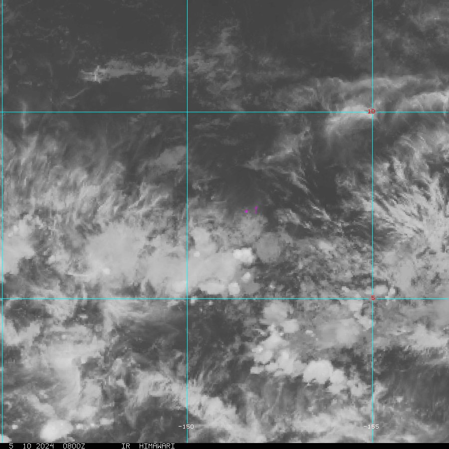
JMA 0Z analysis:
LOW PRESSURE AREA 1010 HPA NEAR 10N 143E WNW 15 KT.
Nothing imminent going on here. Latest vis loop:

NWS Guam's take from the AFD:
A SURFACE TROUGH EXTENDS NORTHWESTWARD FROM 3N144E TO A TROPICAL
DISTURBANCE CENTERED OVER YAP NEAR 10N139E...THEN CONTINUES
NORTHWARD TO END NEAR IWO TO ISLAND AT 25N141E. CONVERGING SURFACE
WINDS NEAR THE DISTURBANCE ARE PRODUCING SCATTERED SHOWERS AND A FEW
THUNDERSTORMS OVER KOROR AND YAP BETWEEN 7N AND 13N FROM 132E TO
141E...AND ALSO JUST SOUTHEAST OF GUAM WITHIN 100 MILES OF A LINE
FROM 10N143E TO 13N148E. TRADE WINDS CONVERGING TOWARD THE
SOUTHEASTERN QUADRANT OF THE DISTURBANCE ARE CAUSING SCATTERED
SHOWERS JUST NORTHWEST OF CHUUK WITHIN 65 MILES OF A LINE FROM
7N149E TO 9N151E.
LOW PRESSURE AREA 1010 HPA NEAR 10N 143E WNW 15 KT.
Nothing imminent going on here. Latest vis loop:
NWS Guam's take from the AFD:
A SURFACE TROUGH EXTENDS NORTHWESTWARD FROM 3N144E TO A TROPICAL
DISTURBANCE CENTERED OVER YAP NEAR 10N139E...THEN CONTINUES
NORTHWARD TO END NEAR IWO TO ISLAND AT 25N141E. CONVERGING SURFACE
WINDS NEAR THE DISTURBANCE ARE PRODUCING SCATTERED SHOWERS AND A FEW
THUNDERSTORMS OVER KOROR AND YAP BETWEEN 7N AND 13N FROM 132E TO
141E...AND ALSO JUST SOUTHEAST OF GUAM WITHIN 100 MILES OF A LINE
FROM 10N143E TO 13N148E. TRADE WINDS CONVERGING TOWARD THE
SOUTHEASTERN QUADRANT OF THE DISTURBANCE ARE CAUSING SCATTERED
SHOWERS JUST NORTHWEST OF CHUUK WITHIN 65 MILES OF A LINE FROM
7N149E TO 9N151E.
0 likes
-
StormingB81
- S2K Supporter
- Posts: 5676
- Age: 42
- Joined: Thu Aug 27, 2009 1:45 am
- Location: Rockledge, Florida
http://www.ssd.noaa.gov/PS/TROP/TCFP/da ... inrfpa.png
NOAA Really like the chances of 98w. They all the way up on the chart for probabilty.
NOAA Really like the chances of 98w. They all the way up on the chart for probabilty.
0 likes
-
dexterlabio
- Category 5
- Posts: 3407
- Joined: Sat Oct 24, 2009 11:50 pm
Re: WPAC: INVEST 98W
It seems gone, or maybe it moved NW.
0 likes
Personal Forecast Disclaimer:
The posts in this forum are NOT official forecast and should not be used as such. They are just the opinion of the poster and may or may not be backed by sound meteorological data. They are NOT endorsed by any professional institution or storm2k.org. For official information, please refer to the NHC and NWS products.
The posts in this forum are NOT official forecast and should not be used as such. They are just the opinion of the poster and may or may not be backed by sound meteorological data. They are NOT endorsed by any professional institution or storm2k.org. For official information, please refer to the NHC and NWS products.
Who is online
Users browsing this forum: No registered users and 106 guests