18z Best Track
AL, 91, 2010102818, , BEST, 0, 77N, 504W, 30, 1006, DB
ftp://ftp.tpc.ncep.noaa.gov/atcf/tcweb/ ... 010.invest
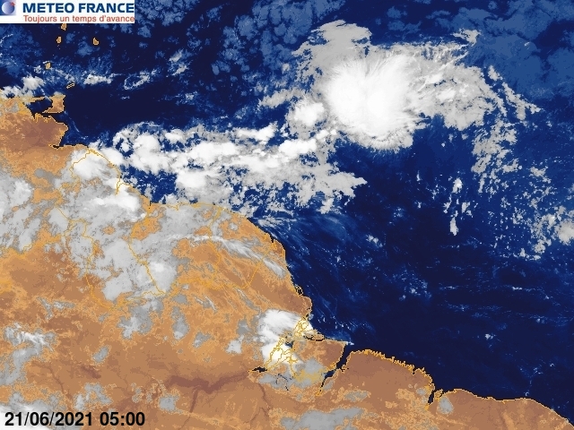
Keeps climbing in latitude.
ATL : EX TOMAS - Discussion
Moderator: S2k Moderators
-
cycloneye

- Admin

- Posts: 139028
- Age: 67
- Joined: Thu Oct 10, 2002 10:54 am
- Location: San Juan, Puerto Rico
Re: ATL : INVEST 91L - Discussion
0 likes
Visit the Caribbean-Central America Weather Thread where you can find at first post web cams,radars
and observations from Caribbean basin members Click Here
and observations from Caribbean basin members Click Here
-
chrisjslucia
- S2K Supporter

- Posts: 236
- Joined: Thu Oct 09, 2008 8:27 pm
- Location: St Lucia
Re: ATL : INVEST 91L - Discussion
bvigal wrote:To heck with the stupid percentage system. I see what I see on satellite. IF it develops (moving 18kt) it will be over a HUMAN's head in 3 days.
I think you're being a tad conservative there BVI, more like two days, especially if it keeps climbing latitude and says hello to Barbados.
0 likes


-
Gustywind

- Category 5

- Posts: 12334
- Joined: Mon Sep 03, 2007 7:29 am
- Location: Baie-Mahault, GUADELOUPE
000
AXNT20 KNHC 281749
TWDAT
TROPICAL WEATHER DISCUSSION
NWS TPC/NATIONAL HURRICANE CENTER MIAMI FL
205 PM EDT THU OCT 28 2010
TROPICAL WEATHER DISCUSSION FOR NORTH AMERICA...CENTRAL
AMERICA...GULF OF MEXICO...CARIBBEAN SEA...NORTHERN SECTIONS OF
SOUTH AMERICA...AND ATLANTIC OCEAN TO THE AFRICAN COAST FROM THE
EQUATOR TO 32N. THE FOLLOWING INFORMATION IS BASED ON SATELLITE
IMAGERY...METEOROLOGICAL ANALYSIS...WEATHER OBSERVATIONS...AND
RADAR.
BASED ON 1200 UTC SURFACE ANALYSIS AND SATELLITE IMAGERY THROUGH
1715 UTC.
...TROPICAL WAVES...
TROPICAL WAVE EXTENDS FROM 03N50W TO 13N46W MOVING W AT 15-20
KT. A 1006 MB LOW IS CENTERED ALONG THE WAVE AXIS NEAR 07N49W
AND CONTINUES TO PROVIDE LOW-LEVEL FOCUS FOR SCATTERED TO
NUMEROUS MODERATE AND SCATTERED STRONG CONVECTION FROM 06N-11N
BETWEEN 45W-52W. SCATTERED MODERATE AND ISOLATED STRONG
CONVECTION IS ELSEWHERE FROM 03N-15N BETWEEN 42W-54W.
ENHANCEMENT OF THE STRONGER ONGOING CONVECTION IS DUE TO UPPER
LEVEL DIFFLUENCE PROVIDED BY A BROAD UPPER LEVEL ANTICYCLONE
CENTERED NEAR 10N50W.
$$
HUFFMAN
0 likes

-
bvigal

- S2K Supporter
- Posts: 2275
- Joined: Sun Jul 24, 2005 8:49 am
- Location: British Virgin Islands
- Contact:
Re: ATL : INVEST 91L - Discussion
chrisjslucia wrote:bvigal wrote:To heck with the stupid percentage system. I see what I see on satellite. IF it develops (moving 18kt) it will be over a HUMAN's head in 3 days.
I think you're being a tad conservative there BVI, more like two days, especially if it keeps climbing latitude and says hello to Barbados.
You are SO CORRECT, Chris! I was being conservative!!
0 likes

-
Gustywind
- Category 5
- Posts: 12334
- Joined: Mon Sep 03, 2007 7:29 am
- Location: Baie-Mahault, GUADELOUPE
Kevin Roth, Lead Meteorologist, The Weather Channel
Oct. 28, 2010 11:09 am ET
ATLANTIC OCEAN
The third system is a well developed tropical wave located about 1000 miles to the southeast of the Windward Islands or just off the coast of South America near French Guiana and Suriname. The wave is moving toward the west-northwest between 15 and 20 mph.
Atmospheric conditions are favorable for development. There is a window of opportunity for the wave to develop an area of low pressure and become a tropical cyclone before it reaches the Windward Islands this weekend.
0 likes


Re:
HURAKAN wrote:ready for Halloween ... lol
0 likes
Andrew '92 Opal '95 Blizzard '96 Izzy '03 Irene '11 Sandy '12
The following post is NOT an official forecast and should not be used as such. It is just the opinion is not be backed by sound meteorological data. It is NOT endorsed by any professional institution including storm2k.org For Official Information please refer to the NHC and NWS products.
The following post is NOT an official forecast and should not be used as such. It is just the opinion is not be backed by sound meteorological data. It is NOT endorsed by any professional institution including storm2k.org For Official Information please refer to the NHC and NWS products.

-
HURAKAN

- Professional-Met

- Posts: 46086
- Age: 37
- Joined: Thu May 20, 2004 4:34 pm
- Location: Key West, FL
- Contact:
Re: ATL : INVEST 91L - Discussion
Macrocane wrote:LOL HURAKAN You've had some free time today, right?
took 1 minute! I had the idea since yesterday
0 likes
-
SouthDadeFish

- Professional-Met
- Posts: 2835
- Joined: Thu Sep 23, 2010 2:54 pm
- Location: Miami, FL
- Contact:
-
cycloneye
- Admin
- Posts: 139028
- Age: 67
- Joined: Thu Oct 10, 2002 10:54 am
- Location: San Juan, Puerto Rico
Re:
SouthDadeFish wrote:28/1745 UTC 8.7N 50.7W T1.5/1.5 91L -- Atlantic
That's a jump up from too weak.
And more north in latitude than 18z Best Track at 7.7N.
0 likes
Visit the Caribbean-Central America Weather Thread where you can find at first post web cams,radars
and observations from Caribbean basin members Click Here
and observations from Caribbean basin members Click Here
-
Gustywind
- Category 5
- Posts: 12334
- Joined: Mon Sep 03, 2007 7:29 am
- Location: Baie-Mahault, GUADELOUPE
Re: Re:
cycloneye wrote:SouthDadeFish wrote:28/1745 UTC 8.7N 50.7W T1.5/1.5 91L -- Atlantic
That's a jump up from too weak.
And more north in latitude than 18z Best Track at 7.7N.
 that's big shift.... to the north.
0 likes
-
northjaxpro

- S2K Supporter
- Posts: 8900
- Joined: Mon Sep 27, 2010 11:21 am
- Location: Jacksonville, FL
The more 91L gains in latitude and can avoid land interaction with SA, the greater probabilities that it will become a substantial tropical cyclone over time.
0 likes
NEVER, EVER SAY NEVER in the tropics and weather in general, and most importantly, with life itself!!
________________________________________________________________________________________
Fay 2008 Beryl 2012 Debby 2012 Colin 2016 Hermine 2016 Julia 2016 Matthew 2016 Irma 2017 Dorian 2019
________________________________________________________________________________________
Fay 2008 Beryl 2012 Debby 2012 Colin 2016 Hermine 2016 Julia 2016 Matthew 2016 Irma 2017 Dorian 2019


Looking decent on the microwave imagery right now and as others have said it is gaining latitude now which is a good thing if this one is going to develop.
Think it has a good chance to be honest down the line as long as it does avoid land which is looking likely.
Think it has a good chance to be honest down the line as long as it does avoid land which is looking likely.
0 likes
Personal Forecast Disclaimer:
The posts in this forum are NOT official forecast and should not be used as such. They are just the opinion of the poster and may or may not be backed by sound meteorological data. They are NOT endorsed by any professional institution or storm2k.org. For official information, please refer to the NHC and NWS products
The posts in this forum are NOT official forecast and should not be used as such. They are just the opinion of the poster and may or may not be backed by sound meteorological data. They are NOT endorsed by any professional institution or storm2k.org. For official information, please refer to the NHC and NWS products

Who is online
Users browsing this forum: No registered users and 56 guests