WPAC: AERE (1101/03W/Bebeng) - Tropical Storm
Moderator: S2k Moderators
-
phwxenthusiast
- Category 2

- Posts: 637
- Joined: Wed Mar 24, 2010 3:10 am
- Location: Holbrook, NY (Long Island)
wow, very hard to track this thing... my short term forecast was a complete bust, lol! and i had to mention that in my latest update tsk (well at least i can learn from these mistakes)... what's making this storm move parallel to the coast instead of the NW movement forecast earlier?? is it topography??
0 likes
-
dexterlabio
- Category 5

- Posts: 3406
- Joined: Sat Oct 24, 2009 11:50 pm
Re: WPAC: AERE (1101/03W/Bebeng) - Tropical Storm
Nice video, Rob! However, the GFS models you showed there got my attention. Seems like there's another circulation forming near 5N 140N. Well that's long range forecast so anything can happen.
Haven't heard any news from North Luzon about Aere's effects. But in Baler City in Southern Aurora, residents were saying in a flash report that the rains kept pouring but the winds were not that strong, that was when Aere made landfall in Palanan (?) somewhere in Isabela.
Haven't heard any news from North Luzon about Aere's effects. But in Baler City in Southern Aurora, residents were saying in a flash report that the rains kept pouring but the winds were not that strong, that was when Aere made landfall in Palanan (?) somewhere in Isabela.
0 likes
Personal Forecast Disclaimer:
The posts in this forum are NOT official forecast and should not be used as such. They are just the opinion of the poster and may or may not be backed by sound meteorological data. They are NOT endorsed by any professional institution or storm2k.org. For official information, please refer to the NHC and NWS products.
The posts in this forum are NOT official forecast and should not be used as such. They are just the opinion of the poster and may or may not be backed by sound meteorological data. They are NOT endorsed by any professional institution or storm2k.org. For official information, please refer to the NHC and NWS products.
-
dexterlabio
- Category 5
- Posts: 3406
- Joined: Sat Oct 24, 2009 11:50 pm
Re:
phwxenthusiast wrote:wow, very hard to track this thing...
Yeah it just moved very near the coast of Isabela, but I think it began to move NW going inland.
0 likes
Personal Forecast Disclaimer:
The posts in this forum are NOT official forecast and should not be used as such. They are just the opinion of the poster and may or may not be backed by sound meteorological data. They are NOT endorsed by any professional institution or storm2k.org. For official information, please refer to the NHC and NWS products.
The posts in this forum are NOT official forecast and should not be used as such. They are just the opinion of the poster and may or may not be backed by sound meteorological data. They are NOT endorsed by any professional institution or storm2k.org. For official information, please refer to the NHC and NWS products.
-
StormingB81

- S2K Supporter

- Posts: 5676
- Age: 42
- Joined: Thu Aug 27, 2009 1:45 am
- Location: Rockledge, Florida


Re:
phwxenthusiast wrote:wow, very hard to track this thing...
I think you might be correct. Remember we saw this last year? I can't remember which storm it was but it was one that hit Taiwan and "slid" up the coast. Later found out it was topography. Really interesting thing to witness on radar.
0 likes
-
RobWESTPACWX
- WestPACMet

- Posts: 1616
- Joined: Fri Sep 17, 2010 2:26 am
- Location: Tokyo, Japan
- Contact:
-
dexterlabio
- Category 5
- Posts: 3406
- Joined: Sat Oct 24, 2009 11:50 pm
Re: WPAC: AERE (1101/03W/Bebeng) - Tropical Storm
Infdidoll wrote:
I think you might be correct. Remember we saw this last year? I can't remember which storm it was but it was one that hit Taiwan and "slid" up the coast. Later found out it was topography. Really interesting thing to witness on radar.
I think that's FANAPI, the Cat3 typhoon that hit Taiwan.
0 likes
Personal Forecast Disclaimer:
The posts in this forum are NOT official forecast and should not be used as such. They are just the opinion of the poster and may or may not be backed by sound meteorological data. They are NOT endorsed by any professional institution or storm2k.org. For official information, please refer to the NHC and NWS products.
The posts in this forum are NOT official forecast and should not be used as such. They are just the opinion of the poster and may or may not be backed by sound meteorological data. They are NOT endorsed by any professional institution or storm2k.org. For official information, please refer to the NHC and NWS products.
Re: WPAC: AERE (1101/03W/Bebeng) - Tropical Storm
dexterlabio wrote:Infdidoll wrote:
I think you might be correct. Remember we saw this last year? I can't remember which storm it was but it was one that hit Taiwan and "slid" up the coast. Later found out it was topography. Really interesting thing to witness on radar.
I think that's FANAPI, the Cat3 typhoon that hit Taiwan.
Yes! That was the one!
0 likes
-
RobWESTPACWX
- WestPACMet
- Posts: 1616
- Joined: Fri Sep 17, 2010 2:26 am
- Location: Tokyo, Japan
- Contact:
Re: WPAC: AERE (1101/03W/Bebeng) - Tropical Storm
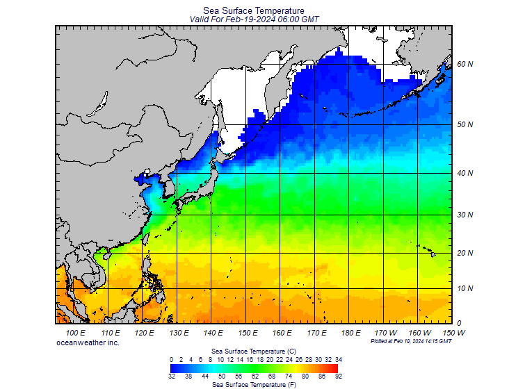
Another factor for continued development of this storm is the fact that Kuriosho is rolling right over the Ryukus
0 likes
Satellites, Charts and Forecasting tools for East Asia at WESTERNPACIFICWEATHER.COM
-
RobWESTPACWX
- WestPACMet
- Posts: 1616
- Joined: Fri Sep 17, 2010 2:26 am
- Location: Tokyo, Japan
- Contact:
I'm leaning a little towards JMA's last warning right now though that takes this storm to the W of Okinawa putting them on the right side. THe west Pac high does not look like it will weaken enough to bring it SE of the island.
Any thoughts?
Any thoughts?
0 likes
Satellites, Charts and Forecasting tools for East Asia at WESTERNPACIFICWEATHER.COM

-
HURAKAN

- Professional-Met

- Posts: 46086
- Age: 37
- Joined: Thu May 20, 2004 4:34 pm
- Location: Key West, FL
- Contact:
Re: WPAC: AERE (1101/03W/Bebeng) - Tropical Storm

WTPN31 PGTW 091500
MSGID/GENADMIN/NAVMARFCSTCEN PEARL HARBOR HI/JTWC//
SUBJ/TROPICAL CYCLONE WARNING//
RMKS/
1. TROPICAL STORM 03W (AERE) WARNING NR 014
01 ACTIVE TROPICAL CYCLONE IN NORTHWESTPAC
MAX SUSTAINED WINDS BASED ON ONE-MINUTE AVERAGE
WIND RADII VALID OVER OPEN WATER ONLY
---
WARNING POSITION:
091200Z --- NEAR 18.0N 122.3E
MOVEMENT PAST SIX HOURS - 360 DEGREES AT 09 KTS
POSITION ACCURATE TO WITHIN 060 NM
POSITION BASED ON CENTER LOCATED BY SATELLITE
PRESENT WIND DISTRIBUTION:
MAX SUSTAINED WINDS - 040 KT, GUSTS 050 KT
WIND RADII VALID OVER OPEN WATER ONLY
RADIUS OF 034 KT WINDS - 100 NM NORTHEAST QUADRANT
115 NM SOUTHEAST QUADRANT
100 NM SOUTHWEST QUADRANT
090 NM NORTHWEST QUADRANT
REPEAT POSIT: 18.0N 122.3E
---
FORECASTS:
12 HRS, VALID AT:
100000Z --- 19.8N 122.7E
MAX SUSTAINED WINDS - 040 KT, GUSTS 050 KT
WIND RADII VALID OVER OPEN WATER ONLY
RADIUS OF 034 KT WINDS - 100 NM NORTHEAST QUADRANT
115 NM SOUTHEAST QUADRANT
100 NM SOUTHWEST QUADRANT
090 NM NORTHWEST QUADRANT
VECTOR TO 24 HR POSIT: 030 DEG/ 13 KTS
---
24 HRS, VALID AT:
101200Z --- 22.0N 124.0E
MAX SUSTAINED WINDS - 040 KT, GUSTS 050 KT
WIND RADII VALID OVER OPEN WATER ONLY
RADIUS OF 034 KT WINDS - 090 NM NORTHEAST QUADRANT
095 NM SOUTHEAST QUADRANT
085 NM SOUTHWEST QUADRANT
080 NM NORTHWEST QUADRANT
VECTOR TO 36 HR POSIT: 045 DEG/ 15 KTS
---
36 HRS, VALID AT:
110000Z --- 24.1N 126.2E
MAX SUSTAINED WINDS - 040 KT, GUSTS 050 KT
WIND RADII VALID OVER OPEN WATER ONLY
RADIUS OF 034 KT WINDS - 080 NM NORTHEAST QUADRANT
085 NM SOUTHEAST QUADRANT
075 NM SOUTHWEST QUADRANT
070 NM NORTHWEST QUADRANT
VECTOR TO 48 HR POSIT: 045 DEG/ 17 KTS
---
EXTENDED OUTLOOK:
48 HRS, VALID AT:
111200Z --- 26.4N 128.9E
MAX SUSTAINED WINDS - 040 KT, GUSTS 050 KT
WIND RADII VALID OVER OPEN WATER ONLY
BECOMING EXTRATROPICAL
RADIUS OF 034 KT WINDS - 075 NM NORTHEAST QUADRANT
080 NM SOUTHEAST QUADRANT
070 NM SOUTHWEST QUADRANT
070 NM NORTHWEST QUADRANT
VECTOR TO 72 HR POSIT: 050 DEG/ 22 KTS
---
72 HRS, VALID AT:
121200Z --- 32.0N 136.9E
MAX SUSTAINED WINDS - 035 KT, GUSTS 045 KT
WIND RADII VALID OVER OPEN WATER ONLY
EXTRATROPICAL
VECTOR TO 96 HR POSIT: 055 DEG/ 31 KTS
---
LONG RANGE OUTLOOK:
NOTE...ERRORS FOR TRACK HAVE AVERAGED NEAR 250 NM
ON DAY 4 AND 350 NM ON DAY 5... AND FOR INTENSITY
NEAR 20 KT EACH DAY.
---
96 HRS, VALID AT:
131200Z --- 38.1N 149.9E
MAX SUSTAINED WINDS - 030 KT, GUSTS 040 KT
WIND RADII VALID OVER OPEN WATER ONLY
EXTRATROPICAL
---
REMARKS:
091500Z POSITION NEAR 18.4N 122.4E.
TROPICAL STORM (TS) 03W (AERE), LOCATED APPROXIMATELY 215 NM
NORTH-NORTHEAST OF MANILA, PHILIPPINES, TRACKED NORTHWARD AT 09
KNOTS OVER THE PAST SIX HOURS. MAXIMUM SIGNIFICANT WAVE HEIGHT AT
091200Z IS 13 FEET. NEXT WARNINGS AT 092100Z, 100300Z, 100900Z AND
101500Z.//
NNNN
0 likes

Re: WPAC: AERE (1101/03W/Bebeng) - Tropical Storm
Aere making it presence known by slamming the Philippines. Aere circulation center should be back over water, slightly intensifying as it moves to the north-north east sparing taiwan and sparing okinawa passing to the south. Good news for Japan, In my conscious mind, this will pass south of Japan and sparing the people of the japan winds and rain.
Aere will be 1 of many many storms that will hit our region this year.We must all be ready. I am...
Aere will be 1 of many many storms that will hit our region this year.We must all be ready. I am...
0 likes
Remember, all of my post aren't official. For official warnings and discussions, Please refer to your local NWS products...
NWS for the Western Pacific
https://www.weather.gov/gum/
NWS for the Western Pacific
https://www.weather.gov/gum/
WTPQ20 RJTD 091500
RSMC TROPICAL CYCLONE ADVISORY
NAME TS 1101 AERE (1101)
ANALYSIS
PSTN 091500UTC 18.5N 122.4E FAIR
MOVE N 08KT
PRES 996HPA
MXWD 035KT
GUST 050KT
30KT 90NM
FORECAST
24HF 101500UTC 22.1N 123.6E 85NM 70%
MOVE NNE 10KT
PRES 996HPA
MXWD 035KT
GUST 050KT
45HF 111200UTC 25.9N 126.2E 180NM 70% TROPICAL DEPRESSION =
0 likes
-
RobWESTPACWX
- WestPACMet
- Posts: 1616
- Joined: Fri Sep 17, 2010 2:26 am
- Location: Tokyo, Japan
- Contact:
Re: WPAC: AERE (1101/03W/Bebeng) - Tropical Storm
Most recent video, a late one here.
[youtube]http://www.youtube.com/watch?v=8J1mDbUlRB8[/youtube]
[youtube]http://www.youtube.com/watch?v=8J1mDbUlRB8[/youtube]
0 likes
Satellites, Charts and Forecasting tools for East Asia at WESTERNPACIFICWEATHER.COM
-
phwxenthusiast
- Category 2
- Posts: 637
- Joined: Wed Mar 24, 2010 3:10 am
- Location: Holbrook, NY (Long Island)
Re: WPAC: AERE (1101/03W/Bebeng) - Tropical Storm
dexterlabio wrote:Infdidoll wrote:
I think you might be correct. Remember we saw this last year? I can't remember which storm it was but it was one that hit Taiwan and "slid" up the coast. Later found out it was topography. Really interesting thing to witness on radar.
I think that's FANAPI, the Cat3 typhoon that hit Taiwan.
oh yeah! now i remember... yeah it was very interesting seeing Aere wobble last night...
0 likes
-
StormingB81
- S2K Supporter
- Posts: 5676
- Age: 42
- Joined: Thu Aug 27, 2009 1:45 am
- Location: Rockledge, Florida
-
StormingB81
- S2K Supporter
- Posts: 5676
- Age: 42
- Joined: Thu Aug 27, 2009 1:45 am
- Location: Rockledge, Florida
Who is online
Users browsing this forum: No registered users and 95 guests