


ATL: INVEST 93L - DISCUSSION
Moderator: S2k Moderators

Yeah thats a good point, even if it were to make it to Texas, its so small that only a small area would benefit...I suspect it ends up going towards the south of the state...
0 likes
Personal Forecast Disclaimer:
The posts in this forum are NOT official forecast and should not be used as such. They are just the opinion of the poster and may or may not be backed by sound meteorological data. They are NOT endorsed by any professional institution or storm2k.org. For official information, please refer to the NHC and NWS products
The posts in this forum are NOT official forecast and should not be used as such. They are just the opinion of the poster and may or may not be backed by sound meteorological data. They are NOT endorsed by any professional institution or storm2k.org. For official information, please refer to the NHC and NWS products
-
Ev1948
- S2K Supporter

- Posts: 65
- Joined: Mon Jun 28, 2010 6:16 pm
- Location: Florida USA -from South New Jersey
Re: ATL: INVEST 93L - DISCUSSION
We had clouds, but not one drop of rain here in east central Florida.. 
0 likes
The system sorta fell apart as it went inland then as the system reached the waters near W.Florida it blew into life again.
0 likes
Personal Forecast Disclaimer:
The posts in this forum are NOT official forecast and should not be used as such. They are just the opinion of the poster and may or may not be backed by sound meteorological data. They are NOT endorsed by any professional institution or storm2k.org. For official information, please refer to the NHC and NWS products
The posts in this forum are NOT official forecast and should not be used as such. They are just the opinion of the poster and may or may not be backed by sound meteorological data. They are NOT endorsed by any professional institution or storm2k.org. For official information, please refer to the NHC and NWS products
-
AdamFirst

- S2K Supporter
- Posts: 2487
- Age: 34
- Joined: Thu Aug 14, 2008 10:54 am
- Location: Port Saint Lucie, FL
Re: ATL: INVEST 93L - DISCUSSION
Ev1948 wrote:We had clouds, but not one drop of rain here in east central Florida..
It clouded over for like 30 minutes here at noon. Otherwise it's been sunny.
0 likes
Dolphins Marlins Canes Golden Panthers HEAT
Andrew 1992 - Irene 1999 - Frances 2004 - Jeanne 2004 - Wilma 2005 - Fay 2008 - Isaac 2012 - Matthew 2016 - Irma 2017 - Dorian 2019 - Ian 2022 - Nicole 2022
Andrew 1992 - Irene 1999 - Frances 2004 - Jeanne 2004 - Wilma 2005 - Fay 2008 - Isaac 2012 - Matthew 2016 - Irma 2017 - Dorian 2019 - Ian 2022 - Nicole 2022
-
cycloneye

- Admin

- Posts: 139025
- Age: 67
- Joined: Thu Oct 10, 2002 10:54 am
- Location: San Juan, Puerto Rico
Re: ATL: INVEST 93L - DISCUSSION
8 PM TWO=Down to 10%.
DISORGANIZED SHOWERS AND THUNDERSTORMS OVER THE FAR NORTHEASTERN
GULF OF MEXICO ARE ASSOCIATED WITH AN ELONGATED LOW PRESSURE AREA.
SIGNIFICANT DEVELOPMENT OF THIS SYSTEM IS UNLIKELY AS ENVIRONMENTAL
CONDITIONS ARE NOT PARTICULARLY CONDUCIVE OVER THE GULF OF MEXICO.
THERE IS A LOW CHANCE...10 PERCENT...OF THIS SYSTEM BECOMING A
TROPICAL CYCLONE DURING THE NEXT 48 HOURS AS IT MOVES
WEST-SOUTHWESTWARD AT 25 MPH.
FORECASTER BLAKE
0 likes
Visit the Caribbean-Central America Weather Thread where you can find at first post web cams,radars
and observations from Caribbean basin members Click Here
and observations from Caribbean basin members Click Here
-
wxman57

- Moderator-Pro Met

- Posts: 22480
- Age: 66
- Joined: Sat Jun 21, 2003 8:06 pm
- Location: Houston, TX (southwest)
Re: ATL: INVEST 93L - DISCUSSION
Looking at the ground truth (surface obs, which are numerous in the area), the disturbance is definitely less organized than 24 hours ago. The LLC which was east of FL has dissipated. There's no longer any evidence of a surface circulation. Obs in the eastern Gulf don't indicate anything significant. It's just a very fast-moving convective complex this evening.
At the rate the leading edge of the convection is moving (25 kts), it will reach the lower to middle Texas coast on Friday morning by sunrise rather than Friday afternoon. Development chances very slim.
At the rate the leading edge of the convection is moving (25 kts), it will reach the lower to middle Texas coast on Friday morning by sunrise rather than Friday afternoon. Development chances very slim.
0 likes
-
lrak

- S2K Supporter
- Posts: 1770
- Age: 57
- Joined: Thu Jun 21, 2007 2:48 pm
- Location: Corpus Christi, TX
Re: ATL: INVEST 93L - DISCUSSION
Any luck for Corpus Christi, it looks a little bigger than it was in the Atlantic?
We are racing RC cars in what used to be a grass backyard.
We are racing RC cars in what used to be a grass backyard.
0 likes
AKA karl
Also
Personal Forecast Disclaimer:
My posts on this forum are NOT official forecast and should not be used as such. My posts are my basic observations and are definitely not backed by any "well some" meteorological knowledge. For official information, please refer to the NHC and NWS products.
Also
Personal Forecast Disclaimer:
My posts on this forum are NOT official forecast and should not be used as such. My posts are my basic observations and are definitely not backed by any "well some" meteorological knowledge. For official information, please refer to the NHC and NWS products.

We had two bouts of storms from this, the second being far stronger. I live right where it went off into the Gulf...New Port Richey/Tarpon Springs. The stronger second hit was around 330pm. Winds were 40mph or so, 1 1/2" of rain fell in less than an hour. Such welcomed rains as it has been bone dry hot and sunny for weeks. Texas - keep your fingers crossed! Hope it hits you, too. That is almost 2" of much needed rain. 
0 likes

Re: ATL: INVEST 93L - DISCUSSION
That little storm is haulin across Florida and into the gulf. What an interesting start to the season.
0 likes
-
Nikki

- S2K Supporter
- Posts: 291
- Joined: Mon Jun 21, 2010 3:38 pm
- Location: Santa Fe, TX (yes I typed that right TEXAS not New Mexico, I am about 20 miles from Galveston, TX)
Re:
gsytch wrote:We had two bouts of storms from this, the second being far stronger. I live right where it went off into the Gulf...New Port Richey/Tarpon Springs. The stronger second hit was around 330pm. Winds were 40mph or so, 1 1/2" of rain fell in less than an hour. Such welcomed rains as it has been bone dry hot and sunny for weeks. Texas - keep your fingers crossed! Hope it hits you, too. That is almost 2" of much needed rain.
Believe me this Texan has her fingers crossed we will get some rain!!
0 likes
My name is Nicole and this is what I go by in Storm2k chat! Come chat with us! We have fun in there too!!
A teacher's purpose is not to create students in her own image, but to develop students who can create their own image. ~Author Unknown
Alicia, Allison, Rita, Ike
A teacher's purpose is not to create students in her own image, but to develop students who can create their own image. ~Author Unknown
Alicia, Allison, Rita, Ike
-
otowntiger
- Category 5

- Posts: 1787
- Joined: Tue Aug 31, 2004 7:06 pm
- Location: Orlando
Re: ATL: INVEST 93L - DISCUSSION
We got 1.78 inches today at my house in Orlando! Awesome. Just what the doctor ordered except most of it happened inside of 30 minutes, not exactly a gentle soaking.
0 likes
-
Rgv20

- S2K Supporter
- Posts: 2456
- Age: 37
- Joined: Wed Jan 05, 2011 5:42 pm
- Location: Edinburg/McAllen Tx
Discussion from the NWS Brownsville
AREA FORECAST DISCUSSION
NATIONAL WEATHER SERVICE BROWNSVILLE TX
729 PM CDT WED JUN 1 2011
.UPDATE...A RARE UPDATE TO THE LONG TERM PORTION OF THE FORECAST.
ADDED LOW POPS TO THE FRIDAY THROUGH SATURDAY TIME FRAME. NHC AND
WFO BRO IS MONITORING A WEAK DISTURBANCE MOVING INTO THE NORTHEAST
GULF OF MEXICO. THIS NON TROPICAL SURFACE LOW IS MOVING RATHER
QUICKLY ALONG THE SOUTHERN PERIPHERY OF THE SUBTROPICAL HIGH
PRESSURE RIDGE SITUATED OVER THE SOUTHERN GULF STATES. THE
DISTURBANCE IS CURRENTLY MOVING SOUTHWEST AT AROUND 25 MPH BUT
COULD TURN MOVE WEST SOUTHWEST AS THE RIDGE ESTABLISHES ITSELF
OVER THE TENNESSEE VALLEY OVER THE NEXT 24 TO 36 HOURS. NUMERICAL
AND HURRICANE MODELS HAVE BEEN FOLLOWING THIS TREND FOR THE LAST
24 HOURS. AT THIS TIME THE LOW WILL BE APPROACHING SOMEWHERE
ALONG THE TEXAS COAST LATER FRIDAY AND SPREADING MOISTURE INLAND
SATURDAY IF IT SURVIVES ITS TRIP ACROSS THE GULF. WITH THE ADDED
TROPICAL MOISTURE WE COULD SEE AN INCREASE IN SHOWERS OVER THE
GULF OF MEXICO WITH SOME ENHANCEMENT OF THE SEA BREEZE OVER THE
RIO GRANDE VALLEY. WITH THIS SAID ADDED 10 TO 20 PERCENT POPS
FRIDAY THROUGH SATURDAY. NO OTHER CHANGES MADE AT THIS TIME WITH
UNCERTAINTY IF THIS SCENARIO WILL PLAY OUT.
0 likes
The following post is NOT an official forecast and should not be used as such. It is just the opinion of the poster and may or may not be backed by sound meteorological data. It is NOT endorsed by any professional institution including storm2k.org For Official Information please refer to the NHC and NWS products.
-
GeneratorPower

- S2K Supporter
- Posts: 1648
- Age: 44
- Joined: Sun Dec 18, 2005 11:48 pm
- Location: Huntsville, AL
Re: ATL: INVEST 93L - DISCUSSION
HeeBGBz wrote:That little storm is haulin across Florida and into the gulf. What an interesting start to the season.
Yeah. But it's one of those giant blobs of convection which looks oh-so-round and drives me crazy. Still, interesting though.
0 likes
-
Terry
- S2K Supporter
- Posts: 1450
- Joined: Wed Aug 11, 2004 8:25 pm
- Location: Lakeland and Anna Maria Island, FL
- Contact:
Re: ATL: INVEST 93L - DISCUSSION
Here is the storm coming across Tampa Bay to the northern tip of Anna Maria Island.
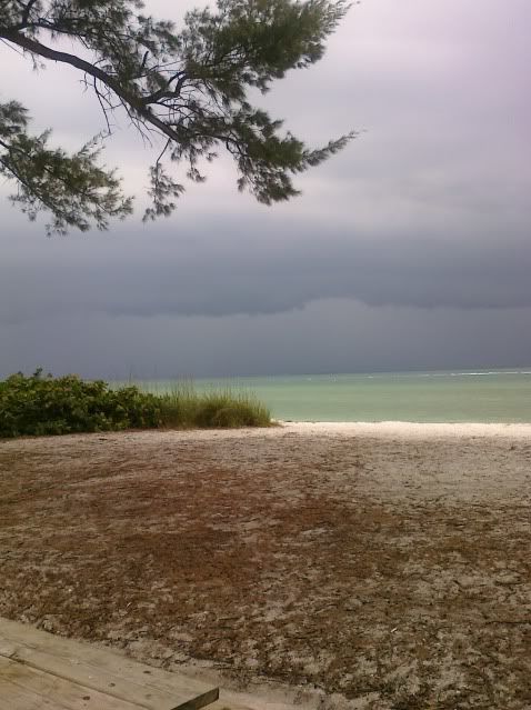
Here is the view to the west. It was like a normal summer clash of the sea breeze fronts as it hit us, but from a slightly different direction.
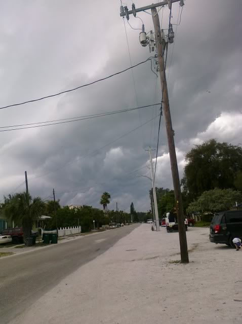
Here is the view to the west. It was like a normal summer clash of the sea breeze fronts as it hit us, but from a slightly different direction.
0 likes
-
JonathanBelles
- Professional-Met

- Posts: 11430
- Age: 33
- Joined: Sat Dec 24, 2005 9:00 pm
- Location: School: Florida State University (Tallahassee, FL) Home: St. Petersburg, Florida
- Contact:
This blob is haulin' t-shower!
Hopefully 93L will hold up long enough that recon will go tomorrow and long enough that you Texans will get some t-shower!
My mention of 93L, the record heat, the Caribbean Disturbance, and tonight's tornadoes across the US: http://jonathanbelles.wordpress.com/ .
Hopefully 93L will hold up long enough that recon will go tomorrow and long enough that you Texans will get some t-shower!
My mention of 93L, the record heat, the Caribbean Disturbance, and tonight's tornadoes across the US: http://jonathanbelles.wordpress.com/ .
0 likes

Re: ATL: INVEST 93L - DISCUSSION
man.. that thing may be in Mexico by tomorrow at this rate.. its really hauling butt.
0 likes
-
Weatherfreak000
Re: ATL: INVEST 93L MODELS
CYCLONE MIKE wrote:tailgater we need more than a tropical wave to help us out around ascension. Of course it would be a good start but we need a good multi day soaking. I wouldn't even care if it came way by a cat 1 or weak 2 as dry as things are right now.
I hear you on that. Here in New Orleans the temperature has been downright trifling. The news reported a lady leaving her baby in a car for 8 hours during NOLA heat and died. As terribly irresponsible or cruel as that lady was, man it was been HOT and no rain in sight.
I'm on board for a June TS strike....if he/she were a fast mover.
0 likes
Who is online
Users browsing this forum: No registered users and 28 guests