ATL: INVEST 94L - DISCUSSION
Moderator: S2k Moderators

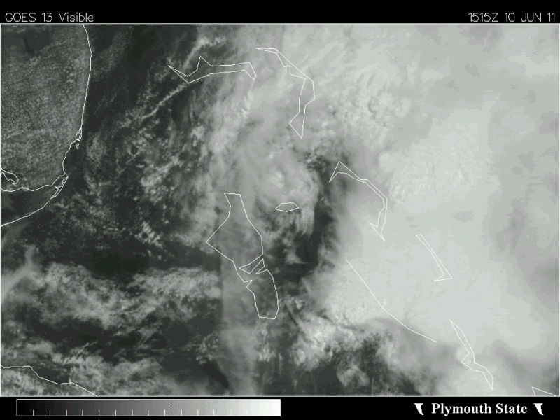
Weak LLC now on the move, looks to be moving just north of Nassau, winds beginning to switch to the SW.
Code: Select all
METAR text:  MYNN 101600Z 20011KT 9999 SCT012 BKN016TCU BKN120 29/26 A2984
Conditions at:  MYNN (NASSAU INTL , BS) observed 1600 UTC 10 June 2011
Temperature:  29.0°C (84°F)
Dewpoint:  26.0°C (79°F) [RH = 84%]
Pressure (altimeter):  29.84 inches Hg (1010.6 mb)
Winds:  from the SSW (200 degrees) at 13 MPH (11 knots; 5.7 m/s)
Visibility:  6 or more miles (10+ km)
Ceiling:  1600 feet AGL
Clouds:  scattered clouds at 1200 feet AGL
broken clouds at 1600 feet AGL
broken clouds at 12000 feet AGL
Weather:  no significant weather observed at this time
0 likes
-
SouthDadeFish

- Professional-Met

- Posts: 2835
- Joined: Thu Sep 23, 2010 2:54 pm
- Location: Miami, FL
- Contact:
Re:
NDG wrote:A personal wx station in Abaco Island, north of the circulation center has been reporting wind gust 30-42 mph all morning long.
Would very interesting to see what would have happened if shear was in the 10-20 knot range instead.
0 likes
-
cycloneye

- Admin

- Posts: 139028
- Age: 67
- Joined: Thu Oct 10, 2002 10:54 am
- Location: San Juan, Puerto Rico
Re: ATL: INVEST 94L - DISCUSSION
TROPICAL WEATHER OUTLOOK
NWS NATIONAL HURRICANE CENTER MIAMI FL
200 PM EDT FRI JUN 10 2011
FOR THE NORTH ATLANTIC...CARIBBEAN SEA AND THE GULF OF MEXICO...
AN ELONGATED TROUGH OF LOW PRESSURE IS PRODUCING A LARGE AREA OF
CLOUDINESS AND THUNDERSTORMS PRIMARILY OVER THE NORTHWESTERN AND
CENTRAL BAHAMAS AND THE ADJACENT ATLANTIC. SURFACE OBSERVATIONS
INDICATE THAT THE AREA OF LOWEST PRESSURE IS LOCATED OVER THE
NORTHWESTERN BAHAMAS MOVING NORTHWARD OR NORTH-NORTHEASTWARD. UPPER
LEVEL WINDS ARE NOT FAVORABLE FOR DEVELOPMENT AND THERE IS A LOW
CHANCE...10 PERCENT...OF THIS SYSTEM BECOMING A TROPICAL OR
SUBTROPICAL CYCLONE DURING THE NEXT 48 HOURS.
ELSEWHERE...TROPICAL CYCLONE FORMATION IS NOT EXPECTED DURING THE
NEXT 48 HOURS.
$$
FORECASTER AVILA
0 likes
Visit the Caribbean-Central America Weather Thread where you can find at first post web cams,radars
and observations from Caribbean basin members Click Here
and observations from Caribbean basin members Click Here

Re: ATL: INVEST 94L - DISCUSSION
Well, if Lixion Avila is telling us that then there's a pretty low chance it'll do anything (lol), though the outflow appears to be good to the north...
This system is giving me a headache - we missed the rain of yesterday and now we'll have to wait for those southwesterly winds forecast for Sunday to blow both the smoke and afternoon thunderstoms this way from the Everglades of Dade County...
Frank
This system is giving me a headache - we missed the rain of yesterday and now we'll have to wait for those southwesterly winds forecast for Sunday to blow both the smoke and afternoon thunderstoms this way from the Everglades of Dade County...
Frank
0 likes
-
northjaxpro

- S2K Supporter

- Posts: 8900
- Joined: Mon Sep 27, 2010 11:21 am
- Location: Jacksonville, FL
The ULL over Apalachee Bay will keep the moderate SW shear pumping over 94L and continue to curtail development. It is really a bummer simply because any type of tropical depression or weak tropical cyclone can bring much needed rain throughout the entire Florida peninsula. The brush fires are just getting out of hand here in NE FL. Smoke is everywhere throughout the region. 
0 likes
NEVER, EVER SAY NEVER in the tropics and weather in general, and most importantly, with life itself!!
________________________________________________________________________________________
Fay 2008 Beryl 2012 Debby 2012 Colin 2016 Hermine 2016 Julia 2016 Matthew 2016 Irma 2017 Dorian 2019
________________________________________________________________________________________
Fay 2008 Beryl 2012 Debby 2012 Colin 2016 Hermine 2016 Julia 2016 Matthew 2016 Irma 2017 Dorian 2019
-
northjaxpro
- S2K Supporter
- Posts: 8900
- Joined: Mon Sep 27, 2010 11:21 am
- Location: Jacksonville, FL
Re:
NDG wrote:Well, at least they now recognized that the lowest surface pressures is in the NW Bahamas.
NDG, yeah, it appeared that the weak LLC organized during the past 12 hours or so around Andros Island. It is moving N-N/NE and I think there is a slim chance that it may try to organize a bit as it moves farther out to sea in a few days. I think the upper environment may improve this weekend as the invest area moves a bit farther out. Still out of luck with this system bringing us relief from this serious drought unfortunately.
0 likes
NEVER, EVER SAY NEVER in the tropics and weather in general, and most importantly, with life itself!!
________________________________________________________________________________________
Fay 2008 Beryl 2012 Debby 2012 Colin 2016 Hermine 2016 Julia 2016 Matthew 2016 Irma 2017 Dorian 2019
________________________________________________________________________________________
Fay 2008 Beryl 2012 Debby 2012 Colin 2016 Hermine 2016 Julia 2016 Matthew 2016 Irma 2017 Dorian 2019
-
OuterBanker
- S2K Supporter
- Posts: 1704
- Joined: Wed Feb 26, 2003 10:53 am
- Location: Nags Head, NC
- Contact:
94l just won't get started. Come on little guy and head this way. We need a tropical system. Say around five inches should do it.
I know everyone in Fla and the Gulf needs it, but so do we.
We have had this fire in the peat bog for a month and every time the wind comes from the SW we get smoke (about every aftenoon, it is really annoying).
NC forest service has had hundreds fighting this since May 3 and say it could last for months. We have had about half of the rain so far this year and the peat is dry and thick.
So could someone send us a tropical storm, just make sure it's nice and wet.
0 likes


94L looks like it's barely fighting, and shear is destroying this invest. If shear would just weaken, and dry air would gain moisture, this storm would probably be Tropical Depression One or Arlene.
______________________________________
Do you Smell what he is COOKING?

______________________________________
Do you Smell what he is COOKING?
0 likes
_____________________
There can be only one Hypercane.....

There can be only one Hypercane.....
-
bvigal

- S2K Supporter
- Posts: 2275
- Joined: Sun Jul 24, 2005 8:49 am
- Location: British Virgin Islands
- Contact:
NDG, if you post another 7mb loop file, I'm going to have to ask you to upgrade my internet to more bandwidth. Internet in countries with 25,000 people and many with their 'finger in the pie' is VERY EXPENSIVE, and very slow. Hope you don't mind paying me $200/month so I can read your posts. Your precip water loop:
1. just froze my computer
2. won't mean anything in a week, because it will have updated and not apply to what you said
3. is against all those "MUST READ" "PLEASE READ" posts at the top of the forums. DO YOU READ?
Or maybe next time I'm in Orlando, you can treat me to dinner!!
1. just froze my computer
2. won't mean anything in a week, because it will have updated and not apply to what you said
3. is against all those "MUST READ" "PLEASE READ" posts at the top of the forums. DO YOU READ?
Or maybe next time I'm in Orlando, you can treat me to dinner!!
0 likes
-
bvigal
- S2K Supporter
- Posts: 2275
- Joined: Sun Jul 24, 2005 8:49 am
- Location: British Virgin Islands
- Contact:
Re: ATL: INVEST 94L - DISCUSSION
So anyway.... can't believe they popped this back on last night, and then never did another model run. File under "Arghhh, I can't believe I fell for this again!!"
Maybe someone can make them a rule: at least 2 model runs before you post or resurrect a "dead" invest. LOL!!
I can't believe I fell for this again!!" Maybe someone can make them a rule: at least 2 model runs before you post or resurrect a "dead" invest. LOL!!
0 likes
Sorry bvigal.
So I guess you do not want to click on my link below, is nearly a 6 mb zoomed in satellite loop of 94L.
The LLC that I pointed out earlier today has not moved much, still just NW of Nassau, not noticed too well in the last frames because of high cirrus moving over it from the convection off of the coast of Cuba.
Is fairly much convection free, not that it had much to begin with.
BTW, pressure in Nassau now down to 1008mb.
http://i20.photobucket.com/albums/b245/ndgarcia/110610222130_an.gif
0 likes
-
bvigal
- S2K Supporter
- Posts: 2275
- Joined: Sun Jul 24, 2005 8:49 am
- Location: British Virgin Islands
- Contact:
Re:
LOL! I might, but only after closing my other windows and apps.NDG wrote:Sorry bvigal.
So I guess you do not want to click on my link below, is nearly a 6 mb zoomed in satellite loop of 94L.
NDG wrote:... BTW, pressure in Nassau now down to 1008mb.
hmm, that's pretty low...
0 likes
-
wxman57

- Moderator-Pro Met

- Posts: 22480
- Age: 66
- Joined: Sat Jun 21, 2003 8:06 pm
- Location: Houston, TX (southwest)
Re: ATL: INVEST 94L - DISCUSSION
It's only in 60 kts of shear now, maybe it has a chance!
... or maybe not.
... or maybe not.
0 likes
-
bvigal
- S2K Supporter
- Posts: 2275
- Joined: Sun Jul 24, 2005 8:49 am
- Location: British Virgin Islands
- Contact:
Re: ATL: INVEST 94L - DISCUSSION
wxman57 wrote:It's only in 60 kts of shear now, maybe it has a chance!
... or maybe not.

0 likes
That personal station in Abaco Island still reporting fairly strong winds, occasionaly gusts to 40mph.
Check out the webcam of the beach, fairly rough surf.
http://www.wunderground.com/weatherstation/WXDailyHistory.asp?ID=IABACOEL1&month=6&day=10&year=2011
Check out the webcam of the beach, fairly rough surf.
http://www.wunderground.com/weatherstation/WXDailyHistory.asp?ID=IABACOEL1&month=6&day=10&year=2011
0 likes
-
HurricaneBelle

- S2K Supporter
- Posts: 974
- Joined: Sun Aug 27, 2006 6:12 pm
- Location: Clearwater, FL
Re: ATL: INVEST 94L - DISCUSSION
wxman57 wrote:It's only in 60 kts of shear now, maybe it has a chance!

0 likes
Who is online
Users browsing this forum: No registered users and 76 guests