ATL: CINDY - Remnants - Discussion

Moderator: S2k Moderators

Message
Author
User avatar
HURAKAN
Professional-Met
Professional-Met
Posts: 46086
Age: 37
Joined: Thu May 20, 2004 4:34 pm
Location: Key West, FL
Contact:

#141 Postby HURAKAN » Thu Jul 21, 2011 11:32 am

Image

Latest visible close-up
0 likes   

User avatar
Hurricaneman
Category 5
Category 5
Posts: 7280
Age: 43
Joined: Tue Aug 31, 2004 3:24 pm
Location: central florida

Re: ATL: CINDY - Tropical Storm - Discussion

#142 Postby Hurricaneman » Thu Jul 21, 2011 11:35 am

looks to be about 55 to 60 kts wouldnt go any higher
0 likes   

User avatar
artist
Category 5
Category 5
Posts: 9793
Joined: Mon Jun 06, 2005 3:26 pm
Location: West Palm

#143 Postby artist » Thu Jul 21, 2011 1:04 pm

000
WTNT23 KNHC 211440
TCMAT3

TROPICAL STORM CINDY FORECAST/ADVISORY NUMBER 4
NWS NATIONAL HURRICANE CENTER MIAMI FL AL032011
1500 UTC THU JUL 21 2011

THERE ARE NO COASTAL WATCHES OR WARNINGS IN EFFECT.

TROPICAL STORM CENTER LOCATED NEAR 40.3N 47.3W AT 21/1500Z
POSITION ACCURATE WITHIN 30 NM

PRESENT MOVEMENT TOWARD THE NORTHEAST OR 40 DEGREES AT 25 KT

ESTIMATED MINIMUM CENTRAL PRESSURE 1002 MB
MAX SUSTAINED WINDS 50 KT WITH GUSTS TO 60 KT.
50 KT....... 0NE 35SE 0SW 0NW.
34 KT....... 60NE 75SE 60SW 0NW.
12 FT SEAS.. 70NE 120SE 100SW 20NW.
WINDS AND SEAS VARY GREATLY IN EACH QUADRANT. RADII IN NAUTICAL
MILES ARE THE LARGEST RADII EXPECTED ANYWHERE IN THAT QUADRANT.

REPEAT...CENTER LOCATED NEAR 40.3N 47.3W AT 21/1500Z
AT 21/1200Z CENTER WAS LOCATED NEAR 39.4N 48.4W

FORECAST VALID 22/0000Z 42.7N 43.6W
MAX WIND 50 KT...GUSTS 60 KT.
50 KT... 40NE 50SE 0SW 0NW.
34 KT... 75NE 90SE 75SW 0NW.

FORECAST VALID 22/1200Z 45.9N 38.4W
MAX WIND 45 KT...GUSTS 55 KT.
34 KT... 90NE 105SE 90SW 0NW.

FORECAST VALID 23/0000Z 49.8N 32.8W...POST-TROP/EXTRATROP
MAX WIND 40 KT...GUSTS 50 KT.
34 KT... 75NE 120SE 100SW 0NW.

FORECAST VALID 23/1200Z 52.0N 26.0W...POST-TROP/EXTRATROP
MAX WIND 25 KT...GUSTS 35 KT.

FORECAST VALID 24/1200Z...DISSIPATED

REQUEST FOR 3 HOURLY SHIP REPORTS WITHIN 300 MILES OF 40.3N 47.3W

NEXT ADVISORY AT 21/2100Z

$$
FORECASTER BEVEN
0 likes   

User avatar
HURAKAN
Professional-Met
Professional-Met
Posts: 46086
Age: 37
Joined: Thu May 20, 2004 4:34 pm
Location: Key West, FL
Contact:

Re: ATL: CINDY - Tropical Storm - Discussion

#144 Postby HURAKAN » Thu Jul 21, 2011 1:21 pm

21/1745 UTC 41.3N 46.3W T2.5/2.5 CINDY


35 knots & tropical
0 likes   

User avatar
HURAKAN
Professional-Met
Professional-Met
Posts: 46086
Age: 37
Joined: Thu May 20, 2004 4:34 pm
Location: Key West, FL
Contact:

#145 Postby HURAKAN » Thu Jul 21, 2011 1:38 pm

Image

still remains impressive
0 likes   

User avatar
HURAKAN
Professional-Met
Professional-Met
Posts: 46086
Age: 37
Joined: Thu May 20, 2004 4:34 pm
Location: Key West, FL
Contact:

#146 Postby HURAKAN » Thu Jul 21, 2011 2:24 pm

AL, 03, 2011072118, , BEST, 0, 414N, 462W, 50, 1002, TS

no change
0 likes   

User avatar
cycloneye
Admin
Admin
Posts: 139051
Age: 67
Joined: Thu Oct 10, 2002 10:54 am
Location: San Juan, Puerto Rico

Re: ATL: CINDY - Advisories

#147 Postby cycloneye » Thu Jul 21, 2011 3:40 pm

TROPICAL STORM CINDY DISCUSSION NUMBER 5
NWS NATIONAL HURRICANE CENTER MIAMI FL AL032011
500 PM AST THU JUL 21 2011

SEVERAL MICROWAVE IMAGES THIS AFTERNOON SHOW THAT CINDY HAS BEEN
TRYING TO FORM AN EYEWALL. A CLEAR SPOT HAS BEEN APPARENT IN
VISIBLE IMAGERY...ALTHOUGH THE DEEP CONVECTION HAS NEVER WRAPPED
AROUND IT ENOUGH TO CALL IT AN EYE. SATELLITE INTENSITY ESTIMATES
FROM TAFB AND SAB ARE UNCHANGED FROM EARLIER...AND A RECENT CIRA
AMSU ESTIMATE WAS 49 KT. BASED ON THIS...THE INITIAL INTENSITY
REMAINS 50 KT...BUT THIS COULD BE A LITTLE CONSERVATIVE.

THE INITIAL MOTION IS 040/24. CINDY REMAINS EMBEDDED IN MODERATE
DEEP-LAYER SOUTHWESTERLY FLOW BETWEEN THE SUBTROPICAL RIDGE TO THE
SOUTHEAST AND THE MAIN BAND OF THE WESTERLIES TO THE NORTHWEST.
THIS PATTERN IS FORECAST TO PERSIST AND STEER CINDY GENERALLY
NORTHEASTWARD FOR 36 HR OR SO...FOLLOWED BY A MORE EAST-
NORTHEASTWARD MOTION BEFORE THE CYCLONE DISSIPATES. THE NEW
FORECAST TRACK IS JUST A LITTLE TO THE LEFT OF THE PREVIOUS
FORECAST BASED ON THE INITIAL POSITION.

CINDY SHOULD WEAKEN DURING THE NEXT COUPLE OF DAYS DUE TO COLD SEA
SURFACE TEMPERATURES ALONG THE FORECAST TRACK AND EXTRATROPICAL
TRANSITION. THE CYCLONE IS EXPECTED TO BECOME EXTRATROPICAL IN
ABOUT 24 HR AND WEAKEN TO A TROUGH IN ABOUT 72 HR IN AGREEMENT WITH
THE GLOBAL MODEL GUIDANCE.

FORECAST POSITIONS AND MAX WINDS

INIT 21/2100Z 42.3N 45.0W 50 KT 60 MPH
12H 22/0600Z 44.5N 41.4W 45 KT 50 MPH
24H 22/1800Z 47.9N 36.1W 40 KT 45 MPH...POST-TROP/EXTRATROP
36H 23/0600Z 51.6N 29.8W 35 KT 40 MPH...POST-TROP/EXTRATROP
48H 23/1800Z 55.0N 22.6W 25 KT 30 MPH...POST-TROP/EXTRATROP
72H 24/1800Z...DISSIPATED

$$
FORECASTER BEVEN
0 likes   
Visit the Caribbean-Central America Weather Thread where you can find at first post web cams,radars
and observations from Caribbean basin members Click Here

CrazyC83
Professional-Met
Professional-Met
Posts: 33393
Joined: Tue Mar 07, 2006 11:57 pm
Location: Deep South, for the first time!

#148 Postby CrazyC83 » Thu Jul 21, 2011 3:42 pm

Doing pretty good considering its latitude...
0 likes   

User avatar
MGC
S2K Supporter
S2K Supporter
Posts: 5792
Joined: Sun Mar 23, 2003 9:05 pm
Location: Pass Christian MS, or what is left.

Re: ATL: CINDY - Tropical Storm - Discussion

#149 Postby MGC » Thu Jul 21, 2011 4:08 pm

Yep, looking like the ET transition has started.....MGC
0 likes   

CrazyC83
Professional-Met
Professional-Met
Posts: 33393
Joined: Tue Mar 07, 2006 11:57 pm
Location: Deep South, for the first time!

#150 Postby CrazyC83 » Thu Jul 21, 2011 4:27 pm

The Atlantic amazes me in that tropical cyclones can routinely get to or above 45N latitude, which isn't even the subtropics...
0 likes   

User avatar
somethingfunny
ChatStaff
ChatStaff
Posts: 3926
Age: 35
Joined: Thu May 31, 2007 10:30 pm
Location: McKinney, Texas

Re:

#151 Postby somethingfunny » Thu Jul 21, 2011 4:29 pm

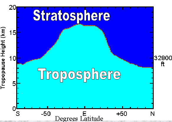
CrazyC83 wrote:The Atlantic amazes me in that tropical cyclones can routinely get to or above 45N latitude, which isn't even the subtropics...


The Gulf Stream is a beast. I recently noticed on a global SST map that the water off Sweden is warmer than the water off Los Angeles, LOL. The WPAC has its' own warm water current but it isn't as strong as the Atlantic's.
0 likes   
I am not a meteorologist, and any posts made by me are not official forecasts or to be interpreted as being intelligent. These posts are just my opinions and are probably silly opinions.

User avatar
KWT
Category 5
Category 5
Posts: 31390
Joined: Tue Aug 17, 2004 11:02 am
Location: UK!!!

#152 Postby KWT » Thu Jul 21, 2011 5:00 pm

Cindy still battling on it seems, 50kts seems a pretty good estimate to me based on its presentation...
0 likes   
Personal Forecast Disclaimer:
The posts in this forum are NOT official forecast and should not be used as such. They are just the opinion of the poster and may or may not be backed by sound meteorological data. They are NOT endorsed by any professional institution or storm2k.org. For official information, please refer to the NHC and NWS products

User avatar
HURAKAN
Professional-Met
Professional-Met
Posts: 46086
Age: 37
Joined: Thu May 20, 2004 4:34 pm
Location: Key West, FL
Contact:

#153 Postby HURAKAN » Thu Jul 21, 2011 5:08 pm

Image

still going strong
0 likes   

User avatar
HURAKAN
Professional-Met
Professional-Met
Posts: 46086
Age: 37
Joined: Thu May 20, 2004 4:34 pm
Location: Key West, FL
Contact:

#154 Postby HURAKAN » Thu Jul 21, 2011 5:12 pm

Image

impressive in visible
0 likes   

User avatar
KWT
Category 5
Category 5
Posts: 31390
Joined: Tue Aug 17, 2004 11:02 am
Location: UK!!!

#155 Postby KWT » Thu Jul 21, 2011 5:19 pm

Yeah that is an impressive looking system, shallow convection though...reminds me of several of the N.Atlantic systerms since 2005 that either became hurricanes or were very close.
0 likes   
Personal Forecast Disclaimer:
The posts in this forum are NOT official forecast and should not be used as such. They are just the opinion of the poster and may or may not be backed by sound meteorological data. They are NOT endorsed by any professional institution or storm2k.org. For official information, please refer to the NHC and NWS products

User avatar
HURAKAN
Professional-Met
Professional-Met
Posts: 46086
Age: 37
Joined: Thu May 20, 2004 4:34 pm
Location: Key West, FL
Contact:

Re:

#156 Postby HURAKAN » Thu Jul 21, 2011 5:25 pm

KWT wrote:Yeah that is an impressive looking system, shallow convection though...reminds me of several of the N.Atlantic systerms since 2005 that either became hurricanes or were very close.


The convection is shallow because the tropopause in the subtropics and polar region is closer to the surface than in tropical regions. So, you will never see reds in the infrared images with these systems.

Image
0 likes   

User avatar
HURAKAN
Professional-Met
Professional-Met
Posts: 46086
Age: 37
Joined: Thu May 20, 2004 4:34 pm
Location: Key West, FL
Contact:

#157 Postby HURAKAN » Thu Jul 21, 2011 5:40 pm

Image

latest microwave
0 likes   

User avatar
HURAKAN
Professional-Met
Professional-Met
Posts: 46086
Age: 37
Joined: Thu May 20, 2004 4:34 pm
Location: Key West, FL
Contact:

Re: ATL: CINDY - Tropical Storm - Discussion

#158 Postby HURAKAN » Thu Jul 21, 2011 8:02 pm

21/2345 UTC 42.7N 43.7W T2.5/2.5 CINDY

no change
0 likes   

User avatar
HURAKAN
Professional-Met
Professional-Met
Posts: 46086
Age: 37
Joined: Thu May 20, 2004 4:34 pm
Location: Key West, FL
Contact:

Re: ATL: CINDY - Tropical Storm - Discussion

#159 Postby HURAKAN » Thu Jul 21, 2011 8:03 pm

AL, 03, 2011072200, , BEST, 0, 427N, 440W, 50, 1002, TS

no change
0 likes   

User avatar
cycloneye
Admin
Admin
Posts: 139051
Age: 67
Joined: Thu Oct 10, 2002 10:54 am
Location: San Juan, Puerto Rico

Re: ATL: CINDY - Tropical Storm - Discussion

#160 Postby cycloneye » Thu Jul 21, 2011 8:06 pm

HURAKAN wrote:AL, 03, 2011072200, , BEST, 0, 427N, 440W, 50, 1002, TS

no change


It went down to 45kts.

AL, 03, 2011072200, , BEST, 0, 427N, 440W, 45, 1000, TS

ftp://ftp.tpc.ncep.noaa.gov/atcf/tcweb/ ... 011.invest
0 likes   
Visit the Caribbean-Central America Weather Thread where you can find at first post web cams,radars
and observations from Caribbean basin members Click Here


Return to “2011”

Who is online

Users browsing this forum: No registered users and 36 guests