
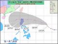
WPAC: MERBOK - Tropical Storm
Moderator: S2k Moderators
-
climateconcern23
- Tropical Low

- Posts: 35
- Age: 33
- Joined: Sat Mar 05, 2011 4:38 am
- Location: Philippines
- Contact:
WPAC: MERBOK - Tropical Storm
Last edited by climateconcern23 on Sat Aug 06, 2011 7:02 pm, edited 2 times in total.
0 likes

-
dexterlabio
- Category 5

- Posts: 3406
- Joined: Sat Oct 24, 2009 11:50 pm
Re: WPAC: INVEST 98W
Wow. Near the area where models depict a new system developing. 
0 likes
Personal Forecast Disclaimer:
The posts in this forum are NOT official forecast and should not be used as such. They are just the opinion of the poster and may or may not be backed by sound meteorological data. They are NOT endorsed by any professional institution or storm2k.org. For official information, please refer to the NHC and NWS products.
The posts in this forum are NOT official forecast and should not be used as such. They are just the opinion of the poster and may or may not be backed by sound meteorological data. They are NOT endorsed by any professional institution or storm2k.org. For official information, please refer to the NHC and NWS products.

Re: WPAC: INVEST 98W
yep euro showing this system developing into a weak tropical storm and that should be it. its moisture should reach mainland japan...
0 likes
Remember, all of my post aren't official. For official warnings and discussions, Please refer to your local NWS products...
NWS for the Western Pacific
https://www.weather.gov/gum/
NWS for the Western Pacific
https://www.weather.gov/gum/
Re: WPAC: INVEST 98W
forecast has this becoming stronger possibly a weak typhoon down the road but eventually recurving out to sea
Next name: Merbok (Malaysia) - A spotted-necked dove, most commonly found in the rural areas and on wasteland, is a popular caged bird by the local inhabitants of Malaysia.
Next name: Merbok (Malaysia) - A spotted-necked dove, most commonly found in the rural areas and on wasteland, is a popular caged bird by the local inhabitants of Malaysia.
0 likes
Remember, all of my post aren't official. For official warnings and discussions, Please refer to your local NWS products...
NWS for the Western Pacific
https://www.weather.gov/gum/
NWS for the Western Pacific
https://www.weather.gov/gum/

-
phwxenthusiast
- Category 2

- Posts: 637
- Joined: Wed Mar 24, 2010 3:10 am
- Location: Holbrook, NY (Long Island)
-
HURAKAN

- Professional-Met

- Posts: 46086
- Age: 37
- Joined: Thu May 20, 2004 4:34 pm
- Location: Key West, FL
- Contact:
Re: WPAC: INVEST 98W
THE AREA OF CONVECTION PREVIOUSLY LOCATED NEAR 23.0N
164.9E, IS NOW LOCATED NEAR 22.8N 163.9E, APPROXIMATELY 245 NM NORTH-
NORTHWEST OF WAKE ISLAND. ANIMATED MULTISPECTRAL SATELLITE IMAGERY
(MSI) HAS SHOWN SHALLOW, BUT PERSISTENT CONVECTION NEAR AN ELONGATED
LOW LEVEL CIRCULATION CENTER (LLCC) OVER THE PAST 48 HOURS. THIS
LLCC, WHICH IS LIKELY A REFLECTION OF AN UPPER LEVEL LOW, APPEARS TO
BE MORE SUBTROPICAL IN STRUCTURE AND APPEARANCE ON MSI. A 01/2301
ASCAT PASS INDICATES 10-20 KNOT WINDS NEAR THE LLCC WITH 25-30 KNOT
GRADIENT WINDS DISPLACED WELL TO THE NORTH OF THE LLCC. UPPER LEVEL
ANALYSIS INDICATES THE SYSTEM IS JUST EQUATORWARD OF AN UPPER-LEVEL
DIFFLUENT REGION. MEAN SEA LEVEL PRESSURE AT WAKE ISLAND AT 02/0300Z
WAS 1008 MB, A 2 MB DROP DURING THE PAST 24 HOURS. MAXIMUM SUSTAINED
SURFACE WINDS ARE ESTIMATED AT 15 TO 20 KNOTS. MINIMUM SEA LEVEL
PRESSURE IS ESTIMATED TO BE NEAR 1006 MB. THE POTENTIAL FOR THE
DEVELOPMENT OF A SIGNIFICANT TROPICAL CYCLONE WITHIN THE NEXT 24
HOURS REMAINS MEDIUM.
0 likes
Re: WPAC: INVEST 98W
if this was in the atlantic, this would be a subtropical storm. i don't think jtwc even uses that term.
euro forecasting another tropical cyclone to develop right in front of this. we will see...
euro forecasting another tropical cyclone to develop right in front of this. we will see...
0 likes
Remember, all of my post aren't official. For official warnings and discussions, Please refer to your local NWS products...
NWS for the Western Pacific
https://www.weather.gov/gum/
NWS for the Western Pacific
https://www.weather.gov/gum/
-
phwxenthusiast
- Category 2
- Posts: 637
- Joined: Wed Mar 24, 2010 3:10 am
- Location: Holbrook, NY (Long Island)
-
oaba09
- S2K Supporter

- Posts: 1496
- Age: 37
- Joined: Thu Oct 01, 2009 10:02 am
- Location: Valenzuela, Philippines
- Contact:
Re:
phwxenthusiast wrote:upgraded now to TS Merbok by JMA.. i think the title needs to be updated...
Yup, JMA already upgraded this to a TS...
There is also a new TD west of Merbok and east of Muifa
0 likes
-
phwxenthusiast
- Category 2
- Posts: 637
- Joined: Wed Mar 24, 2010 3:10 am
- Location: Holbrook, NY (Long Island)
Re: Re:
oaba09 wrote:phwxenthusiast wrote:upgraded now to TS Merbok by JMA.. i think the title needs to be updated...
Yup, JMA already upgraded this to a TS...
There is also a new TD west of Merbok and east of Muifa
lol i know, a very busy pacific indeed!! or maybe it's just the JMA being trigger happy?? haha we don't know...

interestingly, JTWC is still keeping the Medium rating despite good organization on IR and VIS...
0 likes

Think its probably been a TD/TS for a little while now judging by that above Sat.image from last night.
0 likes
Personal Forecast Disclaimer:
The posts in this forum are NOT official forecast and should not be used as such. They are just the opinion of the poster and may or may not be backed by sound meteorological data. They are NOT endorsed by any professional institution or storm2k.org. For official information, please refer to the NHC and NWS products
The posts in this forum are NOT official forecast and should not be used as such. They are just the opinion of the poster and may or may not be backed by sound meteorological data. They are NOT endorsed by any professional institution or storm2k.org. For official information, please refer to the NHC and NWS products
WTPQ20 RJTD 030900
RSMC TROPICAL CYCLONE ADVISORY
NAME TS 1110 MERBOK (1110)
ANALYSIS
PSTN 030900UTC 23.4N 160.6E FAIR
MOVE WNW SLOWLY
PRES 1000HPA
MXWD 035KT
GUST 050KT
30KT 130NM NORTH 90NM SOUTH
FORECAST
24HF 040900UTC 24.9N 156.3E 70NM 70%
MOVE WNW 10KT
PRES 990HPA
MXWD 045KT
GUST 065KT
45HF 050600UTC 26.2N 153.7E 110NM 70%
MOVE WNW 07KT
PRES 985HPA
MXWD 050KT
GUST 070KT
69HF 060600UTC 28.4N 152.6E 160NM 70%
MOVE NNW 06KT
PRES 980HPA
MXWD 055KT
GUST 080KT =
0 likes
-
dexterlabio
- Category 5
- Posts: 3406
- Joined: Sat Oct 24, 2009 11:50 pm
Re: WPAC: Merbok
Many systems now on NRL including a new invest 99W but no info and image yet. Still waiting on JTWC's warning for this storm, and I thought they would issue the warning along with the latest warning on Muifa.
0 likes
Personal Forecast Disclaimer:
The posts in this forum are NOT official forecast and should not be used as such. They are just the opinion of the poster and may or may not be backed by sound meteorological data. They are NOT endorsed by any professional institution or storm2k.org. For official information, please refer to the NHC and NWS products.
The posts in this forum are NOT official forecast and should not be used as such. They are just the opinion of the poster and may or may not be backed by sound meteorological data. They are NOT endorsed by any professional institution or storm2k.org. For official information, please refer to the NHC and NWS products.

Here we go, warning #1 on TD 12W:
WTPN31 PGTW 030900
MSGID/GENADMIN/NAVMARFCSTCEN PEARL HARBOR HI/JTWC//
SUBJ/TROPICAL CYCLONE WARNING//
RMKS/
1. TROPICAL DEPRESSION 12W (MERBOK) WARNING NR 001
01 ACTIVE TROPICAL CYCLONE IN NORTHWESTPAC (sic)
MAX SUSTAINED WINDS BASED ON ONE-MINUTE AVERAGE
WIND RADII VALID OVER OPEN WATER ONLY
---
WARNING POSITION:
030600Z --- NEAR 23.5N 160.7E
MOVEMENT PAST SIX HOURS - 280 DEGREES AT 12 KTS
POSITION ACCURATE TO WITHIN 060 NM
POSITION BASED ON CENTER LOCATED BY SATELLITE
PRESENT WIND DISTRIBUTION:
MAX SUSTAINED WINDS - 030 KT, GUSTS 040 KT
WIND RADII VALID OVER OPEN WATER ONLY
REPEAT POSIT: 23.5N 160.7E
---
FORECASTS:
12 HRS, VALID AT:
031800Z --- 24.1N 158.4E
MAX SUSTAINED WINDS - 035 KT, GUSTS 045 KT
WIND RADII VALID OVER OPEN WATER ONLY
VECTOR TO 24 HR POSIT: 290 DEG/ 09 KTS
---
24 HRS, VALID AT:
040600Z --- 24.8N 156.5E
MAX SUSTAINED WINDS - 040 KT, GUSTS 050 KT
WIND RADII VALID OVER OPEN WATER ONLY
RADIUS OF 034 KT WINDS - 040 NM NORTHEAST QUADRANT
035 NM SOUTHEAST QUADRANT
035 NM SOUTHWEST QUADRANT
040 NM NORTHWEST QUADRANT
VECTOR TO 36 HR POSIT: 315 DEG/ 07 KTS
---
36 HRS, VALID AT:
041800Z --- 25.8N 155.4E
MAX SUSTAINED WINDS - 045 KT, GUSTS 055 KT
WIND RADII VALID OVER OPEN WATER ONLY
RADIUS OF 034 KT WINDS - 060 NM NORTHEAST QUADRANT
055 NM SOUTHEAST QUADRANT
055 NM SOUTHWEST QUADRANT
060 NM NORTHWEST QUADRANT
VECTOR TO 48 HR POSIT: 330 DEG/ 07 KTS
---
EXTENDED OUTLOOK:
48 HRS, VALID AT:
050600Z --- 27.0N 154.6E
MAX SUSTAINED WINDS - 050 KT, GUSTS 065 KT
WIND RADII VALID OVER OPEN WATER ONLY
RADIUS OF 034 KT WINDS - 085 NM NORTHEAST QUADRANT
080 NM SOUTHEAST QUADRANT
075 NM SOUTHWEST QUADRANT
080 NM NORTHWEST QUADRANT
VECTOR TO 72 HR POSIT: 340 DEG/ 06 KTS
---
72 HRS, VALID AT:
060600Z --- 29.2N 153.8E
MAX SUSTAINED WINDS - 055 KT, GUSTS 070 KT
WIND RADII VALID OVER OPEN WATER ONLY
RADIUS OF 050 KT WINDS - 030 NM NORTHEAST QUADRANT
025 NM SOUTHEAST QUADRANT
025 NM SOUTHWEST QUADRANT
025 NM NORTHWEST QUADRANT
RADIUS OF 034 KT WINDS - 100 NM NORTHEAST QUADRANT
100 NM SOUTHEAST QUADRANT
095 NM SOUTHWEST QUADRANT
095 NM NORTHWEST QUADRANT
VECTOR TO 96 HR POSIT: 015 DEG/ 07 KTS
---
LONG RANGE OUTLOOK:
NOTE...ERRORS FOR TRACK HAVE AVERAGED NEAR 250 NM
ON DAY 4 AND 350 NM ON DAY 5... AND FOR INTENSITY
NEAR 20 KT EACH DAY.
---
96 HRS, VALID AT:
070600Z --- 32.1N 154.6E
MAX SUSTAINED WINDS - 055 KT, GUSTS 070 KT
WIND RADII VALID OVER OPEN WATER ONLY
VECTOR TO 120 HR POSIT: 035 DEG/ 09 KTS
---
120 HRS, VALID AT:
080600Z --- 34.9N 157.2E
MAX SUSTAINED WINDS - 045 KT, GUSTS 055 KT
WIND RADII VALID OVER OPEN WATER ONLY
---
REMARKS:
030600Z POSITION NEAR 23.7N 160.1E.
TROPICAL DEPRESSION 12W (MERBOK), LOCATED APPROXIMATELY 420 NM
NORTHWEST OF WAKE ISLAND, HAS TRACKED WEST-NORTHWESTWARD AT 10 KNOTS
OVER THE PAST SIX HOURS. ANIMATED INFRARED SATELLITE IMAGERY SHOWS
DEEP CONVECTION ALONG THE WESTERN PERIPHERY OF A LOW-LEVEL
CIRCULATION CENTER (LLCC) WITH ADDITIONAL CONVECTION WRAPPING IN
FROM THE NORTH. A 03/0753Z 91 GHZ SSMIS ALSO SHOWS THIS CONVECTION
ALONG THE WESTERN AND NORTHERN QUADRANTS OF TD 12W. TD 12W IS
CURRENTLY TRANSITIONING FROM A SUBTROPICAL TO TROPICAL SYSTEM AS
VIGOROUS OUTFLOW HAS ALLOWED CONVECTION TO PERSIST AND WINDS TO
INCREASE NEAR THE LLCC. THIS PERSISTENT CONVECTION HAS RESULTED IN A
WEAK WARM CORE DEVELOPING, AS EVIDENCED ON A 03/0238Z TEMPERATURE
ANOMALY CROSS SECTION. INCREASING WINDS NEAR THE LLCC HAVE LIKELY
EXTENDED OUTWARD TO THE GRADIENT LEVEL WINDS DEPICTED ON A 02/2238Z
ASCAT PASS, FURTHER ENHANCING THE TRANSITION FROM A SUBTROPICAL TO
TROPICAL SYSTEM. UPPER AIR STREAMLINE ANALYSIS INDICATES TD 12W LIES
JUST SOUTH OF AN UPPER LEVEL RIDGE AXIS IN A REGION OF MODERATE (20-
30 KNOT) VERTICAL WIND SHEAR. ANIMATED WATER VAPOR IMAGERY SHOWS
EXCELLENT MERIDIONAL OUTFLOW INTO A TROPICAL UPPER TROPOSPHERIC
(TUTT) CELL TO THE EAST WITH GOOD POLEWARD AND EQUATORWARD OUTFLOW
AS WELL. A LARGE CHANNEL OF DRY AIR IS WRAPPING AROUND TD 12W AND IS
INHIBITING CONVECTION ON THE SOUTHEASTERN QUADRANT. INITIAL POSITION
IS BASED ON THE ABOVE IR AND MICROWAVE IMAGERY WITH MEDIUM
CONFIDENCE. INITIAL INTENSITY IS BASED ON PGTW AND RJTD DVORAK
CURRENT INTENSITY ESTIMATES OF 30 TO 35 KNOTS. TD 12W IS EXPECTED TO
CONTINUE TRACKING ALONG THE SOUTHERN AND WESTERN PERIPHERY OF A LOW
TO MID-LEVEL STEERING RIDGE ANCHORED TO THE NORTHEAST. INTENSITY IS
EXPECTED TO GRADUALLY INCREASE BEFORE PEAKING AT TAU 96. SEA SURFACE
TEMPERATURES AND OCEAN HEAT CONTENT WILL DECREASE AFTER THIS POINT,
AND TD 12W IS EXPECTED TO DECREASE IN INTENSITY. NUMERICAL MODEL
GUIDANCE IS IN FAIR AGREEMENT, AND THIS FORECAST IS CLOSE TO THE
CONSENSUS. MAXIMUM SIGNIFICANT WAVE HEIGHT AT 030600Z IS 8 FEET.
NEXT WARNINGS AT 031500Z, 032100Z, 040300Z AND 040900Z. REFER TO
TYPHOON 11W (MUIFA) WARNINGS (WTPN32 PGTW)
FOR SIX-HOURLY UPDATES.
//
NNNN
0 likes

Re: WPAC: MERBOK - Tropical Storm
Merbok. Sounds like a nerdy robot. The next name on the list sounds like over-the-counter pain meds. This list has some odd ones! 
Not much out there in the way of populations and land mass for this one to affect, though, is there?
Not much out there in the way of populations and land mass for this one to affect, though, is there?
0 likes
Who is online
Users browsing this forum: No registered users and 103 guests