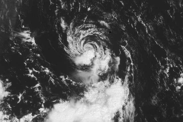
NHC seems pretty convincing that this merits its classification:
TROPICAL STORM JOSE SPECIAL DISCUSSION NUMBER 1
NWS NATIONAL HURRICANE CENTER MIAMI FL AL112011
800 AM AST SUN AUG 28 2011
THE AREA OF LOW PRESSURE SOUTH OF BERMUDA HAS
MAINTAINED ENOUGH
ORGANIZED DEEP CONVECTION TO BE CONSIDERED AS A TROPICAL CYCLONE.
DURING THE LAST 24 HOURS...THE LOW HAS EXPERIENCED SEVERAL BURSTS
OF DEEP CONVECTION...WITH ANOTHER BURST NOW BEGINNING JUST EAST OF
THE CENTER.
DVORAK T-NUMBERS HAVE RECENTLY INCREASED TO 2.0 AND
SUPPORT INITIATING ADVISORIES. THE INITIAL WIND SPEED IS 35
KT...BASED ON AN ASCAT PASS FROM OVERNIGHT WHICH SUGGESTED THE
MAXIMUM WINDS WERE AT LEAST 35 KT. NORTHEASTERLY TO EASTERLY SHEAR
OF 40-50 KT OVER THE CYCLONE...ASSOCIATED WITH THE OUTFLOW OF
HURRICANE IRENE...IS HAMPERING SIGNIFICANT DEVELOPMENT. ALTHOUGH
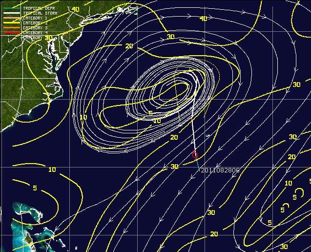
GLOBAL MODELS INDICATE THAT THE SHEAR COULD LESSEN SOMEWHAT DURING
THE NEXT 24-48 HOURS...MODEL GUIDANCE SUGGESTS DISSIPATION WITHIN
36 HOURS AND THE OFFICIAL FORECAST FOLLOWS SUIT. THE CYCLONE SHOULD
MOVE NORTHWARD AND THEN NORTH-NORTHEASTWARD AROUND THE WESTERN SIDE
OF A LOW-/MID-LEVEL RIDGE OVER THE CENTRAL ATLANTIC BEFORE LOSING
ITS IDENTITY.
GIVEN THE PROXIMITY OF THE CYCLONE TO BERMUDA...THE BERMUDA WEATHER
SERVICE HAS ISSUED A TROPICAL STORM WARNING FOR BERMUDA.
Heck, if Irene was a hurricane last night into this morning with barely any reports of sustained tropical storm force winds as she made landfall in jersey last night...then this could certainly be a t.s.!!!
Macrocane wrote:Andrew92 wrote:I'm sorry, but this is the most ridiculous upgrade to a tropical storm I have ever seen in my life. Where is the deep convection that the discussion claims there is???
-Andrew92
I agree with you in my
Unofficial opinion it doesn't meet the criteria to be a tropical cyclone, convection has not mantained enough time near the center.