CPAC: DANIEL - Post-Tropical
Moderator: S2k Moderators


Re: EPAC: DANIEL - Hurricane
My personal predictions on hurricanes becoming pretty powerful have been well supported lately.....what is going on??? I tend to argue against NHC predictions.
0 likes
NOTICE: I cannot give an expert analysis. Most of my "observations" are made visually with the help of only vital information provided by public advisories.
-
Yellow Evan

- Professional-Met

- Posts: 15951
- Age: 25
- Joined: Fri Jul 15, 2011 12:48 pm
- Location: Henderson, Nevada/Honolulu, HI
- Contact:
Re: EPAC: DANIEL - Hurricane
Fyzn94 wrote:My personal predictions on hurricanes becoming pretty powerful have been well supported lately.....what is going on??? I tend to argue against NHC predictions.
The EPAC is being awesome, that is what is going on.
0 likes
Re: EPAC: DANIEL - Hurricane

Why are they prettier when weakening?
0 likes
NOTICE: I cannot give an expert analysis. Most of my "observations" are made visually with the help of only vital information provided by public advisories.
-
Kingarabian

- S2K Supporter

- Posts: 15434
- Joined: Sat Aug 08, 2009 3:06 am
- Location: Honolulu, Hawaii
-
Yellow Evan
- Professional-Met
- Posts: 15951
- Age: 25
- Joined: Fri Jul 15, 2011 12:48 pm
- Location: Henderson, Nevada/Honolulu, HI
- Contact:
Re:
Kingarabian wrote:I dont think its weakening at all... with a new deep convective ring trying to wrap around its eye.
Its really amazing how its trying to strengthen even though its over 25c ssts..
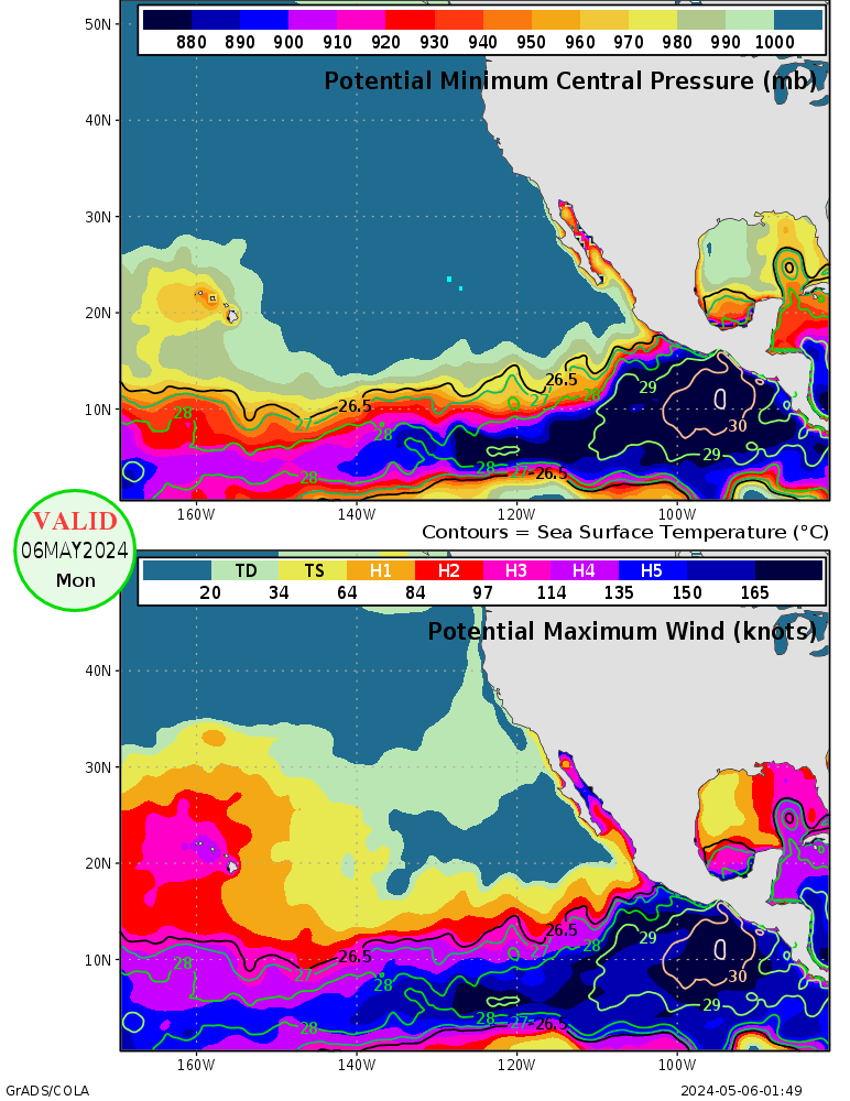
What is the MPI for 25 C?
0 likes
-
Kingarabian
- S2K Supporter
- Posts: 15434
- Joined: Sat Aug 08, 2009 3:06 am
- Location: Honolulu, Hawaii
Re: Re:
Yellow Evan wrote:Kingarabian wrote:I dont think its weakening at all... with a new deep convective ring trying to wrap around its eye.
Its really amazing how its trying to strengthen even though its over 25c ssts..
What is the MPI for 25 C?
For this week it's a TS-Cat1..
Last edited by Kingarabian on Sun Jul 08, 2012 3:44 pm, edited 1 time in total.
0 likes
RIP Kobe Bryant
-
cycloneye

- Admin

- Posts: 139052
- Age: 67
- Joined: Thu Oct 10, 2002 10:54 am
- Location: San Juan, Puerto Rico
Re: EPAC: DANIEL - Hurricane
HURRICANE DANIEL DISCUSSION NUMBER 19
NWS NATIONAL HURRICANE CENTER MIAMI FL EP042012
200 PM PDT SUN JUL 08 2012
CENTRAL CONVECTION HAD BEEN DIMINISHING IN COVERAGE AND INTENSITY...
ALTHOUGH RECENTLY CLOUD TOPS NEAR THE EYEWALL HAVE COOLED. THE EYE
IS STILL APPARENT IN INFRARED IMAGERY...AND IS CLOUD FILLED ON THE
VISIBLE IMAGES. THE ADVISORY WIND SPEED IS HELD AT 90 KT IN
ACCORDANCE WITH CURRENT INTENSITY ESTIMATES FROM TAFB AND SAB.
ALTHOUGH DANIEL SHOULD REMAIN IN A LOW SHEAR ENVIRONMENT FOR THE
NEXT COUPLE OF DAYS...GRADUAL WEAKENING IS LIKELY AS THE TROPICAL
CYCLONE MOVES OVER RELATIVELY COOL WATERS AND THROUGH A STABLE AIR
MASS. THE NHC INTENSITY FORECAST IS CLOSE TO THE LGEM PREDICTION
AND THE INTENSITY MODEL CONSENSUS.
DANIEL CONTINUES ITS PERSISTENT WESTWARD TREK AND THE CURRENT MOTION
ESTIMATE IS 275/12. THE TRACK FORECAST SCENARIO HAS NOT CHANGED
OVER THE PAST COUPLE OF DAYS. A PRONOUNCED MID-TROPOSPHERIC
SUBTROPICAL RIDGE IS EXPECTED TO MAINTAIN AN EASTERLY STEERING
CURRENT FOR THE CYCLONE OVER THE NEXT SEVERAL DAYS. THE OFFICIAL
TRACK FORECAST IS BASICALLY AN EXTENSION OF THE PREVIOUS ONES AND
LIES BETWEEN THE LATEST GFS AND ECMWF TRACKS.
FORECAST POSITIONS AND MAX WINDS
INIT 08/2100Z 15.2N 125.0W 90 KT 105 MPH
12H 09/0600Z 15.3N 127.0W 80 KT 90 MPH
24H 09/1800Z 15.6N 129.9W 70 KT 80 MPH
36H 10/0600Z 15.7N 132.9W 55 KT 65 MPH
48H 10/1800Z 15.8N 136.0W 45 KT 50 MPH
72H 11/1800Z 15.9N 142.0W 35 KT 40 MPH
96H 12/1800Z 16.0N 148.0W 30 KT 35 MPH
120H 13/1800Z 16.0N 153.0W 25 KT 30 MPH...POST-TROP/REMNT LOW
$$
FORECASTER PASCH
0 likes
Visit the Caribbean-Central America Weather Thread where you can find at first post web cams,radars
and observations from Caribbean basin members Click Here
and observations from Caribbean basin members Click Here
-
Kingarabian
- S2K Supporter
- Posts: 15434
- Joined: Sat Aug 08, 2009 3:06 am
- Location: Honolulu, Hawaii

-
Yellow Evan
- Professional-Met
- Posts: 15951
- Age: 25
- Joined: Fri Jul 15, 2011 12:48 pm
- Location: Henderson, Nevada/Honolulu, HI
- Contact:
Re: Re:
Kingarabian wrote:Yellow Evan wrote:Kingarabian wrote:I dont think its weakening at all... with a new deep convective ring trying to wrap around its eye.
Its really amazing how its trying to strengthen even though its over 25c ssts..
What is the MPI for 25 C?
For this week it's a TS-Cat1..
Wow, and Dainel is a Cat 2. This storm is getting more amazing as I type this.
0 likes
-
Yellow Evan
- Professional-Met
- Posts: 15951
- Age: 25
- Joined: Fri Jul 15, 2011 12:48 pm
- Location: Henderson, Nevada/Honolulu, HI
- Contact:


Thats certainly a good looking hurricane right now, doesn't look like its weakening at all at the moment thats for sure!
0 likes
Personal Forecast Disclaimer:
The posts in this forum are NOT official forecast and should not be used as such. They are just the opinion of the poster and may or may not be backed by sound meteorological data. They are NOT endorsed by any professional institution or storm2k.org. For official information, please refer to the NHC and NWS products
The posts in this forum are NOT official forecast and should not be used as such. They are just the opinion of the poster and may or may not be backed by sound meteorological data. They are NOT endorsed by any professional institution or storm2k.org. For official information, please refer to the NHC and NWS products
-
Kingarabian
- S2K Supporter
- Posts: 15434
- Joined: Sat Aug 08, 2009 3:06 am
- Location: Honolulu, Hawaii

Re: EPAC: DANIEL - Hurricane
How do you arrive at the conclusion that the eye is warming by looking at a conventional channel-4 image? Doesn't make any sense to me.
0 likes
-
Kingarabian
- S2K Supporter
- Posts: 15434
- Joined: Sat Aug 08, 2009 3:06 am
- Location: Honolulu, Hawaii
Re: EPAC: DANIEL - Hurricane
Laplacian wrote:How do you arrive at the conclusion that the eye is warming by looking at a conventional channel-4 image? Doesn't make any sense to me.
No I just posted that picture because it looked good. Sorry for the confusion.
My basis for saying that they eye is warming is based on the last few frames and analysis from ADT:
Code: Select all
        UW - CIMSS
              ADVANCED DVORAK TECHNIQUE
                  ADT-Version 8.1.3
         Tropical Cyclone Intensity Algorithm

             ----- Current Analysis -----
     Date :  08 JUL 2012    Time :   213000 UTC
      Lat :   15:09:38 N     Lon :  125:15:33 W


                CI# /Pressure/ Vmax
                4.6 / 975.8mb/ 79.6kt


             Final T#  Adj T#  Raw T#
                4.6     5.0     5.0

 Estimated radius of max. wind based on IR : 13 km

 Center Temp :  -0.2C    Cloud Region Temp : -52.0C

 Scene Type : EYE

 Positioning Method : RING/SPIRAL COMBINATION

 Ocean Basin : EAST PACIFIC
 Dvorak CI > MSLP Conversion Used : PACIFIC

 Tno/CI Rules : Constraint Limits : NO LIMIT
                   Weakening Flag : OFF
           Rapid Dissipation Flag : OFF

 C/K/Z MSLP Estimate Inputs :
  - Average 34 knot radii :   87km
  - Environmental MSLP    : 1009mb

 Satellite Viewing Angle : 21.0 degrees
Edit:
Really funny how the weakening flag is off right now despite t/he dry air and very cool SST's.
How does a storm strengthen with this much dry air around it?

0 likes
RIP Kobe Bryant
-
Yellow Evan
- Professional-Met
- Posts: 15951
- Age: 25
- Joined: Fri Jul 15, 2011 12:48 pm
- Location: Henderson, Nevada/Honolulu, HI
- Contact:
-
hurricaneCW
- Category 5

- Posts: 1773
- Joined: Wed Mar 03, 2010 6:20 am
- Location: Toms River, NJ
Re: EPAC: DANIEL - Hurricane
Isn't the low shear the reason why the dry air hasn't penetrated into the system?
0 likes
-
Yellow Evan
- Professional-Met
- Posts: 15951
- Age: 25
- Joined: Fri Jul 15, 2011 12:48 pm
- Location: Henderson, Nevada/Honolulu, HI
- Contact:
Re: EPAC: DANIEL - Hurricane
hurricaneCW wrote:Isn't the low shear the reason why the dry air hasn't penetrated into the system?
It's likely helping IMO.
0 likes
-
Kingarabian
- S2K Supporter
- Posts: 15434
- Joined: Sat Aug 08, 2009 3:06 am
- Location: Honolulu, Hawaii
Re: EPAC: DANIEL - Hurricane
hurricaneCW wrote:Isn't the low shear the reason why the dry air hasn't penetrated into the system?
On point. Exactly what I was thinking last night.
0 likes
RIP Kobe Bryant
-
Kingarabian
- S2K Supporter
- Posts: 15434
- Joined: Sat Aug 08, 2009 3:06 am
- Location: Honolulu, Hawaii

-
cycloneye
- Admin
- Posts: 139052
- Age: 67
- Joined: Thu Oct 10, 2002 10:54 am
- Location: San Juan, Puerto Rico
Re: EPAC: DANIEL - Hurricane
The 00z Best Track mantains Daniel at 90kts.
EP, 04, 2012070900, , BEST, 0, 152N, 1257W, 90, 970, HU
ftp://ftp.nhc.noaa.gov/atcf/tcweb/inves ... 012.invest
EP, 04, 2012070900, , BEST, 0, 152N, 1257W, 90, 970, HU
ftp://ftp.nhc.noaa.gov/atcf/tcweb/inves ... 012.invest
0 likes
Visit the Caribbean-Central America Weather Thread where you can find at first post web cams,radars
and observations from Caribbean basin members Click Here
and observations from Caribbean basin members Click Here
Who is online
Users browsing this forum: No registered users and 46 guests