WPAC: HAIKUI - Post-Tropical

Moderator: S2k Moderators

Message
Author
User avatar
euro6208
Category 5
Category 5
Posts: 18547
Joined: Mon Mar 08, 2004 7:50 pm
Location: Guam

Re: WPAC: HAIKUI - Severe Tropical Storm

#61 Postby euro6208 » Tue Aug 07, 2012 8:59 am

Image

clearly a typhoon but JTWC actually decreased intensity to 60 knots? it's becoming annular off the chinese coast...

TXPQ27 KNES 071004
TCSWNP

A. 12W (HAIKUI)

B. 07/0832Z

C. 28.0N

D. 123.3E

E. ONE/MTSAT

F. T4.5/4.5/D0.5/24HRS

G. IR/EIR/VIS/SSMI

H. REMARKS...HAIKUI HAS IMPROVED IN APPEARANCE FROM 6 HOURS PREVIOUS
WITH A SOMEWHAT LESS RAGGED EYE AND COLDER CLOUD TOPS SURROUNDING
THE LOW LEVEL CENTER. EYE TEMPERATURE HAS ALSO COOLED A BIT PAST 6
HOURS. SYSTEM HAS A LARGE ANNULAR APPEARANCE WITH EYE GREATER THAN
45NM IN DIAMETER.
MG SURROUNDING TEMPERATURE WITH OW EYE AND MG RING
TEMPERATURE GIVE DT=4.5. MET=5.0 AND PT.4.5. FT IS BASED ON DT.
0 likes   
Remember, all of my post aren't official. For official warnings and discussions, Please refer to your local NWS products...

NWS for the Western Pacific

https://www.weather.gov/gum/

User avatar
yulou
Tropical Depression
Tropical Depression
Posts: 99
Age: 26
Joined: Sat Nov 20, 2010 8:19 am
Location: Houston,TX
Contact:

#62 Postby yulou » Tue Aug 07, 2012 9:22 am

___________10-min 2-min GUST(m/s)
Dongji Island(76m) 45.9 46.3 55.1

OH MY GODDDDDDDDDDDDDDDDDDDDDDDDDDDDD!
it can be increased to C3

Shanghai and Ningbo,hold on!Complete the defense work!
0 likes   
Chinese.
Houston, TX.

Bilis(0604) Saomai(0608) Goni(0907)

User avatar
yulou
Tropical Depression
Tropical Depression
Posts: 99
Age: 26
Joined: Sat Nov 20, 2010 8:19 am
Location: Houston,TX
Contact:

#63 Postby yulou » Tue Aug 07, 2012 9:36 am

Image

NMC and Zhejiang has issued red typhoon alerts
0 likes   
Chinese.
Houston, TX.

Bilis(0604) Saomai(0608) Goni(0907)

Meow

Re: WPAC: HAIKUI - Typhoon

#64 Postby Meow » Tue Aug 07, 2012 9:58 am

The JMA upgraded Haikui to a typhoon.

Image

TY 1211 (HAIKUI)
Issued at 12:50 UTC, 7 August 2012

<Analyses at 07/12 UTC>
Scale -
Intensity Strong
Center position N28°20'(28.3°)
E123°00'(123.0°)
Direction and speed of movement NW 10km/h(6kt)
Central pressure 965hPa
Maximum wind speed near the center 35m/s(65kt)
Maximum wind gust speed 50m/s(95kt)
Area of 50kt winds or more ALL190km(100NM)
Area of 30kt winds or more N440km(240NM)
S330km(180NM)

<Forecast for 08/00 UTC>
Intensity -
Center position of probability circle N29°30'(29.5°)
E121°30'(121.5°)
Direction and speed of movement NW 15km/h(8kt)
Central pressure 965hPa
Maximum wind speed near the center 30m/s(60kt)
Maximum wind gust speed 45m/s(85kt)
Radius of probability circle 90km(50NM)
Storm warning area ALL280km(150NM)

<Forecast for 08/12 UTC>
Intensity -
Center position of probability circle N30°30'(30.5°)
E120°05'(120.1°)
Direction and speed of movement NW 15km/h(8kt)
Central pressure 980hPa
Maximum wind speed near the center 23m/s(45kt)
Maximum wind gust speed 35m/s(65kt)
Radius of probability circle 130km(70NM)

<Forecast for 09/12 UTC>
Intensity -
Center position of probability circle N31°05'(31.1°)
E119°25'(119.4°)
Direction and speed of movement Almost stationary
Central pressure 994hPa
Maximum sustained wind speed 18m/s(35kt)
Maximum wind gust speed 25m/s(50kt)
Radius of probability circle 200km(110NM)

<Forecast for 10/12 UTC>
Intensity -
TD
Center position of probability circle N31°30'(31.5°)
E119°05'(119.1°)
Direction and speed of movement Almost stationary
Central pressure 998hPa
Radius of probability circle 300km(160NM)
0 likes   

Meow

Re: WPAC: HAIKUI - Typhoon

#65 Postby Meow » Tue Aug 07, 2012 9:59 am

But the JTWC downgraded Haikui to a tropical storm simultaneously.

Image

WTPN33 PGTW 071500
MSGID/GENADMIN/JOINT TYPHOON WRNCEN PEARL HARBOR HI//
SUBJ/TROPICAL CYCLONE WARNING//
RMKS/
1. TROPICAL STORM 12W (HAIKUI) WARNING NR 020
DOWNGRADED FROM TYPHOON 12W
02 ACTIVE TROPICAL CYCLONES IN NORTHWESTPAC
MAX SUSTAINED WINDS BASED ON ONE-MINUTE AVERAGE
WIND RADII VALID OVER OPEN WATER ONLY
---
WARNING POSITION:
071200Z --- NEAR 28.1N 122.8E
MOVEMENT PAST SIX HOURS - 310 DEGREES AT 08 KTS
POSITION ACCURATE TO WITHIN 035 NM
POSITION BASED ON CENTER LOCATED BY SATELLITE
PRESENT WIND DISTRIBUTION:
MAX SUSTAINED WINDS - 060 KT, GUSTS 075 KT
WIND RADII VALID OVER OPEN WATER ONLY
RADIUS OF 050 KT WINDS - 030 NM NORTHEAST QUADRANT
030 NM SOUTHEAST QUADRANT
030 NM SOUTHWEST QUADRANT
030 NM NORTHWEST QUADRANT
RADIUS OF 034 KT WINDS - 090 NM NORTHEAST QUADRANT
080 NM SOUTHEAST QUADRANT
080 NM SOUTHWEST QUADRANT
090 NM NORTHWEST QUADRANT
REPEAT POSIT: 28.1N 122.8E
---
FORECASTS:
12 HRS, VALID AT:
080000Z --- 29.2N 121.6E
MAX SUSTAINED WINDS - 050 KT, GUSTS 065 KT
WIND RADII VALID OVER OPEN WATER ONLY
VECTOR TO 24 HR POSIT: 315 DEG/ 07 KTS
---
24 HRS, VALID AT:
081200Z --- 30.2N 120.4E
MAX SUSTAINED WINDS - 035 KT, GUSTS 045 KT
WIND RADII VALID OVER OPEN WATER ONLY
DISSIPATING AS A SIGNIFICANT TROPICAL CYCLONE OVER LAND
VECTOR TO 36 HR POSIT: 320 DEG/ 05 KTS
---
36 HRS, VALID AT:
090000Z --- 30.9N 119.7E
MAX SUSTAINED WINDS - 020 KT, GUSTS 030 KT
WIND RADII VALID OVER OPEN WATER ONLY
DISSIPATED AS A SIGNIFICANT TROPICAL CYCLONE OVER LAND
---
REMARKS:
071500Z POSITION NEAR 28.4N 122.5E.
TROPICAL STORM 12W (HAIKUI), LOCATED APPROXIMATELY 225 NM
SOUTH-SOUTHEAST OF SHANGHAI, CHINA, HAS TRACKED NORTHWESTWARD AT 08
KNOTS OVER THE PAST SIX HOURS. MAXIMUM SIGNIFICANT WAVE HEIGHT AT
071200Z IS 28 FEET. NEXT WARNINGS AT 072100Z, 080300Z, 080900Z AND
081500Z.
REFER TO TROPICAL STORM 13W (THIRTEEN) WARNINGS (WTPN31 PGTW) FOR
SIX-HOURLY UPDATES. //
NNNN
0 likes   

User avatar
euro6208
Category 5
Category 5
Posts: 18547
Joined: Mon Mar 08, 2004 7:50 pm
Location: Guam

Re:

#66 Postby euro6208 » Tue Aug 07, 2012 10:20 am

yulou wrote:Image

NMC and Zhejiang has issued red typhoon alerts


this is a very powerful typhoon about to make landfall and 1 min winds of only 60 knots? another postseason adjustment :roll:

to my amateur eyes, this is likely a high end category 2...winds of 90 knots ...


The posts in this forum are NOT official forecast and should not be used as such. They are just the opinion of the poster and may or may not be backed by sound meteorological data. They are NOT endorsed by any professional institution or storm2k.org. For official information, please refer to the JTWC and JMA products.
0 likes   
Remember, all of my post aren't official. For official warnings and discussions, Please refer to your local NWS products...

NWS for the Western Pacific

https://www.weather.gov/gum/

User avatar
euro6208
Category 5
Category 5
Posts: 18547
Joined: Mon Mar 08, 2004 7:50 pm
Location: Guam

Re: WPAC: HAIKUI - Typhoon

#67 Postby euro6208 » Tue Aug 07, 2012 10:29 am

Image

WDPN33 PGTW 071500
MSGID/GENADMIN/JOINT TYPHOON WRNCEN PEARL HARBOR HI//
SUBJ/PROGNOSTIC REASONING FOR TROPICAL STORM 12W (HAIKUI) WARNING NR
20//
RMKS//
1. FOR METEOROLOGISTS.
2. 6 HOUR SUMMARY AND ANALYSIS.
TROPICAL STORM (TS) 12W (HAIKUI), LOCATED APPROXIMATELY 225 NM
SOUTH-SOUTHEAST OF SHANGHAI, CHINA, HAS TRACKED NORTHWESTWARD AT 08
KNOTS OVER THE PAST SIX HOURS. ANIMATED ENHANCE INFRARED SATELLITE
IMAGERY SHOWS A RAGGED ELONGATED EYE WITH CONVECTIVE BANDS BECOMING
MORE SHALLOW AND LOOSE. THE CURRENT POSITION IS BASED ON THE ABOVE
ANIMATION AND SUPPORTED BY A SEMI-CIRCLE LOW LEVEL FEATURE ON A
071116Z 37GHZ SSMI-S MICROWAVE IMAGE. THE CURRENT INTENSITY IS
AVERAGED FROM DVORAK ESTIMATES FROM PGTW AND RJTD. UPPER-LEVEL
ANALYSIS INDICATES THE CYCLONE IS JUST TO THE WEST OF AN ANTICYCLONE
IN AN AREA OF LIGHT (05-10 KNOT) VERTICAL WIND SHEAR. IT IS BEING
STEERED BY A DEEP-LAYERED SUBTROPICAL RIDGE (STR) TO THE NORTH.
3. FORECAST REASONING.
A. NO CHANGE TO THE FORECAST PHILOSOPHY SINCE THE PREVIOUS
PROGNOSTIC REASONING MESSAGE.
B. TS 12W IS FORECAST TO MAINTAIN ITS CURRENT TRACK AND MAKE
LANDFALL SOUTH OF ZHOUSHAN, CHINA, JUST BEFORE TAU 12. IT WILL THEN
RAPIDLY WEAKEN AND DISSIPATE AS A SIGNIFICANT TROPICAL CYCLONE OVER
LAND BY TAU 36 DUE TO FRICTIONAL EFFECTS. A SHORTWAVE TROUGH MOVING
THROUGH CENTRAL CHINA IS FORECAST TO INTERACT WITH THE SYSTEM AND MAY
CAUSE AN ABRUPT TURN TO THE NORTHEAST JUST PRIOR TO OR SHORTLY AFTER
DISSIPATION. THERE REMAINS A SMALL PROBABILITY FOR REGENERATION
AFTER THE REMNANTS OF TS 12W TRACK BACK OVER THE EAST CHINA SEA,
HOWEVER, INCREASED SHEAR DUE TO THE TROUGH AND LOWER SEA SURFACE
TEMPERATURES MAKE THIS AN UNLIKELY SCENARIO. THE MODELS ARE IN TIGHT
AGREEMENT THROUGH THE END OF THE FORECAST. AS A RESULT, THERE IS
HIGH CONFIDENCE IN THE FORECAST TRACK. //
NNNN

TPPN12 PGTW 071519

A. TROPICAL STORM 12W (HAIKUI)

B. 07/1432Z

C. 28,2N

D. 122,7E

E. FIVE/MTSAT

F. T3.5/4.0/W0.5/24HRS STT: S0.0/03HRS

G. IR/EIR

H. REMARKS: 38A/PBO SBC/ANMTN. .75 WRAP YIELDS A DT OF 3.0. MET
WAS 4.0; PT WAS 3.5. DBO PT AS DECREASE IN INTENSITY FROM EYE
METHOD TO WRAP DOES NOT ACCURATELY REPRESENT DEPICTION ON
METSAT.

no wonder why JTWC decreased the intensity although this is clearly a strong typhoon...i don't even understand anything in Letter H ...
0 likes   
Remember, all of my post aren't official. For official warnings and discussions, Please refer to your local NWS products...

NWS for the Western Pacific

https://www.weather.gov/gum/

User avatar
euro6208
Category 5
Category 5
Posts: 18547
Joined: Mon Mar 08, 2004 7:50 pm
Location: Guam

Re: WPAC: HAIKUI - Typhoon

#68 Postby euro6208 » Tue Aug 07, 2012 11:23 am

Image

very large eye
0 likes   
Remember, all of my post aren't official. For official warnings and discussions, Please refer to your local NWS products...

NWS for the Western Pacific

https://www.weather.gov/gum/

User avatar
euro6208
Category 5
Category 5
Posts: 18547
Joined: Mon Mar 08, 2004 7:50 pm
Location: Guam

Re: WPAC: HAIKUI - Typhoon

#69 Postby euro6208 » Tue Aug 07, 2012 11:48 am

rainbands hitting shanghai ...
0 likes   
Remember, all of my post aren't official. For official warnings and discussions, Please refer to your local NWS products...

NWS for the Western Pacific

https://www.weather.gov/gum/

User avatar
somethingfunny
ChatStaff
ChatStaff
Posts: 3926
Age: 35
Joined: Thu May 31, 2007 10:30 pm
Location: McKinney, Texas

Re: WPAC: HAIKUI - Typhoon

#70 Postby somethingfunny » Tue Aug 07, 2012 2:26 pm

euro6208 wrote:[imghttp://tropic.ssec.wisc.edu/real-time/mimic-tc/2012_12W/webManager/gifsBy12hr_06.gif[/img]

very large eye


That's not good, the strongest portion of the eyewall is going into the bay.
Last edited by somethingfunny on Tue Aug 07, 2012 3:27 pm, edited 1 time in total.
0 likes   
I am not a meteorologist, and any posts made by me are not official forecasts or to be interpreted as being intelligent. These posts are just my opinions and are probably silly opinions.

User avatar
yulou
Tropical Depression
Tropical Depression
Posts: 99
Age: 26
Joined: Sat Nov 20, 2010 8:19 am
Location: Houston,TX
Contact:

#71 Postby yulou » Tue Aug 07, 2012 3:13 pm

2-min Sustained Wind TOP10(After 0712Z)
Place Wind Time(BJT)
Dongji(Linhai)46.9 08/07 22:07
Dongting(Putuo Dist)38.4 08/07 23:03
Mount Liangheng(Putuo Dict)37.5 08/07 22:43
Ximopan(Putuo Dict)37.1 08/07 23:12
Shipu(Xiangshan)36.8 08/07 23:53
Dachen Island(Jiaojiang Dist)36.6 08/07 21:04
Niushan(Sanmen)35.1 08/07 23:57
Mount Nanjiu(Xiangshan)34.0 08/08 00:28
Shang Dachen(Jiaojiang Dict)34.0 08/07 21:08
Damao(Dinghai Dict)33.1 08/07 22:33
0 likes   
Chinese.
Houston, TX.

Bilis(0604) Saomai(0608) Goni(0907)

Meow

#72 Postby Meow » Tue Aug 07, 2012 3:33 pm

Typhoon Haikui has made landfall over Xiangshan County in Zhejiang, China at 19:20 UTC (03:20 CST on August 8).
0 likes   

phwxenthusiast
Category 2
Category 2
Posts: 637
Joined: Wed Mar 24, 2010 3:10 am
Location: Holbrook, NY (Long Island)

Re:

#73 Postby phwxenthusiast » Tue Aug 07, 2012 7:09 pm

yulou wrote:2-min Sustained Wind TOP10(After 0712Z)
Place Wind Time(BJT)
Dongji(Linhai)46.9 08/07 22:07
Dongting(Putuo Dist)38.4 08/07 23:03
Mount Liangheng(Putuo Dict)37.5 08/07 22:43
Ximopan(Putuo Dict)37.1 08/07 23:12
Shipu(Xiangshan)36.8 08/07 23:53
Dachen Island(Jiaojiang Dist)36.6 08/07 21:04
Niushan(Sanmen)35.1 08/07 23:57
Mount Nanjiu(Xiangshan)34.0 08/08 00:28
Shang Dachen(Jiaojiang Dict)34.0 08/07 21:08
Damao(Dinghai Dict)33.1 08/07 22:33


wow, those are some really strong winds, thanks for that... kinda wish they'd (JMA and JTWC) increase the winds further than 65kts lol...
0 likes   

User avatar
yulou
Tropical Depression
Tropical Depression
Posts: 99
Age: 26
Joined: Sat Nov 20, 2010 8:19 am
Location: Houston,TX
Contact:

Re: Re:

#74 Postby yulou » Tue Aug 07, 2012 9:43 pm

euro6208 wrote:
this is a very powerful typhoon about to make landfall and 1 min winds of only 60 knots? another postseason adjustment :roll:

to my amateur eyes, this is likely a high end category 2...winds of 90 knots ...


The posts in this forum are NOT official forecast and should not be used as such. They are just the opinion of the poster and may or may not be backed by sound meteorological data. They are NOT endorsed by any professional institution or storm2k.org. For official information, please refer to the JTWC and JMA products.

i think so.tropopause at 25N is much lower than tropopause over tropics.So cloud top temperature will be much higher.We can't estimate typhoon intensity by IR only.
i estimated DT of Haikui(using VIS,before the landfall),it was about 5.0.it's better to put Haikui at 90KT

phwxenthusiast wrote:wow, those are some really strong winds, thanks for that... kinda wish they'd (JMA and JTWC) increase the winds further than 65kts lol...

in fact,the can't see those wind data.
they can only see the data from international exchange stations.


p.s.can anybody understand my poor english? :(

radar 1920Z
Image
Last edited by yulou on Tue Aug 07, 2012 10:27 pm, edited 1 time in total.
0 likes   
Chinese.
Houston, TX.

Bilis(0604) Saomai(0608) Goni(0907)

User avatar
yulou
Tropical Depression
Tropical Depression
Posts: 99
Age: 26
Joined: Sat Nov 20, 2010 8:19 am
Location: Houston,TX
Contact:

#75 Postby yulou » Tue Aug 07, 2012 10:14 pm

two piece of surprising news:
1.Haikui landfell over Xiangshan at 1920Z,but it didn't leave Xiangshan still 2230Z.
2.The big eye can be seen on radar until 2320Z!
Image
0 likes   
Chinese.
Houston, TX.

Bilis(0604) Saomai(0608) Goni(0907)

User avatar
euro6208
Category 5
Category 5
Posts: 18547
Joined: Mon Mar 08, 2004 7:50 pm
Location: Guam

Re: WPAC: HAIKUI - Typhoon

#76 Postby euro6208 » Tue Aug 07, 2012 10:37 pm

Image

comparing haikui and ernesto, haikui has a very impressive radar imagery at landfall than ernesto and a defined eye noted on both IR and VIS...clearly haikui is stronger so i would place haikui's landfall intensity at 95 knots...too bad we don't have recon...it could be stronger....

unfortunately, the stronger of the two has to make landfall in a very populated area...over 100 million people alone...


The posts in this forum are NOT official forecast and should not be used as such. They are just the opinion of the poster and may or may not be backed by sound meteorological data. They are NOT endorsed by any professional institution or storm2k.org. For official information, please refer to the JTWC and JMA products.
0 likes   
Remember, all of my post aren't official. For official warnings and discussions, Please refer to your local NWS products...

NWS for the Western Pacific

https://www.weather.gov/gum/

phwxenthusiast
Category 2
Category 2
Posts: 637
Joined: Wed Mar 24, 2010 3:10 am
Location: Holbrook, NY (Long Island)

Re: Re:

#77 Postby phwxenthusiast » Tue Aug 07, 2012 11:18 pm

yulou wrote:
phwxenthusiast wrote:wow, those are some really strong winds, thanks for that... kinda wish they'd (JMA and JTWC) increase the winds further than 65kts lol...

in fact,the can't see those wind data.
they can only see the data from international exchange stations.


JTWC did include these though on their remarks:
"PRIOR TO
MAKING LANDFALL, SURFACE OBSERVATIONS FROM DACHEN DAO AND SHIPU
SHOWED MAXIMUM SUSTAINED WINDS OF 64 TO 70 KNOTS WITH MINIMUM SLP
NEAR 970 MB."

btw, do you know how far Dongji is from the landfall point??

yeah your English is just fine..:)
0 likes   

HurricaneBill
Category 5
Category 5
Posts: 3420
Joined: Sun Apr 11, 2004 5:51 pm
Location: East Longmeadow, MA, USA

Re: Re:

#78 Postby HurricaneBill » Tue Aug 07, 2012 11:20 pm

yulou wrote:p.s.can anybody understand my poor english? :(


Your english isn't poor. I can understand you. :)
0 likes   

User avatar
KWT
Category 5
Category 5
Posts: 31390
Joined: Tue Aug 17, 2004 11:02 am
Location: UK!!!

#79 Postby KWT » Wed Aug 08, 2012 6:02 am

Love watching these sorts of systems landfall, especially one with a large eye. Hopefully not too much damage is being caused by it.
0 likes   
Personal Forecast Disclaimer:
The posts in this forum are NOT official forecast and should not be used as such. They are just the opinion of the poster and may or may not be backed by sound meteorological data. They are NOT endorsed by any professional institution or storm2k.org. For official information, please refer to the NHC and NWS products

User avatar
euro6208
Category 5
Category 5
Posts: 18547
Joined: Mon Mar 08, 2004 7:50 pm
Location: Guam

Re: WPAC: HAIKUI - Typhoon

#80 Postby euro6208 » Wed Aug 08, 2012 10:16 am

Final Warning from JTWC......still a strong tropical storm south of shanghai...

WTPN33 PGTW 080300
MSGID/GENADMIN/JOINT TYPHOON WRNCEN PEARL HARBOR HI//
SUBJ/TROPICAL CYCLONE WARNING//
RMKS/
1. TROPICAL STORM 12W (HAIKUI) WARNING NR 022
DOWNGRADED FROM TYPHOON 12W
02 ACTIVE TROPICAL CYCLONES IN NORTHWESTPAC
MAX SUSTAINED WINDS BASED ON ONE-MINUTE AVERAGE
WIND RADII VALID OVER OPEN WATER ONLY
---
WARNING POSITION:
080000Z --- NEAR 29.7N 121.3E
MOVEMENT PAST SIX HOURS - 315 DEGREES AT 09 KTS
POSITION ACCURATE TO WITHIN 060 NM
POSITION BASED ON CENTER LOCATED BY SATELLITE
PRESENT WIND DISTRIBUTION:
MAX SUSTAINED WINDS - 060 KT, GUSTS 075 KT
WIND RADII VALID OVER OPEN WATER ONLY
REPEAT POSIT: 29.7N 121.3E
---
FORECASTS:
12 HRS, VALID AT:
081200Z --- 30.6N 119.6E
MAX SUSTAINED WINDS - 045 KT, GUSTS 055 KT
WIND RADII VALID OVER OPEN WATER ONLY
DISSIPATING AS A SIGNIFICANT TROPICAL CYCLONE OVER LAND
VECTOR TO 24 HR POSIT: 300 DEG/ 05 KTS
---
24 HRS, VALID AT:
090000Z --- 31.1N 118.6E
MAX SUSTAINED WINDS - 030 KT, GUSTS 040 KT
WIND RADII VALID OVER OPEN WATER ONLY
DISSIPATING AS A SIGNIFICANT TROPICAL CYCLONE OVER LAND
VECTOR TO 36 HR POSIT: 290 DEG/ 03 KTS
---
36 HRS, VALID AT:
091200Z --- 31.3N 118.0E
MAX SUSTAINED WINDS - 020 KT, GUSTS 030 KT
WIND RADII VALID OVER OPEN WATER ONLY
DISSIPATED AS A SIGNIFICANT TROPICAL CYCLONE OVER LAND
---
REMARKS:
080300Z POSITION NEAR 29.9N 120.9E.
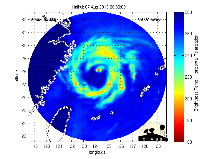
TROPICAL STORM 12W (HAIKUI), LOCATED APPROXIMATELY 95 NM SOUTH OF
SHANGHAI, CHINA, HAS TRACKED NORTHWESTWARD AT 09 KNOTS OVER THE PAST
SIX HOURS. ANIMATED MULTISPECTRAL SATELLITE IMAGERY AND RADAR
IMAGERY INDICATE THAT TS 12W MADE LANDFALL AROUND 07/20Z AND HAS
CONTINUED TO TRACK SLOWLY INLAND WHILE WEAKENING SLIGHTLY. PRIOR TO
MAKING LANDFALL, SURFACE OBSERVATIONS FROM DACHEN DAO AND SHIPU
SHOWED MAXIMUM SUSTAINED WINDS OF 64 TO 70 KNOTS WITH MINIMUM SLP
NEAR 970 MB. THE INITIAL POSITION IS BASED ON THE PGTW FIX AND RADAR
WITH GOOD CONFIDENCE. THE INITIAL INTENSITY IS BASED ON DVORAK
ESTIMATES RANGING FROM 55 TO 65 KNOTS. TS 12W IS FORECAST TO
CONTINUE TRACKING WEST-NORTHWESTWARD TO NORTHWESTWARD THROUGH THE
PERIOD AND WILL DISSIPATE OVER LAND BY TAU 36. THERE IS HIGH
CONFIDENCE IN THE FORECAST TRACK BASED ON THE TIGHTLY-GROUPED
DYNAMIC MODELS. AFTER TAU 48, THERE IS A LOW PROBABILITY OF THE
REMNANTS TRACKING BACK OVER THE EAST CHINA SEA; HOWEVER,
REGENERATION AS A TROPICAL CYCLONE IS UNLIKELY DUE TO MIDLATITUDE
WESTERLIES STRENGTHENING OVER THE EAST CHINA SEA. THIS IS THE FINAL
WARNING ON THIS SYSTEM BY THE JOINT TYPHOON WRNCEN PEARL HARBOR HI.
THE SYSTEM WILL BE CLOSELY MONITORED FOR SIGNS OF REGENERATION.
REFER TO TROPICAL STORM 13W (THIRTEEN) WARNINGS (WTPN31 PGTW) FOR
SIX-HOURLY UPDATES.//
NNNN

Image
0 likes   
Remember, all of my post aren't official. For official warnings and discussions, Please refer to your local NWS products...

NWS for the Western Pacific

https://www.weather.gov/gum/


Return to “2012”

Who is online

Users browsing this forum: No registered users and 108 guests