ATL: HELENE - Post-Tropical

Moderator: S2k Moderators

Message
Author
User avatar
Riptide
Category 2
Category 2
Posts: 753
Age: 32
Joined: Fri Jul 23, 2010 3:33 pm
Location: Cape May, New Jersey
Contact:

Re:

#21 Postby Riptide » Mon Aug 06, 2012 9:46 pm

WYNweather wrote::uarrow: how about the one east of that? Wonder what it is going to look like when it leaves the coast

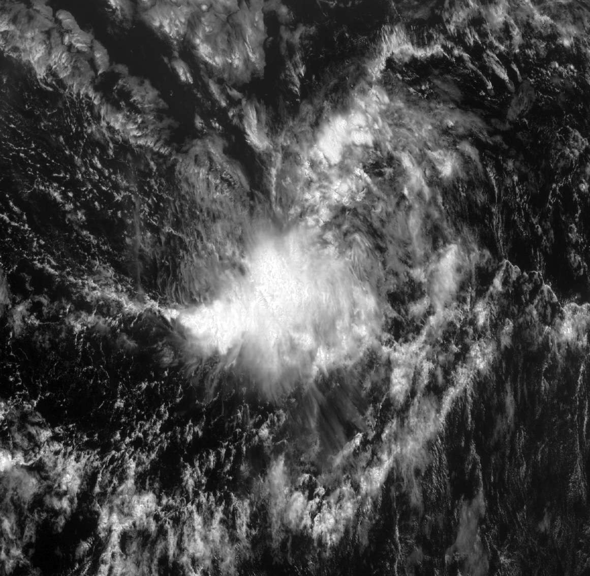
This is the wave that the GFS and other global models were identifying as a long tracking Cape Verde hurricane.
0 likes   

User avatar
Gustywind
Category 5
Category 5
Posts: 12334
Joined: Mon Sep 03, 2007 7:29 am
Location: Baie-Mahault, GUADELOUPE

#22 Postby Gustywind » Mon Aug 06, 2012 10:47 pm

Interresting debuts for August since one week we alaways have something to track... and keep an eye on as things heating up more than seriously. Twaves becoming more organized but conditions are not really excellent. Let's wait and see.
0 likes   

User avatar
Hurricane Alexis
Category 2
Category 2
Posts: 683
Age: 27
Joined: Thu Jun 14, 2012 7:59 pm
Location: Miami,Florida

Re: ATL: INVEST 92L

#23 Postby Hurricane Alexis » Tue Aug 07, 2012 1:20 am

A TROPICAL WAVE CONTINUES TO PRODUCE AN AREA OF SHOWERS AND
THUNDERSTORMS A FEW HUNDRED MILES SOUTHWEST OF THE CAPE VERDE
ISLANDS. THE CIRCULATION ASSOCIATED WITH THE WAVE IS CURRENTLY
ELONGATED...AND UPPER-LEVEL WINDS ARE ONLY MARGINALLY CONDUCIVE FOR
DEVELOPMENT. THIS SYSTEM HAS A LOW CHANCE...20 PERCENT...OF
BECOMING A TROPICAL CYCLONE DURING THE NEXT 48 HOURS AS IT MOVES
WESTWARD AT ABOUT 10 MPH.
0 likes   
Personal Forecast Disclaimer:
The posts in this forum are NOT official forecast and should not be used as such. They are just the opinion of the poster and may or may not be backed by sound meteorological data. They are NOT endorsed by any professional institution or storm2k.org. For official information, please refer to the NHC and NWS products.

User avatar
Hurricane Alexis
Category 2
Category 2
Posts: 683
Age: 27
Joined: Thu Jun 14, 2012 7:59 pm
Location: Miami,Florida

ATL: INVEST 92L

#24 Postby Hurricane Alexis » Tue Aug 07, 2012 1:33 am

0z Euro at 120hrs. First model showing some development out of this wave.

Image

Uploaded with ImageShack.us
0 likes   
Personal Forecast Disclaimer:
The posts in this forum are NOT official forecast and should not be used as such. They are just the opinion of the poster and may or may not be backed by sound meteorological data. They are NOT endorsed by any professional institution or storm2k.org. For official information, please refer to the NHC and NWS products.

User avatar
Hurricane Alexis
Category 2
Category 2
Posts: 683
Age: 27
Joined: Thu Jun 14, 2012 7:59 pm
Location: Miami,Florida

#25 Postby Hurricane Alexis » Tue Aug 07, 2012 1:36 am

0 likes   
Personal Forecast Disclaimer:
The posts in this forum are NOT official forecast and should not be used as such. They are just the opinion of the poster and may or may not be backed by sound meteorological data. They are NOT endorsed by any professional institution or storm2k.org. For official information, please refer to the NHC and NWS products.

User avatar
Gustywind
Category 5
Category 5
Posts: 12334
Joined: Mon Sep 03, 2007 7:29 am
Location: Baie-Mahault, GUADELOUPE

#26 Postby Gustywind » Tue Aug 07, 2012 5:16 am

Stays at 20%

000
ABNT20 KNHC 070555
TWOAT

TROPICAL WEATHER OUTLOOK
NWS NATIONAL HURRICANE CENTER MIAMI FL
200 AM EDT TUE AUG 7 2012

FOR THE NORTH ATLANTIC...CARIBBEAN SEA AND THE GULF OF MEXICO...

A TROPICAL WAVE CONTINUES TO PRODUCE AN AREA OF SHOWERS AND
THUNDERSTORMS A FEW HUNDRED MILES SOUTHWEST OF THE CAPE VERDE
ISLANDS. THE CIRCULATION ASSOCIATED WITH THE WAVE IS CURRENTLY
ELONGATED...AND UPPER-LEVEL WINDS ARE ONLY MARGINALLY CONDUCIVE FOR
DEVELOPMENT. THIS SYSTEM HAS A LOW CHANCE...20 PERCENT...OF
BECOMING A TROPICAL CYCLONE DURING THE NEXT 48 HOURS AS IT MOVES
WESTWARD AT ABOUT 10 MPH.


ELSEWHERE...TROPICAL CYCLONE FORMATION IS NOT EXPECTED DURING THE
NEXT 48 HOURS.

$$
FORECASTER BERG
0 likes   

User avatar
Gustywind
Category 5
Category 5
Posts: 12334
Joined: Mon Sep 03, 2007 7:29 am
Location: Baie-Mahault, GUADELOUPE

#27 Postby Gustywind » Tue Aug 07, 2012 5:20 am

000
AXNT20 KNHC 070600
TWDAT

TROPICAL WEATHER DISCUSSION
NWS NATIONAL HURRICANE CENTER MIAMI FL
205 AM EDT TUE AUG 07 2012


TROPICAL WAVE EXTENDS FROM 12N27W TO 18N23W MOVING W AT 15 KT. A
1009 MB LOW IS CENTERED AT THE SOUTHERN EXTENT OF THE WAVE AXIS
NEAR 12N27W AND AN EARLIER 06/2248 UTC ASCAT PASS DEPICTED THE
CIRCULATION EMBEDDED WITHIN THE MONSOON TROUGH AXIS.
A MAXIMUM
IN TOTAL PRECIPITABLE WATER IMAGERY IS ALSO OBSERVED BETWEEN
22W-29W WITH SCATTERED MODERATE CONVECTION OCCURRING FROM
09N-12N BETWEEN 26W-31W.
0 likes   

User avatar
Gustywind
Category 5
Category 5
Posts: 12334
Joined: Mon Sep 03, 2007 7:29 am
Location: Baie-Mahault, GUADELOUPE

#28 Postby Gustywind » Tue Aug 07, 2012 5:22 am

07/0600 UTC 11.7N 27.9W T1.0/1.0 92L -- Atlantic
:rarrow: http://www.ssd.noaa.gov/PS/TROP/tdpositions.html
0 likes   

User avatar
cycloneye
Admin
Admin
Posts: 139027
Age: 67
Joined: Thu Oct 10, 2002 10:54 am
Location: San Juan, Puerto Rico

Re: ATL: INVEST 92L

#29 Postby cycloneye » Tue Aug 07, 2012 7:10 am

8 AM TWO.

A TROPICAL WAVE CONTINUES TO PRODUCE AN AREA OF SHOWERS AND
THUNDERSTORMS SEVERAL HUNDRED MILES SOUTHWEST OF THE CAPE VERDE
ISLANDS. THE CIRCULATION ASSOCIATED WITH THE WAVE REMAINS
ELONGATED...AND UPPER-LEVEL WINDS ARE ONLY CURRENTLY MARGINALLY
CONDUCIVE FOR DEVELOPMENT. THIS SYSTEM HAS A LOW CHANCE...20
PERCENT...OF BECOMING A TROPICAL CYCLONE DURING THE NEXT 48 HOURS
AS IT MOVES WESTWARD AT ABOUT 10 MPH.
0 likes   
Visit the Caribbean-Central America Weather Thread where you can find at first post web cams,radars
and observations from Caribbean basin members Click Here

FutureEM
Tropical Storm
Tropical Storm
Posts: 139
Joined: Sat May 19, 2012 8:16 am

#30 Postby FutureEM » Tue Aug 07, 2012 8:03 am

Not really a criticism of the NHC, but I think they have this pegged a bit low for development. It's been persistent since it left the coast in a high SAL environment, plus it has a higher chance of going into the Caribbean then Florence. JMO
0 likes   

User avatar
cycloneye
Admin
Admin
Posts: 139027
Age: 67
Joined: Thu Oct 10, 2002 10:54 am
Location: San Juan, Puerto Rico

Re: ATL: INVEST 92L - Models

#31 Postby cycloneye » Tue Aug 07, 2012 8:05 am

12z Models

Code: Select all

WHXX01 KWBC 071243
CHGHUR
TROPICAL CYCLONE GUIDANCE MESSAGE
NWS NATIONAL HURRICANE CENTER MIAMI FL
1243 UTC TUE AUG 7 2012

DISCLAIMER...NUMERICAL MODELS ARE SUBJECT TO LARGE ERRORS.
PLEASE REFER TO NHC OFFICIAL FORECASTS FOR TROPICAL CYCLONE
AND SUBTROPICAL CYCLONE INFORMATION.

ATLANTIC OBJECTIVE AIDS FOR

DISTURBANCE INVEST (AL922012) 20120807 1200 UTC

...00 HRS... ...12 HRS... ...24 HRS. .. ...36 HRS...
120807 1200 120808 0000 120808 1200 120809 0000

LAT LON LAT LON LAT LON LAT LON
BAMS 11.8N 29.6W 12.4N 32.1W 12.7N 35.0W 12.7N 38.1W
BAMD 11.8N 29.6W 12.5N 32.5W 13.1N 35.2W 13.4N 37.9W
BAMM 11.8N 29.6W 12.7N 32.2W 13.3N 34.8W 13.4N 37.3W
LBAR 11.8N 29.6W 12.4N 32.6W 13.2N 35.7W 13.9N 38.6W
SHIP 25KTS 28KTS 31KTS 34KTS
DSHP 25KTS 28KTS 31KTS 34KTS

...48 HRS... ...72 HRS... ...96 HRS. .. ..120 HRS...
120809 1200 120810 1200 120811 1200 120812 1200

LAT LON LAT LON LAT LON LAT LON
BAMS 12.3N 41.3W 11.4N 48.6W 11.5N 56.9W 12.8N 65.5W
BAMD 13.2N 40.4W 12.5N 45.1W 12.4N 49.5W 13.2N 53.5W
BAMM 13.1N 39.8W 11.9N 44.7W 11.1N 49.3W 11.1N 53.8W
LBAR 14.2N 41.3W 14.1N 46.7W 14.2N 51.2W 13.2N 52.5W
SHIP 37KTS 44KTS 55KTS 67KTS
DSHP 37KTS 44KTS 55KTS 67KTS

...INITIAL CONDITIONS...
LATCUR = 11.8N LONCUR = 29.6W DIRCUR = 275DEG SPDCUR = 13KT
LATM12 = 11.7N LONM12 = 26.6W DIRM12 = 275DEG SPDM12 = 11KT
LATM24 = 11.6N LONM24 = 24.5W
WNDCUR = 25KT RMAXWD = 60NM WNDM12 = 25KT
CENPRS = 1009MB OUTPRS = 1011MB OUTRAD = 150NM SDEPTH = S
RD34NE = 0NM RD34SE = 0NM RD34SW = 0NM RD34NW = 0NM

$$
NNNN


Image
0 likes   
Visit the Caribbean-Central America Weather Thread where you can find at first post web cams,radars
and observations from Caribbean basin members Click Here

User avatar
ROCK
Category 5
Category 5
Posts: 9254
Age: 52
Joined: Tue Aug 17, 2004 7:30 am
Location: Kemah, Texas

Re:

#32 Postby ROCK » Tue Aug 07, 2012 8:20 am

FutureEM wrote:Not really a criticism of the NHC, but I think they have this pegged a bit low for development. It's been persistent since it left the coast in a high SAL environment, plus it has a higher chance of going into the Caribbean then Florence. JMO


oh they will be all over it once it gets around 70W or so....thats if it survives...I think Flo took some of that SAL with her and opened the door for Flash Gordon,,,
0 likes   

User avatar
Gustywind
Category 5
Category 5
Posts: 12334
Joined: Mon Sep 03, 2007 7:29 am
Location: Baie-Mahault, GUADELOUPE

#33 Postby Gustywind » Tue Aug 07, 2012 8:27 am

07/1145 UTC 12.0N 29.5W T1.0/1.0 92L
07/0600 UTC 11.7N 27.9W T1.0/1.0 92L
0 likes   

User avatar
Blown Away
S2K Supporter
S2K Supporter
Posts: 9861
Joined: Wed May 26, 2004 6:17 am

Re: ATL: INVEST 92L - Models

#34 Postby Blown Away » Tue Aug 07, 2012 10:03 am

12z Ships has 92L as a hurricane in 120 hours? Is anybody buying this at this time? I'm not seeing much model support??
0 likes   
Hurricane Eye Experience: David 79, Irene 99, Frances 04, Jeanne 04, Wilma 05...
Hurricane Brush Experience: Andrew 92, Erin 95, Floyd 99, Matthew 16, Irma 17, Ian 22, Nicole 22…

User avatar
ROCK
Category 5
Category 5
Posts: 9254
Age: 52
Joined: Tue Aug 17, 2004 7:30 am
Location: Kemah, Texas

Re: ATL: INVEST 92L - Models

#35 Postby ROCK » Tue Aug 07, 2012 10:45 am

new intensity forecast out....LGEM and SHIPS brings this to a cat 1 east of windard islands.....uh Luis / Gusty you might want to be watching this one REAL close... :D
0 likes   

tolakram
Admin
Admin
Posts: 19165
Age: 60
Joined: Sun Aug 27, 2006 8:23 pm
Location: Florence, KY (name is Mark)

ATL: INVEST 92L - Models

#36 Postby tolakram » Tue Aug 07, 2012 11:24 am

latest loop

Image
0 likes   
M a r k
- - - - -
Join us in chat: Storm2K Chatroom Invite. Android and IOS apps also available.

The posts in this forum are NOT official forecasts and should not be used as such. Posts are NOT endorsed by any professional institution or STORM2K.org. For official information and forecasts, please refer to NHC and NWS products.

tolakram
Admin
Admin
Posts: 19165
Age: 60
Joined: Sun Aug 27, 2006 8:23 pm
Location: Florence, KY (name is Mark)

Re: ATL: INVEST 92L

#37 Postby tolakram » Tue Aug 07, 2012 11:48 am

Visible from an hour ago.

Image
0 likes   
M a r k
- - - - -
Join us in chat: Storm2K Chatroom Invite. Android and IOS apps also available.

The posts in this forum are NOT official forecasts and should not be used as such. Posts are NOT endorsed by any professional institution or STORM2K.org. For official information and forecasts, please refer to NHC and NWS products.

Steve H.
Category 5
Category 5
Posts: 2134
Joined: Sat Oct 19, 2002 9:06 am
Location: Palm Bay, Florida

Re: ATL: INVEST 92L - Models

#38 Postby Steve H. » Tue Aug 07, 2012 11:51 am

Interestingly the 12Z GFS doesn't develop 92L at all. It develops the low behind it. :roll: hhhhmmm.
0 likes   

Aric Dunn
Category 5
Category 5
Posts: 21228
Age: 41
Joined: Sun Sep 19, 2004 9:58 pm
Location: Ready for the Chase.
Contact:

Re: ATL: INVEST 92L

#39 Postby Aric Dunn » Tue Aug 07, 2012 12:11 pm

Does not look to be as elongated anymore. as convection increases should tighten up. Its also far enough to the south to stay away from most of the sal. in the next hour depending on convection they may go up to 30% but more likely at 8 if convection keeps increasing.

Image
0 likes   
Note: If I make a post that is brief. Please refer back to previous posts for the analysis or reasoning. I do not re-write/qoute what my initial post said each time.
If there is nothing before... then just ask :)

Space & Atmospheric Physicist, Embry-Riddle Aeronautical University,
I believe the sky is falling...

User avatar
cycloneye
Admin
Admin
Posts: 139027
Age: 67
Joined: Thu Oct 10, 2002 10:54 am
Location: San Juan, Puerto Rico

Re: ATL: INVEST 92L

#40 Postby cycloneye » Tue Aug 07, 2012 1:06 pm

2 PM TWO.

THE CIRCULATION ASSOCIATED WITH A TROPICAL WAVE SEVERAL HUNDRED
MILES SOUTHWEST OF THE CAPE VERDE ISLANDS HAS BECOME A LITTLE
BETTER ORGANIZED TODAY. HOWEVER...THE ASSOCIATED SHOWER ACTIVITY
IS DISORGANIZED AND UPPER-LEVEL WINDS REMAIN ONLY MARGINALLY
CONDUCIVE FOR DEVELOPMENT. THIS SYSTEM HAS A LOW CHANCE...
20 PERCENT...OF BECOMING A TROPICAL CYCLONE DURING THE NEXT 48 HOURS
AS IT MOVES WESTWARD AT ABOUT 10 MPH.
0 likes   
Visit the Caribbean-Central America Weather Thread where you can find at first post web cams,radars
and observations from Caribbean basin members Click Here


Return to “2012”

Who is online

Users browsing this forum: No registered users and 36 guests