ATL: HELENE - Post-Tropical

Moderator: S2k Moderators

Message
Author
Aric Dunn
Category 5
Category 5
Posts: 21228
Age: 41
Joined: Sun Sep 19, 2004 9:58 pm
Location: Ready for the Chase.
Contact:

Re: ATL: INVEST 92L - Models

#41 Postby Aric Dunn » Tue Aug 07, 2012 1:28 pm

0 likes   
Note: If I make a post that is brief. Please refer back to previous posts for the analysis or reasoning. I do not re-write/qoute what my initial post said each time.
If there is nothing before... then just ask :)

Space & Atmospheric Physicist, Embry-Riddle Aeronautical University,
I believe the sky is falling...

User avatar
Gustywind
Category 5
Category 5
Posts: 12334
Joined: Mon Sep 03, 2007 7:29 am
Location: Baie-Mahault, GUADELOUPE

#42 Postby Gustywind » Tue Aug 07, 2012 1:30 pm

Decreasing numbers...

07/1800 UTC 12.3N 31.3W TOO WEAK 92L
07/1145 UTC 12.0N 29.5W T1.0/1.0 92L
0 likes   

User avatar
KWT
Category 5
Category 5
Posts: 31390
Joined: Tue Aug 17, 2004 11:02 am
Location: UK!!!

#43 Postby KWT » Tue Aug 07, 2012 1:30 pm

Can't fail to miss the decent rotation there with 92L but conditions aren't the best out there from the looks of things.
0 likes   
Personal Forecast Disclaimer:
The posts in this forum are NOT official forecast and should not be used as such. They are just the opinion of the poster and may or may not be backed by sound meteorological data. They are NOT endorsed by any professional institution or storm2k.org. For official information, please refer to the NHC and NWS products

User avatar
Gustywind
Category 5
Category 5
Posts: 12334
Joined: Mon Sep 03, 2007 7:29 am
Location: Baie-Mahault, GUADELOUPE

#44 Postby Gustywind » Tue Aug 07, 2012 1:32 pm

000
AXNT20 KNHC 071804 CCA
TWDAT

TROPICAL WEATHER DISCUSSION...COR
NWS NATIONAL HURRICANE CENTER MIAMI FL
205 PM EDT TUE AUG 07 2012

...TROPICAL WAVES...

AN ATLANTIC OCEAN TROPICAL WAVE IS ALONG 18N28W TO 15N29W
TO A 1009 MB LOW PRESSURE CENTER THAT IS NEAR 12N19W...IN THE
MONSOON TROUGH. CONVECTIVE PRECIPITATION...SCATTERED MODERATE
TO ISOLATED STRONG IS FROM 10N TO 15N BETWEEN 27W AND 31W...
AND FROM 10N TO 12N BETWEEN 32W AND 35W.
0 likes   

User avatar
Gustywind
Category 5
Category 5
Posts: 12334
Joined: Mon Sep 03, 2007 7:29 am
Location: Baie-Mahault, GUADELOUPE

#45 Postby Gustywind » Tue Aug 07, 2012 1:33 pm

Anyone can post a map related to the SAL please? :) That will give us a better idea of the weather conditions ahead of 92L :)
0 likes   

Tertius
S2K Supporter
S2K Supporter
Posts: 127
Joined: Mon Aug 09, 2004 3:12 pm
Location: Delray Beach, FL

Re: ATL: INVEST 92L

#46 Postby Tertius » Tue Aug 07, 2012 1:44 pm

Image
0 likes   

User avatar
Gustywind
Category 5
Category 5
Posts: 12334
Joined: Mon Sep 03, 2007 7:29 am
Location: Baie-Mahault, GUADELOUPE

Re: ATL: INVEST 92L

#47 Postby Gustywind » Tue Aug 07, 2012 1:47 pm

Tertius wrote:Image

Thanks to you :) everbody should appreciate and envoy it.
0 likes   

User avatar
Extratropical94
Professional-Met
Professional-Met
Posts: 3535
Age: 29
Joined: Wed Oct 20, 2010 6:36 am
Location: Hamburg, Germany
Contact:

Re: ATL: INVEST 92L

#48 Postby Extratropical94 » Tue Aug 07, 2012 1:47 pm

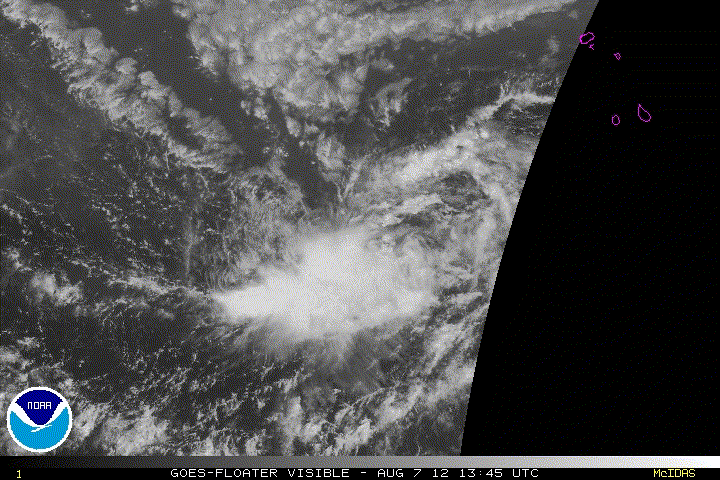
Tertius wrote:http://tropic.ssec.wisc.edu/real-time/sal/splitE.jpg


If 92L can eat up that tip of the SAL which is right in front of the invest, the conditions would be pretty good for the next waves, especially Pouch 13L
0 likes   
54° 11' 59'' N, 9° 9' 20'' E
Boomer Sooner!
Go Broncos! Go Cards! Go Niners!
- Daniel

User avatar
cycloneye
Admin
Admin
Posts: 139073
Age: 67
Joined: Thu Oct 10, 2002 10:54 am
Location: San Juan, Puerto Rico

Re: ATL: INVEST 92L - Models

#49 Postby cycloneye » Tue Aug 07, 2012 1:50 pm

18z Models

Wow,SHIP up to 77kts.

Code: Select all

WHXX01 KWBC 071834
CHGHUR
TROPICAL CYCLONE GUIDANCE MESSAGE
NWS NATIONAL HURRICANE CENTER MIAMI FL
1834 UTC TUE AUG 7 2012
 
DISCLAIMER...NUMERICAL MODELS ARE SUBJECT TO LARGE ERRORS.
PLEASE REFER TO NHC OFFICIAL FORECASTS FOR TROPICAL CYCLONE
AND SUBTROPICAL CYCLONE INFORMATION.
 
ATLANTIC OBJECTIVE AIDS FOR
 
DISTURBANCE INVEST (AL922012) 20120807 1800 UTC
 
        ...00 HRS...   ...12 HRS...   ...24 HRS. ..   ...36 HRS...
        120807  1800   120808  0600   120808  1800   120809  0600
 
         LAT    LON     LAT    LON     LAT    LON     LAT    LON
BAMS    11.8N  31.3W   12.4N  33.7W   12.8N  36.4W   12.6N  39.3W
BAMD    11.8N  31.3W   12.5N  34.0W   13.0N  36.4W   13.1N  38.8W
BAMM    11.8N  31.3W   12.7N  33.8W   13.3N  36.2W   13.3N  38.5W
LBAR    11.8N  31.3W   12.2N  34.7W   12.8N  38.1W   13.3N  41.4W
SHIP        25KTS          29KTS          35KTS          41KTS
DSHP        25KTS          29KTS          35KTS          41KTS
 
        ...48 HRS...   ...72 HRS...   ...96 HRS. ..   ..120 HRS...
        120809  1800   120810  1800   120811  1800   120812  1800
 
         LAT    LON     LAT    LON     LAT    LON     LAT    LON
BAMS    12.2N  42.3W   11.2N  49.4W   11.3N  57.0W   12.2N  64.9W
BAMD    12.8N  41.1W   12.0N  45.5W   12.3N  49.1W   13.7N  52.3W
BAMM    13.0N  40.9W   12.1N  45.4W   11.8N  49.1W   12.5N  52.7W
LBAR    13.5N  44.5W   13.4N  50.4W   13.6N  54.6W     .0N    .0W
SHIP        47KTS          60KTS          72KTS          77KTS
DSHP        47KTS          60KTS          72KTS          77KTS
 
         ...INITIAL CONDITIONS...
LATCUR =  11.8N LONCUR =  31.3W DIRCUR = 270DEG SPDCUR =  17KT
LATM12 =  11.8N LONM12 =  27.8W DIRM12 = 272DEG SPDM12 =  15KT
LATM24 =  11.6N LONM24 =  25.5W
WNDCUR =   25KT RMAXWD =   60NM WNDM12 =   25KT
CENPRS = 1009MB OUTPRS = 1011MB OUTRAD =  150NM SDEPTH =   S
RD34NE =    0NM RD34SE =    0NM RD34SW =    0NM RD34NW =   0NM
 
0 likes   
Visit the Caribbean-Central America Weather Thread where you can find at first post web cams,radars
and observations from Caribbean basin members Click Here

User avatar
KWT
Category 5
Category 5
Posts: 31390
Joined: Tue Aug 17, 2004 11:02 am
Location: UK!!!

#50 Postby KWT » Tue Aug 07, 2012 1:56 pm

SHIPS certainly agressive with it, other models do very little with it at all though.
0 likes   
Personal Forecast Disclaimer:
The posts in this forum are NOT official forecast and should not be used as such. They are just the opinion of the poster and may or may not be backed by sound meteorological data. They are NOT endorsed by any professional institution or storm2k.org. For official information, please refer to the NHC and NWS products

Dean4Storms
S2K Supporter
S2K Supporter
Posts: 6355
Age: 61
Joined: Sun Aug 31, 2003 1:01 pm
Location: Miramar Bch. FL

#51 Postby Dean4Storms » Tue Aug 07, 2012 2:12 pm

Strange season so far.
0 likes   

User avatar
cycloneye
Admin
Admin
Posts: 139073
Age: 67
Joined: Thu Oct 10, 2002 10:54 am
Location: San Juan, Puerto Rico

Re: ATL: INVEST 92L - Models

#52 Postby cycloneye » Tue Aug 07, 2012 2:16 pm

No wonder why SHIP has 92L going to hurricane. Is because the shear will not be a problem so the only impediment would be the dry air. 18z forecast.

Code: Select all

SHEAR (KT)        12     9     8    10    13     6     5     3     2     0     3     7     6

ftp://ftp.nhc.noaa.gov/atcf/stext/12080 ... _ships.txt
0 likes   
Visit the Caribbean-Central America Weather Thread where you can find at first post web cams,radars
and observations from Caribbean basin members Click Here

User avatar
KWT
Category 5
Category 5
Posts: 31390
Joined: Tue Aug 17, 2004 11:02 am
Location: UK!!!

#53 Postby KWT » Tue Aug 07, 2012 2:19 pm

Looks like the lower levels are much quicker than the upper levels, sorta the same problem Ernesto had from the looks of the BAM's suite.
0 likes   
Personal Forecast Disclaimer:
The posts in this forum are NOT official forecast and should not be used as such. They are just the opinion of the poster and may or may not be backed by sound meteorological data. They are NOT endorsed by any professional institution or storm2k.org. For official information, please refer to the NHC and NWS products

blazess556
Professional-Met
Professional-Met
Posts: 250
Joined: Mon Aug 31, 2009 10:51 pm
Location: Germantown, MD

Re: ATL: INVEST 92L - Models

#54 Postby blazess556 » Tue Aug 07, 2012 2:22 pm

The 12Z GFDL does take 92L down to about a 1000 mb TS with 40-50 kt winds for days 3-5.
0 likes   

User avatar
'CaneFreak
Category 5
Category 5
Posts: 1475
Joined: Mon Jun 05, 2006 10:50 am
Location: New Bern, NC

Re: ATL: INVEST 92L - Models

#55 Postby 'CaneFreak » Tue Aug 07, 2012 2:22 pm

Mid level dry air indeed. I guess the research question becomes: why are we seeing so much mid level dry air in the tropical Atlantic? Is there something about the climatic changes we have seen in recent years that is allowing for more dry air to plague the Atlantic for longer periods than normal?

Code: Select all

700-500 MB RH     59    60    59    54    54    51    45    45    41    40    38    39    37


cycloneye wrote:No wonder why SHIP has 92L going to hurricane. Is because the shear will not be a problem so the only impediment would be the dry air. 18z forecast.

Code: Select all

SHEAR (KT)        12     9     8    10    13     6     5     3     2     0     3     7     6

ftp://ftp.nhc.noaa.gov/atcf/stext/12080 ... _ships.txt
0 likes   

User avatar
KWT
Category 5
Category 5
Posts: 31390
Joined: Tue Aug 17, 2004 11:02 am
Location: UK!!!

Re:

#56 Postby KWT » Tue Aug 07, 2012 2:33 pm

Gustywind wrote:Decreasing numbers...

07/1800 UTC 12.3N 31.3W TOO WEAK 92L
07/1145 UTC 12.0N 29.5W T1.0/1.0 92L


I think the actual best rotation is to the south of where they are looking, somewhere around 11N.
0 likes   
Personal Forecast Disclaimer:
The posts in this forum are NOT official forecast and should not be used as such. They are just the opinion of the poster and may or may not be backed by sound meteorological data. They are NOT endorsed by any professional institution or storm2k.org. For official information, please refer to the NHC and NWS products

User avatar
cycloneye
Admin
Admin
Posts: 139073
Age: 67
Joined: Thu Oct 10, 2002 10:54 am
Location: San Juan, Puerto Rico

Re: ATL: INVEST 92L

#57 Postby cycloneye » Tue Aug 07, 2012 2:51 pm

Image
0 likes   
Visit the Caribbean-Central America Weather Thread where you can find at first post web cams,radars
and observations from Caribbean basin members Click Here

User avatar
KWT
Category 5
Category 5
Posts: 31390
Joined: Tue Aug 17, 2004 11:02 am
Location: UK!!!

#58 Postby KWT » Tue Aug 07, 2012 3:01 pm

A few storms flaring up on that loop there cycloneye. SAL very evident to the north of it still as well.
0 likes   
Personal Forecast Disclaimer:
The posts in this forum are NOT official forecast and should not be used as such. They are just the opinion of the poster and may or may not be backed by sound meteorological data. They are NOT endorsed by any professional institution or storm2k.org. For official information, please refer to the NHC and NWS products

User avatar
TheBurn
Category 2
Category 2
Posts: 524
Joined: Thu Jul 28, 2005 4:00 pm
Location: Rincon, PR

Re: ATL: INVEST 92L

#59 Postby TheBurn » Tue Aug 07, 2012 3:25 pm

18:00 UTC RGB Natural Color - 92L
et tu Florence? And I really like the reflection in this shot...

Image
0 likes   

tolakram
Admin
Admin
Posts: 19165
Age: 60
Joined: Sun Aug 27, 2006 8:23 pm
Location: Florence, KY (name is Mark)

Re: ATL: INVEST 92L

#60 Postby tolakram » Tue Aug 07, 2012 4:09 pm

0 likes   
M a r k
- - - - -
Join us in chat: Storm2K Chatroom Invite. Android and IOS apps also available.

The posts in this forum are NOT official forecasts and should not be used as such. Posts are NOT endorsed by any professional institution or STORM2K.org. For official information and forecasts, please refer to NHC and NWS products.


Return to “2012”

Who is online

Users browsing this forum: No registered users and 105 guests