ATL: JOYCE - Post-Tropical
Moderator: S2k Moderators
-
hurricanes1234
- Category 5

- Posts: 2903
- Joined: Sat Jul 28, 2012 6:19 pm
- Location: Trinidad and Tobago
Re: ATL: INVEST 96L
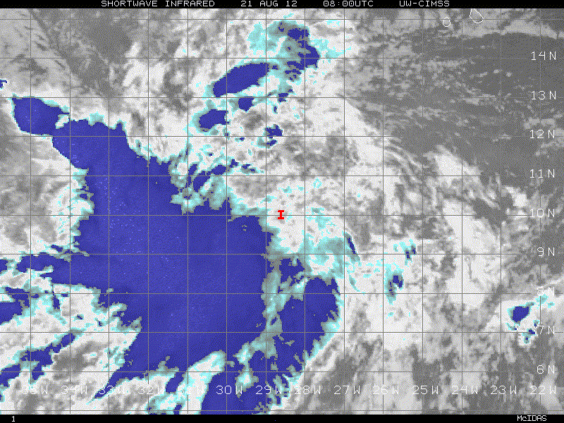
96L is looking alright now. Indeed better looking than yesterday.
0 likes
PLEASE NOTE: With the exception of information from weather agencies that I may copy and paste here, my posts will NEVER be official, since I am NOT a meteorologist. They are solely my amateur opinion, and may or may not be accurate. Therefore, please DO NOT use them as official details, particularly when making important decisions. Thank you.
-
cheezyWXguy

- Category 5
- Posts: 5528
- Joined: Mon Feb 13, 2006 12:29 am
- Location: Dallas, TX
Re: ATL: INVEST 96L
wow, thats actually pretty good looking wave,looks like pretty strong vorticity. And at 10.4N with 94L clearing out the SAL, this one could be the one to watch. I havent really checked to see what kind of model support it has, but Im guessing with the lack of activity on the models thread, probably not much.
0 likes
-
cycloneye

- Admin

- Posts: 139028
- Age: 67
- Joined: Thu Oct 10, 2002 10:54 am
- Location: San Juan, Puerto Rico
Re: ATL: INVEST 96L
Here is NHC preliminary thinking by 72 hours on 96L.

0 likes
Visit the Caribbean-Central America Weather Thread where you can find at first post web cams,radars
and observations from Caribbean basin members Click Here
and observations from Caribbean basin members Click Here

Re: ATL: INVEST 96L
so much better looking than 94L right now....I have to agree.....its not caught up in the low level flow just yet like 94L....so moving a tad slower....not sure of track just yet...still way out there....
0 likes
-
brunota2003

- S2K Supporter

- Posts: 9476
- Age: 33
- Joined: Sat Jul 30, 2005 9:56 pm
- Location: Stanton, KY...formerly Havelock, NC
- Contact:
-
cycloneye
- Admin
- Posts: 139028
- Age: 67
- Joined: Thu Oct 10, 2002 10:54 am
- Location: San Juan, Puerto Rico
Re: ATL: INVEST 96L
Not looking bad. 94L is helping to clean the sal for this.

0 likes
Visit the Caribbean-Central America Weather Thread where you can find at first post web cams,radars
and observations from Caribbean basin members Click Here
and observations from Caribbean basin members Click Here
-
cycloneye
- Admin
- Posts: 139028
- Age: 67
- Joined: Thu Oct 10, 2002 10:54 am
- Location: San Juan, Puerto Rico
Re: ATL: INVEST 96L
Up to 40%
AN AREA OF LOW PRESSURE HAS FORMED ABOUT 375 MILES SOUTHWEST OF THE
CAPE VERDE ISLANDS IN ASSOCIATION WITH A TROPICAL WAVE. SHOWERS
AND THUNDERSTORMS ARE SHOWING SOME SIGNS OF ORGANIZATION... AND
FURTHER DEVELOPMENT OF THIS LOW IS POSSIBLE OVER THE NEXT FEW DAYS.
THIS SYSTEM HAS A MEDIUM CHANCE...40 PERCENT...OF BECOMING A
TROPICAL CYCLONE DURING THE NEXT 48 HOURS AS IT MOVES WESTWARD AT
15 TO 20 MPH.
0 likes
Visit the Caribbean-Central America Weather Thread where you can find at first post web cams,radars
and observations from Caribbean basin members Click Here
and observations from Caribbean basin members Click Here
-
northjaxpro

- S2K Supporter
- Posts: 8900
- Joined: Mon Sep 27, 2010 11:21 am
- Location: Jacksonville, FL
96L looks rather good this evening. 94L has cleared the way for this system scouring out the SAL. It should be decent conditions for this to continue to develop and reach named status I feel within the next 36-48 hours. GFS runs a couple of days ago had this system developing and following on the heels of 94L and entering the Eastern Carribean by late this weekend. Still a ways to go with this system, but definitely looks impressive at this time.
__________________________
My posts in this forum are NOT official forecast. They are just the opinion of this poster. For official information, please refer to the NHC and NWS products.
__________________________
My posts in this forum are NOT official forecast. They are just the opinion of this poster. For official information, please refer to the NHC and NWS products.
0 likes
NEVER, EVER SAY NEVER in the tropics and weather in general, and most importantly, with life itself!!
________________________________________________________________________________________
Fay 2008 Beryl 2012 Debby 2012 Colin 2016 Hermine 2016 Julia 2016 Matthew 2016 Irma 2017 Dorian 2019
________________________________________________________________________________________
Fay 2008 Beryl 2012 Debby 2012 Colin 2016 Hermine 2016 Julia 2016 Matthew 2016 Irma 2017 Dorian 2019
-
cycloneye
- Admin
- Posts: 139028
- Age: 67
- Joined: Thu Oct 10, 2002 10:54 am
- Location: San Juan, Puerto Rico
Re: ATL: INVEST 96L
ASCAT caught the developing circulation around 6:57 PM EDT.

0 likes
Visit the Caribbean-Central America Weather Thread where you can find at first post web cams,radars
and observations from Caribbean basin members Click Here
and observations from Caribbean basin members Click Here
-
cycloneye
- Admin
- Posts: 139028
- Age: 67
- Joined: Thu Oct 10, 2002 10:54 am
- Location: San Juan, Puerto Rico
Re: ATL: INVEST 96L
00z Best Track
AL, 96, 2012082100, , BEST, 0, 103N, 269W, 25, 1010, DB
ftp://ftp.nhc.noaa.gov/atcf/tcweb/inves ... 012.invest
AL, 96, 2012082100, , BEST, 0, 103N, 269W, 25, 1010, DB
ftp://ftp.nhc.noaa.gov/atcf/tcweb/inves ... 012.invest
0 likes
Visit the Caribbean-Central America Weather Thread where you can find at first post web cams,radars
and observations from Caribbean basin members Click Here
and observations from Caribbean basin members Click Here

Re: ATL: INVEST 96L
Stephanie wrote:96L definitely looks better than 94L at this point.
most defintely....its not fighting off the stable air like 94L and its not embedded in that screaming east to west low level flow....
0 likes
-
CrazyC83
- Professional-Met

- Posts: 33393
- Joined: Tue Mar 07, 2006 11:57 pm
- Location: Deep South, for the first time!
Up to 50% now. There is an error in the graphic.
2. A WELL-DEFINED LOW PRESSURE SYSTEM ASSOCIATED WITH A TROPICAL WAVE
IS LOCATED ABOUT 380 MILES SOUTHWEST OF THE CAPE VERDE ISLANDS.
SHOWERS AND THUNDERSTORMS CONTINUE TO SHOW SIGNS OF ORGANIZATION...
AND FURTHER DEVELOPMENT OF THIS DISTURBANCE IS POSSIBLE OVER THE
NEXT FEW DAYS. THIS SYSTEM HAS A MEDIUM CHANCE...50 PERCENT...OF
BECOMING A TROPICAL CYCLONE DURING THE NEXT 48 HOURS AS IT MOVES
WESTWARD AT ABOUT 15 MPH.
0 likes
-
bob rulz
- Category 5
- Posts: 1667
- Age: 34
- Joined: Sat Jan 28, 2006 7:30 pm
- Location: Salt Lake City, Utah
Re: ATL: INVEST 96L
Impressive!
And at just above 10N...that's a scary position for an Invest to be in. Obviously it's still a LONG ways out and may not even do anything, but this is definitely something to keep an eye on.
And at just above 10N...that's a scary position for an Invest to be in. Obviously it's still a LONG ways out and may not even do anything, but this is definitely something to keep an eye on.
0 likes
-
Gustywind

- Category 5
- Posts: 12334
- Joined: Mon Sep 03, 2007 7:29 am
- Location: Baie-Mahault, GUADELOUPE
Mentionned now as a special feature given the latest TWD
000
AXNT20 KNHC 210601
TWDAT
TROPICAL WEATHER DISCUSSION
NWS NATIONAL HURRICANE CENTER MIAMI FL
205 AM EDT TUE AUG 21 2012
TROPICAL WEATHER DISCUSSION FOR NORTH AMERICA...CENTRAL
AMERICA...GULF OF MEXICO...CARIBBEAN SEA...NORTHERN SECTIONS
OF SOUTH AMERICA...AND ATLANTIC OCEAN TO THE AFRICAN COAST
FROM THE EQUATOR TO 32N. THE FOLLOWING INFORMATION IS BASED
ON SATELLITE IMAGERY...WEATHER OBSERVATIONS...RADAR...AND
METEOROLOGICAL ANALYSIS.
BASED ON 0000 UTC SURFACE ANALYSIS AND SATELLITE IMAGERY
THROUGH 0515 UTC.
...SPECIAL FEATURES...
AN ATLANTIC OCEAN TROPICAL WAVE IS ALONG 16N26W 13N27W TO
A 1010 MB LOW PRESSURE CENTER THAT IS ALONG THE WAVE NEAR
10N27W. NUMEROUS STRONG CONVECTIVE PRECIPITATION IS FROM 8N
TO 11N BETWEEN 29W AND 32W. BROKEN TO OVERCAST MULTILAYERED
CLOUDS AND OTHER POSSIBLE RAINSHOWERS ARE ELSEWHERE FROM 10N
TO 22N BETWEEN 23W AND 34W. A MIDDLE LEVEL TO UPPER LEVEL
INVERTED TROUGH IS ALONG 22N30W 16N32W 10N33W TO THE WEST
OF THIS WAVE. THIS SYSTEM HAS A MEDIUM CHANCE OF BECOMING
A TROPICAL CYCLONE DURING THE NEXT 48 HOURS AS IT MOVES
WESTWARD 15 TO 20 MPH.
0 likes
-
tolakram
- Admin
- Posts: 19165
- Age: 60
- Joined: Sun Aug 27, 2006 8:23 pm
- Location: Florence, KY (name is Mark)
Re: ATL: INVEST 96L (60%)
1. A WELL-DEFINED LOW PRESSURE SYSTEM ASSOCIATED WITH A TROPICAL WAVE
IS LOCATED ABOUT 425 MILES SOUTHWEST OF THE CAPE VERDE ISLANDS.
SHOWERS AND THUNDERSTORMS CONTINUE TO SHOW SIGNS OF ORGANIZATION...
AND A TROPICAL DEPRESSION COULD FORM DURING THE NEXT DAY OR TWO.
THIS SYSTEM HAS A HIGH CHANCE...60 PERCENT...OF BECOMING A TROPICAL
CYCLONE DURING THE NEXT 48 HOURS AS IT MOVES WESTWARD AT ABOUT 15
MPH.
0 likes
M a r k
- - - - -
Join us in chat: Storm2K Chatroom Invite. Android and IOS apps also available.
The posts in this forum are NOT official forecasts and should not be used as such. Posts are NOT endorsed by any professional institution or STORM2K.org. For official information and forecasts, please refer to NHC and NWS products.
-
tolakram
- Admin
- Posts: 19165
- Age: 60
- Joined: Sun Aug 27, 2006 8:23 pm
- Location: Florence, KY (name is Mark)
Re: ATL: INVEST 96L (60%)
latest loop
0 likes
M a r k
- - - - -
Join us in chat: Storm2K Chatroom Invite. Android and IOS apps also available.
The posts in this forum are NOT official forecasts and should not be used as such. Posts are NOT endorsed by any professional institution or STORM2K.org. For official information and forecasts, please refer to NHC and NWS products.
- - - - -
Join us in chat: Storm2K Chatroom Invite. Android and IOS apps also available.
The posts in this forum are NOT official forecasts and should not be used as such. Posts are NOT endorsed by any professional institution or STORM2K.org. For official information and forecasts, please refer to NHC and NWS products.
Who is online
Users browsing this forum: No registered users and 64 guests