ATL: KIRK - Post-Tropical - Discussion

Moderator: S2k Moderators

Message
Author
User avatar
cheezyWXguy
Category 5
Category 5
Posts: 5528
Joined: Mon Feb 13, 2006 12:29 am
Location: Dallas, TX

Re:

#41 Postby cheezyWXguy » Sat Aug 25, 2012 6:31 pm

Aric Dunn wrote:anyone else notice this is already very likely a TD. impressive circ already established. guess they are busy with Isaac

You think? It looks like the circulation is still a bit elongated SW to NE to me. It may be fully closed, but if it were up to me I probably wouldve waited til tomorrow. I think theyll raise chances in the next TWO though.
0 likes   

rainstorm

#42 Postby rainstorm » Sat Aug 25, 2012 6:43 pm

18Z gfs develops it out to sea.
0 likes   

WeatherGuesser
Category 5
Category 5
Posts: 2672
Joined: Tue Jun 29, 2010 6:46 am

#43 Postby WeatherGuesser » Sat Aug 25, 2012 6:47 pm

Up to 50%

AN AREA OF LOW PRESSURE LOCATED ABOUT 500 MILES WEST OF THE CAPE
VERDE ISLANDS HAS BECOME BETTER DEFINED TODAY. ENVIRONMENTAL
CONDITIONS APPEAR TO SUPPORT FURTHER DEVELOPMENT...AND THIS LOW
COULD BECOME A TROPICAL DEPRESSION OVER THE NEXT DAY OR TWO. THIS
SYSTEM HAS A MEDIUM CHANCE...50 PERCENT...OF BECOMING A TROPICAL
CYCLONE DURING THE NEXT 48 HOURS AS IT MOVES TOWARD THE
WEST-NORTHWEST AT 10 TO 15 MPH.
0 likes   

hurricanes1234
Category 5
Category 5
Posts: 2903
Joined: Sat Jul 28, 2012 6:19 pm
Location: Trinidad and Tobago

Re:

#44 Postby hurricanes1234 » Sat Aug 25, 2012 6:49 pm

WeatherGuesser wrote:Up to 50%


I thought so..... :P
0 likes   
PLEASE NOTE: With the exception of information from weather agencies that I may copy and paste here, my posts will NEVER be official, since I am NOT a meteorologist. They are solely my amateur opinion, and may or may not be accurate. Therefore, please DO NOT use them as official details, particularly when making important decisions. Thank you.

tolakram
Admin
Admin
Posts: 19165
Age: 60
Joined: Sun Aug 27, 2006 8:23 pm
Location: Florence, KY (name is Mark)

Re: ATL : INVEST 97L

#45 Postby tolakram » Sat Aug 25, 2012 7:25 pm

saved loop

Image
0 likes   
M a r k
- - - - -
Join us in chat: Storm2K Chatroom Invite. Android and IOS apps also available.

The posts in this forum are NOT official forecasts and should not be used as such. Posts are NOT endorsed by any professional institution or STORM2K.org. For official information and forecasts, please refer to NHC and NWS products.

User avatar
Portastorm
Storm2k Moderator
Storm2k Moderator
Posts: 9787
Age: 61
Joined: Fri Jul 11, 2003 9:16 am
Location: South Austin, TX
Contact:

Re: ATL : INVEST 97L

#46 Postby Portastorm » Sat Aug 25, 2012 7:26 pm

Looking like it is getting its act together quite well.
0 likes   
Any forecasts under my name are to be taken with a grain of salt. Get your best forecasts from the National Weather Service and National Hurricane Center.

I'm a certified Advanced SKYWARN-trained spotter and am active on Twitter at @TravisCOSW, a social media partner of the NWS Austin-San Antonio office.

User avatar
Gustywind
Category 5
Category 5
Posts: 12334
Joined: Mon Sep 03, 2007 7:29 am
Location: Baie-Mahault, GUADELOUPE

#47 Postby Gustywind » Sat Aug 25, 2012 8:31 pm

Up to 50%


000
ABNT20 KNHC 252345
TWOAT

TROPICAL WEATHER OUTLOOK
NWS NATIONAL HURRICANE CENTER MIAMI FL
800 PM EDT SAT AUG 25 2012

FOR THE NORTH ATLANTIC...CARIBBEAN SEA AND THE GULF OF MEXICO...

AN AREA OF LOW PRESSURE LOCATED ABOUT 500 MILES WEST OF THE CAPE
VERDE ISLANDS HAS BECOME BETTER DEFINED TODAY. ENVIRONMENTAL
CONDITIONS APPEAR TO SUPPORT FURTHER DEVELOPMENT...AND THIS LOW
COULD BECOME A TROPICAL DEPRESSION OVER THE NEXT DAY OR TWO. THIS
SYSTEM HAS A MEDIUM CHANCE...50 PERCENT...OF BECOMING A TROPICAL
CYCLONE DURING THE NEXT 48 HOURS AS IT MOVES TOWARD THE
WEST-NORTHWEST AT 10 TO 15 MPH.
0 likes   

User avatar
Gustywind
Category 5
Category 5
Posts: 12334
Joined: Mon Sep 03, 2007 7:29 am
Location: Baie-Mahault, GUADELOUPE

#48 Postby Gustywind » Sat Aug 25, 2012 8:35 pm

000
AXNT20 KNHC 252356
TWDAT

TROPICAL WEATHER DISCUSSION
NWS NATIONAL HURRICANE CENTER MIAMI FL
805 PM EDT SAT AUG 25 2012

TROPICAL WEATHER DISCUSSION FOR NORTH AMERICA...CENTRAL
AMERICA...GULF OF MEXICO...CARIBBEAN SEA...NORTHERN SECTIONS
OF SOUTH AMERICA...AND ATLANTIC OCEAN TO THE AFRICAN COAST
FROM THE EQUATOR TO 32N. THE FOLLOWING INFORMATION IS BASED
ON SATELLITE IMAGERY...WEATHER OBSERVATIONS...RADAR...AND
METEOROLOGICAL ANALYSIS.

BASED ON 1800 UTC SURFACE ANALYSIS AND SATELLITE IMAGERY
THROUGH 2315 UTC.

...SPECIAL FEATURES...

TROPICAL WAVE EXTENDS FROM 21N31W TO A 1009 MB SURFACE LOW NEAR
15N32W
MOVING WNW NEAR 15 KT. THE WAVE/LOW LIES WITHIN A LARGE
SURGE OF DEEP LAYER MOISTURE PRESENT ACROSS MUCH OF THE EASTERN
TROPICAL ATLC. BROAD CYCLONIC FLOW IS AROUND THE WAVE/LOW AND
THE MONSOON TROUGH AND THE SYSTEM HAS BECOME SLIGHTLY MORE
ORGANIZED TODAY. CURRENTLY SCATTERED MODERATE/ISOLATED STRONG
CONVECTION IS FROM 13N-20N BETWEEN 28W-36W. DEVELOPMENT OF THIS
SYSTEM IS POSSIBLE OVER THE NEXT COUPLE OF DAYS
0 likes   

User avatar
cycloneye
Admin
Admin
Posts: 139063
Age: 67
Joined: Thu Oct 10, 2002 10:54 am
Location: San Juan, Puerto Rico

Re: ATL : INVEST 97L

#49 Postby cycloneye » Sun Aug 26, 2012 6:57 am

Remains at 50%.


TROPICAL WEATHER OUTLOOK
NWS NATIONAL HURRICANE CENTER MIAMI FL
800 AM EDT SUN AUG 26 2012

FOR THE NORTH ATLANTIC...CARIBBEAN SEA AND THE GULF OF MEXICO...

THE NATIONAL HURRICANE CENTER IS ISSUING ADVISORIES ON TROPICAL
STORM ISAAC...LOCATED ABOUT 135 MILES EAST-SOUTHEAST OF KEY WEST.

SHOWERS AND THUNDERSTORMS ASSOCIATED WITH A LARGE AREA OF LOW
PRESSURE LOCATED ABOUT 650 MILES WEST OF THE CAPE VERDE ISLANDS
HAVE CHANGED LITTLE IN ORGANIZATION DURING THE LAST SEVERAL HOURS.
ENVIRONMENTAL CONDITIONS APPEAR CONDUCIVE FOR DEVELOPMENT...AND
THIS LOW COULD BECOME A TROPICAL DEPRESSION OVER THE NEXT DAY OR
TWO. THIS SYSTEM HAS A MEDIUM CHANCE...50 PERCENT...OF BECOMING A
TROPICAL CYCLONE DURING THE NEXT 48 HOURS AS IT MOVES
WEST-NORTHWESTWARD TO NORTHWESTWARD AT 10 TO 15 MPH.

ELSEWHERE...TROPICAL CYCLONE FORMATION IS NOT EXPECTED DURING THE
NEXT 48 HOURS.

$$
FORECASTER CANGIALOSI
0 likes   
Visit the Caribbean-Central America Weather Thread where you can find at first post web cams,radars
and observations from Caribbean basin members Click Here

User avatar
TreasureIslandFLGal
S2K Supporter
S2K Supporter
Posts: 1558
Age: 56
Joined: Sun Aug 15, 2004 6:16 pm
Location: Clearwater, Florida ~3 miles from the coast now. We finally moved safely off the barrier island!

#50 Postby TreasureIslandFLGal » Sun Aug 26, 2012 7:09 am

yeah but isn't this just a recurve? then again, early Isaac was supposed to recurve too. ;)
0 likes   
Chrissy & Ligeia
Chrissy & Nikki
:flag:

hurricanes1234
Category 5
Category 5
Posts: 2903
Joined: Sat Jul 28, 2012 6:19 pm
Location: Trinidad and Tobago

Re: ATL : INVEST 97L

#51 Postby hurricanes1234 » Sun Aug 26, 2012 9:45 am

Looking very disorganized right now.
0 likes   
PLEASE NOTE: With the exception of information from weather agencies that I may copy and paste here, my posts will NEVER be official, since I am NOT a meteorologist. They are solely my amateur opinion, and may or may not be accurate. Therefore, please DO NOT use them as official details, particularly when making important decisions. Thank you.

User avatar
cycloneye
Admin
Admin
Posts: 139063
Age: 67
Joined: Thu Oct 10, 2002 10:54 am
Location: San Juan, Puerto Rico

Re: ATL : INVEST 97L

#52 Postby cycloneye » Sun Aug 26, 2012 7:01 pm

Down to 40%.

TROPICAL WEATHER OUTLOOK
NWS NATIONAL HURRICANE CENTER MIAMI FL
800 PM EDT SUN AUG 26 2012

FOR THE NORTH ATLANTIC...CARIBBEAN SEA AND THE GULF OF MEXICO...

THE NATIONAL HURRICANE CENTER IS ISSUING ADVISORIES ON TROPICAL
STORM ISAAC...LOCATED ABOUT 60 MILES SOUTHWEST OF KEY WEST.

SHOWERS AND THUNDERSTORMS CONTINUE NEAR A BROAD AREA OF LOW PRESSURE
LOCATED ABOUT 800 MILES WEST-NORTHWEST OF THE CAPE VERDE ISLANDS.
WHILE THIS SYSTEM STILL HAS THE POTENTIAL TO BECOME A TROPICAL
DEPRESSION OVER THE NEXT DAY OR SO...UPPER-LEVEL WINDS COULD BECOME
LESS CONDUCIVE FOR DEVELOPMENT AFTER THAT TIME. THIS LOW HAS A
MEDIUM CHANCE...40 PERCENT...OF BECOMING A TROPICAL CYCLONE DURING
THE NEXT 48 HOURS AS IT MOVES WEST-NORTHWESTWARD TO NORTHWESTWARD
AT 10 TO 15 MPH.

ELSEWHERE...TROPICAL CYCLONE FORMATION IS NOT EXPECTED DURING THE
NEXT 48 HOURS.

$$
FORECASTER BLAKE
0 likes   
Visit the Caribbean-Central America Weather Thread where you can find at first post web cams,radars
and observations from Caribbean basin members Click Here

hurricanes1234
Category 5
Category 5
Posts: 2903
Joined: Sat Jul 28, 2012 6:19 pm
Location: Trinidad and Tobago

Re: ATL : INVEST 97L

#53 Postby hurricanes1234 » Sun Aug 26, 2012 7:20 pm

The posts in this forum are NOT official forecast and should not be used as such. They are just the opinion of the poster and may or may not be backed by sound meteorological data. They are NOT endorsed by any professional institution or storm2k.org. For official information, please refer to the NHC and NWS products.

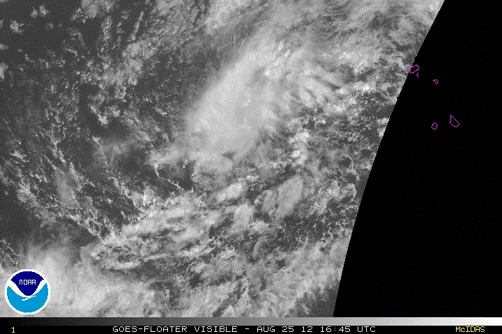
Not very surprising that it's down to 40%, given that the convection is displaced to the northeast of the circulation - I'd say there's a 55% chance this goes downhill from here.
0 likes   
PLEASE NOTE: With the exception of information from weather agencies that I may copy and paste here, my posts will NEVER be official, since I am NOT a meteorologist. They are solely my amateur opinion, and may or may not be accurate. Therefore, please DO NOT use them as official details, particularly when making important decisions. Thank you.

hurricanes1234
Category 5
Category 5
Posts: 2903
Joined: Sat Jul 28, 2012 6:19 pm
Location: Trinidad and Tobago

Re: ATL : INVEST 97L

#54 Postby hurricanes1234 » Mon Aug 27, 2012 11:19 am

Continues to spin down in the face of wind shear. Was down to 30% last night. If the models showed this developing into a monster hurricane, unfortunately they made a huge mistake, because this is only a sad tropical wave that came off of Africa. :crying: :cry:
0 likes   
PLEASE NOTE: With the exception of information from weather agencies that I may copy and paste here, my posts will NEVER be official, since I am NOT a meteorologist. They are solely my amateur opinion, and may or may not be accurate. Therefore, please DO NOT use them as official details, particularly when making important decisions. Thank you.

hurricanes1234
Category 5
Category 5
Posts: 2903
Joined: Sat Jul 28, 2012 6:19 pm
Location: Trinidad and Tobago

Re: ATL : INVEST 97L

#55 Postby hurricanes1234 » Mon Aug 27, 2012 11:20 am

hurricanes1234 wrote:Continues to spin down in the face of wind shear. Was down to 30% last night. If the models showed this developing into a monster hurricane, unfortunately they made a huge mistake, because this is only a sad tropical wave that came off of Africa. :crying: :cry:


The posts in this forum are NOT official forecast and should not be used as such. They are just the opinion of the poster and may or may not be backed by sound meteorological data. They are NOT endorsed by any professional institution or storm2k.org. For official information, please refer to the NHC and NWS products.
0 likes   
PLEASE NOTE: With the exception of information from weather agencies that I may copy and paste here, my posts will NEVER be official, since I am NOT a meteorologist. They are solely my amateur opinion, and may or may not be accurate. Therefore, please DO NOT use them as official details, particularly when making important decisions. Thank you.

User avatar
ROCK
Category 5
Category 5
Posts: 9254
Age: 52
Joined: Tue Aug 17, 2004 7:30 am
Location: Kemah, Texas

Re: ATL : INVEST 97L

#56 Postby ROCK » Mon Aug 27, 2012 11:55 am

97L was never a worry....its the bad boy behind it that will slip under the ridge....and come across IMO...
0 likes   

rainstorm

#57 Postby rainstorm » Mon Aug 27, 2012 7:15 pm

0 likes   

User avatar
MGC
S2K Supporter
S2K Supporter
Posts: 5792
Joined: Sun Mar 23, 2003 9:05 pm
Location: Pass Christian MS, or what is left.

Re: ATL : INVEST 97L

#58 Postby MGC » Mon Aug 27, 2012 7:21 pm

Just needs a bit more convection near the center......MGC
0 likes   

User avatar
cycloneye
Admin
Admin
Posts: 139063
Age: 67
Joined: Thu Oct 10, 2002 10:54 am
Location: San Juan, Puerto Rico

Re: ATL : INVEST 97L

#59 Postby cycloneye » Tue Aug 28, 2012 6:59 am

Up to 40%.


SHOWER ACTIVITY ASSOCIATED WITH AN AREA OF LOW PRESSURE LOCATED
ABOUT 1250 MILES WEST-NORTHWEST OF THE CAPE VERDE ISLANDS IS A
LITTLE MORE CONCENTRATED THIS MORNING. ENVIRONMENTAL CONDITIONS
APPEAR TO BE CONDUCIVE FOR SLOW DEVELOPMENT DURING THE NEXT
COUPLE OF DAYS. THIS SYSTEM HAS A MEDIUM CHANCE...40 PERCENT...OF
BECOMING A TROPICAL CYCLONE DURING THE NEXT 48 HOURS AS THE LOW
MOVES WEST-NORTHWESTWARD TO NORTHWESTWARD AT 10 TO 15 MPH.
0 likes   
Visit the Caribbean-Central America Weather Thread where you can find at first post web cams,radars
and observations from Caribbean basin members Click Here

rainstorm

#60 Postby rainstorm » Tue Aug 28, 2012 7:05 am

i think it will be a storm.
0 likes   


Return to “2012”

Who is online

Users browsing this forum: No registered users and 109 guests