ATL: SANDY - Remnants - Discussion
Moderator: S2k Moderators
-
Kingarabian

- S2K Supporter

- Posts: 15432
- Joined: Sat Aug 08, 2009 3:06 am
- Location: Honolulu, Hawaii

Re: ATL: SANDY - Hurricane - Discussion
Seems to be moving nw now correct?
0 likes
Personal Forecast Disclaimer:
The posts in this forum are NOT official forecast and should not be used as such. They are just the opinion of the poster and may or may not be backed by sound meteorological data. They are NOT endorsed by any professional institution or storm2k.org. For official information, please refer to the NHC and NWS products.
The posts in this forum are NOT official forecast and should not be used as such. They are just the opinion of the poster and may or may not be backed by sound meteorological data. They are NOT endorsed by any professional institution or storm2k.org. For official information, please refer to the NHC and NWS products.

Re: ATL: SANDY - Hurricane - Discussion
stephen23 wrote:Seems to be moving nw now correct?
Interesting, the RUC (well now referred to as the RAP) model has Sandy sitting on Bimini in 24 hours. I am assuming the latest data from the dropsondes have been digested for the current run (and upcoming 0Z runs this eve?? Amazing how the NOGAPS & NAM have right on this system
0 likes
Personal Forecast Disclaimer:
The posts in this forum are NOT official forecast and should not be used as such. They are just the opinion of the poster and may or may not be backed by sound meteorological data. They are NOT endorsed by any professional institution or storm2k.org. For official information, please refer to the NHC and NWS products.
The posts in this forum are NOT official forecast and should not be used as such. They are just the opinion of the poster and may or may not be backed by sound meteorological data. They are NOT endorsed by any professional institution or storm2k.org. For official information, please refer to the NHC and NWS products.
Re: ATL: SANDY - Hurricane - Discussion
chaser1 wrote:stephen23 wrote:Seems to be moving nw now correct?
Interesting, the RUC (well now referred to as the RAP) model has Sandy sitting on Bimini in 24 hours. I am assuming the latest data from the dropsondes have been digested for the current run (and upcoming 0Z runs this eve?? Amazing how the NOGAPS & NAM have right on this system
Seems to be right on Euro track as well.
0 likes
Personal Forecast Disclaimer:
The posts in this forum are NOT official forecast and should not be used as such. They are just the opinion of the poster and may or may not be backed by sound meteorological data. They are NOT endorsed by any professional institution or storm2k.org. For official information, please refer to the NHC and NWS products.
The posts in this forum are NOT official forecast and should not be used as such. They are just the opinion of the poster and may or may not be backed by sound meteorological data. They are NOT endorsed by any professional institution or storm2k.org. For official information, please refer to the NHC and NWS products.
-
Hurricane Alexis

- Category 2

- Posts: 683
- Age: 27
- Joined: Thu Jun 14, 2012 7:59 pm
- Location: Miami,Florida
Re: ATL: SANDY - Hurricane - Discussion
Wow. Bimini is really close to the coast! This could turn to out to be a big surprise for SFL.
0 likes
Personal Forecast Disclaimer:
The posts in this forum are NOT official forecast and should not be used as such. They are just the opinion of the poster and may or may not be backed by sound meteorological data. They are NOT endorsed by any professional institution or storm2k.org. For official information, please refer to the NHC and NWS products.
The posts in this forum are NOT official forecast and should not be used as such. They are just the opinion of the poster and may or may not be backed by sound meteorological data. They are NOT endorsed by any professional institution or storm2k.org. For official information, please refer to the NHC and NWS products.
-
ozonepete
- Professional-Met

- Posts: 4743
- Joined: Mon Sep 07, 2009 3:23 pm
- Location: From Ozone Park, NYC / Now in Brooklyn, NY
Re: ATL: SANDY - Hurricane - Discussion
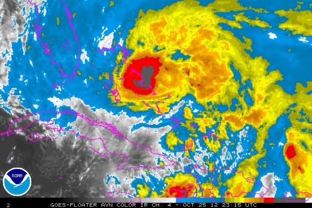
Core looks to be consolidating into a nice circular pattern again. That will let it maintain or even strengthen more again.
0 likes
Re: ATL: SANDY - Hurricane - Discussion
chaser1 wrote:stephen23 wrote:Seems to be moving nw now correct?
Interesting, the RUC (well now referred to as the RAP) model has Sandy sitting on Bimini in 24 hours. I am assuming the latest data from the dropsondes have been digested for the current run (and upcoming 0Z runs this eve?? Amazing how the NOGAPS & NAM have right on this system
Hard to picture Sandy getting over towards Bimini. Would have to put on the brakes and head WNW
0 likes
-
TheDreamTraveler

- Category 2
- Posts: 633
- Joined: Sun Aug 22, 2010 3:10 am
- Location: PA
I feel as though many people along the East Coast, and well inland for that matter, are going to be really caught off guard by this storm. For example, the mentality of some of the people TWC has interviewed about the storm has me very concerned. Acting as if this is just another Nor'easter and that the media is just hyping it again. That may be the case for many storms, but not this one. This one has the potential to be historic, and one the Northeast and Mid Atlantic will possibly remember for decades. The amount and types of damage possible for so many locations is so unprecedented that even I can't almost believe it. I just hope people prepare and take all warnings seriously. This isn't your typical run-of-the-mill storm.
0 likes
-
chris_fit

- Category 5

- Posts: 3078
- Joined: Wed Sep 10, 2003 11:58 pm
- Location: Tampa Bay Area, FL
- Contact:
Re: ATL: SANDY - Hurricane - Discussion
Per latest recon - we have a clear NNW heading for the first time
0 likes

Re: ATL: SANDY - Hurricane - Discussion
stephen23 wrote:chaser1 wrote:stephen23 wrote:Seems to be moving nw now correct?
Interesting, the RUC (well now referred to as the RAP) model has Sandy sitting on Bimini in 24 hours. I am assuming the latest data from the dropsondes have been digested for the current run (and upcoming 0Z runs this eve?? Amazing how the NOGAPS & NAM have right on this system
Seems to be right on Euro track as well.
Am I missing something? The way she's moving I can't see this nearing Bimini. The center seems to be north of Bimini already Or at least parallel
I do agree she seems to be crankIng again
0 likes
-
ozonepete
- Professional-Met
- Posts: 4743
- Joined: Mon Sep 07, 2009 3:23 pm
- Location: From Ozone Park, NYC / Now in Brooklyn, NY
Re: ATL: SANDY - Hurricane - Discussion
chris_fit wrote:Per latest recon - we have a clear NNW heading for the first time
Right on the forecast track.
0 likes
-
galaxy401

- Category 5
- Posts: 2298
- Age: 28
- Joined: Sat Aug 25, 2012 9:04 pm
- Location: Casa Grande, Arizona
Re: ATL: SANDY - Hurricane - Discussion
chris_fit wrote:Per latest recon - we have a clear NNW heading for the first time
Advisory confirms it.
PRESENT MOVEMENT...NNW OR 345 DEGREES AT 17 MPH...27 KM/H
0 likes
Got my eyes on moving right into Hurricane Alley: Florida.
-
AdamFirst

- S2K Supporter
- Posts: 2487
- Age: 34
- Joined: Thu Aug 14, 2008 10:54 am
- Location: Port Saint Lucie, FL
Re: ATL: SANDY - Hurricane - Discussion

8PM advisory graphic has the center on the left edge of the current cone.
0 likes
Dolphins Marlins Canes Golden Panthers HEAT
Andrew 1992 - Irene 1999 - Frances 2004 - Jeanne 2004 - Wilma 2005 - Fay 2008 - Isaac 2012 - Matthew 2016 - Irma 2017 - Dorian 2019 - Ian 2022 - Nicole 2022
Andrew 1992 - Irene 1999 - Frances 2004 - Jeanne 2004 - Wilma 2005 - Fay 2008 - Isaac 2012 - Matthew 2016 - Irma 2017 - Dorian 2019 - Ian 2022 - Nicole 2022
Re: ATL: SANDY - Hurricane - Discussion
Jim Cantore over at Singer Island, FL about 2 miles from my house. I forget - he used to act as a Hurricane shield. Does that still hold true or is he more of a Hurricane magnet now 
0 likes
-
WeatherGuesser
- Category 5
- Posts: 2672
- Joined: Tue Jun 29, 2010 6:46 am
NOTE THAT THE TROPICAL CYCLONE WIND SPEED PROBABILITIES ARE NOT
DESIGNED TO HANDLE THE TYPE OF STRUCTURAL CHANGES ANTICIPATED WITH
SANDY DURING THE FORECAST PERIOD. AS A RESULT...THESE PROBABILITIES
WILL UNDERESTIMATE THE ACTUAL RISK OF STRONG WINDS AWAY FROM THE
CENTER OF SANDY.
http://www.nhc.noaa.gov/text/refresh/MI ... 2037.shtml

DESIGNED TO HANDLE THE TYPE OF STRUCTURAL CHANGES ANTICIPATED WITH
SANDY DURING THE FORECAST PERIOD. AS A RESULT...THESE PROBABILITIES
WILL UNDERESTIMATE THE ACTUAL RISK OF STRONG WINDS AWAY FROM THE
CENTER OF SANDY.
http://www.nhc.noaa.gov/text/refresh/MI ... 2037.shtml
0 likes
-
WilmingtonSandbar
- S2K Supporter
- Posts: 503
- Joined: Sun Aug 29, 2010 12:11 pm
- Location: Southport, NC
Re: ATL: SANDY - Hurricane - Discussion
jhpigott wrote:Jim Cantore over at Singer Island, FL about 2 miles from my house. I forget - he used to act as a Hurricane shield. Does that still hold true or is he more of a Hurricane magnet now
I know that in the 90s he was a magnet. At least on the NC coast he was. Maybe his polarity changed.
0 likes
Diana X2 (look it up), Bertha, Fran, Bonnie, Floyd, Dennis, Charley, Ophelia, Ernesto, Irene, Matthew, And Florence
-
jlauderdal
- S2K Supporter
- Posts: 6771
- Joined: Wed May 19, 2004 5:46 am
- Location: NE Fort Lauderdale
- Contact:
Re:
TheDreamTraveler wrote:I feel as though many people along the East Coast, and well inland for that matter, are going to be really caught off guard by this storm. For example, the mentality of some of the people TWC has interviewed about the storm has me very concerned. Acting as if this is just another Nor'easter and that the media is just hyping it again. That may be the case for many storms, but not this one. This one has the potential to be historic, and one the Northeast and Mid Atlantic will possibly remember for decades. The amount and types of damage possible for so many locations is so unprecedented that even I can't almost believe it. I just hope people prepare and take all warnings seriously. This isn't your typical run-of-the-mill storm.
this is 2012, nobody has an excuse to be caught off guard by anything these days unless you live in a cave with no access to the outside world...folks, its not like there is going to be a nuclear bomb set off...it could be a big deal and preparations will be made in hopes of minimizing the damage
0 likes
-
dexterlabio
- Category 5
- Posts: 3406
- Joined: Sat Oct 24, 2009 11:50 pm
Re: ATL: SANDY - Hurricane - Discussion
Just the mere idea of a hybrid hurricane-nor'easter type of storm is already scary. I've seen the GFS agreeing with the rest of the models about a freakish weather system over NEUS. If this pans out, is it gonna be more like a "blizzard" event with heavy snow or a storm surge event because of high winds?
Keeping an eye on this. My relatives are having a vacation in New York and they'll only be coming back after Halloween...
Keeping an eye on this. My relatives are having a vacation in New York and they'll only be coming back after Halloween...
0 likes
Personal Forecast Disclaimer:
The posts in this forum are NOT official forecast and should not be used as such. They are just the opinion of the poster and may or may not be backed by sound meteorological data. They are NOT endorsed by any professional institution or storm2k.org. For official information, please refer to the NHC and NWS products.
The posts in this forum are NOT official forecast and should not be used as such. They are just the opinion of the poster and may or may not be backed by sound meteorological data. They are NOT endorsed by any professional institution or storm2k.org. For official information, please refer to the NHC and NWS products.
Re: ATL: SANDY - Hurricane - Discussion
I'm seeing 'Frankenstorm', 'worst storm in 100 years', 'much worse than the Perfect Storm' etc headlines from the major news sites. So at least word is getting out. Hopefully it's over-hyped when all is said and done.
0 likes
-
pricetag56
- Tropical Storm

- Posts: 133
- Joined: Sat Aug 21, 2010 4:18 pm
Re: ATL: SANDY - Hurricane - Discussion
If a storm the size and strength the models are predicting hits NYC what kind of storm surge would we see 25ft or higher that have to be a category 5 surge at that size and strength? And another question I heard Brian Norcross on the weather channel saying it is possible for the storm to have a sub 940 pressure because the hurricane will get wrapped into the nor easter and then it will begin to regain tropical characteristics? So its basically like a hurricane on steroids? Can someone elaborate a little more on this because It is very interesting.
0 likes
Who is online
Users browsing this forum: No registered users and 21 guests