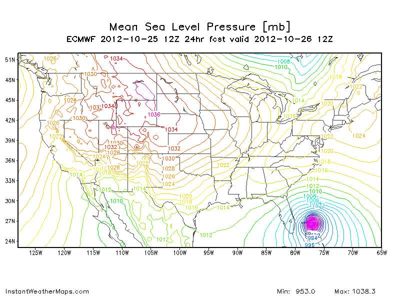
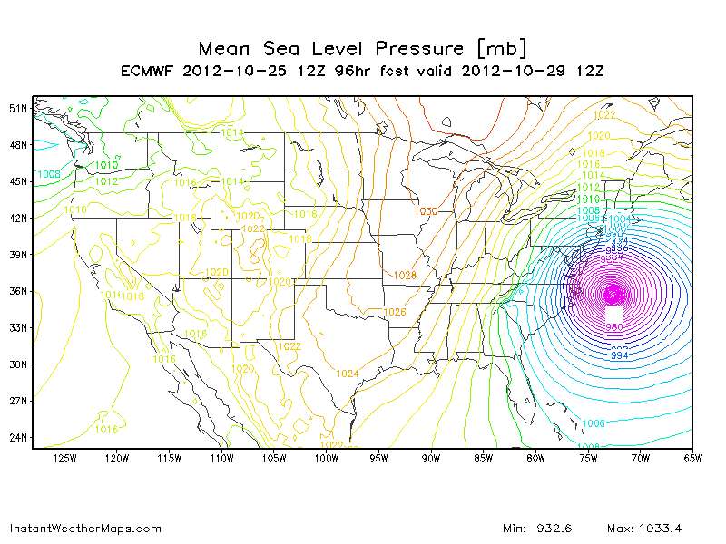
MWatkins wrote:RVAHudson wrote:Hey guys... I've been lurking here for a while, but a quick question... Am I seeing this correctly that this latest euro run has Sandy coming in farther south, along the Chesapeake Bay, 96-120 hours out, or am I looking at this completely wrong?
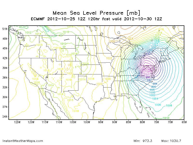
http://www.instantweathermaps.com/ECMWF ... b&hour=120
You are seeing that correctly.
This isn't the usual steering deal. Usually we're used to see systems pushed west by building high pressure to the north.
This time, Sandy will be "pulled" westward by the flow around the negatively-tilted trough over the upper midwest, it's acting like a magnet.
Moreover, the Sandy will have a lot of energy injected into it from that weather system. That baroclinic forcing will make this much larger than a normal tropical system. Winds will be very strong well north of the center. Could be historic.
This isn't without precedent, this has happened a lot of times over the years. It just hasn't happened since the internet has been around, so this a new experience for a lot of weather people.
MW
I was hoping that I was simply misinterpreting it. I work in public safety here in Richmond Virginia, and am trying to decide how plausible this scenario is, and consequently how prepared I should have my people at the station get; I have no meteorological training, just a hobby interest. Looking at that wind field makes me nervous, since we're only 70-100 miles SW of where the euro has her coming on shore. Then again, the GFS has her going much farther north, and I don't want to unduly alarm my people and look like Chicken Little