ATL: INVEST 90L

Moderator: S2k Moderators
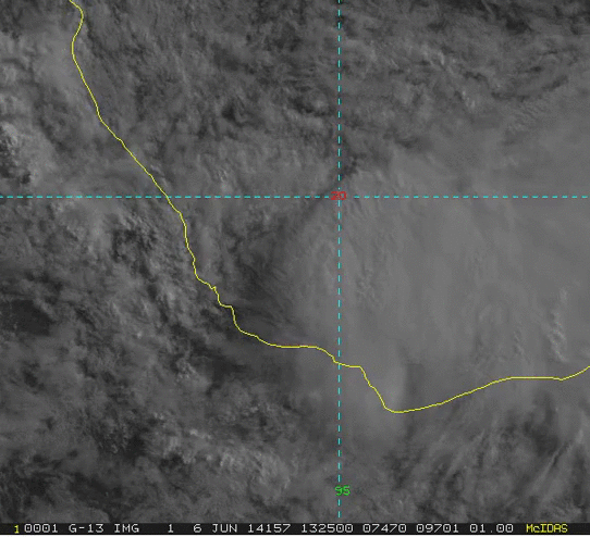
Message
Author
User avatar
cycloneye
Admin
Admin
Posts: 139328
Age: 67
Joined: Thu Oct 10, 2002 10:54 am
Location: San Juan, Puerto Rico

Re: ATL: INVEST 90L

#121 Postby cycloneye » Fri Jun 06, 2014 12:48 pm

Meow wrote:
cycloneye wrote:Plane flying back to base

You can see it at graphic I posted at recon thread.

Why is it near 30N? :eek:


Base is above the 30N latitude.
0 likes   
Visit the Caribbean-Central America Weather Thread where you can find at first post web cams,radars
and observations from Caribbean basin members Click Here

Meow

Re: ATL: INVEST 90L

#122 Postby Meow » Fri Jun 06, 2014 12:51 pm

cycloneye wrote:Base is above the 30N latitude.

Didn’t the plane investigate 90L? So the recon may be cancelled again? :roll:
0 likes   

User avatar
cycloneye
Admin
Admin
Posts: 139328
Age: 67
Joined: Thu Oct 10, 2002 10:54 am
Location: San Juan, Puerto Rico

Re: ATL: INVEST 90L

#123 Postby cycloneye » Fri Jun 06, 2014 12:54 pm

Meow wrote:
cycloneye wrote:Base is above the 30N latitude.

Didn’t the plane investigate 90L? So the recon may be cancelled again? :roll:


They turned around as the 2 PM TWO said,there are no thunderstorms around the low.
0 likes   
Visit the Caribbean-Central America Weather Thread where you can find at first post web cams,radars
and observations from Caribbean basin members Click Here

SeGaBob

#124 Postby SeGaBob » Fri Jun 06, 2014 12:54 pm

They need to quit playing around and investigate 90L now... it will be too late if they don't hurry up.
0 likes   

davidiowx
Category 1
Category 1
Posts: 386
Joined: Tue Sep 10, 2013 11:07 am
Location: Richmond, TX

#125 Postby davidiowx » Fri Jun 06, 2014 12:56 pm

:uarrow: I wouldn't even bother. It looks like it is about to move ashore as we speak.
0 likes   

Alyono
Professional-Met
Professional-Met
Posts: 6961
Joined: Fri Apr 26, 2013 3:52 pm
Location: Texas Coast

#126 Postby Alyono » Fri Jun 06, 2014 12:57 pm

this isn't a sheared TC... its a convectionless swirl
0 likes   

HurricaneTracker2031
Tropical Storm
Tropical Storm
Posts: 248
Age: 24
Joined: Fri Jul 19, 2013 7:20 pm
Location: Pembroke Pines, FL, USA
Contact:

Re: ATL: INVEST 90L

#127 Postby HurricaneTracker2031 » Fri Jun 06, 2014 1:01 pm

It would be way too late for them to investigate it. 90L would be onshore. The next recon they could send out would probably be tomorrow, and that's if they wanted too.
Last edited by HurricaneTracker2031 on Fri Jun 06, 2014 1:02 pm, edited 1 time in total.
0 likes   
SHORT VERSION OF DISCLAIMER: THIS SITE LINK BELOW IS NOT AN OFFICIAL FORECASTING OFFICE AND SHOULD NOT BE USED TO MAKE ANY EMERGENCY DECISIONS....

http://www.macstropicalweather.weebly.com

SeGaBob

#128 Postby SeGaBob » Fri Jun 06, 2014 1:01 pm

This might not get classified the way it appears on satellite. Maybe areas along the coast will report sustained winds of TD or weak TS force and maybe it will be classified post season.
0 likes   

User avatar
TheStormExpert
Category 5
Category 5
Posts: 8487
Age: 30
Joined: Wed Feb 16, 2011 5:38 pm
Location: Palm Beach Gardens, FL

#129 Postby TheStormExpert » Fri Jun 06, 2014 1:02 pm

Looks like we are starting off where we left off back in 2013. :lol:
0 likes   
The following post is NOT an official forecast and should not be used as such. It is just the opinion of the poster and may or may not be backed by sound meteorological data. It is NOT endorsed by storm2k.org.

HurricaneTracker2031
Tropical Storm
Tropical Storm
Posts: 248
Age: 24
Joined: Fri Jul 19, 2013 7:20 pm
Location: Pembroke Pines, FL, USA
Contact:

Re:

#130 Postby HurricaneTracker2031 » Fri Jun 06, 2014 1:03 pm

TheStormExpert wrote:Looks like we are starting off where we left off back in 2013. :lol:


yea lol. it looks that way.
0 likes   
SHORT VERSION OF DISCLAIMER: THIS SITE LINK BELOW IS NOT AN OFFICIAL FORECASTING OFFICE AND SHOULD NOT BE USED TO MAKE ANY EMERGENCY DECISIONS....

http://www.macstropicalweather.weebly.com

User avatar
chaser1
S2K Supporter
S2K Supporter
Posts: 4716
Age: 63
Joined: Sat Oct 15, 2005 5:59 pm
Location: Longwood, Fl

Re: Re:

#131 Postby chaser1 » Fri Jun 06, 2014 1:06 pm

Meow wrote:
Alyono wrote:recon is flying into THAT?

Isn't there a convective requirement for a TC?

Many tropical cyclones were sheared. Why can’t this sheared system be a tropical cyclone?


"....in a meeting? I understand...., well just have Jack Beven call me later so I know where to text my Casio watch barometric pressure and hand held anemometer reading when this squall moves onshore; oh by the way, this little food shack here in Veracruz is pretty cheap - do you suppose I can have a couple more beers and maybe send NHC a receipt? Should be a little cheaper than the cost of a full recon invest....." :lol:
0 likes   
Personal Forecast Disclaimer:
The posts in this forum are NOT official forecast and should not be used as such. They are just the opinion of the poster and may or may not be backed by sound meteorological data. They are NOT endorsed by any professional institution or storm2k.org. For official information, please refer to the NHC and NWS products.


HurricaneTracker2031
Tropical Storm
Tropical Storm
Posts: 248
Age: 24
Joined: Fri Jul 19, 2013 7:20 pm
Location: Pembroke Pines, FL, USA
Contact:

Re: Re:

#132 Postby HurricaneTracker2031 » Fri Jun 06, 2014 1:07 pm

chaser1 wrote:
Meow wrote:
Alyono wrote:recon is flying into THAT?

Isn't there a convective requirement for a TC?

Many tropical cyclones were sheared. Why can’t this sheared system be a tropical cyclone?


"....in a meeting? I understand...., well just have Jack Beven call me later so I know where to text my Casio watch barometric pressure and hand held anemometer reading when this squall moves onshore; oh by the way, this little food shack here in Veracruz is pretty cheap - do you suppose I can have a couple more beers and maybe send NHC a receipt? Should be a little cheaper than the cost of a full recon invest....." :lol:


lol is that an actual quote...
0 likes   
SHORT VERSION OF DISCLAIMER: THIS SITE LINK BELOW IS NOT AN OFFICIAL FORECASTING OFFICE AND SHOULD NOT BE USED TO MAKE ANY EMERGENCY DECISIONS....

http://www.macstropicalweather.weebly.com

supercane4867
Category 5
Category 5
Posts: 4966
Joined: Wed Nov 14, 2012 10:43 am

Re: ATL: INVEST 90L

#133 Postby supercane4867 » Fri Jun 06, 2014 1:16 pm

How could a weak swirl become a TS under 40kt+ of increasing windshear?

Image
0 likes   

User avatar
wxman57
Moderator-Pro Met
Moderator-Pro Met
Posts: 22484
Age: 66
Joined: Sat Jun 21, 2003 8:06 pm
Location: Houston, TX (southwest)

Re:

#134 Postby wxman57 » Fri Jun 06, 2014 1:48 pm

SeGaBob wrote:This might not get classified the way it appears on satellite. Maybe areas along the coast will report sustained winds of TD or weak TS force and maybe it will be classified post season.


There isn't a specific wind criterion for tropical depression classification. A depression requires a well-defined low-level circulation (check) along with organized convection around the LLC (nope). If it develops convection around/near the LLC prior to it moving ashore then it cold be reclassified as a TD.
0 likes   

User avatar
TheStormExpert
Category 5
Category 5
Posts: 8487
Age: 30
Joined: Wed Feb 16, 2011 5:38 pm
Location: Palm Beach Gardens, FL

Re: Re:

#135 Postby TheStormExpert » Fri Jun 06, 2014 1:49 pm

wxman57 wrote:
SeGaBob wrote:This might not get classified the way it appears on satellite. Maybe areas along the coast will report sustained winds of TD or weak TS force and maybe it will be classified post season.


There isn't a specific wind criterion for tropical depression classification. A depression requires a well-defined low-level circulation (check) along with organized convection around the LLC (nope). If it develops convection around/near the LLC prior to it moving ashore then it cold be reclassified as a TD.

So are you saying it already could of been a TD?
0 likes   
The following post is NOT an official forecast and should not be used as such. It is just the opinion of the poster and may or may not be backed by sound meteorological data. It is NOT endorsed by storm2k.org.

User avatar
Hurricane_Luis
Category 2
Category 2
Posts: 723
Age: 26
Joined: Sat Jun 23, 2012 3:14 pm
Location: Tiptree, Essex, United Kingdom
Contact:

#136 Postby Hurricane_Luis » Fri Jun 06, 2014 2:37 pm

This is what all the fuss is about, really. Its moving towards the coast.

Image
0 likes   

Meow

Re: ATL: INVEST 90L

#137 Postby Meow » Fri Jun 06, 2014 2:44 pm

supercane4867 wrote:How could a weak swirl become a TS under 40kt+ of increasing windshear?

If the RSMC Miami were operated by JMA.
0 likes   

User avatar
northjaxpro
S2K Supporter
S2K Supporter
Posts: 8900
Joined: Mon Sep 27, 2010 11:21 am
Location: Jacksonville, FL

Re:

#138 Postby northjaxpro » Fri Jun 06, 2014 2:53 pm

Hurricane_Luis wrote:This is what all the fuss is about, really. Its moving towards the coast.

Image


The western edge of the naked swirl is already on the coast, which is why the plane went back to the base. It makes sense. No deep convection at all near the LLC, all of it sheared off well to the east.

Well, wxman57, is it time to bring in Bones yet, or not bring him out since this apparently will not get designated a TD?
0 likes   
NEVER, EVER SAY NEVER in the tropics and weather in general, and most importantly, with life itself!!

________________________________________________________________________________________

Fay 2008 Beryl 2012 Debby 2012 Colin 2016 Hermine 2016 Julia 2016 Matthew 2016 Irma 2017 Dorian 2019

User avatar
Nimbus
Category 5
Category 5
Posts: 4928
Joined: Mon Jul 19, 2004 10:54 am

#139 Postby Nimbus » Fri Jun 06, 2014 3:16 pm

There were reports yesterday that claimed tropical storm force winds probably were occurring at the surface in the NE quadrant. I voted the first Atlantic named storm would not occur till July 11 so all the shear just never allowed for a well stacked named storm.
0 likes   

User avatar
chaser1
S2K Supporter
S2K Supporter
Posts: 4716
Age: 63
Joined: Sat Oct 15, 2005 5:59 pm
Location: Longwood, Fl

Re: Re:

#140 Postby chaser1 » Fri Jun 06, 2014 3:48 pm

"....in a meeting? I understand...., well just have Jack Beven call me later so I know where to text my Casio watch barometric pressure and hand held anemometer reading when this squall moves onshore; oh by the way, this little food shack here in Veracruz is pretty cheap - do you suppose I can have a couple more beers and maybe send NHC a receipt? Should be a little cheaper than the cost of a full recon invest....." :lol:


lol is that an actual quote...


No... :) Simply "tongue & cheek". Point of course being, for the cost of a steak sandwich and a couple beer..., we might save a perfectly good $20,000 recon flight for something better than a questionable Tropical Depression just about to make landfall. That is assuming increasing 30 knot upper level shear doesn't rip apart whatever's left of its convection, before coming ashore.
0 likes   
Personal Forecast Disclaimer:
The posts in this forum are NOT official forecast and should not be used as such. They are just the opinion of the poster and may or may not be backed by sound meteorological data. They are NOT endorsed by any professional institution or storm2k.org. For official information, please refer to the NHC and NWS products.


Return to “2014”

Who is online

Users browsing this forum: No registered users and 6 guests