gatorcane wrote:Any chance NHC pulls the trigger at 11PM EST or maybe 5AM EST?
At least we will have an official track and increased awareness to the general public of the Caribbean islands and those further upstream possibly in the path.
For example, if this does end up hitting Florida, we are only looking at about 6 days from now.
The posts in this forum are NOT official forecast and should not be used as such. They are just the opinion of the poster and may or may not be backed by sound meteorological data. They are NOT endorsed by any professional institution or storm2k.org. For official information, please refer to the NHC and NWS products.
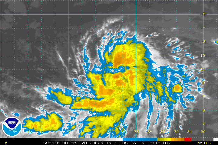
96L is near the 24 hour window from the islands... At the rate it's going it might be a TD/TS by 5am... I say 5am...