floridasun78 wrote:gatorcane wrote:12Z HWRF has shifted south and a bit quicker in bringing 91L into Florida. Here we are at 39 hours with low south of Lake Okeechobee:
what site you get HWRF from?

http://www.tropicaltidbits.com/analysis/models/
Moderator: S2k Moderators

floridasun78 wrote:gatorcane wrote:12Z HWRF has shifted south and a bit quicker in bringing 91L into Florida. Here we are at 39 hours with low south of Lake Okeechobee:
what site you get HWRF from?

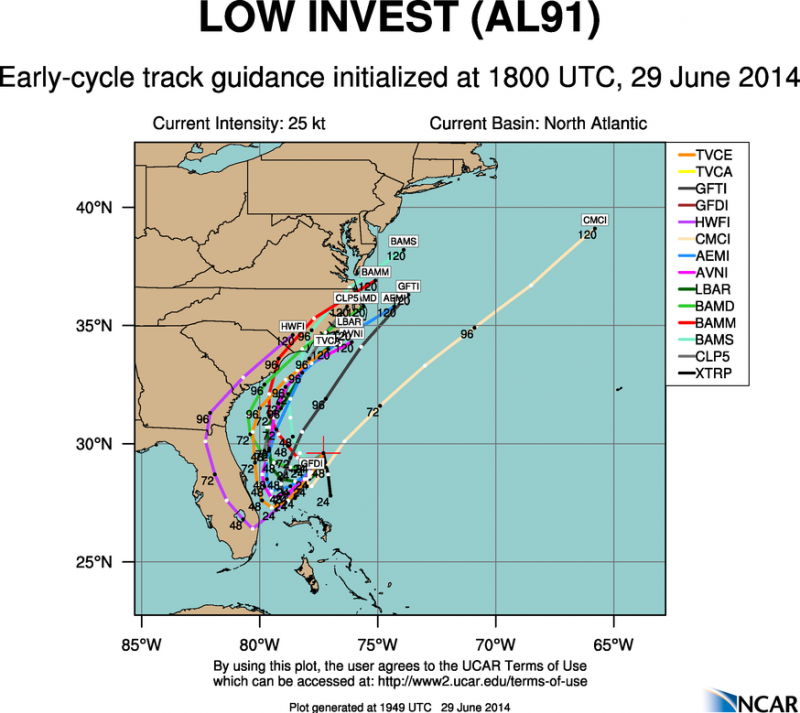
gatorcane wrote:12Z HWRF has shifted south and a bit quicker in bringing 91L into Florida. Here we are at 39 hours with low south of Lake Okeechobee:


floridasun78 wrote:what site you get HWRF from?

NDG wrote:12z Euro over the next 72 hrs is pretty much identical to yesterday's 12z run if anything a little stronger with 91L as it slowly moves near the central and northern FL coast before being picked up by a trough later next week.
TheStormExpert wrote:NDG wrote:12z Euro over the next 72 hrs is pretty much identical to yesterday's 12z run if anything a little stronger with 91L as it slowly moves near the central and northern FL coast before being picked up by a trough later next week.
So it's trended north again?

tolakram wrote:12Z GFS, looking at the weatherbell premium output, has a weak low hitting Florida, then loses it, and then has something emerging off Hatteras at hour 138, then deepening as it moves out to sea.
Regardless of model intensity, which is usually inaccurate anyway, I think the real question is weather or not 91L hits Florida or not.
supercane4867 wrote:floridasun78 wrote:gatorcane wrote:12Z HWRF has shifted south and a bit quicker in bringing 91L into Florida. Here we are at 39 hours with low south of Lake Okeechobee:
what site you get HWRF from?
http://www.tropicaltidbits.com/analysis/models/
floridasun78 wrote:gatorcane wrote:12Z HWRF has shifted south and a bit quicker in bringing 91L into Florida. Here we are at 39 hours with low south of Lake Okeechobee:
what site you get HWRF from?
jlauderdal wrote:floridasun78 wrote:gatorcane wrote:12Z HWRF has shifted south and a bit quicker in bringing 91L into Florida. Here we are at 39 hours with low south of Lake Okeechobee:
what site you get HWRF from?
has hwrf ever had a win?

jlauderdal wrote:floridasun78 wrote:gatorcane wrote:12Z HWRF has shifted south and a bit quicker in bringing 91L into Florida. Here we are at 39 hours with low south of Lake Okeechobee:
what site you get HWRF from?
has hwrf ever had a win?


Users browsing this forum: No registered users and 4 guests