
http://www.ndbc.noaa.gov/station_page.p ... t=M&tz=STN
Buoy 42055 at 22.2N and 94W...winds have switched to ENE and still turning. If I didn't know any better, I would say the center was heading toward it. That would be much farther N than expected...
ATL: DOLLY - REMNANTS - Discussion
Moderator: S2k Moderators
-
tropicwatch

- Category 5

- Posts: 3205
- Age: 60
- Joined: Sat Jun 02, 2007 10:01 am
- Location: Panama City Florida
- Contact:
Re: ATL: FIVE - Tropical Depression - Discussion
Wind shear has come down considerably.

0 likes
Tropicwatch
Agnes 72', Eloise 75, Elena 85', Kate 85', Charley 86', Florence 88', Beryl 94', Dean 95', Erin 95', Opal 95', Earl 98', Georges 98', Ivan 2004', Arlene 2005', Dennis 2005', Ida 2009' Debby 2012' Irma 2017' Michael 2018'
Agnes 72', Eloise 75, Elena 85', Kate 85', Charley 86', Florence 88', Beryl 94', Dean 95', Erin 95', Opal 95', Earl 98', Georges 98', Ivan 2004', Arlene 2005', Dennis 2005', Ida 2009' Debby 2012' Irma 2017' Michael 2018'

Re: ATL: FIVE - Tropical Depression - Discussion
High-res rapidscan NASA imagery shows the center appearing to become better defined slightly to the northwest of the lastest convection.
0 likes
The above post is not official and should not be used as such. It is the opinion of the poster and may or may not be backed by sound meteorological data. It is not endorsed by any professional institution or storm2k.org. For official information, please refer to the NHC and NWS products.
-
cycloneye

- Admin

- Posts: 139027
- Age: 67
- Joined: Thu Oct 10, 2002 10:54 am
- Location: San Juan, Puerto Rico
Re: ATL: FIVE - Tropical Depression - Discussion
00z Best Track is slightly more north and east of 7 PM CDT NHC advisory position:
AL, 05, 2014090200, , BEST, 0, 206N, 935W, 25, 1007, TD
AL, 05, 2014090200, , BEST, 0, 206N, 935W, 25, 1007, TD
0 likes
Visit the Caribbean-Central America Weather Thread where you can find at first post web cams,radars
and observations from Caribbean basin members Click Here
and observations from Caribbean basin members Click Here
-
tropicwatch
- Category 5
- Posts: 3205
- Age: 60
- Joined: Sat Jun 02, 2007 10:01 am
- Location: Panama City Florida
- Contact:
Re: ATL: FIVE - Tropical Depression - Discussion
If the wind shear stays down this might turn out to be one of the more decent looking systems we have seen this year.

0 likes
Tropicwatch
Agnes 72', Eloise 75, Elena 85', Kate 85', Charley 86', Florence 88', Beryl 94', Dean 95', Erin 95', Opal 95', Earl 98', Georges 98', Ivan 2004', Arlene 2005', Dennis 2005', Ida 2009' Debby 2012' Irma 2017' Michael 2018'
Agnes 72', Eloise 75, Elena 85', Kate 85', Charley 86', Florence 88', Beryl 94', Dean 95', Erin 95', Opal 95', Earl 98', Georges 98', Ivan 2004', Arlene 2005', Dennis 2005', Ida 2009' Debby 2012' Irma 2017' Michael 2018'
-
ozonepete
- Professional-Met

- Posts: 4743
- Joined: Mon Sep 07, 2009 3:23 pm
- Location: From Ozone Park, NYC / Now in Brooklyn, NY
Re: ATL: INVEST 99L - Discussion
drezee wrote:drezee wrote:There is a bit of NNW shear...it also seems to be moving a bit more northerly than model depictions. Convection is displaced to the SE and will be until a tower pops over the center
Like clockwork here comes the tower and we may get off to the races until landfall...
Yeah kaboom almost right over where we think the center is. And shear does look to be dropping now.
0 likes
Re: ATL: FIVE - Tropical Depression - Discussion
Seems the center is NE of where they are placing it on SSD Floater.
0 likes
-
ozonepete
- Professional-Met
- Posts: 4743
- Joined: Mon Sep 07, 2009 3:23 pm
- Location: From Ozone Park, NYC / Now in Brooklyn, NY
Re: ATL: FIVE - Tropical Depression - Discussion
If that convective blowup continues to thrive and expand I'm pretty sure RECON will find TS winds in there. And they may have to extend TS warnings a little northward. This is just what I'm thinking right now based on what we've been seeing, not a forecast.
0 likes
-
lrak

- S2K Supporter

- Posts: 1770
- Age: 57
- Joined: Thu Jun 21, 2007 2:48 pm
- Location: Corpus Christi, TX
Re:
drezee wrote:Buoy 42055 now has NE winds and gusting to 30mph. Pressure down to 1007.8 last hour
So that would suggest the center to be closer to 22.2 latitude?
0 likes
AKA karl
Also
Personal Forecast Disclaimer:
My posts on this forum are NOT official forecast and should not be used as such. My posts are my basic observations and are definitely not backed by any "well some" meteorological knowledge. For official information, please refer to the NHC and NWS products.
Also
Personal Forecast Disclaimer:
My posts on this forum are NOT official forecast and should not be used as such. My posts are my basic observations and are definitely not backed by any "well some" meteorological knowledge. For official information, please refer to the NHC and NWS products.
-
ozonepete
- Professional-Met
- Posts: 4743
- Joined: Mon Sep 07, 2009 3:23 pm
- Location: From Ozone Park, NYC / Now in Brooklyn, NY
Re: Re:
lrak wrote:drezee wrote:Buoy 42055 now has NE winds and gusting to 30mph. Pressure down to 1007.8 last hour
So that would suggest the center to be closer to 22.2 latitude?
Well minimally the center should be southeast or east-southeast of there. Just more evidence the center is northeast of where they have it located.
0 likes
-
TheStormExpert

- Category 5
- Posts: 8487
- Age: 30
- Joined: Wed Feb 16, 2011 5:38 pm
- Location: Palm Beach Gardens, FL
Re: ATL: FIVE - Tropical Depression - Discussion
panamatropicwatch wrote:If the wind shear stays down this might turn out to be one of the more decent looking systems we have seen this year.
http://tropicwatch.info/GANIMmkYcAE10.jpg
Arthur was pretty darn good looking for a Cat.2 hurricane in early July, Cristobal looked somewhat ok on it's final days, and Bertha... WAS A JOKE!
Last edited by TheStormExpert on Mon Sep 01, 2014 8:37 pm, edited 1 time in total.
0 likes
The following post is NOT an official forecast and should not be used as such. It is just the opinion of the poster and may or may not be backed by sound meteorological data. It is NOT endorsed by storm2k.org.
-
lrak
- S2K Supporter
- Posts: 1770
- Age: 57
- Joined: Thu Jun 21, 2007 2:48 pm
- Location: Corpus Christi, TX
Re: Re:
ozonepete wrote:lrak wrote:drezee wrote:Buoy 42055 now has NE winds and gusting to 30mph. Pressure down to 1007.8 last hour
So that would suggest the center to be closer to 22.2 latitude?
Well minimally the center should be southeast or east-southeast of there. Just more evidence the center is northeast of where they have it located.
Oh, ok I see what you mean. Thanks.
0 likes
-
lrak
- S2K Supporter
- Posts: 1770
- Age: 57
- Joined: Thu Jun 21, 2007 2:48 pm
- Location: Corpus Christi, TX
Re: ATL: FIVE - Tropical Depression - Discussion
I don't wish for anything bad to happen but it sure would be nice to get a good swell out of this for S. TX. It's WAY over due! Any thoughts for a swell time if any for S. TX?
0 likes
AKA karl
Also
Personal Forecast Disclaimer:
My posts on this forum are NOT official forecast and should not be used as such. My posts are my basic observations and are definitely not backed by any "well some" meteorological knowledge. For official information, please refer to the NHC and NWS products.
Also
Personal Forecast Disclaimer:
My posts on this forum are NOT official forecast and should not be used as such. My posts are my basic observations and are definitely not backed by any "well some" meteorological knowledge. For official information, please refer to the NHC and NWS products.
-
TheProfessor

- Professional-Met
- Posts: 3505
- Age: 27
- Joined: Tue Dec 03, 2013 10:56 am
- Location: Wichita, Kansas
Re: ATL: FIVE - Tropical Depression - Discussion
tailgater wrote:I realize that the ridge is supposed to push TD 5 west and and maybe a bit south of due west as it nears the coast but is there a chance with this setting up just about as far north as any of the models were predicting that the nose of the ridge building west noses in a bit south of TD 5. Just a question I was wondering about as a slight possiblity.
Doesn't look likely judging from the steering charts

If this storm moves further north than they thought, Could the ridge catch it and pull it even further North West?
0 likes
An alumnus of The Ohio State University.
Your local National Weather Service office is your best source for weather information.
Your local National Weather Service office is your best source for weather information.
-
Rail Dawg

- S2K Supporter
- Posts: 308
- Joined: Mon Aug 27, 2012 5:02 pm
- Location: Where the eye makes landfall.
Re: ATL: FIVE - Tropical Depression - Discussion
You guys have been doing a good job with this one.
Keep it up!
Chuck
Keep it up!
Chuck
0 likes
Although I have been a hurricane forecaster since 1980 that only means I've been wrong lots of times.
-
ozonepete
- Professional-Met
- Posts: 4743
- Joined: Mon Sep 07, 2009 3:23 pm
- Location: From Ozone Park, NYC / Now in Brooklyn, NY
Re: ATL: FIVE - Tropical Depression - Discussion
lrak wrote:I don't wish for anything bad to happen but it sure would be nice to get a good swell out of this for S. TX. It's WAY over due! Any thoughts for a swell time if any for S. TX?
Would think Tuesday would be your day.
0 likes

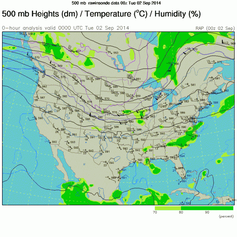
Fairly strong narrow mid level ridging across the gulf coast this evening from the 0z sounding, in fact the narrow ridging extends from the Atlantic near Bermuda all the way to the eastern Pacific, TD 9 cannot gain that much latitude overall, the trough across the northern Plains is just going to keep up moving ENE and not dig southward to weaken the ridge.
0 likes
-
ozonepete
- Professional-Met
- Posts: 4743
- Joined: Mon Sep 07, 2009 3:23 pm
- Location: From Ozone Park, NYC / Now in Brooklyn, NY
Re: ATL: FIVE - Tropical Depression - Discussion
TheProfessor wrote:tailgater wrote:I realize that the ridge is supposed to push TD 5 west and and maybe a bit south of due west as it nears the coast but is there a chance with this setting up just about as far north as any of the models were predicting that the nose of the ridge building west noses in a bit south of TD 5. Just a question I was wondering about as a slight possiblity.
Doesn't look likely judging from the steering charts
http://tropic.ssec.wisc.edu/real-time/a ... g8dlm1.GIF
If this storm moves further north than they thought, Could the ridge catch it and pull it even further North West?
Yes. The stronger it gets the more northward it will go as it would get steered more by the western side of that ridge. But I still don't see that happening yet. We will have to wait for the NHC to relocate the center and issue a new track. And we definitely to wait for the next RECON to get a good handle on what's happening. So outside of a probable center relocation I don't think the NHC will say much in their next discussion at 11PM EDT. They will wait for RECON which is smart. There's still enough time before landfall.
0 likes
-
lrak
- S2K Supporter
- Posts: 1770
- Age: 57
- Joined: Thu Jun 21, 2007 2:48 pm
- Location: Corpus Christi, TX
Re: ATL: FIVE - Tropical Depression - Discussion
ozonepete wrote:lrak wrote:I don't wish for anything bad to happen but it sure would be nice to get a good swell out of this for S. TX. It's WAY over due! Any thoughts for a swell time if any for S. TX?
Would think Tuesday would be your day.
Oh, I'm already feeling sick...cough....sneeze around 4:30pm Monday
Thanks ozonepete!
0 likes
AKA karl
Also
Personal Forecast Disclaimer:
My posts on this forum are NOT official forecast and should not be used as such. My posts are my basic observations and are definitely not backed by any "well some" meteorological knowledge. For official information, please refer to the NHC and NWS products.
Also
Personal Forecast Disclaimer:
My posts on this forum are NOT official forecast and should not be used as such. My posts are my basic observations and are definitely not backed by any "well some" meteorological knowledge. For official information, please refer to the NHC and NWS products.
Who is online
Users browsing this forum: No registered users and 75 guests