Station SACV4
EPA & Mexican Government Cooperative Program
Location: 19.174N 96.093W
Date: Sun, 25 Aug 2013 20:00:00 UTC
Winds: NNW (340°) at 33.0 kt gusting to 40.0 kt
Atmospheric Pressure: 29.79 in and falling
Air Temperature: 80.6 F
Dew Point: 75.0 F
ATL: FERNAND - Renmants - Discussion
Moderator: S2k Moderators
-
tropicwatch

- Category 5

- Posts: 3205
- Age: 60
- Joined: Sat Jun 02, 2007 10:01 am
- Location: Panama City Florida
- Contact:
0 likes
Tropicwatch
Agnes 72', Eloise 75, Elena 85', Kate 85', Charley 86', Florence 88', Beryl 94', Dean 95', Erin 95', Opal 95', Earl 98', Georges 98', Ivan 2004', Arlene 2005', Dennis 2005', Ida 2009' Debby 2012' Irma 2017' Michael 2018'
Agnes 72', Eloise 75, Elena 85', Kate 85', Charley 86', Florence 88', Beryl 94', Dean 95', Erin 95', Opal 95', Earl 98', Georges 98', Ivan 2004', Arlene 2005', Dennis 2005', Ida 2009' Debby 2012' Irma 2017' Michael 2018'

Re:
CrazyC83 wrote:1044mb is the background pressure extrapolated, so the pressure of the storm could be quite high.
Come on. 1044mb happens under very very very strong winter highs. Its clearly an issue with recon flying so high.
0 likes
-
CrazyC83
- Professional-Met

- Posts: 33397
- Joined: Tue Mar 07, 2006 11:57 pm
- Location: Deep South, for the first time!
Re: Re:
RL3AO wrote:CrazyC83 wrote:1044mb is the background pressure extrapolated, so the pressure of the storm could be quite high.
Come on. 1044mb happens under very very very strong winter highs. Its clearly an issue with recon flying so high.
I wasn't sure, since I can't recall seeing it so high even over an adjacent ridge.
0 likes
-
bamajammer4eva
- Category 4

- Posts: 907
- Joined: Sun Apr 18, 2010 3:21 am
- Location: Ozark, AL
-
ScottNAtlanta

- Category 5
- Posts: 2009
- Joined: Sat May 25, 2013 3:11 pm
- Location: Atlanta, GA
Re: ATL: INVEST 95L - Discussion
This is the closest station right now...and its showing close to TS winds with falling pressure
(19°10'27" N 96°5'34" W)
Station SACV4 - Sacrifice Island, Mexico
Wind Direction (WDIR): NNW ( 340 deg true )
Wind Speed Wind Speed (WSPD): 33.0 kts
Wind Gust Wind Gust (GST): 40.0 kts
Atmospheric Pressure Atmospheric Pressure (PRES): 29.79 in
Pressure Tendency Pressure Tendency (PTDY): -0.06 in ( Falling )
Air Temperature Air Temperature (ATMP): 80.6 °F
Dew Point Dew Point (DEWP): 75.0 °F
24-hour plot - Wind Speed at 10 Meters Wind Speed at 10 meters (WSPD10M): 33.0 kts
24-hour plot - Wind Speed at 10 Meters Wind Speed at 20 meters (WSPD20M): 36.9 kts
Last edited by ScottNAtlanta on Sun Aug 25, 2013 3:50 pm, edited 1 time in total.
0 likes
The posts in this forum are NOT official forecast and should not be used as such. They are just the opinion of the poster and may or may not be backed by sound meteorological data. They are NOT endorsed by any professional institution or storm2k.org. For official information, please refer to the NHC and NWS products.
NHC just released its TD 6 as of now.
0 likes
The posts in this forum are NOT official forecast and should not be used as such. They are just the opinion of the poster and may or may not be backed by sound meteorological data. They are NOT endorsed by any professional institution or storm2k.org. For official information, please refer to the NHC and NWS products.
-
cycloneye

- Admin

- Posts: 139490
- Age: 67
- Joined: Thu Oct 10, 2002 10:54 am
- Location: San Juan, Puerto Rico
Re: ATL: SIX-Tropical Depression - Discussion
...TROPICAL DEPRESSION FORMS IN THE SOUTHWESTERN BAY OF CAMPECHE...
...TROPICAL STORM WARNING ISSUED FOR PORTIONS OF GULF COAST OF
MEXICO...
SUMMARY OF 400 PM CDT...2100 UTC...INFORMATION
----------------------------------------------
LOCATION...19.5N 95.5W
ABOUT 50 MI...80 KM ENE OF VERACRUZ MEXICO
MAXIMUM SUSTAINED WINDS...35 MPH...55 KM/H
PRESENT MOVEMENT...W OR 270 DEGREES AT 12 MPH...19 KM/H
MINIMUM CENTRAL PRESSURE...1006 MB...29.71 INCHES
0 likes
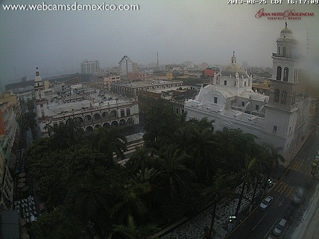
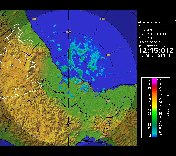
Visit the Caribbean-Central America Weather Thread where you can find at first post web cams,radars
and observations from Caribbean basin members Click Here
and observations from Caribbean basin members Click Here

Re: Re:
CrazyC83 wrote:RL3AO wrote:CrazyC83 wrote:1044mb is the background pressure extrapolated, so the pressure of the storm could be quite high.
Come on. 1044mb happens under very very very strong winter highs. Its clearly an issue with recon flying so high.
I wasn't sure, since I can't recall seeing it so high even over an adjacent ridge.
All you have to do is look at the pressures reported by the buoys along the GOM, which they highest is around 1020-1022 mb along the north central gulf coast, much lower in the BOC.
0 likes
I don't see how this doesn't make land fall tonight.
0 likes
The posts in this forum are NOT official forecast and should not be used as such. They are just the opinion of the poster and may or may not be backed by sound meteorological data. They are NOT endorsed by any professional institution or storm2k.org. For official information, please refer to the NHC and NWS products.
-
SeGaBob
I feel that the plane may find this as a 40-45mph TS. 
_________________
The posts in this forum are NOT official forecast and should not be used as such. They are just the opinion of the poster and may or may not be backed by sound meteorological data. They are NOT endorsed by any professional institution or storm2k.org. For official information, please refer to the NHC and NWS products.
0 likes
-
northjaxpro

- S2K Supporter

- Posts: 8900
- Joined: Mon Sep 27, 2010 11:21 am
- Location: Jacksonville, FL
IT probably will reach minimum TS status just before coming ashore this evening.
0 likes
NEVER, EVER SAY NEVER in the tropics and weather in general, and most importantly, with life itself!!
________________________________________________________________________________________
Fay 2008 Beryl 2012 Debby 2012 Colin 2016 Hermine 2016 Julia 2016 Matthew 2016 Irma 2017 Dorian 2019
________________________________________________________________________________________
Fay 2008 Beryl 2012 Debby 2012 Colin 2016 Hermine 2016 Julia 2016 Matthew 2016 Irma 2017 Dorian 2019
-
hurricanekid416
- Tropical Storm

- Posts: 179
- Joined: Wed Oct 24, 2012 2:43 pm
I'm not so sure that recon will get there before landfall
0 likes
Personal Forecast Disclaimer:
The posts in this forum are NOT official forecast and should not be used as such. They are just the opinion of the poster and may or may not be backed by sound meteorological data. They are NOT endorsed by any professional institution or storm2k.org. For official information, please refer to the NHC and NWS products.
The posts in this forum are NOT official forecast and should not be used as such. They are just the opinion of the poster and may or may not be backed by sound meteorological data. They are NOT endorsed by any professional institution or storm2k.org. For official information, please refer to the NHC and NWS products.
41 knot wind gusts now near the coast off of Veracruz, the airport reporting 35 mph wind gusts a as squall moves through.
Conditions at VERV4 as of
(4:00 pm CDT)
2100 GMT on 08/25/2013:
Wind Direction (WDIR): N ( 350 deg true )
Wind Speed (WSPD): 32.1 kts
Wind Gust (GST): 41.0 kts
Atmospheric Pressure (PRES): 29.76 in
Pressure Tendency (PTDY): -0.06 in ( Falling )
Air Temperature (ATMP): 79.2 °F
Wind Speed at 10 meters (WSPD10M): 31.1 kts
Wind Speed at 20 meters (WSPD20M): 35.0 kts
0 likes
-
SouthDadeFish

- Professional-Met
- Posts: 2835
- Joined: Thu Sep 23, 2010 2:54 pm
- Location: Miami, FL
- Contact:

-
Hurricaneman

- Category 5
- Posts: 7284
- Age: 43
- Joined: Tue Aug 31, 2004 3:24 pm
- Location: central florida
Re:
SouthDadeFish wrote:Center is becoming very well defined:
http://img836.imageshack.us/img836/624/dwb.gif
my eyes may be playing tricks on me, but is that a forming eye
The posts in this forum are NOT official forecast and should not be used as such. They are just the opinion of the poster and may or may not be backed by sound meteorological data. They are NOT endorsed by any professional institution or storm2k.org. For official information, please refer to the NHC and NWS products
0 likes
-
TropicalAnalystwx13

- Category 5
- Posts: 2109
- Age: 26
- Joined: Tue Jul 19, 2011 8:20 pm
- Location: Wilmington, NC
- Contact:

Who is online
Users browsing this forum: No registered users and 14 guests