ATL: INVEST 95L - Discussion

Moderator: S2k Moderators

Message
Author
User avatar
HURAKAN
Professional-Met
Professional-Met
Posts: 46086
Age: 37
Joined: Thu May 20, 2004 4:34 pm
Location: Key West, FL
Contact:

#361 Postby HURAKAN » Thu Sep 19, 2013 8:00 pm

Image

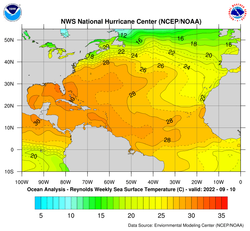
SST is not the problem
0 likes   

User avatar
NDG
S2K Supporter
S2K Supporter
Posts: 14934
Joined: Sun Jul 09, 2006 10:14 pm
Location: Orlando, FL

#362 Postby NDG » Thu Sep 19, 2013 8:02 pm

I agree, SSTs in the BOC are not the problem, the lack of UL divergence due to the outflow channel from Manuel sinking in the BOC kept 95L at bay so far.

SSTs in the BOC only cooled down to the low 80s at most in the BOC, alreay warming up nicely to 83-84 deg.
Image
0 likes   

User avatar
SouthDadeFish
Professional-Met
Professional-Met
Posts: 2835
Joined: Thu Sep 23, 2010 2:54 pm
Location: Miami, FL
Contact:

Re: ATL: INVEST 95L - Discussion - 50% - 50%

#363 Postby SouthDadeFish » Thu Sep 19, 2013 8:45 pm

Ingrid did indeed upwell cooler waters...

Pre-Ingrid:

Image

Recent:

Image

While SSTs are still warm enough to support genesis, it would have certainly helped to have waters 2C warmer than current levels... Keep in mind Ingrid sat over the same area for multiple days with 55+ knot winds. That will cause some mixing.
0 likes   

stormkite
S2K Supporter
S2K Supporter
Posts: 672
Joined: Fri Sep 13, 2013 3:59 am

#364 Postby stormkite » Thu Sep 19, 2013 8:46 pm

It’s looks like a dogs breakfast on satellite image. But i think wxman57 is spot on with his  analysis of the forecast.


My opinion and statements DO NOT represent the opinion of the NHC, NWS, or any other professional agency, organization, or group. For official information, please refer to the NHC and NWS products.
0 likes   

User avatar
SouthDadeFish
Professional-Met
Professional-Met
Posts: 2835
Joined: Thu Sep 23, 2010 2:54 pm
Location: Miami, FL
Contact:

#365 Postby SouthDadeFish » Thu Sep 19, 2013 8:47 pm

Sandy, your image is of a 7 day period ending on Sep 14.... That will not accurately reflect the mixing caused by Ingrid.
0 likes   

User avatar
SouthDadeFish
Professional-Met
Professional-Met
Posts: 2835
Joined: Thu Sep 23, 2010 2:54 pm
Location: Miami, FL
Contact:

#366 Postby SouthDadeFish » Thu Sep 19, 2013 8:51 pm

I would like to clarify, I do not think SSTs are the biggest issue, but just trying to point out there was some cooling. Shear is obviously causing problems.
0 likes   

Dean4Storms
S2K Supporter
S2K Supporter
Posts: 6355
Age: 61
Joined: Sun Aug 31, 2003 1:01 pm
Location: Miramar Bch. FL

#367 Postby Dean4Storms » Thu Sep 19, 2013 8:53 pm

The SST's did cool down some but still sufficient to generate TC genesis. Could have been a combination of sinking air left over from the Anti-Cyclone that has been over Manuel and the slightly cooler SST's.

I don't see much coming from this other than some rain enhancement along the MX, TX, LA Coasts, shear increasing and dry air behind the front should be enough to keep this in check.
0 likes   
My opinion and statements DO NOT represent the opinion of the EMA, NHC, NWS, or any other professional agency, organization, or group. For official information, please refer to the NHC and NWS products.

ozonepete
Professional-Met
Professional-Met
Posts: 4743
Joined: Mon Sep 07, 2009 3:23 pm
Location: From Ozone Park, NYC / Now in Brooklyn, NY

Re: ATL: INVEST 95L - Discussion - 50% - 50%

#368 Postby ozonepete » Thu Sep 19, 2013 9:42 pm

SouthDadeFish wrote:Ingrid did indeed upwell cooler waters...

Pre-Ingrid:

http://www.aoml.noaa.gov/phod/dataphod1 ... 4gosst.png

Recent:

http://www.aoml.noaa.gov/phod/dataphod1 ... 1gosst.png

While SSTs are still warm enough to support genesis, it would have certainly helped to have waters 2C warmer than current levels... Keep in mind Ingrid sat over the same area for multiple days with 55+ knot winds. That will cause some mixing.


Hi SouthDade :)
The change in SST is too small to attribute to upwelling from Ingrid. It could definitely have lowered SSTs by 2-4F, but not by upwelling. That type of SST temp drop would happen under any good large low pressure area, and is due to the simple factors of cloud cover and cool rainfall. Also in this case there could likely have been some climatological drop in SST normally attributed from 11 to 18 September. It also didn't sit over the same area for multiple days - it moved slowly, but it kept moving. To clarify what I said earlier, there is always some small removal of heat from the ocean surface by any TC due to cloud cover and rainfall, but it is not significant for a relatively weaker storm such as Ingrid. For a moving storm only a cat 2 or higher actually sucks heat out of the water to the point where temperatures drop significantly down to 10 meters below sea level and lower. That is when upwelling of the cooler water below starts to occur.

Also, those charts are accurate only to roughly 2 degrees C, which means they could be off by 2 degrees C. For example, you could ask what caused the cooling just off of the northern Yucatan during that time.
0 likes   

User avatar
wkwally
Category 1
Category 1
Posts: 279
Joined: Sun Jun 27, 2010 9:18 pm
Location: Humble, Texas

Re: ATL: INVEST 95L - Discussion - 50% - 50%

#369 Postby wkwally » Thu Sep 19, 2013 10:13 pm

I have been wrong many a time but after looking at 95L I think the NHC needs to send a priest to it and read it last rights

My opinion and statements DO NOT represent the opinion of the EMA, NHC, NWS, or any other professional agency, organization, or group. For official information, please refer to the NHC and NWS products.
0 likes   

ozonepete
Professional-Met
Professional-Met
Posts: 4743
Joined: Mon Sep 07, 2009 3:23 pm
Location: From Ozone Park, NYC / Now in Brooklyn, NY

Re: ATL: INVEST 95L - Discussion - 50% - 50%

#370 Postby ozonepete » Thu Sep 19, 2013 10:55 pm

You are right this time Wally. :wink: It looks awful.
0 likes   

stormkite
S2K Supporter
S2K Supporter
Posts: 672
Joined: Fri Sep 13, 2013 3:59 am

#371 Postby stormkite » Thu Sep 19, 2013 11:11 pm

24th-26th looks interesting 2 low merging?

http://magicseaweed.com/Gulf-of-Mexico- ... 4842545092

My opinion and statements DO NOT represent the opinion of the EMA, NHC, NWS, or any other professional agency, organization, or group. For official information, please refer to the NHC and NWS products.
0 likes   

User avatar
SouthDadeFish
Professional-Met
Professional-Met
Posts: 2835
Joined: Thu Sep 23, 2010 2:54 pm
Location: Miami, FL
Contact:

Re: ATL: INVEST 95L - Discussion - 50% - 50%

#372 Postby SouthDadeFish » Thu Sep 19, 2013 11:23 pm

Thanks for the reply Pete.

Forgive me for the loose use of the term upwelling. You are correct that the mere presence of convective clouds can lower SSTs. I had also gone off incorrect anecdotal evidence of the duration Ingrid lasted over the BoC. I checked the past advisories, and in fact, Ingrid moved much quicker than I thought.

I also went back the last few years and found that during this time period, the BoC is in fact quite toasty unless a storm moves through. There should not be a climatological drop in SSTs. Nonetheless, my point was SSTs were lower than to be expected for this time of year due to Ingrid's presence. Yes, still warm enough for genesis, but not the typical temperatures we see this time of year.

It turns out the environment 95L is situated in is less favorable than originally anticipated. Development chances will most likely be steadily dropped for the next couple of TWOs.
0 likes   

supercane4867
Category 5
Category 5
Posts: 4966
Joined: Wed Nov 14, 2012 10:43 am

Re: ATL: INVEST 95L - Discussion - 50% - 50%

#373 Postby supercane4867 » Fri Sep 20, 2013 12:38 am

Down to 30%

AN AREA OF LOW PRESSURE LOCATED OVER THE SOUTHWESTERN GULF OF MEXICO
ABOUT 100 MILES EAST OF TUXPAN MEXICO IS PRODUCING ONLY LIMITED
SHOWER AND THUNDERSTORM ACTIVITY. ENVIRONMENTAL CONDITIONS ARE ONLY
MARGINALLY CONDUCIVE...AND SIGNIFICANT DEVELOPMENT OF THIS SYSTEM
IS BECOMING LESS LIKELY. THIS SYSTEM HAS A MEDIUM CHANCE...30
PERCENT...OF BECOMING A TROPICAL CYCLONE DURING THE NEXT 48 HOURS
WHILE IT MOVES TOWARD THE WEST-NORTHWEST OR NORTHWEST AT 5 TO 10
MPH...AND A MEDIUM CHANCE...30 PERCENT...OF BECOMING A TROPICAL
CYCLONE DURING THE NEXT 5 DAYS. THIS DISTURBANCE WILL CONTINUE TO
PRODUCE LOCALLY HEAVY RAINS OVER PORTIONS OF EASTERN AND SOUTHERN
MEXICO DURING THE NEXT COUPLE OF DAYS.
0 likes   

User avatar
cycloneye
Admin
Admin
Posts: 139409
Age: 67
Joined: Thu Oct 10, 2002 10:54 am
Location: San Juan, Puerto Rico

Re: ATL: INVEST 95L - Discussion - 30% - 30%

#374 Postby cycloneye » Fri Sep 20, 2013 6:35 am

8 AM TWO:

SHOWER ACTIVITY ASSOCIATED WITH AN AREA OF LOW PRESSURE OVER THE
SOUTHWESTERN GULF OF MEXICO...ABOUT 90 MILES EAST OF TAMPICO
MEXICO...IS LIMITED. THE LOW IS EXPECTED TO MOVE TOWARD THE
NORTHWEST AT 5 TO 10 MPH...AND ENVIRONMENTAL CONDITIONS ARE ONLY
MARGINALLY FAVORABLE FOR DEVELOPMENT. THIS SYSTEM HAS A MEDIUM
CHANCE...30 PERCENT...OF BECOMING A TROPICAL CYCLONE DURING THE
NEXT 48 HOURS...AND A MEDIUM CHANCE...30 PERCENT...OF BECOMING A
TROPICAL CYCLONE DURING THE NEXT 5 DAYS. THIS DISTURBANCE WILL
CONTINUE TO PRODUCE LOCALLY HEAVY RAINS OVER PORTIONS OF EASTERN
AND SOUTHERN MEXICO DURING THE NEXT COUPLE OF DAYS. AN AIR FORCE
HURRICANE HUNTER PLANE WILL INVESTIGATE THE AREA LATER TODAY...IF
NECESSARY.
0 likes   
Visit the Caribbean-Central America Weather Thread where you can find at first post web cams,radars
and observations from Caribbean basin members Click Here

ninel conde
Category 5
Category 5
Posts: 1245
Joined: Mon Aug 04, 2008 2:18 pm

#375 Postby ninel conde » Fri Sep 20, 2013 6:59 am

Joe Bastardi ‏@BigJoeBastardi 23m

See why NHC "downgraded" 95L but huge problems in nw gulf coastal waters named or not. GFS has 20" rain near La coast pic.twitter.com/W4hi4t5jDe
0 likes   
The posts in this forum are NOT official forecast and should not be used as such. They are just the opinion of the poster and may or may not be backed by sound meteorological data. They are NOT endorsed by any professional institution or storm2k.org. For official information, please refer to the NHC and NWS products.

Dean4Storms
S2K Supporter
S2K Supporter
Posts: 6355
Age: 61
Joined: Sun Aug 31, 2003 1:01 pm
Location: Miramar Bch. FL

#376 Postby Dean4Storms » Fri Sep 20, 2013 7:13 am

Models are beginning to gel with this developing a bit more off the TX coast and with cool air diving down into northern MX behind the front I think this could increase convergence offshore TX considerably. Don't know if it becomes purely tropical or not but the possibility of very heavy rain from Houston area over the weekend eastward toward the FL Panhandle as next week unfolds certainly looks plausible.
0 likes   
My opinion and statements DO NOT represent the opinion of the EMA, NHC, NWS, or any other professional agency, organization, or group. For official information, please refer to the NHC and NWS products.

User avatar
Steve
S2K Supporter
S2K Supporter
Posts: 8608
Joined: Sat Apr 05, 2003 11:41 pm
Location: Not a state-caster

Re: ATL: INVEST 95L - Discussion - 30% - 30%

#377 Postby Steve » Fri Sep 20, 2013 7:14 am

Hey Ninel. I noticed that on the qpf this morning. It didn't show 20" but there is some deep tropical moisture coming up. Looks like a lot of rain for coastal Texas, then Louisiana and points east. Whether something ends up developing or whether there is just a tropical surge, there should be a lot of tropical rainfall this weekend into early next week for many of us Gulf of Mexicans.

Of note, and I realize this isn't the model thread, but GFS 06z brings down the big eastern high much further west. I didn't see that scenario, and I'm not sure it verifies, but what it appears to do is Lift up a wave of moisture, front maybe washes out as the high builds down from the great lakes which then sets up a block and keeps the mean trough farther west and bottled up in Texas. And in line with what joe b noted, early next week could be beneficial for SE Texas overall drought conditions even though there has been a little recent relief. Word.

This post is NOT official.
0 likes   

ninel conde
Category 5
Category 5
Posts: 1245
Joined: Mon Aug 04, 2008 2:18 pm

#378 Postby ninel conde » Fri Sep 20, 2013 7:21 am

lets hope texas can get some drought relief and all the rain doesnt fall further east.
0 likes   
The posts in this forum are NOT official forecast and should not be used as such. They are just the opinion of the poster and may or may not be backed by sound meteorological data. They are NOT endorsed by any professional institution or storm2k.org. For official information, please refer to the NHC and NWS products.

User avatar
wxman57
Moderator-Pro Met
Moderator-Pro Met
Posts: 22484
Age: 66
Joined: Sat Jun 21, 2003 8:06 pm
Location: Houston, TX (southwest)

Re: ATL: INVEST 95L - Discussion - 30% - 30%

#379 Postby wxman57 » Fri Sep 20, 2013 7:29 am

The Euro may have a good handle on the situation. It has the front weaker/slower and 95L merging with the front along the TX coast over the weekend and stalling along the mid to upper coast. Could be a good rain maker for SE TX and south LA, but tropical development chances don't look too good at least initially.
0 likes   

rockyman
Category 5
Category 5
Posts: 1967
Joined: Thu Jun 26, 2003 12:24 pm
Location: Dauphin Island, AL

#380 Postby rockyman » Fri Sep 20, 2013 7:37 am

The low level steering flow seems to be pointing this system almost due north:

Image
0 likes   


Return to “2013”

Who is online

Users browsing this forum: No registered users and 4 guests