EPAC: BARBARA - Remnants
Moderator: S2k Moderators

-
SouthDadeFish

- Professional-Met

- Posts: 2835
- Joined: Thu Sep 23, 2010 2:54 pm
- Location: Miami, FL
- Contact:

-
SouthDadeFish
- Professional-Met
- Posts: 2835
- Joined: Thu Sep 23, 2010 2:54 pm
- Location: Miami, FL
- Contact:


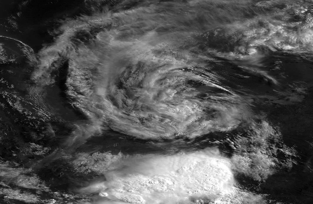
There seems to be something going on to the south of Barbara's COC now... another convection burst, maybe?
0 likes
Personal Forecast Disclaimer:
The posts in this forum are NOT official forecast and should not be used as such. They are just the opinion of the poster and may or may not be backed by sound meteorological data. They are NOT endorsed by any professional institution or storm2k.org.
Hope this helped
The posts in this forum are NOT official forecast and should not be used as such. They are just the opinion of the poster and may or may not be backed by sound meteorological data. They are NOT endorsed by any professional institution or storm2k.org.
Hope this helped
-
tolakram
- Admin

- Posts: 19165
- Age: 60
- Joined: Sun Aug 27, 2006 8:23 pm
- Location: Florence, KY (name is Mark)
Re: EPAC: BARBARA - Tropical Depression
The mid level circulation may be shearing off to the east, hard to tell. Doesn't look good at the moment.
0 likes
M a r k
- - - - -
Join us in chat: Storm2K Chatroom Invite. Android and IOS apps also available.
The posts in this forum are NOT official forecasts and should not be used as such. Posts are NOT endorsed by any professional institution or STORM2K.org. For official information and forecasts, please refer to NHC and NWS products.
-
cycloneye

- Admin
- Posts: 139063
- Age: 67
- Joined: Thu Oct 10, 2002 10:54 am
- Location: San Juan, Puerto Rico
Re: EPAC: BARBARA - Tropical Depression
cycloneye wrote:The new Best Track at 12z mantains as TD.
EP, 02, 2013053012, , BEST, 0, 183N, 943W, 25, 1004, TD
ftp://ftp.nhc.noaa.gov/atcf/tcweb/inves ... 013.invest
ATCF updated the position on the 12z Best Track.
EP, 02, 2013053012, , BEST, 0, 184N, 949W, 25, 1004, TD
0 likes
Visit the Caribbean-Central America Weather Thread where you can find at first post web cams,radars
and observations from Caribbean basin members Click Here
and observations from Caribbean basin members Click Here
-
JonathanBelles
- Professional-Met
- Posts: 11430
- Age: 33
- Joined: Sat Dec 24, 2005 9:00 pm
- Location: School: Florida State University (Tallahassee, FL) Home: St. Petersburg, Florida
- Contact:
Re: EPAC: BARBARA - Tropical Depression
cycloneye wrote:ATCF updated the position on the 12z Best Track.
EP, 02, 2013053012, , BEST, 0, 184N, 949W, 25, 1004, TD
That seems really far west when you look at satellite.
0 likes
-
ozonepete
- Professional-Met
- Posts: 4743
- Joined: Mon Sep 07, 2009 3:23 pm
- Location: From Ozone Park, NYC / Now in Brooklyn, NY
Re: EPAC: BARBARA - Tropical Depression
0 likes
-
vbhoutex

- Storm2k Executive
- Posts: 28974
- Age: 72
- Joined: Wed Oct 09, 2002 11:31 pm
- Location: Spring Branch area, Houston, TX
- Contact:
Re: EPAC: BARBARA - Tropical Depression
Barbara made it across the isthmus a lot more intact than I expected. Is it a game changer? Too early to tell especially with the llc apparently now just offshore. Still looks like plenty of shear to her N so if there is a process of regeneration I would expect it to be slow. Once she gets further N and more into the shear I don't hold out a lot of hope for an intact core.
0 likes
Skywarn, C.E.R.T.
Please click below to donate to STORM2K to help with the expenses of keeping the site going:

Please click below to donate to STORM2K to help with the expenses of keeping the site going:
-
cycloneye
- Admin
- Posts: 139063
- Age: 67
- Joined: Thu Oct 10, 2002 10:54 am
- Location: San Juan, Puerto Rico
Re: EPAC: BARBARA - Tropical Depression
BULLETIN
TROPICAL DEPRESSION BARBARA ADVISORY NUMBER 9
NWS NATIONAL HURRICANE CENTER MIAMI FL EP022013
800 AM PDT THU MAY 30 2013
...BARBARA NEAR THE GULF COAST OF MEXICO BUT VERY ILL DEFINED...
...THREAT OF HEAVY RAINS AND FLOODING CONTINUES...
SUMMARY OF 800 AM PDT...1500 UTC...INFORMATION
----------------------------------------------
LOCATION...18.5N 95.0W
ABOUT 40 MI...60 KM SE OF COATZACOALCOS MEXICO
MAXIMUM SUSTAINED WINDS...30 MPH...45 KM/H
PRESENT MOVEMENT...NW OR 310 DEGREES AT 3 MPH...6 KM/H
MINIMUM CENTRAL PRESSURE...1005 MB...29.68 INCHES
WATCHES AND WARNINGS
--------------------
THERE ARE NO COASTAL WATCHES OR WARNINGS IN EFFECT.
DISCUSSION AND 48-HOUR OUTLOOK
------------------------------
AT 800 AM PDT...1500 UTC...THE POORLY DEFINED CENTER OF TROPICAL
DEPRESSION BARBARA WAS LOCATED NEAR LATITUDE 18.5 NORTH...LONGITUDE
95.0 WEST. THE DEPRESSION IS MOVING TOWARD THE NORTHWEST NEAR 3
MPH...6 KM/H. A TURN TOWARD THE WEST-NORTHWEST AND WEST IS
EXPECTED OVER THE NEXT DAY OR SO. ON THE FORECAST TRACK...THE
CENTER WILL BE MOVING VERY NEAR OR ALONG THE GULF COAST OF MEXICO.
MAXIMUM SUSTAINED WINDS HAVE DECREASED TO NEAR 30 MPH...45
KM/H...WITH HIGHER GUSTS. BARBARA IS FORECAST TO DISSIPATE IN A
DAY OR SO.
THE ESTIMATED MINIMUM CENTRAL PRESSURE IS 1005 MB...29.68 INCHES.
HAZARDS AFFECTING LAND
----------------------
RAINFALL...BARBARA IS EXPECTED TO PRODUCE ADDITIONAL RAINFALL
AMOUNTS OF 3 TO 5 INCHES ACROSS PORTIONS OF SOUTHEASTERN MEXICO...
BRINGING STORM TOTALS IN EXCESS OF 25 INCHES. THESE RAINS COULD
CAUSE LIFE THREATENING FLASH FLOODS AND MUD SLIDES.
NEXT ADVISORY
-------------
NEXT COMPLETE ADVISORY...200 PM PDT.
$$
FORECASTER PASCH/LANDSEA
TROPICAL DEPRESSION BARBARA DISCUSSION NUMBER 9
NWS NATIONAL HURRICANE CENTER MIAMI FL EP022013
800 AM PDT THU MAY 30 2013
FINDING THE LOW-LEVEL CENTER OF THE CYCLONE HAS BEEN A REAL
CHALLENGE THIS MORNING. THE CENTER OF ROTATION THAT IS EVIDENT ON
VISIBLE SATELLITE IMAGERY IS NOT CONSISTENT WITH SURFACE WIND
OBSERVATIONS FROM STANDARD AND AUTOMATED MEXICAN WEATHER STATIONS.
IN FACT...THERE IS SOME DOUBT THAT A WELL-DEFINED SURFACE CENTER
EVEN EXISTS. HOWEVER...WE THINK THE MOST PRUDENT ACTION AT THIS
TIME IS TO MAINTAIN THE SYSTEM AS A DEPRESSION UNTIL ADDITIONAL
VISIBLE IMAGES AND SURFACE DATA BECOME AVAILABLE. THE CURRENT
ADVISORY POSITION IS IN REASONABLE AGREEMENT WITH THE SURFACE WIND
DATA.
THE INITIAL MOTION IS A VERY UNCERTAIN 310/3. MOST OF THE DYNAMICAL
GUIDANCE SUGGESTS THAT THE CENTER WILL NOT MOVE VERY FAR INTO THE
GULF OF MEXICO. SINCE THE SURFACE CENTER HAS BECOME VERY DISRUPTED
AND IS NOT EXPECTED TO MOVE FAR FROM LAND...THE FORECAST SHOWS THE
SYSTEM DISSIPATING IN A DAY OR SO.
ALTHOUGH THE CYCLONE SHOULD DISSIPATE SOON...HEAVY RAINS REMAIN A
SERIOUS CONCERN. DISTURBED WEATHER ASSOCIATED WITH THE REMNANTS
OF BARBARA IS LIKELY TO PERSIST OVER SOUTHEASTERN MEXICO AND
PORTIONS OF CENTRAL AMERICA FOR THE NEXT SEVERAL DAYS...AND A
HEIGHTENED RISK OF DANGEROUS FLOODING AND MUD SLIDES WILL CONTINUE
OVER THIS REGION.
FORECAST POSITIONS AND MAX WINDS
INIT 30/1500Z 18.5N 95.0W 25 KT 30 MPH...INLAND
12H 31/0000Z 18.7N 95.5W 25 KT 30 MPH...POST-TROP/REMNT LOW
24H 31/1200Z 18.8N 96.2W 20 KT 25 MPH...POST-TROP/REMNT LOW
36H 01/0000Z...DISSIPATED
$$
FORECASTER PASCH/LANDSEA
0 likes
Visit the Caribbean-Central America Weather Thread where you can find at first post web cams,radars
and observations from Caribbean basin members Click Here
and observations from Caribbean basin members Click Here


Re:
RL3AO wrote:This would be a first to survive the EPac to Atlantic passage correct? Like I said last night, it took the perfect path.
I believe the last time was in 1949.
0 likes
Floyd 1999 · Irene 2011 · Sandy 2012
-
tolakram
- Admin
- Posts: 19165
- Age: 60
- Joined: Sun Aug 27, 2006 8:23 pm
- Location: Florence, KY (name is Mark)
Re: EPAC: BARBARA - Tropical Depression
I don't think there is much at the surface.
0 likes
M a r k
- - - - -
Join us in chat: Storm2K Chatroom Invite. Android and IOS apps also available.
The posts in this forum are NOT official forecasts and should not be used as such. Posts are NOT endorsed by any professional institution or STORM2K.org. For official information and forecasts, please refer to NHC and NWS products.
- - - - -
Join us in chat: Storm2K Chatroom Invite. Android and IOS apps also available.
The posts in this forum are NOT official forecasts and should not be used as such. Posts are NOT endorsed by any professional institution or STORM2K.org. For official information and forecasts, please refer to NHC and NWS products.
-
JonathanBelles
- Professional-Met
- Posts: 11430
- Age: 33
- Joined: Sat Dec 24, 2005 9:00 pm
- Location: School: Florida State University (Tallahassee, FL) Home: St. Petersburg, Florida
- Contact:
Re:
Alyono wrote:There is nothing where NHC put the center. Not sure how they got 95W. I wonder if they simply do not want this in the BOC since it should die soon anyways
That's what I was thinking.
0 likes
-
weatherwindow

- Category 4

- Posts: 904
- Joined: Mon Sep 20, 2004 9:48 am
- Location: key west/ft lauderdale
Re: Re:
JonathanBelles wrote:Alyono wrote:There is nothing where NHC put the center. Not sure how they got 95W. I wonder if they simply do not want this in the BOC since it should die soon anyways
That's what I was thinking.
With the NHCs choice of verbiage, the handwriting is on the wall. They are following the typical timeline: retain the system for one or two advisories, allowing it to winddown and then drop it. A little disappointed I was looking forward to being on hand for a 50 or 100year event
0 likes
-
TheEuropean

- Professional-Met
- Posts: 1793
- Age: 58
- Joined: Tue Sep 20, 2005 3:17 pm
- Location: Voerde, Germany
- Contact:
Re: Re:
Phoenix's Song wrote:RL3AO wrote:This would be a first to survive the EPac to Atlantic passage correct? Like I said last night, it took the perfect path.
I believe the last time was in 1949.
Last time it was Northeast Pacific Hurricane Cosme that became Atlantic Tropical Storm Allison (June 1989).
Source: FAQ http://www.aoml.noaa.gov/hrd/tcfaq/tcfaqHED.html
(german version: http://www.naturgewalten.de/hurrikan/hurrfaq.htm)
Thomas
0 likes


I'm puzzled but happy
I'm still confused as to what is happening with Barb but I'm praying its in the BOC for real, a historical moment for us all to enjoy 
 . No convection? No problem.
The NHC is cheating now . What can of worms does making this technically in the GOM open? I bet the NHC is not looking forward to such can being opened because then the media will jump and pounce, maybe other unknown procedures start 
 .
.
Alyono wrote:There is nothing where NHC put the center. Not sure how they got 95W. I wonder if they simply do not want this in the BOC since it should die soon anyways
The NHC is cheating now
0 likes
Who is online
Users browsing this forum: No registered users and 115 guests