Kingarabian wrote:Does anyone have access to the most recent microwave passes over Cosme?

Moderator: S2k Moderators

Kingarabian wrote:Does anyone have access to the most recent microwave passes over Cosme?
brunota2003 wrote:Is anyone else having issues getting into the NRL page? I can't get it to load!


Kingarabian wrote:Can't load the NRL page as well.
Does anyone have access to the most recent microwave passes over Cosme?

SouthDadeFish wrote:Kingarabian wrote:Can't load the NRL page as well.
Does anyone have access to the most recent microwave passes over Cosme?
I have had no issues accessing the back up NRL site:
https://www.fnmoc.navy.mil/tcweb/cgi-bin/tc_home.cgi


Cyclenall wrote:FORECASTER ZELINSKY? Have I seen this forecaster before?
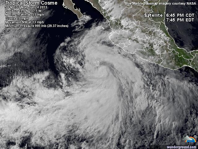
Cosme is shedding its outer-bands...now going in for the wrap-around.


brunota2003 wrote:Probably slim to none. Especially without observations or recon, unless an eye pops out, I doubt the sat estimates will budget much.
Users browsing this forum: No registered users and 105 guests


