
WPAC: WIPHA - Post-Tropical
Moderator: S2k Moderators
-
cycloneye

- Admin

- Posts: 139080
- Age: 67
- Joined: Thu Oct 10, 2002 10:54 am
- Location: San Juan, Puerto Rico
Re: WPAC: WIPHA - Typhoon
0 likes
Visit the Caribbean-Central America Weather Thread where you can find at first post web cams,radars
and observations from Caribbean basin members Click Here
and observations from Caribbean basin members Click Here

Re: WPAC: WIPHA - Typhoon
[quote="cycloneye"][/quote]
WDPN31 PGTW 121500
MSGID/GENADMIN/JOINT TYPHOON WRNCEN PEARL HARBOR HI//
SUBJ/PROGNOSTIC REASONING FOR TYPHOON 25W (WIPHA) WARNING NR 09//
RMKS//
1. FOR METEOROLOGISTS.
2. 6 HOUR SUMMARY AND ANALYSIS.
TYPHOON 25W (WIPHA), LOCATED APPROXIMATELY 799 NM SOUTHEAST OF
KADENA AB, HAS TRACKED NORTHWESTWARD AT 09 KNOTS OVER THE PAST
SIX HOURS. RECENT ANIMATED INFRARED (IR) SATELLITE IMAGERY DEPICTS A
DEVELOPING CENTRAL DENSE OVERCAST FEATURE WITH A BROAD DEEP
CONVECTIVE BAND WRAPPING TIGHTLY ACROSS THE SOUTHERN SEMI-CIRCLE
INTO A CONSOLIDATED LOW-LEVEL CIRCULATION CENTER (LLCC). A 120827Z
SSMIS MICROWAVE IMAGE REVEALS A MICROWAVE EYE FEATURE SURROUNDED BY
SEVERAL FRAGMENTED CONVECTIVE BANDS AS WELL AS A BROADER BAND OF
DEEP CONVECTION WRAPPING FROM THE SOUTHWEST QUADRANT INTO THE
CIRCULATION CENTER. THE CURRENT POSITION IS BASED ON IR AND
EXTRAPOLATED FROM THE AFOREMENTIONED MICROWAVE IMAGE WITH HIGH
CONFIDENCE. THE CURRENT INTENSITY IS BASED ON CONGRUENT DVORAK
ESTIMATES OF 65 KNOTS FROM ALL REPORTING AGENCIES. UPPER-LEVEL
ANALYSIS INDICATES FAVORABLE ENVIRONMENTAL CONDITIONS REMAIN IN
PLACE, WITH LOW (5 TO 10 KTS) NORTHEASTERLY VERTICAL WIND SHEAR
(VWS), AND STRONG RADIAL OUTFLOW OBSERVED IN ANIMATED WATER VAPOR
IMAGERY. POLEWARD OUTFLOW CONTINUES TO BE ENHANCED BY A TUTT CELL TO
THE NORTHEAST. TY 25W IS TRACKING ALONG THE SOUTHWESTERN PERIPHERY
OF THE DEEP-LAYERED SUBTROPICAL RIDGE (STR) TO THE NORTHEAST.
3. FORECAST REASONING.
A. THERE IS NO CHANGE TO THE FORECAST TRACK PHILOSOPHY SINCE THE
PREVIOUS PROGNOSTIC REASONING MESSAGE.
B. TY 25W WILL TURN POLEWARD AS IT PROGRESSES ALONG THE
SOUTHWESTERN PERIPHERY OF THE STEERING RIDGE OVER THE NEXT 48 HOURS.
FAVORABLE ENVIRONMENTAL CONDITIONS WILL DRIVE THE SYSTEM TO A PEAK
INTENSITY OF 105 KNOTS BY TAU 48. INTENSITY GUIDANCE SUGGESTS A HIGH
LIKELIHOOD OF RAPID INTENSIFICATION WITHIN THE NEXT 24 HOURS, WHICH
IS REFLECTED IN THE 25-KNOT INCREASE FROM 65 KNOTS UP TO 90 KNOTS BY
TAU 24. DURING TAUS 36-48, TY 25W SHOULD CONTINUE TO INTENSIFY AT A
CLIMATOLOGICAL RATE, BUT THE POSSIBILITY OF FURTHER RAPID
INTENSIFICATION STILL EXISTS. DYNAMICAL TRACK GUIDANCE CONTINUES TO
BE IN TIGHT AGREEMENT THROUGH TAU 48 AND THE CURRENT FORECAST TRACK
LIES CLOSE TO THE MULTI-MODEL CONSENSUS. BASED ON THE STRONG
AGREEMENT AMONG THE OBJECTIVE AIDS AND SIMILARITIES IN MULTIPLE
DYNAMICAL MODEL FIELDS, THE CONFIDENCE IN THIS PORTION OF THE
FORECAST TRACK IS HIGH.
C. TY 25W IS THEN EXPECTED TO CREST THE RIDGE AXIS AND BEGIN TO
TURN TO THE NORTHEAST AT AN INTENSITY OF 90 KNOTS PRIOR TO TAU 72.
TY WIPHA IS FORECAST TO BEGIN EXTRATROPICAL TRANSITION NEAR TAU 72
AS THE SYSTEM BEGINS TO INTERACT WITH THE BAROCLINIC BOUNDARY. IN
THE EXTENDED PERIOD, TY 25W WILL ACCELERATE TO THE NORTHEAST, AHEAD
OF A MID-LATITUDE SHORTWAVE TROUGH APPROACHING FROM THE NORTHWEST.
WIPHA WILL BECOME FULLY EMBEDDED IN THE MID-LATITUDE WESTERLIES AND
COMPLETE EXTRATROPICAL TRANSITION BY TAU 96. INCREASING VWS AND
COOLER SEA SURFACE TEMPERATURES WILL INDUCE STEADY WEAKENING ALONG
THIS PORTION OF THE FORECAST TRACK. POST-RECURVATURE TRACK SPEEDS
AND POSITIONING SHOW SIGNIFICANT SPREAD AND UNCERTAINTY. THE JTWC
FORECAST TRACK IS POSITIONED SLIGHTLY FASTER THAN THE MULTI-MODEL
CONSENSUS FOR THIS PORTION OF THE FORECAST TO OFFSET THE SLOWER
TRACKERS. HOWEVER, DUE TO UNCERTAINTY IN THE POST-RECURVATURE TRACK
SPEEDS, CONFIDENCE IN THE EXTENDED TRACK FORECAST IS LOW.//
NNNN
0 likes
Remember, all of my post aren't official. For official warnings and discussions, Please refer to your local NWS products...
NWS for the Western Pacific
https://www.weather.gov/gum/
NWS for the Western Pacific
https://www.weather.gov/gum/
Re: WPAC: WIPHA - Typhoon

0 likes
Remember, all of my post aren't official. For official warnings and discussions, Please refer to your local NWS products...
NWS for the Western Pacific
https://www.weather.gov/gum/
NWS for the Western Pacific
https://www.weather.gov/gum/
-
TropicalAnalystwx13

- Category 5

- Posts: 2109
- Age: 26
- Joined: Tue Jul 19, 2011 8:20 pm
- Location: Wilmington, NC
- Contact:
-
Hurricane_Luis

- Category 2

- Posts: 723
- Age: 26
- Joined: Sat Jun 23, 2012 3:14 pm
- Location: Tiptree, Essex, United Kingdom
- Contact:
Re:
TropicalAnalystwx13 wrote:The core remains a bit ragged. It's a huge storm. Winds look to be up to 75kts or so.
Not to shabby though.

0 likes


-
mrbagyo

- Category 5
- Posts: 3614
- Age: 31
- Joined: Thu Apr 12, 2012 9:18 am
- Location: 14.13N 120.98E
- Contact:
Re: WPAC: WIPHA - Typhoon

small eye
0 likes
The posts in this forum are NOT official forecast and should not be used as such. They are just the opinion of the poster and may or may not be backed by sound meteorological data. They are NOT endorsed by any professional institution or storm2k.org. For official information, please refer to RSMC, NHC and NWS products.
-
cycloneye
- Admin
- Posts: 139080
- Age: 67
- Joined: Thu Oct 10, 2002 10:54 am
- Location: San Juan, Puerto Rico
Re: WPAC: WIPHA - Typhoon
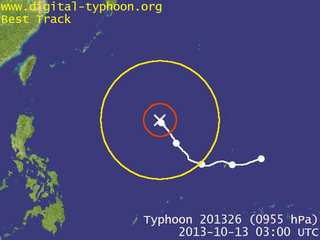
Peak now is at 115kts.

0 likes
Visit the Caribbean-Central America Weather Thread where you can find at first post web cams,radars
and observations from Caribbean basin members Click Here
and observations from Caribbean basin members Click Here


-----------------------------------------------------------------------------------------------
GLOBAL MODEL DATA TIME 12UTC 12.10.2013
TYPHOON WIPHA ANALYSED POSITION : 17.2N 138.4E
VERIFYING TIME POSITION STRENGTH TENDENCY
-------------- -------- -------- --------
12UTC 12.10.2013 17.2N 138.4E INTENSE
00UTC 13.10.2013 18.6N 137.7E INTENSE LITTLE CHANGE
12UTC 13.10.2013 20.2N 136.9E STRONG LITTLE CHANGE
00UTC 14.10.2013 22.0N 135.7E INTENSE INTENSIFYING SLIGHTLY
12UTC 14.10.2013 23.9N 134.4E INTENSE INTENSIFYING RAPIDLY
00UTC 15.10.2013 26.0N 134.4E INTENSE INTENSIFYING SLIGHTLY
12UTC 15.10.2013 28.7N 136.1E INTENSE WEAKENING SLIGHTLY
00UTC 16.10.2013 32.8N 139.4E INTENSE INTENSIFYING RAPIDLY
12UTC 16.10.2013 38.9N 145.4E INTENSE INTENSIFYING RAPIDLY
-----------------------------------------------------------------------------------------------
The way this storm is shaping up and the track it's following wont be surprised at all if we see another Cat5.
Personal Forecast Disclaimer:
The posts in this forum are NOT official forecast and should not be used as such. They are just the opinion of the poster and may or may not be backed by sound meteorological data. They are NOT endorsed by any professional institution or storm2k.org. For official information, please refer to the NHC and NWS products.
Last edited by stormkite on Sun Oct 13, 2013 1:11 am, edited 1 time in total.
0 likes

-
mrbagyo
- Category 5
- Posts: 3614
- Age: 31
- Joined: Thu Apr 12, 2012 9:18 am
- Location: 14.13N 120.98E
- Contact:
Re: WPAC: WIPHA - Typhoon
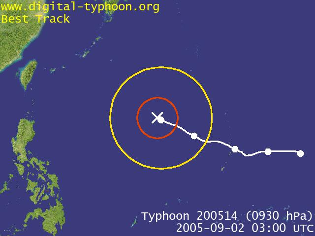
this is one big typhoon... Wipha reminds me of the size of typhoon Nabi

<Analyses at 13/06 UTC>
Scale Large
Intensity Strong
Center position N19°05'(19.1°)
E137°05'(137.1°)
Direction and speed of movement NNW 15km/h(7kt)
Central pressure 955hPa
Maximum wind speed near the center 40m/s(75kt)
Maximum wind gust speed 55m/s(105kt)
Area of 50kt winds or more ALL150km(80NM)
Area of 30kt winds or more SE - 850km(450NM) NW - 560km(300NM)
Latest visible image
0 likes
The posts in this forum are NOT official forecast and should not be used as such. They are just the opinion of the poster and may or may not be backed by sound meteorological data. They are NOT endorsed by any professional institution or storm2k.org. For official information, please refer to RSMC, NHC and NWS products.
-
jaguarjace

- Category 4

- Posts: 975
- Age: 29
- Joined: Sat Jun 11, 2011 7:38 am
- Location: Khon Kaen, Thailand
Re: WPAC: WIPHA - Typhoon

0 likes
Owner of the Tropical Archive YouTube channel
Web Developer at Force Thirteen
Twitter/X : @force13_support
Web Developer at Force Thirteen
Twitter/X : @force13_support
-
mrbagyo
- Category 5
- Posts: 3614
- Age: 31
- Joined: Thu Apr 12, 2012 9:18 am
- Location: 14.13N 120.98E
- Contact:
Re: WPAC: WIPHA - Typhoon
projected peak is now 125 knots per JTWC
0 likes
The posts in this forum are NOT official forecast and should not be used as such. They are just the opinion of the poster and may or may not be backed by sound meteorological data. They are NOT endorsed by any professional institution or storm2k.org. For official information, please refer to RSMC, NHC and NWS products.


-
hurricanes1234
- Category 5
- Posts: 2903
- Joined: Sat Jul 28, 2012 6:19 pm
- Location: Trinidad and Tobago
Re: WPAC: WIPHA - Typhoon
Wow! Must be a Category 4 now... 

0 likes
PLEASE NOTE: With the exception of information from weather agencies that I may copy and paste here, my posts will NEVER be official, since I am NOT a meteorologist. They are solely my amateur opinion, and may or may not be accurate. Therefore, please DO NOT use them as official details, particularly when making important decisions. Thank you.
-
hurricanes1234
- Category 5
- Posts: 2903
- Joined: Sat Jul 28, 2012 6:19 pm
- Location: Trinidad and Tobago
Re: WPAC: WIPHA - Typhoon
Best Track now a 115 knot Category 4!
25W WIPHA 131013 1200 19.8N 136.4E WPAC 115 937
25W WIPHA 131013 1200 19.8N 136.4E WPAC 115 937
0 likes
PLEASE NOTE: With the exception of information from weather agencies that I may copy and paste here, my posts will NEVER be official, since I am NOT a meteorologist. They are solely my amateur opinion, and may or may not be accurate. Therefore, please DO NOT use them as official details, particularly when making important decisions. Thank you.
Re: WPAC: WIPHA - Typhoon
hurricanes1234 wrote:Wow! Must be a Category 4 now...
Amazing rapid intensification .
0 likes
Remember, all of my post aren't official. For official warnings and discussions, Please refer to your local NWS products...
NWS for the Western Pacific
https://www.weather.gov/gum/
NWS for the Western Pacific
https://www.weather.gov/gum/
Re: WPAC: WIPHA - Typhoon
hurricanes1234 wrote:Best Track now a 115 knot Category 4!
25W WIPHA 131013 1200 19.8N 136.4E WPAC 115 937
0 likes
Remember, all of my post aren't official. For official warnings and discussions, Please refer to your local NWS products...
NWS for the Western Pacific
https://www.weather.gov/gum/
NWS for the Western Pacific
https://www.weather.gov/gum/
-
hurricanes1234
- Category 5
- Posts: 2903
- Joined: Sat Jul 28, 2012 6:19 pm
- Location: Trinidad and Tobago
Re: WPAC: WIPHA - Typhoon
Eyewall replacement cycle could be beginning. It has started to shrink and JTWC noted concentric eyewall inside it. Would it finish in time to strengthen?
0 likes
PLEASE NOTE: With the exception of information from weather agencies that I may copy and paste here, my posts will NEVER be official, since I am NOT a meteorologist. They are solely my amateur opinion, and may or may not be accurate. Therefore, please DO NOT use them as official details, particularly when making important decisions. Thank you.
Who is online
Users browsing this forum: No registered users and 104 guests