ATL: DANNY - Models
Moderator: S2k Moderators
-
AutoPenalti
- Category 5

- Posts: 3949
- Age: 27
- Joined: Mon Aug 17, 2015 4:16 pm
- Location: Ft. Lauderdale, Florida
Wow, in the end, it was just a fish.
0 likes
The posts in this forum are NOT official forecasts and should not be used as such. They are just the opinion of the poster and may or may not be backed by sound meteorological data. They are NOT endorsed by any professional institution or STORM2K. For official information, please refer to products from the NHC and NWS.
Model Runs Cheat Sheet:
GFS (5:30 AM/PM, 11:30 AM/PM)
HWRF, GFDL, UKMET, NAVGEM (6:30-8:00 AM/PM, 12:30-2:00 AM/PM)
ECMWF (1:45 AM/PM)
TCVN is a weighted averaged

Re: ATL: DANNY - Models
"Wow, in the end, it was just a fish."
Lot of them end up that way...especially early....but now that Danny has started to "plow the road" time to look east.
Lot of them end up that way...especially early....but now that Danny has started to "plow the road" time to look east.
0 likes
-
Chris_in_Tampa
- Category 5
- Posts: 4963
- Age: 41
- Joined: Thu Jun 21, 2007 11:06 pm
- Location: Tampa, Florida, USA
- Contact:
Re:
It's not a fish. The forecast track and models pass over some of the Lesser Antilles, where there are watches or warnings up for some of the northern islands. Also, some models shifted more west. This is not a fish near term and what it will be long term is still uncertain. (and any re-curvature could always hit Bermuda)AutoPenalti wrote:Wow, in the end, it was just a fish.
0 likes
-
TheStormExpert

- Category 5
- Posts: 8487
- Age: 30
- Joined: Wed Feb 16, 2011 5:38 pm
- Location: Palm Beach Gardens, FL


-
toad strangler

- S2K Supporter

- Posts: 4162
- Joined: Sun Jul 28, 2013 3:09 pm
- Location: Earth
- Contact:


-
tolakram
- Admin

- Posts: 19165
- Age: 60
- Joined: Sun Aug 27, 2006 8:23 pm
- Location: Florence, KY (name is Mark)
Re: ATL: DANNY - Models
12Z GFS
Seems to move Danny further south.
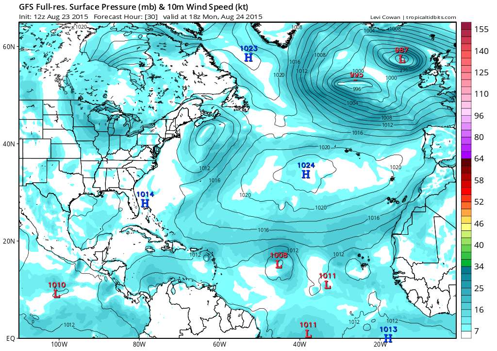
Seems to move Danny further south.
0 likes
M a r k
- - - - -
Join us in chat: Storm2K Chatroom Invite. Android and IOS apps also available.
The posts in this forum are NOT official forecasts and should not be used as such. Posts are NOT endorsed by any professional institution or STORM2K.org. For official information and forecasts, please refer to NHC and NWS products.
-
tolakram
- Admin
- Posts: 19165
- Age: 60
- Joined: Sun Aug 27, 2006 8:23 pm
- Location: Florence, KY (name is Mark)
Re: ATL: DANNY - Models
0 likes
M a r k
- - - - -
Join us in chat: Storm2K Chatroom Invite. Android and IOS apps also available.
The posts in this forum are NOT official forecasts and should not be used as such. Posts are NOT endorsed by any professional institution or STORM2K.org. For official information and forecasts, please refer to NHC and NWS products.
- - - - -
Join us in chat: Storm2K Chatroom Invite. Android and IOS apps also available.
The posts in this forum are NOT official forecasts and should not be used as such. Posts are NOT endorsed by any professional institution or STORM2K.org. For official information and forecasts, please refer to NHC and NWS products.
-
tolakram
- Admin
- Posts: 19165
- Age: 60
- Joined: Sun Aug 27, 2006 8:23 pm
- Location: Florence, KY (name is Mark)
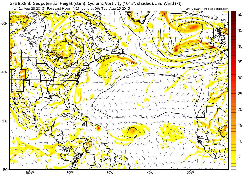
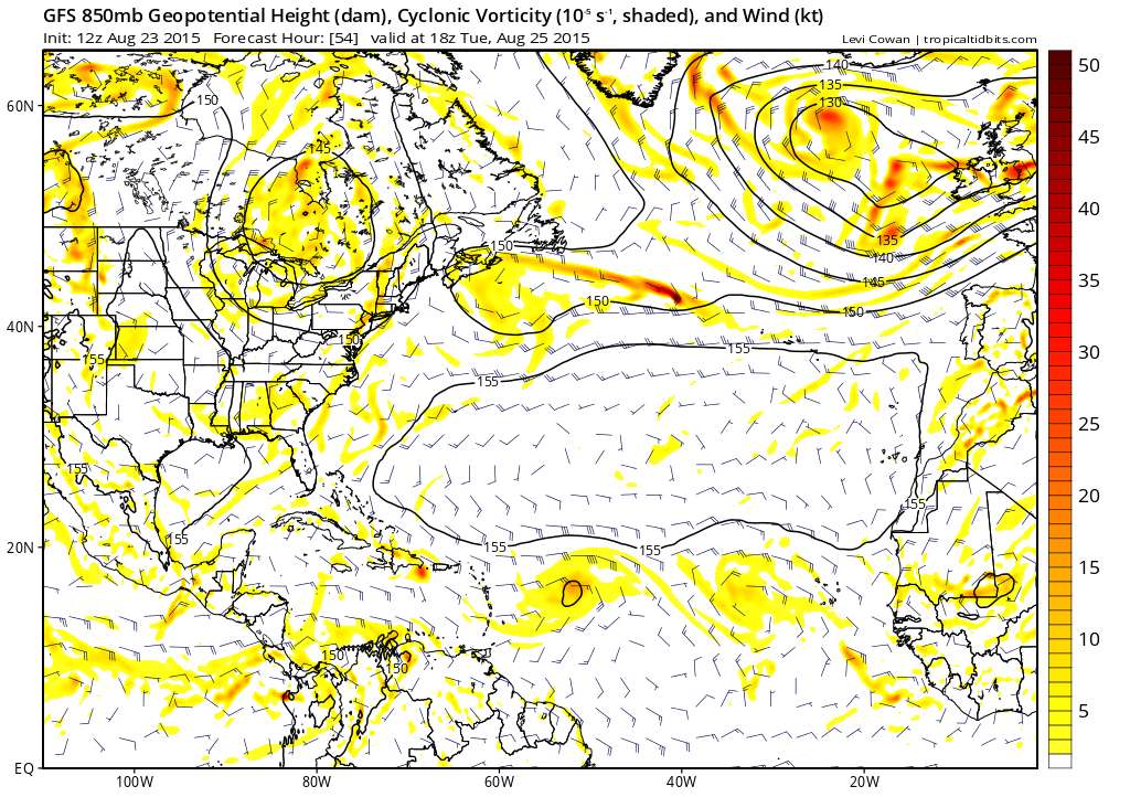
Re: ATL: DANNY - Models
Over Hispaniola this run, vorticity wiped out next frame, but does look stronger for longer.
0 likes
M a r k
- - - - -
Join us in chat: Storm2K Chatroom Invite. Android and IOS apps also available.
The posts in this forum are NOT official forecasts and should not be used as such. Posts are NOT endorsed by any professional institution or STORM2K.org. For official information and forecasts, please refer to NHC and NWS products.
- - - - -
Join us in chat: Storm2K Chatroom Invite. Android and IOS apps also available.
The posts in this forum are NOT official forecasts and should not be used as such. Posts are NOT endorsed by any professional institution or STORM2K.org. For official information and forecasts, please refer to NHC and NWS products.
-
toad strangler
- S2K Supporter
- Posts: 4162
- Joined: Sun Jul 28, 2013 3:09 pm
- Location: Earth
- Contact:
Re:
gatorcane wrote:06Z GFDL, 960MB:
GFDL has consistently been showing a solution like this. I can only assume that its a model that has been "tossed" by NHC this go around.
_______________________________________________________________________________________________________________________________________________
My posts in this forum are NOT official forecast and should not be used as such. They are just my opinion and may or may not be backed by sound meteorological data. They are NOT endorsed by any professional institution or storm2k.org. For official information, please refer to the NHC and NWS products.
0 likes
-
toad strangler
- S2K Supporter
- Posts: 4162
- Joined: Sun Jul 28, 2013 3:09 pm
- Location: Earth
- Contact:
Re: Re:
The GFDL is also in the re-curve camp. NHC does not seem to be buying either re-strengthening OR Fish


_______________________________________________________________________________________________________________________________________________
My posts in this forum are NOT official forecast and should not be used as such. They are just my opinion and may or may not be backed by sound meteorological data. They are NOT endorsed by any professional institution or storm2k.org. For official information, please refer to the NHC and NWS products.
0 likes
-
toad strangler
- S2K Supporter
- Posts: 4162
- Joined: Sun Jul 28, 2013 3:09 pm
- Location: Earth
- Contact:
Re: Re:
The GFDL is also in the re-curve camp. NHC does not seem to be buying either re-strengthening OR Fish
_____________________________________________________________________________________________________________________________________________________________________________________________________________________
My posts in this forum are NOT official forecast and should not be used as such. They are just my opinion and may or may not be backed by sound meteorological data. They are NOT endorsed by any professional institution or storm2k.org. For official information, please refer to the NHC and NWS products.
0 likes

-
WPBWeather

- S2K Supporter
- Posts: 535
- Age: 65
- Joined: Thu Jul 18, 2013 12:33 pm
Re:
gatorcane wrote:12Z UKMET shows the low from Danny staying in tact and shows a track further south, passing south of Cuba, south of Hispaniola and Puerto Rico, and into the SE Gulf. In the previous UKMET runs, it opened Danny into a wave.
Yes! Some of the models on the SFWMD web site show Danny bending back to the FL straits and the Gulf. I think I mentioned the TCVN line for Danny kissed Ft. Lauderdale yesterday. What a crazy storm.
0 likes
-
TheStormExpert
- Category 5
- Posts: 8487
- Age: 30
- Joined: Wed Feb 16, 2011 5:38 pm
- Location: Palm Beach Gardens, FL


-
floridasun78
- Category 5
- Posts: 3755
- Joined: Sun May 17, 2009 10:16 pm
- Location: miami fl
-
WPBWeather
- S2K Supporter
- Posts: 535
- Age: 65
- Joined: Thu Jul 18, 2013 12:33 pm
Re: ATL: DANNY - Models
Frank2 wrote:That makes no sense - the system is almost dissipated...
Ok now. We've had Danny dead or dying for days now. I cannot sleep until I know. Will there be a tomorrow for him??
0 likes
Who is online
Users browsing this forum: No registered users and 105 guests