Arabian Sea: CHAPALA - Post-Tropical
Moderator: S2k Moderators
-
Kingarabian

- S2K Supporter

- Posts: 15434
- Joined: Sat Aug 08, 2009 3:06 am
- Location: Honolulu, Hawaii
-
Yellow Evan

- Professional-Met

- Posts: 15951
- Age: 25
- Joined: Fri Jul 15, 2011 12:48 pm
- Location: Henderson, Nevada/Honolulu, HI
- Contact:
Re: Re:
Alyono wrote:Kingarabian wrote:Alyono wrote:eyewall replacement underway
Hopefully it struggles from here on.
it should regain if not exceed its old intensity
Depends on how much dry air is a factor. It's been a messy ERC so far so I won't be shocked if we end up with a 60 mile wide eye.
0 likes
-
mrbagyo

- Category 5

- Posts: 3614
- Age: 31
- Joined: Thu Apr 12, 2012 9:18 am
- Location: 14.13N 120.98E
- Contact:
Re: Arabian Sea: CHAPALA - Extremely Severe Cyclonic Storm

Shear is relaxing along its path, if thats the case, it might not choke up a lot of dry air into its core. Let's see. ..
0 likes
The posts in this forum are NOT official forecast and should not be used as such. They are just the opinion of the poster and may or may not be backed by sound meteorological data. They are NOT endorsed by any professional institution or storm2k.org. For official information, please refer to RSMC, NHC and NWS products.
-
wxman57

- Moderator-Pro Met

- Posts: 22480
- Age: 66
- Joined: Sat Jun 21, 2003 8:06 pm
- Location: Houston, TX (southwest)
Re: Arabian Sea: CHAPALA - Extremely Severe Cyclonic Storm
I'm not sure it's an ERC. Microwave does show the eye collapsing but I don't see another eyewall building. It's definitely a good bit weaker than 12 hours ago, possibly due to dry air entrainment from the northwest. I don't think it will recover to its former intensity.
http://tropic.ssec.wisc.edu/real-time/mimic-tc/2015_04A/webManager/last24hrs.gif
http://tropic.ssec.wisc.edu/real-time/mimic-tc/2015_04A/webManager/last24hrs.gif
0 likes
-
WeatherGuesser
- Category 5
- Posts: 2672
- Joined: Tue Jun 29, 2010 6:46 am
First stories starting to appear:
Rare cyclone heads toward Arabia, may dump year's worth of rain
USA TODAY - 6 hours ago
Cyclone Chapala is taking aim at the Arabian Peninsula and is forecast to strengthen into a Category 5 storm today, with winds of up to 166 mph. It should approach Oman and Yemen at Category 2 or 3 strength late Sunday or early Monday.
0 likes
-
WeatherGuesser
- Category 5
- Posts: 2672
- Joined: Tue Jun 29, 2010 6:46 am
NASA satellites have been providing data on powerful Tropical Cyclone Chapala as it continued strengthening in the Arabian Sea. The Global Precipitation Measurement Mission or GPM core satellite provided a look at strengthening Tropical Cyclone Chapala in the Arabian Sea. Additionally, NASA's Aqua satellite got a good look at the storm's small eye.
Tropical Cyclone Chapala developed in the very warm waters of the Arabian Sea west of India on October 28, 2015. Tropical Cyclone Chapala is a Category 4 Hurricane on the Saffir-Simpson Scale and is forecast to become a Category 5 later on October 30, 2015.
http://phys.org/news/2015-10-nasa-power ... nfall.html
0 likes
-
WeatherGuesser
- Category 5
- Posts: 2672
- Joined: Tue Jun 29, 2010 6:46 am

-
Kingarabian
- S2K Supporter
- Posts: 15434
- Joined: Sat Aug 08, 2009 3:06 am
- Location: Honolulu, Hawaii
-
wxman57
- Moderator-Pro Met
- Posts: 22480
- Age: 66
- Joined: Sat Jun 21, 2003 8:06 pm
- Location: Houston, TX (southwest)
Re: Arabian Sea: CHAPALA - Extremely Severe Cyclonic Storm
Dvorak down to 5.0. Probably a Cat 2 now.
0 likes
-
Yellow Evan
- Professional-Met
- Posts: 15951
- Age: 25
- Joined: Fri Jul 15, 2011 12:48 pm
- Location: Henderson, Nevada/Honolulu, HI
- Contact:
Looking quite ragged, but I imagine the RMW has expanded quite a bit. While I'd say this is around 105 knots (an an ugly 105 knots at that) now, this is still a very dangerous hurricane to a region where tropical cyclones are quite rare.
FYI, this isn't the only area where TC's hit that is a Desert. Western Australia and the Baja California Peninsula are the same way.
FYI, this isn't the only area where TC's hit that is a Desert. Western Australia and the Baja California Peninsula are the same way.
0 likes
-
TropicalAnalystwx13

- Category 5
- Posts: 2109
- Age: 26
- Joined: Tue Jul 19, 2011 8:20 pm
- Location: Wilmington, NC
- Contact:
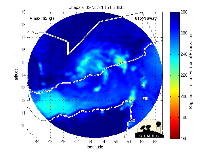
A recent microwave pass confirms Chapala underwent an eyewall replacement cycle earlier today.
It's a tough call whether we see any strengthening over the next day or two. Shear remains low and ocean temps remain warm, but there is an excess amount of dry air nearby. That said, Chapala did a good job of keeping dry air out of its core prior to the EWRC.

It's a tough call whether we see any strengthening over the next day or two. Shear remains low and ocean temps remain warm, but there is an excess amount of dry air nearby. That said, Chapala did a good job of keeping dry air out of its core prior to the EWRC.
0 likes
-
Kingarabian
- S2K Supporter
- Posts: 15434
- Joined: Sat Aug 08, 2009 3:06 am
- Location: Honolulu, Hawaii
-
1900hurricane

- Category 5
- Posts: 6044
- Age: 32
- Joined: Fri Feb 06, 2015 12:04 pm
- Location: Houston, TX
- Contact:
Re:
Kingarabian wrote:Looks like we'll be seeing a 30-40NM eye if it manages to complete the cycle.
It'll probably continue to contract as the inner eyewall dissipates. Looks like a pretty standard eyewall replacement cycle, and we'll probably get a common eye size out of it.
I'm actually pretty impressed it's managed to keep the dry air out while the eyewall replacement cycle has been ongoing. A few prior microwave passes made look like it was starting to get a wrap in, but the pass Cody posted above looks pretty clean. At this point, I'd say I'm in the restrengthening camp with Alyono, although probably not as agressive as him (low to mid-grade cat 4 following eyewall replacement seems good to me).
0 likes
Contract Meteorologist. TAMU & MSST. Fiercely authentic, one of a kind. We are all given free will, so choose a life meant to be lived. We are the Masters of our own Stories.
Opinions expressed are mine alone.
Follow me on Twitter at @1900hurricane : Read blogs at https://1900hurricane.wordpress.com/
Opinions expressed are mine alone.
Follow me on Twitter at @1900hurricane : Read blogs at https://1900hurricane.wordpress.com/

-
Kingarabian
- S2K Supporter
- Posts: 15434
- Joined: Sat Aug 08, 2009 3:06 am
- Location: Honolulu, Hawaii

-
Yellow Evan
- Professional-Met
- Posts: 15951
- Age: 25
- Joined: Fri Jul 15, 2011 12:48 pm
- Location: Henderson, Nevada/Honolulu, HI
- Contact:

Who is online
Users browsing this forum: No registered users and 104 guests