It appears that what ever circulation is left, is now emerging into the BOC.
Visible Satellite loop
http://weather.msfc.nasa.gov/cgi-bin/get-goes?satellite=GOES-E%20CONUS&lat=21&lon=-93&type=Animation&info=vis&numframes=15
ATL: INVEST 95L - Discussion
Moderator: S2k Moderators
- tropicwatch
- Category 5
- Posts: 3205
- Age: 60
- Joined: Sat Jun 02, 2007 10:01 am
- Location: Panama City Florida
- Contact:
Re: ATL: INVEST 95L - Discussion
0 likes
Tropicwatch
Agnes 72', Eloise 75, Elena 85', Kate 85', Charley 86', Florence 88', Beryl 94', Dean 95', Erin 95', Opal 95', Earl 98', Georges 98', Ivan 2004', Arlene 2005', Dennis 2005', Ida 2009' Debby 2012' Irma 2017' Michael 2018'
- TheStormExpert
- Category 5
- Posts: 8487
- Age: 30
- Joined: Wed Feb 16, 2011 5:38 pm
- Location: Palm Beach Gardens, FL
Re: ATL: INVEST 95L - Discussion
Bye!
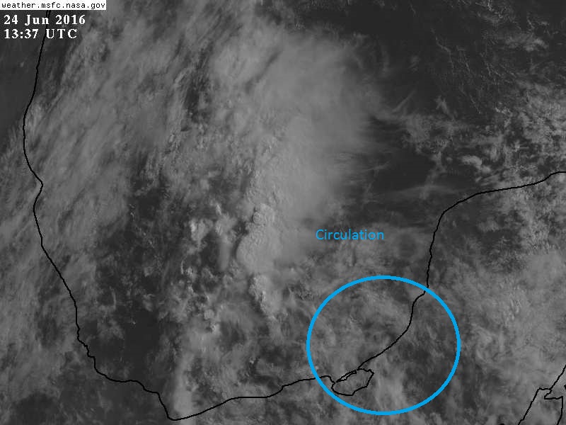
TROPICAL WEATHER OUTLOOK
NWS NATIONAL HURRICANE CENTER MIAMI FL
200 PM EDT FRI JUN 24 2016
For the North Atlantic...Caribbean Sea and the Gulf of Mexico:
1. Disorganized showers and thunderstorms continue over the Bay of Campeche in association with a weak area of low pressure. Although development of this system is not expected, locally heavy rain is possible when the low moves inland over eastern Mexico on Saturday.
* Formation chance through 48 hours...low...near 0 percent
* Formation chance through 5 days...low...near 0 percent
Forecaster Blake
0 likes
The following post is NOT an official forecast and should not be used as such. It is just the opinion of the poster and may or may not be backed by sound meteorological data. It is NOT endorsed by storm2k.org.
Who is online
Users browsing this forum: No registered users and 33 guests