
ATL: DON - Remnants - Discussion
Moderator: S2k Moderators
-
cycloneye

- Admin

- Posts: 139481
- Age: 67
- Joined: Thu Oct 10, 2002 10:54 am
- Location: San Juan, Puerto Rico
Re: ATL: INVEST 95L - Models
High pressure is strong.
1 likes
Visit the Caribbean-Central America Weather Thread where you can find at first post web cams,radars
and observations from Caribbean basin members Click Here
and observations from Caribbean basin members Click Here

Re: ATL: INVEST 95L - Discussion
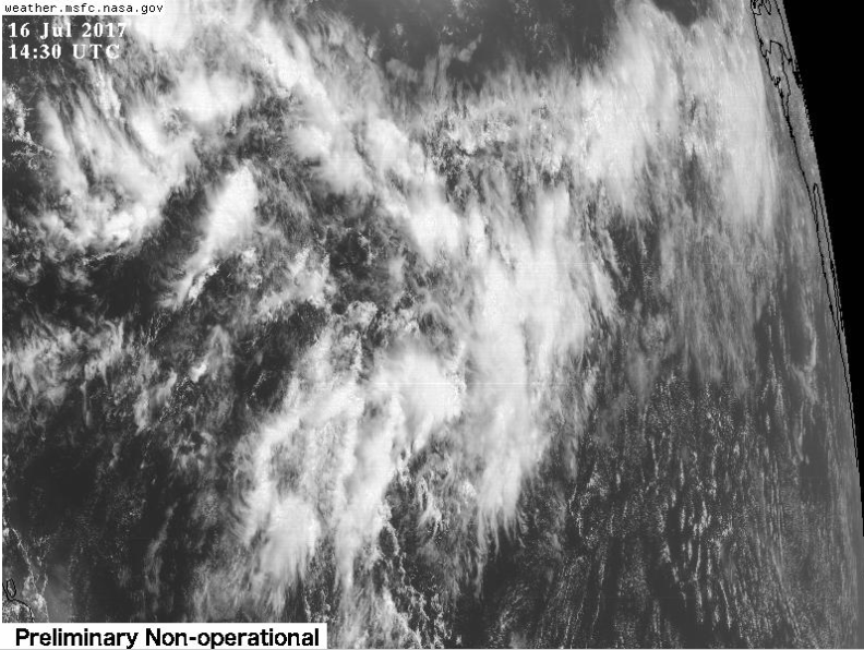
Detachment of the two 850mb vorts clearly depicted with the west one strengthening.

2 likes
-
dexterlabio
- Category 5

- Posts: 3408
- Joined: Sat Oct 24, 2009 11:50 pm
Re: ATL: INVEST 95L - Models
The location of this system plus the previous tropical systems in the Atlantic (and EPAC as well) reminds me of a typical WPAC setup. Isn't it remarkable that the monsoon trough at this time of the year is positioned a bit south of its usual location?
0 likes
Personal Forecast Disclaimer:
The posts in this forum are NOT official forecast and should not be used as such. They are just the opinion of the poster and may or may not be backed by sound meteorological data. They are NOT endorsed by any professional institution or storm2k.org. For official information, please refer to the NHC and NWS products.
The posts in this forum are NOT official forecast and should not be used as such. They are just the opinion of the poster and may or may not be backed by sound meteorological data. They are NOT endorsed by any professional institution or storm2k.org. For official information, please refer to the NHC and NWS products.
-
cycloneye
- Admin
- Posts: 139481
- Age: 67
- Joined: Thu Oct 10, 2002 10:54 am
- Location: San Juan, Puerto Rico
ATL: DON - Recon
If necesarry first mission will be on the 17th of July in the afternoon.
Code: Select all
NOUS42 KNHC 161445
REPRPD
WEATHER RECONNAISSANCE FLIGHTS
CARCAH, NATIONAL HURRICANE CENTER, MIAMI, FL.
1045 AM EDT SUN 16 JULY 2017
SUBJECT: TROPICAL CYCLONE PLAN OF THE DAY (TCPOD)
         VALID 17/1100Z TO 18/1100Z JULY 2017
         TCPOD NUMBER.....17-046

I.  ATLANTIC REQUIREMENTS
    1. SUSPECT AREA (EAST OF WINDWARD ISLANDS)
       FLIGHT ONE -- TEAL 74         FLIGHT TWO -- TEAL 75
       A. 17/1800Z                   A. 18/1130Z, 1730Z
       B. AFXXX 01BBA INVEST         B. AFXXX 0205A CYCLONE
       C. 17/1500Z                   C. 18/0930Z
       D. 11.5N 52.5W                D. 12.0N 57.0W
       E. 17/1800Z TO 17/2200Z       E. 18/1100Z TO 18/1730Z
       F. SFC TO 10,000 FT           F. SFC TO 10,000 FT
0 likes
Visit the Caribbean-Central America Weather Thread where you can find at first post web cams,radars
and observations from Caribbean basin members Click Here
and observations from Caribbean basin members Click Here
-
tropicwatch

- Category 5
- Posts: 3205
- Age: 60
- Joined: Sat Jun 02, 2007 10:01 am
- Location: Panama City Florida
- Contact:
Re: ATL: INVEST 95L - Discussion
Looks like a circulation might be starting to form.
1 likes
Tropicwatch
Agnes 72', Eloise 75, Elena 85', Kate 85', Charley 86', Florence 88', Beryl 94', Dean 95', Erin 95', Opal 95', Earl 98', Georges 98', Ivan 2004', Arlene 2005', Dennis 2005', Ida 2009' Debby 2012' Irma 2017' Michael 2018'
Agnes 72', Eloise 75, Elena 85', Kate 85', Charley 86', Florence 88', Beryl 94', Dean 95', Erin 95', Opal 95', Earl 98', Georges 98', Ivan 2004', Arlene 2005', Dennis 2005', Ida 2009' Debby 2012' Irma 2017' Michael 2018'
-
AutoPenalti
- Category 5
- Posts: 3950
- Age: 27
- Joined: Mon Aug 17, 2015 4:16 pm
- Location: Ft. Lauderdale, Florida
Re: ATL: INVEST 95L - Discussion
panamatropicwatch wrote:Looks like a circulation might be starting to form.
It's the one on the top left of the graphic, correct?
0 likes
The posts in this forum are NOT official forecasts and should not be used as such. They are just the opinion of the poster and may or may not be backed by sound meteorological data. They are NOT endorsed by any professional institution or STORM2K. For official information, please refer to products from the NHC and NWS.
Model Runs Cheat Sheet:
GFS (5:30 AM/PM, 11:30 AM/PM)
HWRF, GFDL, UKMET, NAVGEM (6:30-8:00 AM/PM, 12:30-2:00 AM/PM)
ECMWF (1:45 AM/PM)
TCVN is a weighted averaged

Re: ATL: INVEST 95L - Discussion
JPmia wrote:Wasn't that one of the reasons why the 2005 season was so busy because of a favorable monsoon trough position?
the Caribbean monsoon trough was incredible favorable. We had the monsoon trough extending into the EAST Caribbean in July. Allowed Dennis and Emily to go hog wild. The tropical Atlantic was under producing except for Philippe in 2005
The African monsoon trough was quiet, as was the SAL. Dry air that year likely came from the north. 2005 is an example of a season without a SAL. The tropical Atlantic is quiet, but the waves can survive until th western basin where they can develop (The SAL due to instability, may make the waves stronger over Africa)
0 likes
-
tropicwatch
- Category 5
- Posts: 3205
- Age: 60
- Joined: Sat Jun 02, 2007 10:01 am
- Location: Panama City Florida
- Contact:
Re: ATL: INVEST 95L - Discussion
AutoPenalti wrote:panamatropicwatch wrote:Looks like a circulation might be starting to form.
It's the one on the top left of the graphic, correct?
Yes but I just noticed that the convection southeast of it also looks to be forming one too maybe.
0 likes
Tropicwatch
Agnes 72', Eloise 75, Elena 85', Kate 85', Charley 86', Florence 88', Beryl 94', Dean 95', Erin 95', Opal 95', Earl 98', Georges 98', Ivan 2004', Arlene 2005', Dennis 2005', Ida 2009' Debby 2012' Irma 2017' Michael 2018'
Agnes 72', Eloise 75, Elena 85', Kate 85', Charley 86', Florence 88', Beryl 94', Dean 95', Erin 95', Opal 95', Earl 98', Georges 98', Ivan 2004', Arlene 2005', Dennis 2005', Ida 2009' Debby 2012' Irma 2017' Michael 2018'
-
TheStormExpert

- Category 5
- Posts: 8487
- Age: 30
- Joined: Wed Feb 16, 2011 5:38 pm
- Location: Palm Beach Gardens, FL
Re: ATL: INVEST 95L - Models
12z GFS & GFS-P hinting at possibly getting 2 TC's from this monsoon trough?
0 likes
The following post is NOT an official forecast and should not be used as such. It is just the opinion of the poster and may or may not be backed by sound meteorological data. It is NOT endorsed by storm2k.org.
Re: ATL: INVEST 95L - Models

0 likes


Re: ATL: INVEST 95L - Models
EDIT: Looks like the UKMET is developing the eastern half instead.
12z UKMET output:
NEW TROPICAL CYCLONE FORECAST TO DEVELOP AFTER 24 HOURS
FORECAST POSITION AT T+ 24 : 9.8N 36.4W
LEAD CENTRAL MAXIMUM WIND
VERIFYING TIME TIME POSITION PRESSURE (MB) SPEED (KNOTS)
-------------- ---- -------- ------------- -------------
1200UTC 17.07.2017 24 9.8N 36.4W 1012 22
0000UTC 18.07.2017 36 10.8N 37.3W 1012 25
1200UTC 18.07.2017 48 11.7N 38.7W 1011 28
0000UTC 19.07.2017 60 12.5N 40.5W 1011 26
1200UTC 19.07.2017 72 14.0N 43.0W 1012 26
0000UTC 20.07.2017 84 15.0N 45.8W 1014 26
1200UTC 20.07.2017 96 17.0N 48.9W 1015 26
0000UTC 21.07.2017 108 CEASED TRACKING
0 likes
Re: ATL: INVEST 95L - Discussion
This monsoon trough setup with model disagreement over the most likely location for development reminds me of pre-Cristobal 2014, albeit with less of a future to it.
0 likes
-
Hurricaneman

- Category 5
- Posts: 7284
- Age: 43
- Joined: Tue Aug 31, 2004 3:24 pm
- Location: central florida
Re: ATL: INVEST 95L - Discussion
Could we maybe get Don from this system and maybe Emily on the SE vortex
0 likes
-
tropicwatch
- Category 5
- Posts: 3205
- Age: 60
- Joined: Sat Jun 02, 2007 10:01 am
- Location: Panama City Florida
- Contact:
Re: ATL: INVEST 95L - Discussion
Hurricaneman wrote:Could we maybe get Don from this system and maybe Emily on the SE vortex
From the 95L model thread:
TheStormExpert wrote:12z GFS & GFS-P hinting at possibly getting 2 TC's from this monsoon trough?
0 likes
Tropicwatch
Agnes 72', Eloise 75, Elena 85', Kate 85', Charley 86', Florence 88', Beryl 94', Dean 95', Erin 95', Opal 95', Earl 98', Georges 98', Ivan 2004', Arlene 2005', Dennis 2005', Ida 2009' Debby 2012' Irma 2017' Michael 2018'
Agnes 72', Eloise 75, Elena 85', Kate 85', Charley 86', Florence 88', Beryl 94', Dean 95', Erin 95', Opal 95', Earl 98', Georges 98', Ivan 2004', Arlene 2005', Dennis 2005', Ida 2009' Debby 2012' Irma 2017' Michael 2018'
-
cycloneye
- Admin
- Posts: 139481
- Age: 67
- Joined: Thu Oct 10, 2002 10:54 am
- Location: San Juan, Puerto Rico
Re: ATL: INVEST 95L - Discussion
Tropical Weather Outlook
NWS National Hurricane Center Miami FL
200 PM EDT Sun Jul 16 2017
For the North Atlantic...Caribbean Sea and the Gulf of Mexico:
A westward-moving trough of low pressure located about 1000 miles
east-southeast of the Windward Islands continues to produce
disorganized showers and thunderstorms. Environmental conditions
are marginally conducive for some development of this system before
it reaches the Lesser Antilles in two to three days. After
that time, less favorable upper-level winds are expected to hinder
additional development. An Air Force Reserve reconnaissance
aircraft is scheduled to investigate the disturbance Monday
afternoon, if necessary.
* Formation chance through 48 hours...low...20 percent.
* Formation chance through 5 days...medium...40 percent.
$$
Forecaster Brown

0 likes
Visit the Caribbean-Central America Weather Thread where you can find at first post web cams,radars
and observations from Caribbean basin members Click Here
and observations from Caribbean basin members Click Here

Re: ATL: INVEST 95L - Discussion
There is a storm relative circulation but just a few intermittent bursts of convection near the center of that. The TUTT has brought down somewhat dry air ahead of the system but 04 seemed to perk up a bit approaching -50w. Maybe the SST environment is better further west?
0 likes

Re: ATL: INVEST 95L - Discussion
ATCF Best Track
System ID: AL95 (INVEST)
1800 UTC Jul 16, 2017
Location: 10.5°N, 45.9°N
Central Pressure: 1011 mb
Maximum Winds (1-min): 20 kt (23 mph)
Type: Disturbance (DB)
System ID: AL95 (INVEST)
1800 UTC Jul 16, 2017
Location: 10.5°N, 45.9°N
Central Pressure: 1011 mb
Maximum Winds (1-min): 20 kt (23 mph)
Type: Disturbance (DB)

0 likes
-
tarheelprogrammer

- S2K Supporter

- Posts: 1793
- Joined: Mon Mar 28, 2016 9:25 pm
- Location: Raleigh, NC area (Garner, NC)
Re: ATL: INVEST 95L - Discussion
ECMWF is not developing this it looks like, and that semi-permanent TUTT(s) that arrives nearly every summer recently will cause it problems. Also, the shear I believe from the Pacific will shred it in the Caribbean. There is not much of a future for 95L, and it will be a miracle if it gets a name. However, as we seen with Joaquin a few years ago, it can happen. Anything can happen in the tropics. 
0 likes
My posts are not official forecasts. They are just my opinion and may or may not be backed by sound meteorological data. They are NOT endorsed by any professional institution or storm2k.org. For official information, please refer to the NHC and NWS products.
-
Aric Dunn
- Category 5
- Posts: 21228
- Age: 41
- Joined: Sun Sep 19, 2004 9:58 pm
- Location: Ready for the Chase.
- Contact:
Re: ATL: INVEST 95L - Discussion
tarheelprogrammer wrote:ECMWF is not developing this it looks like, and that semi-permanent TUTT(s) that arrives nearly every summer recently will cause it problems. Also, the shear I believe from the Pacific will shred it in the Caribbean. There is not much of a future for 95L, and it will be a miracle if it gets a name. However, as we seen with Joaquin a few years ago, it can happen. Anything can happen in the tropics.
Yeah the wave behind it has better shot.. but nothing looks likely in the near trerm..
2 likes
Note: If I make a post that is brief. Please refer back to previous posts for the analysis or reasoning. I do not re-write/qoute what my initial post said each time.
If there is nothing before... then just ask
Space & Atmospheric Physicist, Embry-Riddle Aeronautical University,
I believe the sky is falling...
If there is nothing before... then just ask
Space & Atmospheric Physicist, Embry-Riddle Aeronautical University,
I believe the sky is falling...
-
cycloneye
- Admin
- Posts: 139481
- Age: 67
- Joined: Thu Oct 10, 2002 10:54 am
- Location: San Juan, Puerto Rico
Re: ATL: INVEST 95L - Models
* ATLANTIC SHIPS INTENSITY FORECAST *
* IR SAT DATA AVAILABLE, OHC AVAILABLE *
* INVEST AL952017 07/16/17 18 UTC *
TIME (HR) 0 6 12 18 24 36 48 60 72 84 96 108 120
V (KT) NO LAND 20 22 26 29 33 43 52 58 64 67 67 69 69
V (KT) LAND 20 22 26 29 33 43 52 58 64 67 67 69 69
V (KT) LGEM 20 21 22 23 25 29 34 39 43 45 43 41 39
Storm Type TROP TROP TROP TROP TROP TROP TROP TROP TROP TROP TROP TROP TROP
SHEAR (KT) 11 11 11 7 7 2 3 11 12 19 26 30 26
SHEAR ADJ (KT) -5 -4 -5 -3 0 5 1 2 0 -2 -3 -4 -7
SHEAR DIR 103 109 100 96 97 65 303 256 244 237 269 277 276
SST (C) 27.6 27.6 27.8 28.0 28.1 28.1 28.1 28.3 28.2 28.2 28.1 28.0 28.2
POT. INT. (KT) 133 132 135 138 139 140 140 143 142 143 142 140 143
ADJ. POT. INT. 135 133 136 139 140 142 143 149 148 150 148 146 148
200 MB T (C) -54.2 -54.4 -54.7 -54.6 -54.0 -54.3 -53.8 -53.9 -53.8 -53.8 -53.7 -53.5 -53.6
200 MB VXT (C) -0.1 -0.2 -0.2 -0.3 -0.4 -0.1 -0.2 -0.1 -0.1 -0.1 0.0 0.0 -0.1
TH_E DEV (C) 6 6 7 7 8 9 10 10 11 10 12 11 12
700-500 MB RH 67 67 67 63 64 62 56 56 53 53 51 52 53
MODEL VTX (KT) 8 8 8 8 9 10 10 10 11 11 10 9 8
850 MB ENV VOR 40 39 32 26 39 18 21 30 33 31 29 47 14
200 MB DIV 60 73 61 40 52 26 11 43 33 15 15 36 39
700-850 TADV -5 -5 -6 -6 -4 -4 -4 -7 -4 2 4 2 6
LAND (KM) 932 863 799 768 743 704 535 238 277 299 228 354 384
LAT (DEG N) 10.5 10.7 10.9 11.3 11.6 12.0 12.5 12.6 13.2 13.7 14.5 14.7 14.8
LONG(DEG W) 45.9 47.2 48.4 49.6 50.8 53.3 56.4 59.8 63.3 67.2 71.2 75.4 79.5
STM SPEED (KT) 13 12 12 12 12 14 15 17 18 20 20 20 19
HEAT CONTENT 24 40 33 21 18 38 39 46 32 43 32 63 47
FORECAST TRACK FROM TABM INITIAL HEADING/SPEED (DEG/KT):270/ 14 CX,CY: -13/ 0
T-12 MAX WIND: 20 PRESSURE OF STEERING LEVEL (MB): 571 (MEAN=618)
GOES IR BRIGHTNESS TEMP. STD DEV. 50-200 KM RAD: 18.0 (MEAN=14.5)
% GOES IR PIXELS WITH T < -20 C 50-200 KM RAD: 62.0 (MEAN=65.0)
PRELIM RI PROB (DV .GE. 55 KT IN 48 HR): 1.8
INDIVIDUAL CONTRIBUTIONS TO INTENSITY CHANGE
6 12 18 24 36 48 60 72 84 96 108 120
----------------------------------------------------------
SAMPLE MEAN CHANGE 1. 2. 3. 4. 6. 8. 9. 10. 11. 12. 13. 13.
SST POTENTIAL 0. 0. 1. 2. 6. 12. 19. 24. 29. 34. 37. 41.
VERTICAL SHEAR MAG 1. 2. 3. 4. 6. 8. 9. 9. 8. 4. 1. -2.
VERTICAL SHEAR ADJ 0. 1. 1. 2. 2. 2. 1. 2. 2. 2. 3. 4.
VERTICAL SHEAR DIR 0. 1. 1. 2. 3. 4. 3. 1. -1. -2. -3. -4.
PERSISTENCE -0. -1. -1. -1. -1. -1. -1. -1. -0. 0. 0. 1.
200/250 MB TEMP. -0. -0. -0. -1. -1. -1. -1. -0. -0. 0. 1. 1.
THETA_E EXCESS -0. -0. -0. -0. -0. -0. -0. -0. 0. 0. 0. 1.
700-500 MB RH -0. -0. -0. -1. -1. -2. -2. -2. -2. -2. -2. -2.
MODEL VTX TENDENCY -0. 0. 0. 0. 1. 1. -0. 1. 0. -3. -4. -7.
850 MB ENV VORTICITY 0. 0. 0. 0. 0. 0. 0. 0. 0. 0. 0. 0.
200 MB DIVERGENCE 0. 0. 0. 0. 0. 0. 0. 0. 0. 0. 0. -0.
850-700 T ADVEC 0. -0. -0. -0. -0. -1. -1. -1. -1. -1. -1. -1.
ZONAL STORM MOTION -0. 0. 0. 1. 1. 2. 2. 2. 2. 3. 3. 3.
STEERING LEVEL PRES 0. 0. 0. 0. 0. 0. 0. 0. 0. 0. 0. 0.
DAYS FROM CLIM. PEAK 0. 0. 0. 0. 0. 0. 1. 1. 1. 2. 2. 2.
GOES PREDICTORS 0. 0. 1. 1. 0. -1. -1. -2. -2. -2. -2. -2.
OCEAN HEAT CONTENT -0. -0. -0. -0. -0. -1. -1. -1. -1. -1. -1. -0.
----------------------------------------------------------
TOTAL CHANGE 2. 6. 9. 13. 23. 32. 38. 44. 47. 47. 49. 49.
CURRENT MAX WIND (KT): 20. LAT, LON: 10.5 45.9
** 2017 ATLANTIC RI INDEX AL952017 INVEST 07/16/17 18 UTC **
(SHIPS-RII PREDICTOR TABLE for 30 KT OR MORE MAXIMUM WIND INCREASE IN NEXT 24-h)
Predictor Value RI Predictor Range Scaled Value(0-1) % Contribution
12 HR PERSISTENCE (KT): 0.0 -49.5 to 33.0 0.60 999.0
850-200 MB SHEAR (KT) : 9.3 30.1 to 2.9 0.76 999.0
HEAT CONTENT (KJ/cm2) : 27.2 0.0 to 156.2 0.17 999.0
2nd PC OF IR BR TEMP : 0.1 2.4 to -3.0 0.43 999.0
STD DEV OF IR BR TEMP : 18.0 36.6 to 2.8 0.55 999.0
MAXIMUM WIND (kt) : 20.0 22.5 to 121.0 0.00 0.0
POT = MPI-VMAX (KT) : 116.5 28.4 to 139.6 0.79 999.0
D200 (10**7s-1) : 57.2 -29.7 to 181.5 0.41 999.0
BL DRY-AIR FLUX (w/m2): 62.6 961.4 to -67.1 0.87 999.0
% AREA WITH TPW <45 mm: 0.0 100.0 to 0.0 1.00 999.0
SHIPS Prob RI for 20kt/ 12hr RI threshold= 0% is 0.0 times sample mean ( 5.4%)
SHIPS Prob RI for 25kt/ 24hr RI threshold= 0% is 0.0 times sample mean (11.5%)
SHIPS Prob RI for 30kt/ 24hr RI threshold= 0% is 0.0 times sample mean ( 7.4%)
SHIPS Prob RI for 35kt/ 24hr RI threshold= 0% is 0.0 times sample mean ( 4.3%)
SHIPS Prob RI for 40kt/ 24hr RI threshold= 0% is 0.0 times sample mean ( 2.8%)
SHIPS Prob RI for 45kt/ 36hr RI threshold= 0% is 0.0 times sample mean ( 5.1%)
SHIPS Prob RI for 55kt/ 48hr RI threshold= 0% is 0.0 times sample mean ( 5.3%)
SHIPS Prob RI for 65kt/ 72hr RI threshold= 0% is 0.0 times sample mean ( 6.0%)
Matrix of RI probabilities
------------------------------------------------------------------------------
RI (kt / h) | 20/12 | 25/24 | 30/24 | 35/24 | 40/24 | 45/36 | 55/48 |65/72
------------------------------------------------------------------------------
SHIPS-RII: 0.0% 0.0% 0.0% 0.0% 0.0% 0.0% 0.0% 0.0%
Logistic: 4.0% 25.1% 12.0% 3.7% 2.3% 9.8% 11.1% 18.7%
Bayesian: 1.0% 2.3% 0.4% 0.0% 0.0% 0.4% 0.1% 1.7%
Consensus: 1.7% 9.1% 4.1% 1.3% 0.8% 3.4% 3.7% 6.8%
## ANNULAR HURRICANE INDEX (AHI) AL952017 INVEST 07/16/17 18 UTC ##
## STORM NOT ANNULAR, SCREENING STEP FAILED, NPASS=4 NFAIL=3 ##
## AHI= 0 (AHI OF 100 IS BEST FIT TO ANN. STRUC., 1 IS MARGINAL, 0 IS NOT ANNULAR) ##
** PROBLTY OF AT LEAST 1 SCNDRY EYEWL FORMTN EVENT AL952017 INVEST 07/16/2017 18 UTC **
TIME(HR) 0-12 12-24(0-24) 24-36(0-36) 36-48(0-48)
CLIMO(%) 0 0( 0) 0( 0) 0( 0) <-- PROB BASED ON INTENSITY ONLY
PROB(%) 0 0( 0) 0( 0) 0( 0) PC4 UNAVAIL...MODEL SKILL DEGRADED
** DSHIPS INTENSITY FORECAST ADJUSTED RELATIVE TO ONSET OF ERC WEAKENING PHASE **
TIME (HR) 0 6 12 18 24 36 48 60 72 84 96 108 120
>24HR AGO (DSHIPS) 20 22 26 29 33 43 52 58 64 67 67 69 69
18HR AGO 20 19 23 26 30 40 49 55 61 64 64 66 66
12HR AGO 20 17 16 19 23 33 42 48 54 57 57 59 59
6HR AGO 20 DIS DIS DIS DIS DIS DIS DIS DIS DIS DIS DIS DIS
NOW CURRENT INTENSITY < 83 KT
IN 6HR INTENSITY IN 6HR < 83 KT
IN 12HR INTENSITY IN 12HR < 83 KT
0 likes
Visit the Caribbean-Central America Weather Thread where you can find at first post web cams,radars
and observations from Caribbean basin members Click Here
and observations from Caribbean basin members Click Here
Who is online
Users browsing this forum: No registered users and 5 guests