ATL: HARVEY - Post-Tropical - Discussion

Moderator: S2k Moderators

Message
Author
User avatar
GCANE
S2K Supporter
S2K Supporter
Posts: 10787
Joined: Mon Oct 22, 2007 8:03 am

Re: ATL: HARVEY - Tropical Storm - Discussion

#521 Postby GCANE » Fri Aug 18, 2017 2:47 pm

TUTT over western Cuba could be weakening a bit.
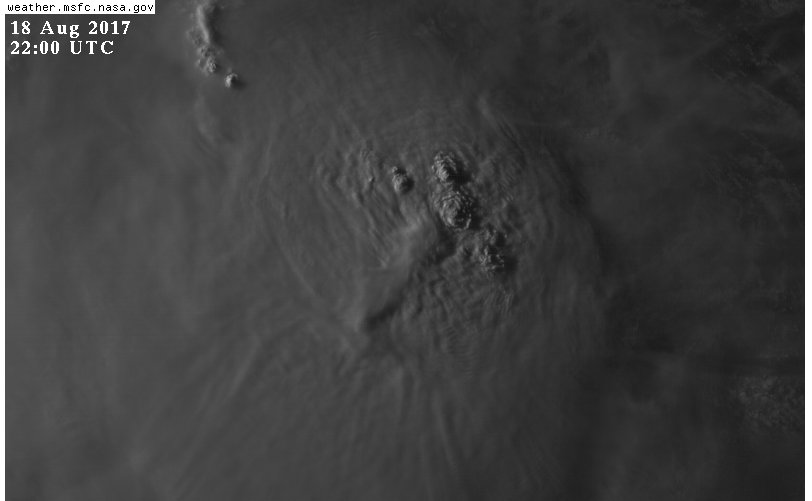
Moisture filling in and 200mb vort a bit less strong.

Image

Image
0 likes   

User avatar
cycloneye
Admin
Admin
Posts: 139345
Age: 67
Joined: Thu Oct 10, 2002 10:54 am
Location: San Juan, Puerto Rico

Re: ATL: HARVEY - Tropical Storm - Discussion

#522 Postby cycloneye » Fri Aug 18, 2017 3:39 pm

Tropical Storm Harvey Discussion Number 6
NWS National Hurricane Center Miami FL AL092017
500 PM AST Fri Aug 18 2017

Again, there has been little change in the structure of Harvey,
with the low-level center near the eastern edge of a strong, but
poorly organized, convective area. Earlier reports from an Air
Force Reserve Hurricane Hunter aircraft included winds suggesting
an increased intensity. However, due to uncertainties in how
representative these measurements were, no appreciable change in
the central pressure, and no improvement in the structure, the
initial intensity is held at 35 kt.

The initial motion is 275/18. A strong low- to mid-level ridge
north of the cyclone should keep Harvey on this general motion
for the next 3 days or so, with the system moving from the eastern
to the western Caribbean Sea during this time. After 72 h, a
west-northwestward motion with a decrease in forward speed is
expected when Harvey passes near or over portions of Central
America, the Yucatan Peninsula, and eastern Mexico. The new
forecast track is a little faster then the previous track, but
there were only minor changes in the direction. It should be noted
that there is considerable uncertainty about how far north Harvey
might get over the Bay of Campeche, with several of the large-scale
models not bringing the center back over the water on the latest
runs.

The current shear should persist for about the next 48 h, and
thus the intensity forecast continues the trend of slow
strengthening during this time. However, the GFS and ECMWF again
forecast Harvey to degenerate to an open wave during this time, and
the rest of the intensity guidance has trended toward a weaker
cyclone. This lowers the confidence in intensification. After
48 h, conditions appear more favorable for strengthening, with the
main uncertainty being how much land Harvey will encounter. The
intensity forecast will again call for a peak intensity of 60 kt in
72 h, followed by weakening due to land interaction.


FORECAST POSITIONS AND MAX WINDS

INIT 18/2100Z 13.4N 62.9W 35 KT 40 MPH
12H 19/0600Z 13.6N 65.7W 35 KT 40 MPH
24H 19/1800Z 13.9N 69.3W 40 KT 45 MPH
36H 20/0600Z 14.2N 73.0W 40 KT 45 MPH
48H 20/1800Z 14.5N 76.7W 45 KT 50 MPH
72H 21/1800Z 15.5N 83.5W 60 KT 70 MPH
96H 22/1800Z 17.5N 88.5W 50 KT 60 MPH...INLAND
120H 23/1800Z 19.0N 92.0W 30 KT 35 MPH...OVER WATER

$$
Forecaster Beven
0 likes   
Visit the Caribbean-Central America Weather Thread where you can find at first post web cams,radars
and observations from Caribbean basin members Click Here

User avatar
chaser1
S2K Supporter
S2K Supporter
Posts: 4719
Age: 63
Joined: Sat Oct 15, 2005 5:59 pm
Location: Longwood, Fl

Re: ATL: HARVEY - Tropical Storm - Discussion

#523 Postby chaser1 » Fri Aug 18, 2017 4:18 pm

With the latest discussion laying everything out, i'm gonna go out on a limb here. Assuming that Harvey will have at least maintained its identity as a closed system, I believe that the storm will undergo some significant strengthening at its crossing 70W and within the 24-36 hr. period. I'll further guess that Belize or Yucatan will have to brace for a Cat. 2 or 3 hurricane. As I see it, the cut-off centered over the Florida Straits will continue to not only move westward but more importantly will gain latitude as well. I think that the shear impacting Harvey now will lesson in about 24 hours as the storm moves a little further west and that we'll see a broader upper anticyclonic flow begin to bridge south and over the Central Caribbean. Obviously no models seems to think that and NHC seems to be hinting towards possibly better upper conditions but further out than that. Hmmm, maybe I wont quite bet the farm on it LOL; better I keep it to a 6-pack of beer!
2 likes   
Personal Forecast Disclaimer:
The posts in this forum are NOT official forecast and should not be used as such. They are just the opinion of the poster and may or may not be backed by sound meteorological data. They are NOT endorsed by any professional institution or storm2k.org. For official information, please refer to the NHC and NWS products.


Thetxhurricanemaster
Category 1
Category 1
Posts: 279
Age: 33
Joined: Tue Aug 01, 2017 6:53 pm
Location: Corpus christi

Re: ATL: HARVEY - Tropical Storm - Discussion

#524 Postby Thetxhurricanemaster » Fri Aug 18, 2017 4:22 pm

chaser1 wrote:With the latest discussion laying everything out, i'm gonna go out on a limb here. Assuming that Harvey will have at least maintained its identity as a closed system, I believe that the storm will undergo some significant strengthening at its crossing 70W and within the 24-36 hr. period. I'll further guess that Belize or Yucatan will have to brace for a Cat. 2 or 3 hurricane. As I see it, the cut-off centered over the Florida Straits will continue to not only move westward but more importantly will gain latitude as well. I think that the shear impacting Harvey now will lesson in about 24 hours as the storm moves a little further west and that we'll see a broader upper anticyclonic flow begin to bridge south and over the Central Caribbean. Obviously no models seems to think that and NHC seems to be hinting towards possibly better upper conditions but further out than that. Hmmm, maybe I wont quite bet the farm on it LOL; better I keep it to a 6-pack of beer!

Lol if that came to fruition the trough would definitely pull it due Northward !!!
0 likes   

Thetxhurricanemaster
Category 1
Category 1
Posts: 279
Age: 33
Joined: Tue Aug 01, 2017 6:53 pm
Location: Corpus christi

Re: ATL: HARVEY - Tropical Storm - Discussion

#525 Postby Thetxhurricanemaster » Fri Aug 18, 2017 4:22 pm

Guys what time does the next recon leave ? Can yall please tell me
0 likes   

User avatar
chaser1
S2K Supporter
S2K Supporter
Posts: 4719
Age: 63
Joined: Sat Oct 15, 2005 5:59 pm
Location: Longwood, Fl

Re: ATL: HARVEY - Tropical Storm - Discussion

#526 Postby chaser1 » Fri Aug 18, 2017 4:35 pm

Thetxhurricanemaster wrote:
chaser1 wrote:With the latest discussion laying everything out, i'm gonna go out on a limb here. Assuming that Harvey will have at least maintained its identity as a closed system, I believe that the storm will undergo some significant strengthening at its crossing 70W and within the 24-36 hr. period. I'll further guess that Belize or Yucatan will have to brace for a Cat. 2 or 3 hurricane. As I see it, the cut-off centered over the Florida Straits will continue to not only move westward but more importantly will gain latitude as well. I think that the shear impacting Harvey now will lesson in about 24 hours as the storm moves a little further west and that we'll see a broader upper anticyclonic flow begin to bridge south and over the Central Caribbean. Obviously no models seems to think that and NHC seems to be hinting towards possibly better upper conditions but further out than that. Hmmm, maybe I wont quite bet the farm on it LOL; better I keep it to a 6-pack of beer!

Lol if that came to fruition the trough would definitely pull it due Northward !!!


Perhaps. I dont think it would to the extent that the E. Gulf would have to worry about it; but I could see that set up aid in its gaining enough latitude to pose a potential threat to your guys in Texas.
0 likes   
Personal Forecast Disclaimer:
The posts in this forum are NOT official forecast and should not be used as such. They are just the opinion of the poster and may or may not be backed by sound meteorological data. They are NOT endorsed by any professional institution or storm2k.org. For official information, please refer to the NHC and NWS products.


Thetxhurricanemaster
Category 1
Category 1
Posts: 279
Age: 33
Joined: Tue Aug 01, 2017 6:53 pm
Location: Corpus christi

Re: ATL: HARVEY - Tropical Storm - Discussion

#527 Postby Thetxhurricanemaster » Fri Aug 18, 2017 4:39 pm

chaser1 wrote:
Thetxhurricanemaster wrote:
chaser1 wrote:With the latest discussion laying everything out, i'm gonna go out on a limb here. Assuming that Harvey will have at least maintained its identity as a closed system, I believe that the storm will undergo some significant strengthening at its crossing 70W and within the 24-36 hr. period. I'll further guess that Belize or Yucatan will have to brace for a Cat. 2 or 3 hurricane. As I see it, the cut-off centered over the Florida Straits will continue to not only move westward but more importantly will gain latitude as well. I think that the shear impacting Harvey now will lesson in about 24 hours as the storm moves a little further west and that we'll see a broader upper anticyclonic flow begin to bridge south and over the Central Caribbean. Obviously no models seems to think that and NHC seems to be hinting towards possibly better upper conditions but further out than that. Hmmm, maybe I wont quite bet the farm on it LOL; better I keep it to a 6-pack of beer!

Lol if that came to fruition the trough would definitely pull it due Northward !!!


Perhaps. I dont think it would to the extent that the E. Gulf would have to worry about it; but I could see that set up aid in its gaining enough latitude to pose a potential threat to your guys in Texas.

Of course that's what I meant ! Yeah the Weather Channel says it could impact the Texas coast next week so it's definitely something to watch half of the models are split .... HWRF takes Harvey due North into the Gulf now ! It's a dangerous trend
0 likes   

User avatar
Cunxi Huang
Category 1
Category 1
Posts: 323
Age: 25
Joined: Thu Sep 26, 2013 12:17 pm
Location: San Luis Obispo, CA

Re: ATL: HARVEY - Tropical Storm - Discussion

#528 Postby Cunxi Huang » Fri Aug 18, 2017 4:48 pm

Thetxhurricanemaster wrote:
chaser1 wrote:
Thetxhurricanemaster wrote:Lol if that came to fruition the trough would definitely pull it due Northward !!!


Perhaps. I dont think it would to the extent that the E. Gulf would have to worry about it; but I could see that set up aid in its gaining enough latitude to pose a potential threat to your guys in Texas.

Of course that's what I meant ! Yeah the Weather Channel says it could impact the Texas coast next week so it's definitely something to watch half of the models are split .... HWRF takes Harvey due North into the Gulf now ! It's a dangerous trend


How about just chill down...it is just too early to talk about the long-term forecast. Well the Channel says that could happen NEXT WEEK since it's still Friday today, and HWRF's forecast does not show an impact to Texas. By the way media always exaggerate things sometimes. So just sit down n' watch. Don't be some kind of aggressive.
Last edited by Cunxi Huang on Fri Aug 18, 2017 4:50 pm, edited 1 time in total.
0 likes   
2006 SuTY SAOMAI | 2009 TY LINFA | 2010 TY FANAPI | 2010 SuTY MEGI | 2016 SuTY MERANTI | 2019 SuTY LEKIMA
DO NOT use my posts for life and death decisions. For official information, please refer to products from your RSMC and national weather agency.

Thetxhurricanemaster
Category 1
Category 1
Posts: 279
Age: 33
Joined: Tue Aug 01, 2017 6:53 pm
Location: Corpus christi

Re: ATL: HARVEY - Tropical Storm - Discussion

#529 Postby Thetxhurricanemaster » Fri Aug 18, 2017 4:50 pm

Cunxi Huang wrote:
Thetxhurricanemaster wrote:
chaser1 wrote:
Perhaps. I dont think it would to the extent that the E. Gulf would have to worry about it; but I could see that set up aid in its gaining enough latitude to pose a potential threat to your guys in Texas.

Of course that's what I meant ! Yeah the Weather Channel says it could impact the Texas coast next week so it's definitely something to watch half of the models are split .... HWRF takes Harvey due North into the Gulf now ! It's a dangerous trend


How about just chill down...it is just too early to talk about the long-term forecast. Well the Channel says that could happen NEXT WEEK since it's still Friday today, and HWRF's forecast does not show an impact to Texas. By the way media always exaggerate things sometimes. So just chill down and don't be some kind of aggressive.

I'm not saying it'll happen I'm just saying to stay on watch
1 likes   

Alyono
Professional-Met
Professional-Met
Posts: 6961
Joined: Fri Apr 26, 2013 3:52 pm
Location: Texas Coast

Re: ATL: HARVEY - Tropical Storm - Discussion

#530 Postby Alyono » Fri Aug 18, 2017 4:57 pm

model ping pong continues. GFS now keeps the system alive
0 likes   

User avatar
chaser1
S2K Supporter
S2K Supporter
Posts: 4719
Age: 63
Joined: Sat Oct 15, 2005 5:59 pm
Location: Longwood, Fl

Re: ATL: HARVEY - Tropical Storm - Discussion

#531 Postby chaser1 » Fri Aug 18, 2017 5:08 pm

Alyono wrote:model ping pong continues. GFS now keeps the system alive


Hmmm, I just took a look. Keeps it fairly weak and to the south. Still, will be interesting to see if it even maintains it during future runs
0 likes   
Personal Forecast Disclaimer:
The posts in this forum are NOT official forecast and should not be used as such. They are just the opinion of the poster and may or may not be backed by sound meteorological data. They are NOT endorsed by any professional institution or storm2k.org. For official information, please refer to the NHC and NWS products.


User avatar
Nimbus
Category 5
Category 5
Posts: 4929
Joined: Mon Jul 19, 2004 10:54 am

Re: ATL: HARVEY - Tropical Storm - Discussion

#532 Postby Nimbus » Fri Aug 18, 2017 5:11 pm

Moving pretty fast ATM and the latest convective burst indicates its not going to die off any time soon. Guess we watch the ULL currently over the keys to see if there is any indication it slows down and will take a position to pick this up.
Last edited by Nimbus on Fri Aug 18, 2017 5:29 pm, edited 1 time in total.
0 likes   

User avatar
srainhoutx
S2K Supporter
S2K Supporter
Posts: 6919
Age: 66
Joined: Sun Jan 14, 2007 11:34 am
Location: Haywood County, NC
Contact:

Re: ATL: HARVEY - Tropical Storm - Discussion

#533 Postby srainhoutx » Fri Aug 18, 2017 5:18 pm

Alyono wrote:model ping pong continues. GFS now keeps the system alive


Look at that upper trough dropping S interacting with the TUTT. The models are clearly struggling. Need the NOAA Global Hawk missions and additional NWS Forecast Office special balloon launches next week.
1 likes   
Carla/Alicia/Jerry(In The Eye)/Michelle/Charley/Ivan/Dennis/Katrina/Rita/Wilma/Ike/Harvey

Member: National Weather Association
Wx Infinity Forums
http://wxinfinity.com/index.php

Facebook.com/WeatherInfinity
Twitter @WeatherInfinity

User avatar
bubba hotep
S2K Supporter
S2K Supporter
Posts: 5531
Joined: Wed Dec 28, 2016 1:00 am
Location: Collin County Texas

Re: ATL: HARVEY - Tropical Storm - Discussion

#534 Postby bubba hotep » Fri Aug 18, 2017 5:21 pm

Getting a little feisty here at sunset

Image
0 likes   
Winter time post are almost exclusively focused on the DFW area.

Thetxhurricanemaster
Category 1
Category 1
Posts: 279
Age: 33
Joined: Tue Aug 01, 2017 6:53 pm
Location: Corpus christi

Re: ATL: HARVEY - Tropical Storm - Discussion

#535 Postby Thetxhurricanemaster » Fri Aug 18, 2017 5:22 pm

srainhoutx wrote:
Alyono wrote:model ping pong continues. GFS now keeps the system alive


Look at that upper trough dropping S interacting with the TUTT. The models are clearly struggling. Need the NOAA Global Hawk missions and additional NWS Forecast Office special balloon launches next week.

GFS stalls this in the BOC for awhile !!!!
1 likes   

stormreader
Category 5
Category 5
Posts: 1242
Joined: Fri Jun 24, 2011 10:58 am

Re: ATL: HARVEY - Tropical Storm - Discussion

#536 Postby stormreader » Fri Aug 18, 2017 5:46 pm

chaser1 wrote:With the latest discussion laying everything out, i'm gonna go out on a limb here. Assuming that Harvey will have at least maintained its identity as a closed system, I believe that the storm will undergo some significant strengthening at its crossing 70W and within the 24-36 hr. period. I'll further guess that Belize or Yucatan will have to brace for a Cat. 2 or 3 hurricane. As I see it, the cut-off centered over the Florida Straits will continue to not only move westward but more importantly will gain latitude as well. I think that the shear impacting Harvey now will lesson in about 24 hours as the storm moves a little further west and that we'll see a broader upper anticyclonic flow begin to bridge south and over the Central Caribbean. Obviously no models seems to think that and NHC seems to be hinting towards possibly better upper conditions but further out than that. Hmmm, maybe I wont quite bet the farm on it LOL; better I keep it to a 6-pack of beer!


Very bold. For the sake of your prediction--good luck!
0 likes   

User avatar
lrak
S2K Supporter
S2K Supporter
Posts: 1770
Age: 57
Joined: Thu Jun 21, 2007 2:48 pm
Location: Corpus Christi, TX

Re: ATL: HARVEY - Tropical Storm - Discussion

#537 Postby lrak » Fri Aug 18, 2017 5:47 pm

Shoot, we haven't had a real threat since 1980 with Allen. I sure hope it doesn't form up like some are saying, I like my A/C and running water. I don't want to go to SA and get a hotel, my salt tank will die. Hopefully it'll just be a sheared storm with lots of beneficial rain. After reading all the posts on Storm2K of post hurricane strikes over the years has me a bit worried now, especially all the stories from Florida and Louisiana.

Hurricane Allen https://en.wikipedia.org/wiki/Hurricane_Allen#/media/File:Allen_1980_track.png
0 likes   
AKA karl

Also
Personal Forecast Disclaimer:
My posts on this forum are NOT official forecast and should not be used as such. My posts are my basic observations and are definitely not backed by any "well some" meteorological knowledge. For official information, please refer to the NHC and NWS products.

stormreader
Category 5
Category 5
Posts: 1242
Joined: Fri Jun 24, 2011 10:58 am

Re: ATL: HARVEY - Tropical Storm - Discussion

#538 Postby stormreader » Fri Aug 18, 2017 5:50 pm

Thetxhurricanemaster wrote:
Cunxi Huang wrote:
Thetxhurricanemaster wrote:Of course that's what I meant ! Yeah the Weather Channel says it could impact the Texas coast next week so it's definitely something to watch half of the models are split .... HWRF takes Harvey due North into the Gulf now ! It's a dangerous trend


How about just chill down...it is just too early to talk about the long-term forecast. Well the Channel says that could happen NEXT WEEK since it's still Friday today, and HWRF's forecast does not show an impact to Texas. By the way media always exaggerate things sometimes. So just chill down and don't be some kind of aggressive.

I'm not saying it'll happen I'm just saying to stay on watch

South Texas may be the "conservative" forecast. Going to say at least that. At least north of the border.
0 likes   

Thetxhurricanemaster
Category 1
Category 1
Posts: 279
Age: 33
Joined: Tue Aug 01, 2017 6:53 pm
Location: Corpus christi

Re: ATL: HARVEY - Tropical Storm - Discussion

#539 Postby Thetxhurricanemaster » Fri Aug 18, 2017 5:50 pm

lrak wrote:Shoot, we haven't had a real threat since 1980 with Allen. I sure hope it doesn't form up like some are saying, I like my A/C and running water. I don't want to go to SA and get a hotel, my salt tank will die. Hopefully it'll just be a sheared storm with lots of beneficial rain. After reading all the posts on Storm2K of post hurricane strikes over the years has me a bit worried now, especially all the stories from Florida and Louisiana.

Hurricane Allen https://en.wikipedia.org/wiki/Hurricane_Allen#/media/File:Allen_1980_track.png

If your in Texas this definitely needs to be watched ...
0 likes   

stormreader
Category 5
Category 5
Posts: 1242
Joined: Fri Jun 24, 2011 10:58 am

Re: ATL: HARVEY - Tropical Storm - Discussion

#540 Postby stormreader » Fri Aug 18, 2017 5:56 pm

lrak wrote:Shoot, we haven't had a real threat since 1980 with Allen. I sure hope it doesn't form up like some are saying, I like my A/C and running water. I don't want to go to SA and get a hotel, my salt tank will die. Hopefully it'll just be a sheared storm with lots of beneficial rain. After reading all the posts on Storm2K of post hurricane strikes over the years has me a bit worried now, especially all the stories from Florida and Louisiana.

Hurricane Allen https://en.wikipedia.org/wiki/Hurricane_Allen#/media/File:Allen_1980_track.png


You're right. You guys are overdue (expecially for a major). And Allen was in some kind of a weakening phase as he approached the Brownsville area.
I think Celia '71 (from memory) may have been worse for Corpus. Cat 3??? I believe. Seems like it rounded the top of the Yucatan coast before heading to Corpus. From what I've read, the big one for Corpus was the great 1919 storm. Know for being extremely large and slow moving. But it came east to west across the GOM from the general direction of the keys. And in mid Sept too. Unusual that it had so little northerly component in Sept. Pressure 27.37 (all from memory--think I'm basically right).
0 likes   


Return to “2017”

Who is online

Users browsing this forum: No registered users and 5 guests