BoB: CYCLONE MORA
Moderator: S2k Moderators
Re: BoB: CYCLONE MORA
center keeps oscillatting around 91.5. That is the key lat as it means the difference from east of Chittagong, keeping the surge low, or west of the city, which would produce a very high tidal surge
0 likes
Re: BoB: CYCLONE MORA
I hope this is not a real video because if it is, this is only the fringes of Mora
https://twitter.com/mir_sidiquee/status ... 6701022212
https://twitter.com/mir_sidiquee/status ... 6701022212
0 likes
-
Yellow Evan

- Professional-Met

- Posts: 15951
- Age: 25
- Joined: Fri Jul 15, 2011 12:48 pm
- Location: Henderson, Nevada/Honolulu, HI
- Contact:
Re: BoB: CYCLONE MORA
IO, 02, 201705292030, 10, DVTS, CI, , 2010N, 9180E, , 2, 65, 2, , , , , , , , , , , , , , , , , B, KNES, VK, IM, 3, 4040 /////, , , HMWRI8, LLCC, T, DT=4.0 BO CBND MET=4.0 PT=4.0 FTBO DT
0 likes
-
SouthDadeFish

- Professional-Met
- Posts: 2835
- Joined: Thu Sep 23, 2010 2:54 pm
- Location: Miami, FL
- Contact:
Re: BoB: CYCLONE MORA
Mora is another great example of how valuable 37-GHz imagery is. The symmetric ring was apparent at 12Z. The shallow convection preceded the symmetric, deep convection apparent on 85-GHz imagery. Glad this thing is running out of time over water, or else look out... Still could be a very dangerous situation.
1 likes
Re: BoB: CYCLONE MORA
SouthDadeFish wrote:Mora is another great example of how valuable 37-GHz imagery is. The symmetric ring was apparent at 12Z. The shallow convection preceded the symmetric, deep convection apparent on 85-GHz imagery. Glad this thing is running out of time over water, or else look out... Still could be a very dangerous situation.
unfortunately, I think we're looking at something really bad right now. This has the look of a 70-75 kt cyclone that is intensifying rapidly now. Cannot rule out 90 kts at landfall.
However, one more day over water, as you siad, would have been beyond catastrophic. The initial MU cat 5 forecasts could have come true then
0 likes

Re: BoB: CYCLONE MORA
and IMD just did something borderline criminal. They just issued an advisory that said no intensification has occurred
They need to be stopped, as their products were at least partially responsible for the Nargis tragedy, and are failing to provide adequate warning this time
They need to be stopped, as their products were at least partially responsible for the Nargis tragedy, and are failing to provide adequate warning this time
1 likes


Re: BoB: CYCLONE MORA
Guess the most important question is how much east component is there to the northerly movement.
0 likes

-
Digital-TC-Chaser
Re: BoB: CYCLONE MORA
Imran_doomhaM_Wx wrote::cry:
clearly now a cyclone with a very destructive core.
Last edited by Digital-TC-Chaser on Mon May 29, 2017 11:51 pm, edited 1 time in total.
0 likes
Re: BoB: CYCLONE MORA
Well, the loops sez straight north so far. Keeps that way for the next, well, even three hours, is likely to be pretty bad.
0 likes
-
StormChaser75

- Tropical Depression

- Posts: 92
- Age: 22
- Joined: Sat Feb 06, 2016 4:23 pm
- Location: Corpus Christi TX
- Contact:


-
doomhaMwx

- Category 5

- Posts: 2398
- Age: 25
- Joined: Tue Apr 18, 2017 4:01 am
- Location: Baguio/Benguet, Philippines
- Contact:
Re: BoB: CYCLONE MORA
Now a Category 1 per latest(00z) JTWC update...
02B MORA 170530 0000 21.0N 91.8E IO 65 974
02B MORA 170530 0000 21.0N 91.8E IO 65 974
0 likes
Re: BoB: CYCLONE MORA
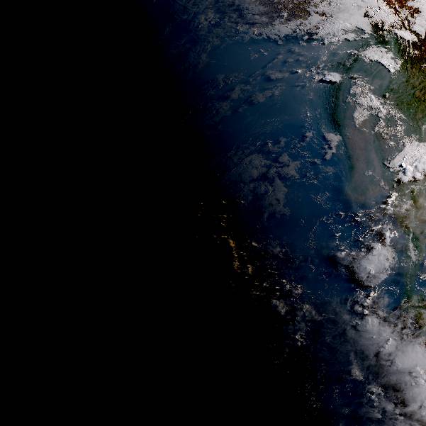
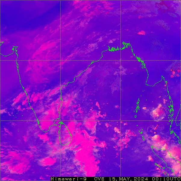
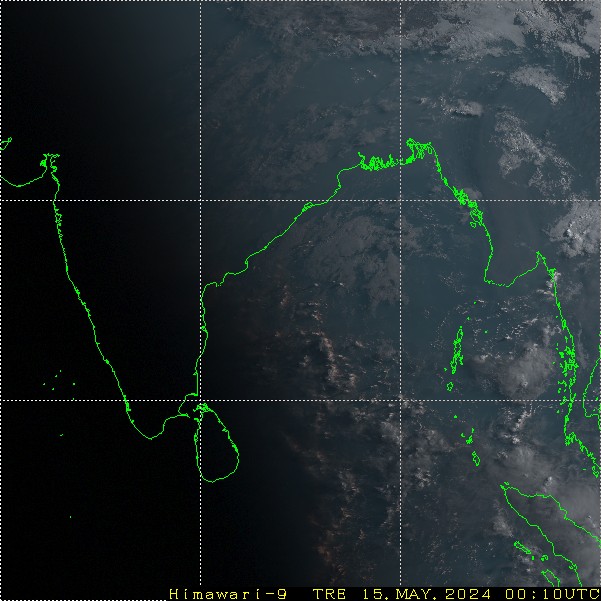
meteosat imagery also confirms that landfall has occurred around Cox's Bazar. Himiwari should NOT be used for precise center tracking as it is on the edge of the satellite. Thus, it's position will be slightly off
0 likes

Re: BoB: CYCLONE MORA
Alyono wrote:meteosat imagery also confirms that landfall has occurred around Cox's Bazar. Himiwari should NOT be used for precise center tracking as it is on the edge of the satellite. Thus, it's position will be slightly off
How much impact may the storm have? Is there any idea how long it will be in Land around Bangladesh? Also, does it moving toward Chittagong?
0 likes
Md. Yasin Kabir
Who is online
Users browsing this forum: No registered users and 106 guests