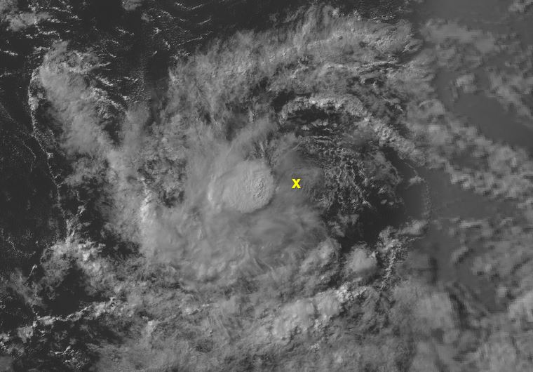
ATL: BERYL - Post-Tropical

Moderator: S2k Moderators

Message
Author
User avatar
Gustywind
Category 5
Category 5
Posts: 12334
Joined: Mon Sep 03, 2007 7:29 am
Location: Baie-Mahault, GUADELOUPE

Re: ATL: INVEST 95L - Discussion

#61 Postby Gustywind » Wed Jul 04, 2018 7:57 am

cycloneye wrote:
Gustywind wrote:
cycloneye wrote:
A small area of low pressure associated with a tropical wave is
producing a concentrated area of showers several hundred miles
west-southwest of the Cabo Verde Islands. Some additional
development of this system is possible during the next few days
while the low moves westward at 10 to 15 mph over the tropical
Atlantic Ocean. Upper-level winds are expected to become less
conducive for development by this weekend when the system approaches
the Lesser Antilles.
* Formation chance through 48 hours...low...30 percent.
* Formation chance through 5 days...low...30 percent.

Increasing % :eek:. Could we deal with a poor barely TD/TS close to the Leewards by the weekend? :roll:


Anything is possible however the probable outlook is we get plenty of bad weather Sunday thru Monday but not as a Tropical Depression or Storm.

Ok Luis i think that. Anyway, we should continue to keep an eye on. Looks like SAL in vicinity should have interaction with this low pressure IMO. Stay tuned.
0 likes   

User avatar
GeneratorPower
S2K Supporter
S2K Supporter
Posts: 1648
Age: 44
Joined: Sun Dec 18, 2005 11:48 pm
Location: Huntsville, AL

ATL: INVEST 95L - Models

#62 Postby GeneratorPower » Wed Jul 04, 2018 8:01 am

The El Niño groupies saying season cancel are going to end up wrong again this year, it seems. The naysayers are all focused on the weak, impotent little pseudoNino we have in the Pacific but ignoring the overall not too bad conditions in the ATL. There are factors we don’t understand in cyclogenesis. And a TS from the “icy” MDR in early July? There is something else going on here. Focus on wind shear and overall thermodynamics (instability) NOT raw water temperature, which by the way is only a fraction of a degree cooler than average across large swaths of the MDR.
6 likes   

Eric Webb
Tropical Storm
Tropical Storm
Posts: 154
Joined: Fri Mar 13, 2015 10:42 pm
Contact:

Re: ATL: INVEST 95L - Discussion

#63 Postby Eric Webb » Wed Jul 04, 2018 8:01 am

I hate to be that guy but this is one of the most organized code yellow invests I've ever seen, I think the NHC is still low-balling it w/ 30% at 8am. While the window for genesis is certainly less than ideal for 95L, the CCKW passage overhead combined with the fact that this has consolidated, persistent moderate-deep convection over the sharp wave axis for at least the last 18-24 hours or so, and is relatively small (thus is capable of spinning up quickly), and given the support for at least a depression from the EPS and GEFS, I certainly see at least a moderate chance for development here already.
6 likes   

User avatar
wxman57
Moderator-Pro Met
Moderator-Pro Met
Posts: 22482
Age: 66
Joined: Sat Jun 21, 2003 8:06 pm
Location: Houston, TX (southwest)

Re: ATL: INVEST 95L - Discussion

#64 Postby wxman57 » Wed Jul 04, 2018 8:04 am

Center is near 10.33N / 35.05W. Looks like it's a TD, to me. ASCAT heading that way.

Image
2 likes   

Eric Webb
Tropical Storm
Tropical Storm
Posts: 154
Joined: Fri Mar 13, 2015 10:42 pm
Contact:

Re: ATL: INVEST 95L - Discussion

#65 Postby Eric Webb » Wed Jul 04, 2018 8:04 am

wxman57 wrote:Looked better yesterday. The environment gets more hostile the farther west it tracks. If it was in the Gulf, it would have been classified as a TD yesterday, but since it's far out to sea and will likely fall apart soon, it's not being upgraded.


Definitely disagree here, the invest still looks solid on GOES-16 and moderate-deep convection continues to persist and further consolidate over the sharp wave axis, it's likely to hold it's own until the weekend, this still has a 2-3 day window to further organize into a depression and I don't think it's far from it right now.
0 likes   

User avatar
GCANE
S2K Supporter
S2K Supporter
Posts: 10787
Joined: Mon Oct 22, 2007 8:03 am

Re: ATL: INVEST 95L - Discussion

#66 Postby GCANE » Wed Jul 04, 2018 8:04 am

Looking at Water Vapor, mid-level moisture not bad around the spinning convection.
Classic well-protected pouch.

Image
1 likes   

User avatar
GCANE
S2K Supporter
S2K Supporter
Posts: 10787
Joined: Mon Oct 22, 2007 8:03 am

Re: ATL: INVEST 95L - Discussion

#67 Postby GCANE » Wed Jul 04, 2018 8:08 am

Looking a little more at WV and seeing some popups firing SW and E of the CoC.
Plenty of juice in this guy.
0 likes   

User avatar
Siker
Category 4
Category 4
Posts: 904
Age: 27
Joined: Thu Oct 25, 2012 7:36 pm
Location: Miami, FL

Re: ATL: INVEST 95L - Discussion

#68 Postby Siker » Wed Jul 04, 2018 8:08 am

With its small size, doubt that mass of convection to the south is doing it any favors. Probably stealing low level convergence, which would explain the further shrinking of convective cover over the actual low.
1 likes   

User avatar
wxman57
Moderator-Pro Met
Moderator-Pro Met
Posts: 22482
Age: 66
Joined: Sat Jun 21, 2003 8:06 pm
Location: Houston, TX (southwest)

Re: ATL: INVEST 95L - Discussion

#69 Postby wxman57 » Wed Jul 04, 2018 8:13 am

Eric Webb wrote:
wxman57 wrote:Looked better yesterday. The environment gets more hostile the farther west it tracks. If it was in the Gulf, it would have been classified as a TD yesterday, but since it's far out to sea and will likely fall apart soon, it's not being upgraded.


Definitely disagree here, the invest still looks solid on GOES-16 and moderate-deep convection continues to persist and further consolidate over the sharp wave axis, it's likely to hold it's own until the weekend, this still has a 2-3 day window to further organize into a depression and I don't think it's far from it right now.


It's showing more signs of easterly low-level wind shear today. Convection isn't centered over the circulation, as it was yesterday.
0 likes   

Eric Webb
Tropical Storm
Tropical Storm
Posts: 154
Joined: Fri Mar 13, 2015 10:42 pm
Contact:

Re: ATL: INVEST 95L - Discussion

#70 Postby Eric Webb » Wed Jul 04, 2018 8:17 am

wxman57 wrote:
Eric Webb wrote:
wxman57 wrote:Looked better yesterday. The environment gets more hostile the farther west it tracks. If it was in the Gulf, it would have been classified as a TD yesterday, but since it's far out to sea and will likely fall apart soon, it's not being upgraded.


Definitely disagree here, the invest still looks solid on GOES-16 and moderate-deep convection continues to persist and further consolidate over the sharp wave axis, it's likely to hold it's own until the weekend, this still has a 2-3 day window to further organize into a depression and I don't think it's far from it right now.


It's showing more signs of easterly low-level wind shear today. Convection isn't centered over the circulation, as it was yesterday.


I'm not sure you can say that because really don't know if there's even a LLC yet, and convection still looks centered generally where it needs to be wrt the wave axis.
0 likes   

Eric Webb
Tropical Storm
Tropical Storm
Posts: 154
Joined: Fri Mar 13, 2015 10:42 pm
Contact:

Re: ATL: INVEST 95L - Discussion

#71 Postby Eric Webb » Wed Jul 04, 2018 8:22 am

Just to reaffirm what I was saying earlier wrt the current organization of 95L

 https://twitter.com/TropicalTidbits/status/1014496312362979328


1 likes   

User avatar
cycloneye
Admin
Admin
Posts: 139137
Age: 67
Joined: Thu Oct 10, 2002 10:54 am
Location: San Juan, Puerto Rico

Re: ATL: INVEST 95L - Discussion

#72 Postby cycloneye » Wed Jul 04, 2018 8:26 am

Off Topic Note: I regret to say that name but I have to from now until it dissipates as we have another MARIA,this time in the Western Pacific and it could intensify to a SuperTyphoon and affect land.
4 likes   
Visit the Caribbean-Central America Weather Thread where you can find at first post web cams,radars
and observations from Caribbean basin members Click Here

Eric Webb
Tropical Storm
Tropical Storm
Posts: 154
Joined: Fri Mar 13, 2015 10:42 pm
Contact:

Re: ATL: INVEST 95L - Discussion

#73 Postby Eric Webb » Wed Jul 04, 2018 8:30 am

1 likes   

User avatar
WAcyclone
Category 1
Category 1
Posts: 349
Joined: Sat Jul 01, 2017 1:56 pm
Location: Perth, Western Australia

Re: ATL: INVEST 95L - Discussion

#74 Postby WAcyclone » Wed Jul 04, 2018 8:34 am

wxman57 wrote:Got a hit with ASCAT. Confirms circulation is above the surface. Red "x" marks the apparent center on the satellite image I posted above at the same time as the ASCAT:

http://wxman57.com/images/95Lb.JPG


That red X is at 36W (not 35W) according to FNMOC. It doesn't seem ASCAT actually hit the interesting part of the system.

Image
1 likes   

User avatar
NotSparta
Professional-Met
Professional-Met
Posts: 1649
Age: 22
Joined: Fri Aug 18, 2017 8:24 am
Location: Naples, FL
Contact:

Re: ATL: INVEST 95L - Discussion

#75 Postby NotSparta » Wed Jul 04, 2018 8:39 am

Eric Webb wrote:[tweet]https://twitter.com/TropicalTidbits/status/1014500789572816896[tweet]


you can see those small convective burst

Image
0 likes   
This post was probably an opinion of mine, and in no way is official. Please refer to http://www.hurricanes.gov for official tropical analysis and advisories.

My website, with lots of tropical wx graphics, including satellite and recon: http://cyclonicwx.com

User avatar
SouthDadeFish
Professional-Met
Professional-Met
Posts: 2835
Joined: Thu Sep 23, 2010 2:54 pm
Location: Miami, FL
Contact:

Re: ATL: INVEST 95L - Discussion

#76 Postby SouthDadeFish » Wed Jul 04, 2018 9:10 am

Any potential surface circulation associated with 95L is likely to be very small. I don't think the location of the recent ASCAT pass necessarily disproves the possibility of a surface circulation, but it definitely doesn't confirm one either.
3 likes   

User avatar
wxman57
Moderator-Pro Met
Moderator-Pro Met
Posts: 22482
Age: 66
Joined: Sat Jun 21, 2003 8:06 pm
Location: Houston, TX (southwest)

Re: ATL: INVEST 95L - Discussion

#77 Postby wxman57 » Wed Jul 04, 2018 9:48 am

Disturbance is embedded in strong easterly trades. Visible loop indicates any LLC is well SE of the convection (red crosshairs).

Image
0 likes   

User avatar
Gustywind
Category 5
Category 5
Posts: 12334
Joined: Mon Sep 03, 2007 7:29 am
Location: Baie-Mahault, GUADELOUPE

Re: ATL: INVEST 95L - Discussion

#78 Postby Gustywind » Wed Jul 04, 2018 9:56 am

DATE/TIME LAT LON CLASSIFICATION STORM
04/1145 UTC 10.2N 34.8W T1.0/1.0 95L
04/0545 UTC 10.1N 33.7W T1.5/1.5 95L
03/2345 UTC 9.4N 31.9W T1.0/1.0 95L
0 likes   

Alyono
Professional-Met
Professional-Met
Posts: 6961
Joined: Fri Apr 26, 2013 3:52 pm
Location: Texas Coast

Re: ATL: INVEST 95L - Discussion

#79 Postby Alyono » Wed Jul 04, 2018 10:00 am

DATE TIME LAT LON CLASSIFICATION ID NAME
20180704 1145 10.2 34.8 T2.0/2.0 95L 95L
20180704 0545 10.1 33.7 T1.5/1.5 95L 95L
20180703 2345 9.4 31.9 T1.0/1.0 95L 95L
0 likes   

User avatar
Gustywind
Category 5
Category 5
Posts: 12334
Joined: Mon Sep 03, 2007 7:29 am
Location: Baie-Mahault, GUADELOUPE

Re: ATL: INVEST 95L - Discussion

#80 Postby Gustywind » Wed Jul 04, 2018 10:19 am

Alyono wrote:DATE TIME LAT LON CLASSIFICATION ID NAME
20180704 1145 10.2 34.8 T2.0/2.0 95L 95L
20180704 0545 10.1 33.7 T1.5/1.5 95L 95L
20180703 2345 9.4 31.9 T1.0/1.0 95L 95L

Looks like you have the latest trend, thanks :)
0 likes   


Return to “2018”

Who is online

Users browsing this forum: No registered users and 40 guests