WPAC: JEBI - Post-Tropical

Moderator: S2k Moderators

Message
Author
User avatar
mrbagyo
Category 5
Category 5
Posts: 3614
Age: 31
Joined: Thu Apr 12, 2012 9:18 am
Location: 14.13N 120.98E
Contact:

WPAC: JEBI - Post-Tropical

#1 Postby mrbagyo » Fri Aug 24, 2018 5:50 pm

I like the appearance and location of this new invest.
Latest runs of both Euro and GFS develops this system then recurves it towards uhmm... Japan?

94W INVEST 180824 1800 8.0N 166.2E WPAC 15 1007
Image

Image


Image
Last edited by mrbagyo on Wed Aug 29, 2018 3:54 am, edited 3 times in total.
0 likes   
The posts in this forum are NOT official forecast and should not be used as such. They are just the opinion of the poster and may or may not be backed by sound meteorological data. They are NOT endorsed by any professional institution or storm2k.org. For official information, please refer to RSMC, NHC and NWS products.

User avatar
1900hurricane
Category 5
Category 5
Posts: 6044
Age: 32
Joined: Fri Feb 06, 2015 12:04 pm
Location: Houston, TX
Contact:

Re: WPAC: INVEST 94W

#2 Postby 1900hurricane » Fri Aug 24, 2018 8:59 pm

It's been a while since we've had a good disturbance this far south and east. Definitely a little more El Nino-esqe.
0 likes   
Contract Meteorologist. TAMU & MSST. Fiercely authentic, one of a kind. We are all given free will, so choose a life meant to be lived. We are the Masters of our own Stories.
Opinions expressed are mine alone.

Follow me on Twitter at @1900hurricane : Read blogs at https://1900hurricane.wordpress.com/

User avatar
euro6208
Category 5
Category 5
Posts: 18547
Joined: Mon Mar 08, 2004 7:50 pm
Location: Guam

Re: WPAC: INVEST 94W

#3 Postby euro6208 » Sat Aug 25, 2018 1:26 am

000
WWPQ80 PGUM 242206
SPSPQ

SPECIAL WEATHER STATEMENT
NATIONAL WEATHER SERVICE TIYAN GU
806 AM ChST Sat Aug 25 2018

PMZ172-173-174-181-252245-
CHUUK-POHNPEI-KOSRAE-MAJURO-
806 AM ChST Sat Aug 25 2018

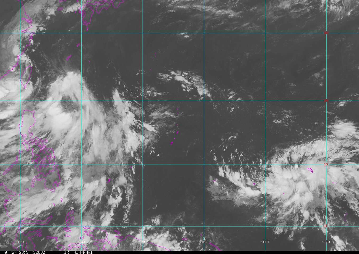
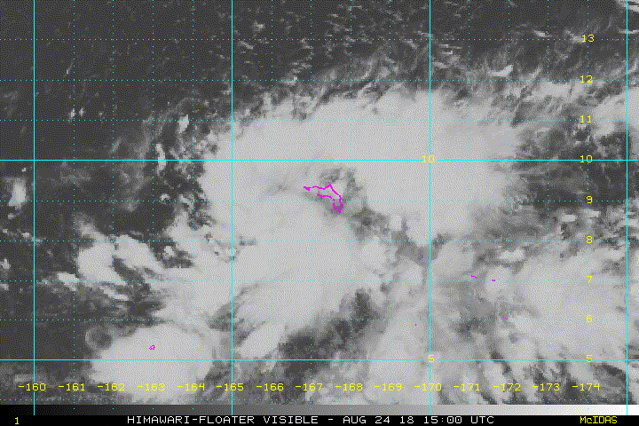
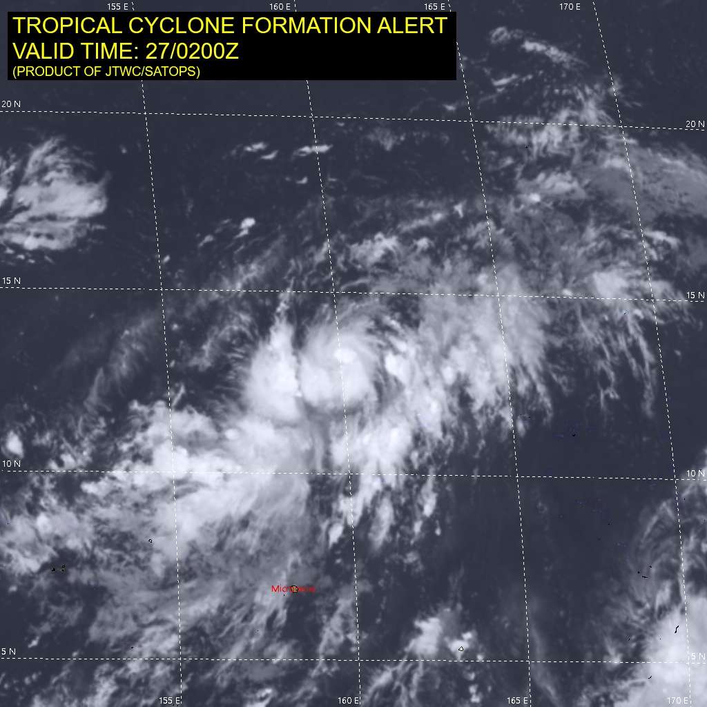
...TROPICAL DISTURBANCE OVER THE MARSHALL ISLANDS AND KOSRAE
STATE...

A TROPICAL DISTURBANCE CENTERED ABOUT 120 MILES TO THE SOUTHWEST OF
KWAJALEIN AND 275 MILES NORTHEAST OF KOSRAE IS CAUSING HEAVY SHOWERS
WITH LOCALLY GUSTY WINDS OF 30 TO 40 MPH FROM NEAR POHNPEI ACROSS
KOSRAE STATE INTO THE NORTHERN MARSHALL ISLANDS.

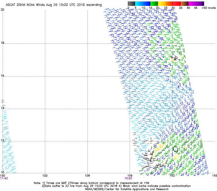
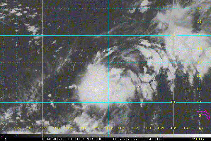
THE DISTURBANCE IS MOVING SLOWLY SO THAT SHOWERS WITH GUSTY WINDS
AND ROUGH SEA CONDITIONS WILL PERSIST ACROSS THESE PARTS OF EASTERN
MICRONESIA FOR THE NEXT DAY OR TWO AT LEAST. AREAS OF HEAVY RAINFALL
WILL CONTINUE AND GRADUALLY MOVE WESTWARD INTO POHNPEI STATE AND THEN
CHUUK STATE BY ABOUT MONDAY.

INTER-ISLAND TRAVEL IS DISCOURAGED WHILE THE DISTURBANCE IS NEARBY
AND OPERATORS OF SMALL CRAFT SHOULD KEEP UPDATED ON CURRENT WEATHER
FORECASTS AND SEA CONDITIONS. WAVE CONDITIONS IN LAGOONS ARE NOT
REPRESENTATIVE OF THE ROUGHER CONDITIONS ON THE OPEN OCEAN.

RESIDENTS OF THESE AREAS SHOULD KEEP INFORMED WITH THE LATEST
FORECASTS AND STATEMENTS FROM THE NATIONAL WEATHER SERVICE AND YOUR
LOCAL EMERGENCY MANAGEMENT OFFICE. THE LATEST WEATHER FORECASTS AND
ADVISORIES FOR MICRONESIA ARE AVAILABLE ON THE WFO GUAM WEBSITE AT
WWW.WEATHER.GOV/GUM/

$$

Simpson
0 likes   
Remember, all of my post aren't official. For official warnings and discussions, Please refer to your local NWS products...

NWS for the Western Pacific

https://www.weather.gov/gum/

Twisted-core
Category 1
Category 1
Posts: 252
Joined: Fri May 11, 2018 9:20 pm

Re: WPAC: INVEST 94W

#4 Postby Twisted-core » Sat Aug 25, 2018 3:22 am

mrbagyo wrote:I like the appearance and location of this new invest.
Latest runs of both Euro and GFS develops this system then recurves it towards uhmm... Japan?


https://imgur.com/cGuz9Bo
UK

https://imgur.com/cxEBh9T
EC


https://imgur.com/KNnXJZs
GFS


Image
0 likes   

User avatar
euro6208
Category 5
Category 5
Posts: 18547
Joined: Mon Mar 08, 2004 7:50 pm
Location: Guam

Re: WPAC: INVEST 94W

#5 Postby euro6208 » Sat Aug 25, 2018 6:12 am

Looks like the models bring this north again towards Japan... :roll:
0 likes   
Remember, all of my post aren't official. For official warnings and discussions, Please refer to your local NWS products...

NWS for the Western Pacific

https://www.weather.gov/gum/

User avatar
euro6208
Category 5
Category 5
Posts: 18547
Joined: Mon Mar 08, 2004 7:50 pm
Location: Guam

Re: WPAC: INVEST 94W

#6 Postby euro6208 » Sat Aug 25, 2018 6:14 am

94W INVEST
As of 06:00 UTC Aug 25, 2018:

Location: 7.6°N 164.3°E
Maximum Winds: 15 kt
Minimum Central Pressure: 1010 mb

Image
0 likes   
Remember, all of my post aren't official. For official warnings and discussions, Please refer to your local NWS products...

NWS for the Western Pacific

https://www.weather.gov/gum/

User avatar
euro6208
Category 5
Category 5
Posts: 18547
Joined: Mon Mar 08, 2004 7:50 pm
Location: Guam

Re: WPAC: INVEST 94W

#7 Postby euro6208 » Sat Aug 25, 2018 6:16 am

NEW TROPICAL STORM FORECAST TO DEVELOP AFTER 48 HOURS

FORECAST POSITION AT T+ 48 : 14.1N 159.6E


VERIFYING TIME POSITION STRENGTH TENDENCY

-------------- -------- -------- --------

00UTC 27.08.2018 14.1N 159.6E WEAK

12UTC 27.08.2018 15.7N 158.4E WEAK LITTLE CHANGE

00UTC 28.08.2018 17.3N 156.7E WEAK LITTLE CHANGE

12UTC 28.08.2018 18.3N 154.7E MODERATE INTENSIFYING SLIGHTLY

00UTC 29.08.2018 18.9N 152.4E MODERATE INTENSIFYING SLIGHTLY

12UTC 29.08.2018 19.2N 150.0E MODERATE INTENSIFYING SLIGHTLY

00UTC 30.08.2018 19.5N 147.2E STRONG INTENSIFYING SLIGHTLY

12UTC 30.08.2018 20.1N 144.1E STRONG INTENSIFYING SLIGHTLY

00UTC 31.08.2018 20.9N 141.1E INTENSE INTENSIFYING SLIGHTLY
0 likes   
Remember, all of my post aren't official. For official warnings and discussions, Please refer to your local NWS products...

NWS for the Western Pacific

https://www.weather.gov/gum/

User avatar
euro6208
Category 5
Category 5
Posts: 18547
Joined: Mon Mar 08, 2004 7:50 pm
Location: Guam

Re: WPAC: INVEST 94W

#8 Postby euro6208 » Sat Aug 25, 2018 6:47 am

EURO

Image
Image

NAVGEM

Image
0 likes   
Remember, all of my post aren't official. For official warnings and discussions, Please refer to your local NWS products...

NWS for the Western Pacific

https://www.weather.gov/gum/

User avatar
euro6208
Category 5
Category 5
Posts: 18547
Joined: Mon Mar 08, 2004 7:50 pm
Location: Guam

Re: WPAC: INVEST 94W

#9 Postby euro6208 » Sat Aug 25, 2018 6:51 am

Image

Such an incredible season for Japan.
0 likes   
Remember, all of my post aren't official. For official warnings and discussions, Please refer to your local NWS products...

NWS for the Western Pacific

https://www.weather.gov/gum/

User avatar
1900hurricane
Category 5
Category 5
Posts: 6044
Age: 32
Joined: Fri Feb 06, 2015 12:04 pm
Location: Houston, TX
Contact:

Re: WPAC: INVEST 94W

#10 Postby 1900hurricane » Sat Aug 25, 2018 3:30 pm

Looks like it may take a couple of days of little development before it gets going according to the latest runs.

Also, test post from Tapatalk.


Sent from my iPhone using Tapatalk
0 likes   
Contract Meteorologist. TAMU & MSST. Fiercely authentic, one of a kind. We are all given free will, so choose a life meant to be lived. We are the Masters of our own Stories.
Opinions expressed are mine alone.

Follow me on Twitter at @1900hurricane : Read blogs at https://1900hurricane.wordpress.com/

User avatar
euro6208
Category 5
Category 5
Posts: 18547
Joined: Mon Mar 08, 2004 7:50 pm
Location: Guam

Re: WPAC: INVEST 94W

#11 Postby euro6208 » Sun Aug 26, 2018 7:19 am

AN AREA OF CONVECTION (INVEST 94W) HAS PERSISTED NEAR
11.4N 161.6E, APPROXIMATELY 550 NM SOUTH-SOUTHWEST OF WAKE ISLAND.
ANIMATED MULTISPECTRAL SATELLITE IMAGERY DEPICTS BROAD TURNING
DEVOID OF A LOW LEVEL CIRCULATION CENTER (LLCC). A 242256Z METOP-A
ASCAT PASS SHOWS GENERAL TROUGHING WITH WEAK WINDS (15 KTS) AND A
250233Z AMSR2 89GHZ IMAGE REVEALS THAT THERE IS SCATTERED
CONVECTION AND BROAD TURNING. THE OVERALL ENVIRONMENT IS FAVORABLE
FOR DEVELOPMENT WITH LOW VERTICAL WIND SHEAR (5-10KTS), GOOD UPPER
LEVEL DIVERGENCE, AND WARM SEA SURFACE TEMPERATURES (28-29C). GLOBAL
MODELS ARE IN AGREEMENT THAT THE SYSTEM WILL TRACK TO THE WEST TO
NORTHWEST AND GRADUALLY DEVELOP INTO A TROPICAL CYCLONE, BUT VARY ON
THE TIMING OF DEVELOPMENT. MAXIMUM SUSTAINED SURFACE WINDS ARE
ESTIMATED AT 10 TO 15 KNOTS. MINIMUM SEA LEVEL PRESSURE IS ESTIMATED
TO BE NEAR 1007 MB. THE POTENTIAL FOR THE DEVELOPMENT OF A
SIGNIFICANT TROPICAL CYCLONE WITHIN THE NEXT 24 HOURS IS LOW.
0 likes   
Remember, all of my post aren't official. For official warnings and discussions, Please refer to your local NWS products...

NWS for the Western Pacific

https://www.weather.gov/gum/

User avatar
euro6208
Category 5
Category 5
Posts: 18547
Joined: Mon Mar 08, 2004 7:50 pm
Location: Guam

Re: WPAC: INVEST 94W

#12 Postby euro6208 » Sun Aug 26, 2018 8:16 am

Image
Image

Much stronger on future Jebi...
0 likes   
Remember, all of my post aren't official. For official warnings and discussions, Please refer to your local NWS products...

NWS for the Western Pacific

https://www.weather.gov/gum/

User avatar
euro6208
Category 5
Category 5
Posts: 18547
Joined: Mon Mar 08, 2004 7:50 pm
Location: Guam

Re: WPAC: INVEST 94W

#13 Postby euro6208 » Sun Aug 26, 2018 8:20 am

GFS

Image
Image
0 likes   
Remember, all of my post aren't official. For official warnings and discussions, Please refer to your local NWS products...

NWS for the Western Pacific

https://www.weather.gov/gum/

User avatar
mrbagyo
Category 5
Category 5
Posts: 3614
Age: 31
Joined: Thu Apr 12, 2012 9:18 am
Location: 14.13N 120.98E
Contact:

Re: WPAC: INVEST 94W

#14 Postby mrbagyo » Sun Aug 26, 2018 10:58 am

Image
0 likes   
The posts in this forum are NOT official forecast and should not be used as such. They are just the opinion of the poster and may or may not be backed by sound meteorological data. They are NOT endorsed by any professional institution or storm2k.org. For official information, please refer to RSMC, NHC and NWS products.

User avatar
euro6208
Category 5
Category 5
Posts: 18547
Joined: Mon Mar 08, 2004 7:50 pm
Location: Guam

Re: WPAC: INVEST 94W

#15 Postby euro6208 » Sun Aug 26, 2018 4:14 pm

THE AREA OF CONVECTION (INVEST 94W) PREVIOUSLY LOCATED
NEAR 11.4N 161.6E, IS NOW LOCATED NEAR 12.0N 160.1E, APPROXIMATELY
900 NM EAST OF GUAM. ANIMATED ENHANCED INFRARED SATELLITE IMAGERY
DEPICTS A CONSOLIDATING LOW LEVEL CIRCULATION CENTER (LLCC) WITH
PERSISTENT DEEP CONVECTION. A 261848Z 91GHZ SSMIS IMAGE DEPICTS
IMPROVED DEEP CONVECTIVE BANDING OVER THE SOUTHERN SEMICIRCLE. A
261102Z ASCAT IMAGE INDICATES AN ELONGATED BUT DEFINED CIRCULATION
WITH 15-20 KTS AROUND THE LLCC. THE UPPER LEVEL ENVIRONMENT IS
FAVORABLE FOR DEVELOPMENT WITH LOW VERTICAL WIND SHEAR (5-10KTS),
GOOD UPPER LEVEL DIVERGENCE, AND WARM SEA SURFACE TEMPERATURES (28-
29C). GLOBAL MODELS ARE IN AGREEMENT THAT THE SYSTEM WILL TRACK TO
THE WEST TO NORTHWEST AND GRADUALLY DEVELOP INTO A TROPICAL CYCLONE,
BUT VARY ON THE TIMING OF DEVELOPMENT. MAXIMUM SUSTAINED SURFACE
WINDS ARE ESTIMATED AT 15 TO 20 KNOTS. MINIMUM SEA LEVEL PRESSURE IS
ESTIMATED TO BE NEAR 1006 MB. THE POTENTIAL FOR THE DEVELOPMENT OF A
SIGNIFICANT TROPICAL CYCLONE WITHIN THE NEXT 24 HOURS IS UPGRADED TO
MEDIUM.
0 likes   
Remember, all of my post aren't official. For official warnings and discussions, Please refer to your local NWS products...

NWS for the Western Pacific

https://www.weather.gov/gum/

Twisted-core
Category 1
Category 1
Posts: 252
Joined: Fri May 11, 2018 9:20 pm

Re: WPAC: INVEST 94W

#16 Postby Twisted-core » Sun Aug 26, 2018 8:14 pm

Just eye balling the satpic, maybe a td has formed.
Image
https://imgur.com/c3C7VMt
0 likes   

User avatar
mrbagyo
Category 5
Category 5
Posts: 3614
Age: 31
Joined: Thu Apr 12, 2012 9:18 am
Location: 14.13N 120.98E
Contact:

Re: WPAC: INVEST 94W

#17 Postby mrbagyo » Sun Aug 26, 2018 8:39 pm

Image

Looking really good this morning but it looks weak on latest ASCAT pass - maybe MLC is just tricking us Lol.
Image

Twisted-core wrote:Just eye balling the satpic, maybe a td has formed.
[im]https://i.imgur.com/c3C7VMt.png[/img]
https://imgur.com/c3C7VMt


JMA still has it as a low - might make it a minor TD soon
1 likes   
The posts in this forum are NOT official forecast and should not be used as such. They are just the opinion of the poster and may or may not be backed by sound meteorological data. They are NOT endorsed by any professional institution or storm2k.org. For official information, please refer to RSMC, NHC and NWS products.

User avatar
mrbagyo
Category 5
Category 5
Posts: 3614
Age: 31
Joined: Thu Apr 12, 2012 9:18 am
Location: 14.13N 120.98E
Contact:

Re: WPAC: INVEST 94W

#18 Postby mrbagyo » Mon Aug 27, 2018 12:04 am

Image
0 likes   
The posts in this forum are NOT official forecast and should not be used as such. They are just the opinion of the poster and may or may not be backed by sound meteorological data. They are NOT endorsed by any professional institution or storm2k.org. For official information, please refer to RSMC, NHC and NWS products.

User avatar
mrbagyo
Category 5
Category 5
Posts: 3614
Age: 31
Joined: Thu Apr 12, 2012 9:18 am
Location: 14.13N 120.98E
Contact:

Re: WPAC: INVEST 94W - Tropical Depression

#19 Postby mrbagyo » Mon Aug 27, 2018 12:08 am

JMA is now calling this a Tropical Depression

Image

TROPICAL DEPRESSION 1008 HPA AT 12N 159E ALMOST STATIONARY.
1 likes   
The posts in this forum are NOT official forecast and should not be used as such. They are just the opinion of the poster and may or may not be backed by sound meteorological data. They are NOT endorsed by any professional institution or storm2k.org. For official information, please refer to RSMC, NHC and NWS products.

User avatar
mrbagyo
Category 5
Category 5
Posts: 3614
Age: 31
Joined: Thu Apr 12, 2012 9:18 am
Location: 14.13N 120.98E
Contact:

Re: WPAC: INVEST 94W - Tropical Depression

#20 Postby mrbagyo » Mon Aug 27, 2018 12:28 am

TCFA
Image
Image

WTPN21 PGTW 270200
MSGID/GENADMIN/JOINT TYPHOON WRNCEN PEARL HARBOR HI//
SUBJ/TROPICAL CYCLONE FORMATION ALERT// RMKS/

1. FORMATION OF A SIGNIFICANT TROPICAL CYCLONE IS POSSIBLE WITHIN 160 NM EITHER SIDE OF A LINE FROM 12.0N 160.3E TO 17.4N 155.2E WITHIN THE NEXT 12 TO 24 HOURS. AVAILABLE DATA DOES NOT JUSTIFY ISSUANCE OF NUMBERED TROPICAL CYCLONE WARNINGS AT THIS TIME. WINDS IN THE AREA ARE ESTIMATED TO BE 20 TO 25 KNOTS. METSAT IMAGERY AT 270130Z INDICATES THAT A CIRCULATION CENTER IS LOCATED NEAR 12.4N 159.8E. THE SYSTEM IS MOVING NORTHWESTWARD AT 06 KNOTS.

2. REMARKS: THE AREA OF CONVECTION (INVEST 94W) PREVIOUSLY LOCATED NEAR 12.0N 160.1E IS NOW LOCATED NEAR 12.4N 159.8E, APPROXIMATELY 885 NM EAST OF GUAM. ANIMATED MULTISPECTRAL SATELLITE IMAGERY AND A 262335Z 89GHZ AMSU IMAGE DEPICT A CONSOLIDATING LOW LEVEL CIRCULATION CENTER (LLCC) WITH IMPROVED DEEP CONVECTIVE BANDING WRAPPING INTO A MORE DEFINED LLCC. A 262235Z ASCAT IMAGE INDICATES AN ELONGATED BUT DEFINED CIRCULATION WITH 15-20 KTS AROUND THE LLCC. THE UPPER LEVEL ENVIRONMENT IS FAVORABLE FOR DEVELOPMENT WITH LOW VERTICAL WIND SHEAR (5-10KTS), GOOD UPPER LEVEL DIVERGENCE, AND WARM SEA SURFACE TEMPERATURES (28-29C). GLOBAL MODELS ARE IN AGREEMENT THAT THE SYSTEM WILL TRACK NORTHWESTWARD OVER THE NEXT 48 HOURS WITH GRADUAL DEVELOPMENT, BUT VARY ON THE TIMING OF DEVELOPMENT. MAXIMUM SUSTAINED SURFACE WINDS ARE ESTIMATED AT 20 TO 25 KNOTS. MINIMUM SEA LEVEL PRESSURE IS ESTIMATED TO BE NEAR 1004 MB. THE POTENTIAL FOR THE DEVELOPMENT OF A SIGNIFICANT TROPICAL CYCLONE WITHIN THE NEXT 24 HOURS IS HIGH.

3. THIS ALERT WILL BE REISSUED, UPGRADED TO WARNING OR CANCELLED BY 280200Z.// NNNN
0 likes   
The posts in this forum are NOT official forecast and should not be used as such. They are just the opinion of the poster and may or may not be backed by sound meteorological data. They are NOT endorsed by any professional institution or storm2k.org. For official information, please refer to RSMC, NHC and NWS products.


Return to “2018”

Who is online

Users browsing this forum: No registered users and 96 guests