ATL: INVEST 95L - Discussion
Moderator: S2k Moderators
-
Stormcenter
- S2K Supporter

- Posts: 6617
- Joined: Wed Sep 03, 2003 11:27 am
- Location: Houston, TX
Re: ATL: INVEST 95L - Discussion
So what is the spin inland over S Texas and how will it affect 95L? I have doubts this will go as far south as TX/MX border.
0 likes

Re: ATL: INVEST 95L - Discussion
Stormcenter wrote:So what is the spin inland over S Texas and how will it affect 95L? I have doubts this will go as far south as TX/MX border.
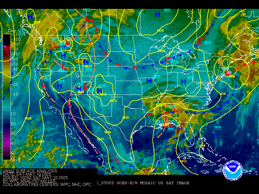
I think it's a combination of a front with surface low and then a stalled TW in the SW Gulf. Pattern (actual weather anyway) has been similar been there for several days interrupting and cooling summer a bit for the coast. Front was farther back the last few days, but here's the latest surface depictions I could find:
http://weather.unisys.com/current-weather/surface-data
https://www.wpc.ncep.noaa.gov/sfc/ussatsfc.gif
https://www.weather.gov/crp/observations
0 likes

Re: ATL: INVEST 95L - Discussion
Steve wrote:Stormcenter wrote:So what is the spin inland over S Texas and how will it affect 95L? I have doubts this will go as far south as TX/MX border.
I think it's a combination of a front with surface low and then a stalled TW in the SW Gulf. Pattern (actual weather anyway) has been similar been there for several days interrupting and cooling summer a bit for the coast. Front was farther back the last few days, but here's the latest surface depictions I could find:
http://weather.unisys.com/current-weather/surface-data
https://www.wpc.ncep.noaa.gov/sfc/ussatsfc.gif
https://www.weather.gov/crp/observations
Yeah it's crept closer to the coast over the last few days, but not by much. Good question is how, if at all, will this affect steering? Is it supposed to move back, which allows 95L to head inland?
0 likes
Personal Forecast Disclaimer:
The posts in this forum are NOT official forecast and should not be used as such. They are just the opinion of the poster and may or may not be backed by sound meteorological data. They are NOT endorsed by any professional institution or storm2k.org. For official information, please refer to the NHC and NWS products.
The posts in this forum are NOT official forecast and should not be used as such. They are just the opinion of the poster and may or may not be backed by sound meteorological data. They are NOT endorsed by any professional institution or storm2k.org. For official information, please refer to the NHC and NWS products.
Re: ATL: INVEST 95L - Discussion
I’m starting to believe that this won’t really be much of anything for SETX besides maybe 2-3” of rain for most parts.
0 likes
-
Sciencerocks
- Category 5

- Posts: 7282
- Age: 38
- Joined: Thu Jul 06, 2017 1:51 am
Re: ATL: INVEST 95L - Discussion
LLC appears to be forming near 22.7/87.5
A depression could form within the next 12-24 hours
Tropical storm is pretty likely
Peak intensity around 45-50 knots
Texas is most likely. This northward development increases the chances of that.

A depression could form within the next 12-24 hours
Tropical storm is pretty likely
Peak intensity around 45-50 knots
Texas is most likely. This northward development increases the chances of that.
2 likes
-
mcheer23

- Professional-Met

- Posts: 422
- Age: 30
- Joined: Sun Jun 24, 2012 8:24 pm
- Location: Sugar Land, Texas
Re: ATL: INVEST 95L - Discussion
Sciencerocks wrote:LLC appears to be forming near 22.7/87.5
A depression could form within the next 12-24 hours
Tropical storm is pretty likely
Peak intensity around 45-50 knots
Texas is most likely. This northward development increases the chances of that.
https://imageshack.com/a/img923/551/r11v5d.gif
I agree. I have had a 60 mph TS between CC and Matagorda for 2 days.
3 likes
Re: ATL: INVEST 95L - Discussion
Cpv17 wrote:I’m starting to believe that this won’t really be much of anything for SETX besides maybe 2-3” of rain for most parts.
What makes you think that? It looks like it is organizing and the odds of it being a lopsided system are higher than not. Especially if it stays a TS or minimal hurricane. That would put SE TX on the dirty side of the system...
1 likes
Re: ATL: INVEST 95L - Discussion
mcheer23 wrote:Sciencerocks wrote:LLC appears to be forming near 22.7/87.5
A depression could form within the next 12-24 hours
Tropical storm is pretty likely
Peak intensity around 45-50 knots
Texas is most likely. This northward development increases the chances of that.
https://imageshack.com/a/img923/551/r11v5d.gif
I agree. I have had a 60 mph TS between CC and Matagorda for 2 days.
Rockport is right in the middle of that. That would be crazy. 2 years in a row with a landfalling system.
1 likes
Re: ATL: INVEST 95L - Discussion
Cpv17 wrote:I’m starting to believe that this won’t really be much of anything for SETX besides maybe 2-3” of rain for most parts.
Our discussions this afternoon focused on this component, and our guys said that they don't believe that the moisture content will be beyond what I posted earlier (2-4") in most places with isolated higher amounts from 6-8". The things about a TS though, is that with saturated ground in some areas, you'll have some tree toppling along with the concern of localized flooding in some areas.
0 likes
Personal Forecast Disclaimer:
The posts in this forum are NOT official forecast and should not be used as such. They are just the opinion of the poster and may or may not be backed by sound meteorological data. They are NOT endorsed by any professional institution or storm2k.org. For official information, please refer to the NHC and NWS products.
The posts in this forum are NOT official forecast and should not be used as such. They are just the opinion of the poster and may or may not be backed by sound meteorological data. They are NOT endorsed by any professional institution or storm2k.org. For official information, please refer to the NHC and NWS products.
-
stormlover2013
- Category 5
- Posts: 2312
- Joined: Thu Aug 22, 2013 12:06 pm
- Location: Lumberton, Texas
-
Stormcenter
- S2K Supporter
- Posts: 6617
- Joined: Wed Sep 03, 2003 11:27 am
- Location: Houston, TX
Re: ATL: INVEST 95L - Discussion
Tough to make any call on landfall or rain potential
when you don’t even have an organized system yet.
Just look how the models are changing with Flo right now.
when you don’t even have an organized system yet.
Just look how the models are changing with Flo right now.
1 likes
Re: ATL: INVEST 95L - Discussion
stormlover2013 wrote:matagorda bay huh, that's gutsy
If it made it that far north it would probably be a bit more stronger and would bring much more wind and rain into our region for sure. I don’t see it making it that far north though. Corpus area looks like a safe bet as of now.
0 likes
-
Stormcenter
- S2K Supporter
- Posts: 6617
- Joined: Wed Sep 03, 2003 11:27 am
- Location: Houston, TX
Re: ATL: INVEST 95L - Discussion
Cpv17 wrote:stormlover2013 wrote:matagorda bay huh, that's gutsy
If it made it that far north it would probably be a bit more stronger and would bring much more wind and rain into our region for sure. I don’t see it making it that far north though. Corpus area looks like a safe bet as of now.
It’s already further north than anyone anticipated.
1 likes
Re: ATL: INVEST 95L - Discussion
7 Day Rainfall Outlook
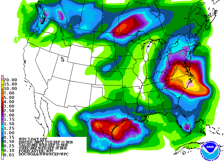
1 likes
Personal Forecast Disclaimer:
The posts in this forum are NOT official forecast and should not be used as such. They are just the opinion of the poster and may or may not be backed by sound meteorological data. They are NOT endorsed by any professional institution or storm2k.org. For official information, please refer to the NHC and NWS products.
The posts in this forum are NOT official forecast and should not be used as such. They are just the opinion of the poster and may or may not be backed by sound meteorological data. They are NOT endorsed by any professional institution or storm2k.org. For official information, please refer to the NHC and NWS products.
-
GumboCane83

- Tropical Wave

- Posts: 9
- Joined: Fri Oct 06, 2017 9:27 pm
-
stormlover2013
- Category 5
- Posts: 2312
- Joined: Thu Aug 22, 2013 12:06 pm
- Location: Lumberton, Texas

Re: ATL: INVEST 95L - Discussion
Thought we were looking at a mid level feature that hopped north over the Yucatan but there does seem to be cyclonic motion in the low level clouds now as well. If it moves pretty fast and doesn't organize very well shouldn't be too bad except where a couple inches of rain can flood.
0 likes
-
jaguars_22
- Category 1

- Posts: 493
- Joined: Tue Jun 20, 2017 2:26 pm

Re: ATL: INVEST 95L - Discussion
jaguars_22 wrote:How fast is this supposed to move?? 0-10? 10-15
We don’t know yet.
0 likes
Re: ATL: INVEST 95L - Discussion
jaguars_22 wrote:How fast is this supposed to move?? 0-10? 10-15
Whatever the distance from where it is now til about 10:00am Friday when NAM has "it" reaching shore. Think this will be Joyce by then, but we'll see.
1 likes
Who is online
Users browsing this forum: No registered users and 17 guests