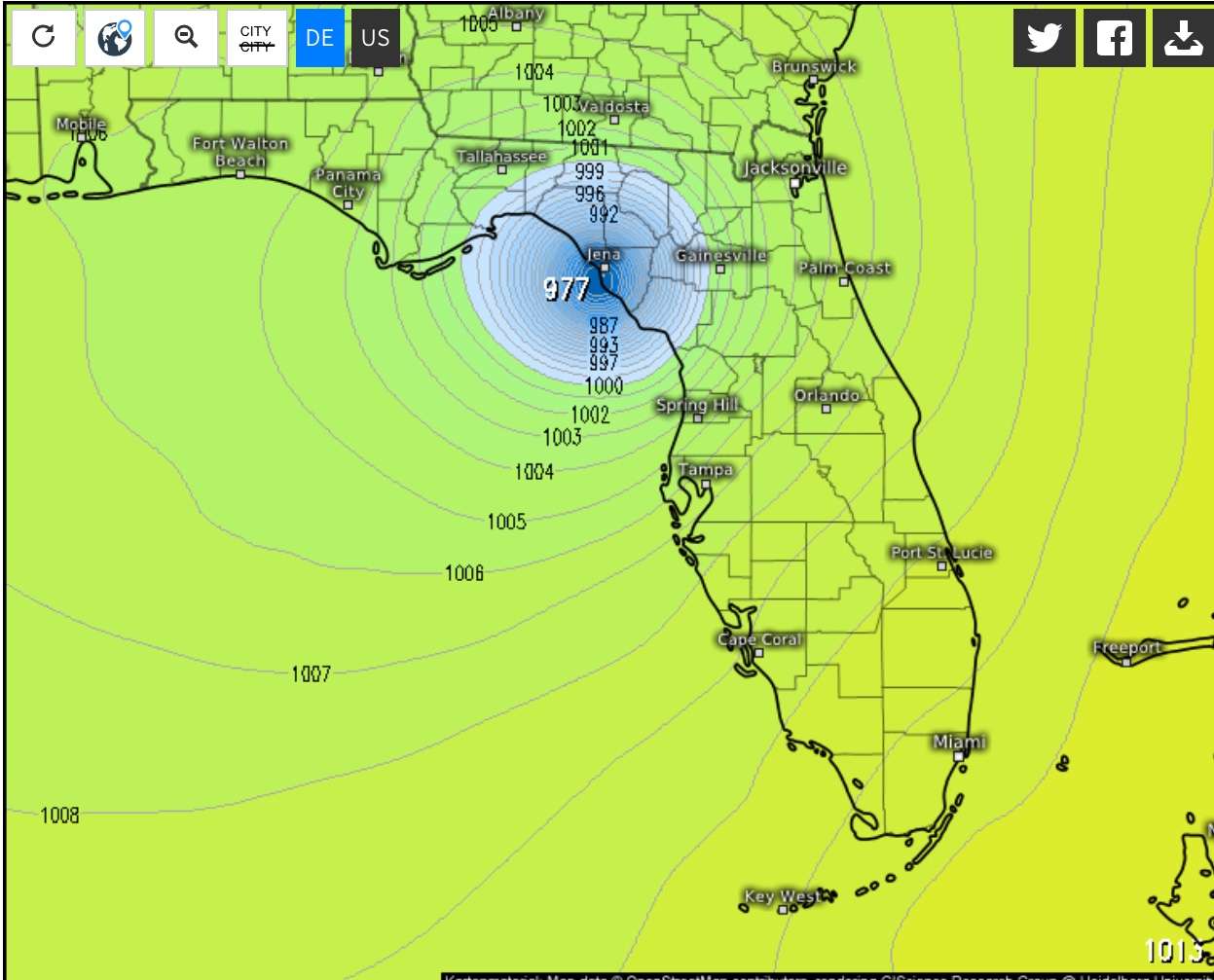
NDG wrote:Is not too often that the GFS is more aggressive on intensity than the SHIPS models over the Atlantic Basin, but the trend is upward with the rest of the models.
https://i.imgur.com/UWTieVC.png
Add the UKMET 12z run to that up swing.
Moderator: S2k Moderators

NDG wrote:Is not too often that the GFS is more aggressive on intensity than the SHIPS models over the Atlantic Basin, but the trend is upward with the rest of the models.
https://i.imgur.com/UWTieVC.png


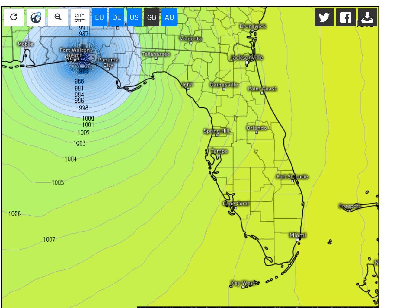
bamajammer4eva wrote:GFS vs UKMET. UKMET is 2 MB weaker, 10 hrs slower and not many more miles different than GFS
https://media.giphy.com/media/1gdqG93w9c6eXqjgKs/giphy.gif
bamajammer4eva wrote:GFS vs UKMET. UKMET is 2 MB weaker, 10 hrs slower and not many more miles different than GFS
https://media.giphy.com/media/1gdqG93w9c6eXqjgKs/giphy.gif
Dean4Storms wrote:
Ugh.... That would be making landfall about 10 miles to my West. Have to prep the RV come Monday for a road trip if this keeps looking like this.


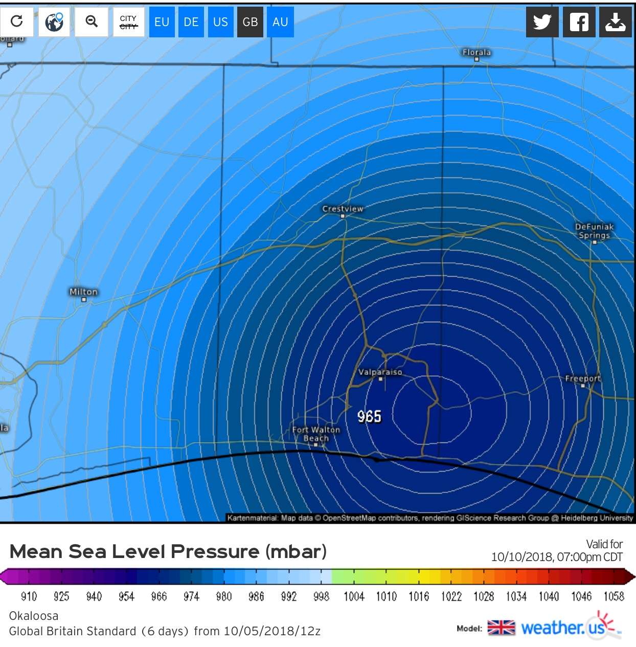
WeatherEmperor wrote:0z UKMET also shifted east to the big bend area. Perhaps the GFS is on to something?
https://uploads.tapatalk-cdn.com/20181006/1715e6a4fba6a5e125d91ac809ff0232.gif
Sent from my iPhone using Tapatalk


MississippiWx wrote:Quite the spread in the models. Really need a dominant area of low pressure to consolidate first to help tighten the spread.
Anyway, I happen to believe the CMC is out to lunch. That track doesn't make sense with climo and the approaching cold front. Also, this is likely to be a sheared storm that is heavily weighted to the east. That kind of system is notorious for winding up further east than anticipated. Mississippi/LA should watch, of course, but I'd be highly surprised if future Michael winds up further west than Pensacola.

Stormcenter wrote:What approaching cold front?MississippiWx wrote:Quite the spread in the models. Really need a dominant area of low pressure to consolidate first to help tighten the spread.
Anyway, I happen to believe the CMC is out to lunch. That track doesn't make sense with climo and the approaching cold front. Also, this is likely to be a sheared storm that is heavily weighted to the east. That kind of system is notorious for winding up further east than anticipated. Mississippi/LA should watch, of course, but I'd be highly surprised if future Michael winds up further west than Pensacola.
Users browsing this forum: No registered users and 79 guests


