ATL: ANDREA - Remnants

Moderator: S2k Moderators

Message
Author
User avatar
CyclonicFury
Category 5
Category 5
Posts: 1974
Age: 25
Joined: Sun Jul 02, 2017 12:32 pm
Location: NC
Contact:

Re: ATL: ANDREA - SubTropical Depression

#81 Postby CyclonicFury » Tue May 21, 2019 11:24 am

wxman57 wrote:
AnnularCane wrote:If Andrea met the criteria, she should have been upgraded.


I don't think it met the criteria.

Why not? The circulation was well defined according to recon with a fall in pressure, and there was a persistent ball of convection to the north of the center for much of yesterday afternoon and evening.
5 likes   
NCSU B.S. in Meteorology Class of 2021. Tropical weather blogger at http://www.cyclonicfury.com. My forecasts and thoughts are NOT official, for official forecasts please consult the National Hurricane Center.

User avatar
wxman57
Moderator-Pro Met
Moderator-Pro Met
Posts: 22480
Age: 66
Joined: Sat Jun 21, 2003 8:06 pm
Location: Houston, TX (southwest)

Re: ATL: ANDREA - SubTropical Depression

#82 Postby wxman57 » Tue May 21, 2019 11:47 am

CyclonicFury wrote:
wxman57 wrote:
AnnularCane wrote:If Andrea met the criteria, she should have been upgraded.


I don't think it met the criteria.

Why not? The circulation was well defined according to recon with a fall in pressure, and there was a persistent ball of convection to the north of the center for much of yesterday afternoon and evening.


Convection was too disorganized and weakening. Circulation was elongated. No banding. It was more or less a small eddy with one squall to the north. This would never have been considered for naming 10-15 years ago.

I was joking about it relinquishing the name Andrea post-season, by the way.
1 likes   

Monsoonjr99
Tropical Storm
Tropical Storm
Posts: 208
Age: 24
Joined: Fri Sep 21, 2018 11:22 pm
Location: Inland Empire, SoCal

Re: ATL: ANDREA - SubTropical Depression

#83 Postby Monsoonjr99 » Tue May 21, 2019 12:21 pm

No more convection. By now it's a remnant low. I think it did meet the criteria for a subtropical storm yesterday, as convection somewhat removed from the center is part of what defines a subtropical cyclone.
4 likes   
The posts in this forum are NOT official forecasts and should not be used as such. They are just the opinion of the poster and may or may not be backed by sound meteorological data. They are NOT endorsed by any professional institution or STORM2K. For official information, please refer to products from the NHC and NWS.

Some Californian who codes things and tracks weather.

Kay '22, Hilary '23

User avatar
chaser1
S2K Supporter
S2K Supporter
Posts: 4681
Age: 63
Joined: Sat Oct 15, 2005 5:59 pm
Location: Longwood, Fl

Re: ATL: ANDREA - SubTropical Depression

#84 Postby chaser1 » Tue May 21, 2019 2:25 pm

wxman57 wrote:
CyclonicFury wrote:
wxman57 wrote:
I don't think it met the criteria.

Why not? The circulation was well defined according to recon with a fall in pressure, and there was a persistent ball of convection to the north of the center for much of yesterday afternoon and evening.


Convection was too disorganized and weakening. Circulation was elongated. No banding. It was more or less a small eddy with one squall to the north. This would never have been considered for naming 10-15 years ago.

I was joking about it relinquishing the name Andrea post-season, by the way.


The largest contradiction to me applies to a large number of E. Tropical Atlantic disturbances over the years that satellite and/or ASCAT clearly suggested an apparent low level center, seemingly obvious west wind inflow, and with far more impressive co-located convection and banding features associated with it, yet the powers that be were inclined to not upgrade. In many cases it was clear that in spite of present appearance, the system was likely to be approaching unfavorable conditions (SAL, upper level shear, cooler SST's, etc) and would soon weaken. Some tropical systems appeared to have vigorous mid to low level turning and tremendous banding but lacked west or south quadrant intense convection around the apparent LLC. Some compact systems looked impressive on vis satellite and convection around part of a clear LLC (albeit sheared) due to it's own fast westward forward motion but appeared to clearly be approaching increasingly volatile conditions. The argument there was that due to the induced shear as a result of the fast forward motion, convection has thus far failed to fully wrap around west of center, thus still lacking the defined characteristics of a T.S. I seem to recall a common argument to not upgrade some prior year disturbances relating to that tropical system lacking adequate persistence of convection (due to fast development, waning and waxing of UL shear, or process of min. and max diurnal convective periods). In some other cases the CDO appeared to be spinning like a top but "no banding features" was tossed out why the disturbance could not yet be upgraded. Further supporting these positions was an obvious lack of having any surface condition verification by either ship reports or recon. So, even if ASCAT or satellite derived winds suggest T.D. or T.S. strength and visible satellite seemed to suggest the circulation was at the surface..... did anyone absolutely know if there was a true surface west wind verses the possibly that the disturbance might still be a very sharp wave instead? Maybe there was enough confidence to believe near-center T.S. strength sustained surface winds were occurring in the north quadrant but "perhaps" the circulation was somewhat elongated and/or not fully at the surface to the extent near center west winds could be entirely verified? I recall at least a couple Caribbean tropical waves having difficulty fully closing off a LLC due to unfavorable upper level conditions while recon confirmed consistent 50-60 kt. winds north and east of center yet somehow lacking all it's boxes being checked to quite qualify for being upgraded.

There have been a few East Atlantic fast upgrades over the years where NHC was comfortable enough to quickly pull the upgrade trigger. Those are certainly the exceptions though. A number of other tropical systems which eventually deteriorated into barely identifiable waves, at one point certainly exhibited far better organization and appearance then Andrea did or a number of other early season Gulf disturbances or frontal lows have in recent years.
2 likes   
Personal Forecast Disclaimer:
The posts in this forum are NOT official forecast and should not be used as such. They are just the opinion of the poster and may or may not be backed by sound meteorological data. They are NOT endorsed by any professional institution or storm2k.org. For official information, please refer to the NHC and NWS products.


User avatar
TheStormExpert
Category 5
Category 5
Posts: 8487
Age: 30
Joined: Wed Feb 16, 2011 5:38 pm
Location: Palm Beach Gardens, FL

Re: ATL: ANDREA - SubTropical Depression

#85 Postby TheStormExpert » Tue May 21, 2019 2:42 pm

Ready to pull Bones out of storage for the first time of the season in just over an hour! :lol:
1 likes   
The following post is NOT an official forecast and should not be used as such. It is just the opinion of the poster and may or may not be backed by sound meteorological data. It is NOT endorsed by storm2k.org.

User avatar
wxman57
Moderator-Pro Met
Moderator-Pro Met
Posts: 22480
Age: 66
Joined: Sat Jun 21, 2003 8:06 pm
Location: Houston, TX (southwest)

Re: ATL: ANDREA - SubTropical Depression

#86 Postby wxman57 » Tue May 21, 2019 2:47 pm

chaser1 wrote:The largest contradiction to me applies to a large number of E. Tropical Atlantic disturbances over the years that satellite and/or ASCAT clearly suggested an apparent low level center, seemingly obvious west wind inflow, and with far more impressive co-located convection and banding features associated with it, yet the powers that be were inclined to not upgrade. In many cases it was clear that in spite of present appearance, the system was likely to be approaching unfavorable conditions (SAL, upper level shear, cooler SST's, etc) and would soon weaken. Some tropical systems appeared to have vigorous mid to low level turning and tremendous banding but lacked west or south quadrant intense convection around the apparent LLC. Some compact systems looked impressive on vis satellite and convection around part of a clear LLC (albeit sheared) due to it's own fast westward forward motion but appeared to clearly be approaching increasingly volatile conditions. The argument there was that due to the induced shear as a result of the fast forward motion, convection has thus far failed to fully wrap around west of center, thus still lacking the defined characteristics of a T.S. I seem to recall a common argument to not upgrade some prior year disturbances relating to that tropical system lacking adequate persistence of convection (due to fast development, waning and waxing of UL shear, or process of min. and max diurnal convective periods). In some other cases the CDO appeared to be spinning like a top but "no banding features" was tossed out why the disturbance could not yet be upgraded. Further supporting these positions was an obvious lack of having any surface condition verification by either ship reports or recon. So, even if ASCAT or satellite derived winds suggest T.D. or T.S. strength and visible satellite seemed to suggest the circulation was at the surface..... did anyone absolutely know if there was a true surface west wind verses the possibly that the disturbance might still be a very sharp wave instead? Maybe there was enough confidence to believe near-center T.S. strength sustained surface winds were occurring in the north quadrant but "perhaps" the circulation was somewhat elongated and/or not fully at the surface to the extent near center west winds could be entirely verified? I recall at least a couple Caribbean tropical waves having difficulty fully closing off a LLC due to unfavorable upper level conditions while recon confirmed consistent 50-60 kt. winds north and east of center yet somehow lacking all it's boxes being checked to quite qualify for being upgraded.

There have been a few East Atlantic fast upgrades over the years where NHC was comfortable enough to quickly pull the upgrade trigger. Those are certainly the exceptions though. A number of other tropical systems which eventually deteriorated into barely identifiable waves, at one point certainly exhibited far better organization and appearance then Andrea did or a number of other early season Gulf disturbances or frontal lows have in recent years.


Whether to upgrade or not is sometimes a difficult decision. For disturbances far away from any land areas, the tendency is to observe day-to-day consistency before upgrading. Often, what appears to be a tropical storm by Africa, dissipates. When a disturbance is closer to land (like Andrea to Bermuda or a disturbance in the Gulf), the tendency may be for a quicker upgrade to make sure that anyone in its path is adequately warned. This is one of my biggest gripes with the current classification system - inconsistency. I've often said that there should be a separate agency with the sole responsibility of upgrading/downgrading, and the NHC should deal with the decisions. I know that will never happen. As a private consulting meteorologist (and company), we could tell that Andrea was not going to become a significant threat. We mentioned it in a daily outlook (possible heavy rain, gusty wind for Bermuda) but we would not have issued any advisories.

In the case of Andrea, I don't know what went on at the NHC when the decision was made to upgrade. Perhaps the forecasters were noting that the GFS, at least, indicated that it would pass Bermuda as a tropical storm. In general, models indicated strenghtening last evening. The models were wrong. It was clear to see by early this morning that Andrea was steadily weakening. I'm sure that the NHC will issue a final warning in about an hour to declare Andrea post-tropical. No real harm done in naming it, except for irritating me. ;-)
1 likes   

User avatar
cycloneye
Admin
Admin
Posts: 139056
Age: 67
Joined: Thu Oct 10, 2002 10:54 am
Location: San Juan, Puerto Rico

Re: ATL: ANDREA - Remnants

#87 Postby cycloneye » Tue May 21, 2019 3:36 pm

 https://twitter.com/NHC_Atlantic/status/1130934803803492352


Post-Tropical Cyclone Andrea Discussion Number 5
NWS National Hurricane Center Miami FL AL012019
500 PM AST Tue May 21 2019

The cyclone has lacked deep convection since early this morning,
and therefore it no longer qualifies as either a tropical or a
subtropical cyclone. Dry mid-level air, the influence of an
upper-level low, and marginal SSTs should preclude re-development.
The cyclone is likely to dissipate in a day or so as it becomes
absorbed into a frontal zone.

Post-tropical Andrea has turned to the east-northeast and the
motion is about 070/7. The system should move mainly eastward
within the mid-level westerlies until dissipation.

This is the last advisory on Andrea. Additional information on this
system can be found in High Seas Forecasts issued by the National
Weather Service, under AWIPS header NFDHSFAT1, WMO header FZNT01
KWBC, and online at ocean.weather.gov/shtml/NFDHSFAT1.php


FORECAST POSITIONS AND MAX WINDS

INIT 21/2100Z 30.8N 68.3W 30 KT 35 MPH...POST-TROPICAL
12H 22/0600Z 31.2N 67.0W 30 KT 35 MPH...POST-TROP/REMNT LOW
24H 22/1800Z 31.7N 62.8W 25 KT 30 MPH...POST-TROP/REMNT LOW
36H 23/0600Z...DISSIPATED

$$
Forecaster Pasch
0 likes   
Visit the Caribbean-Central America Weather Thread where you can find at first post web cams,radars
and observations from Caribbean basin members Click Here

User avatar
galaxy401
Category 5
Category 5
Posts: 2299
Age: 28
Joined: Sat Aug 25, 2012 9:04 pm
Location: Casa Grande, Arizona

Re: ATL: ANDREA - Remnants

#88 Postby galaxy401 » Tue May 21, 2019 10:58 pm

Well that storm just came and went...
0 likes   
Got my eyes on moving right into Hurricane Alley: Florida.

User avatar
chaser1
S2K Supporter
S2K Supporter
Posts: 4681
Age: 63
Joined: Sat Oct 15, 2005 5:59 pm
Location: Longwood, Fl

Re: ATL: ANDREA - Remnants

#89 Postby chaser1 » Wed May 22, 2019 12:48 pm

galaxy401 wrote:Well that storm just came and went...


Godspeed to all the Bermuda First-Responders and clean-up crews
1 likes   
Personal Forecast Disclaimer:
The posts in this forum are NOT official forecast and should not be used as such. They are just the opinion of the poster and may or may not be backed by sound meteorological data. They are NOT endorsed by any professional institution or storm2k.org. For official information, please refer to the NHC and NWS products.


User avatar
Kazmit
Category 5
Category 5
Posts: 1915
Age: 21
Joined: Mon Jul 25, 2016 8:49 am
Location: Williamsburg VA for college, Bermuda otherwise

Re: ATL: ANDREA - Remnants

#90 Postby Kazmit » Wed May 22, 2019 2:21 pm

chaser1 wrote:
galaxy401 wrote:Well that storm just came and went...


Godspeed to all the Bermuda First-Responders and clean-up crews

I did get wet on my morning commute today. :lol:
0 likes   
Igor 2010, Sandy 2012, Fay 2014, Gonzalo 2014, Joaquin 2015, Nicole 2016, Humberto 2019

I am only a tropical weather enthusiast. My predictions are not official and may or may not be backed by sound meteorological data. For official information, please refer to the NHC and NWS products.

User avatar
tropicwatch
Category 5
Category 5
Posts: 3205
Age: 60
Joined: Sat Jun 02, 2007 10:01 am
Location: Panama City Florida
Contact:

Re: ATL: ANDREA - Remnants

#91 Postby tropicwatch » Thu May 23, 2019 4:06 am

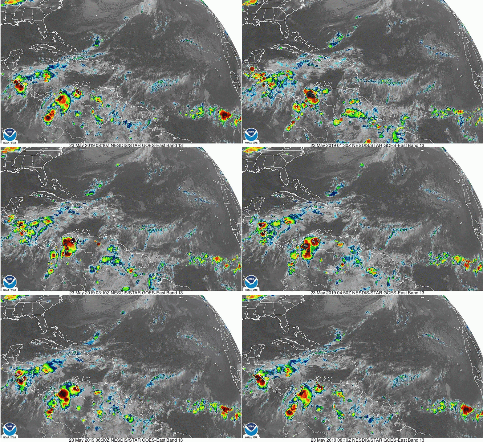
It appears that the front missed the remnants of Andrea and it is drifting southward.
Image
0 likes   
Tropicwatch


Agnes 72', Eloise 75, Elena 85', Kate 85', Charley 86', Florence 88', Beryl 94', Dean 95', Erin 95', Opal 95', Earl 98', Georges 98', Ivan 2004', Arlene 2005', Dennis 2005', Ida 2009' Debby 2012' Irma 2017' Michael 2018'


Return to “2019”

Who is online

Users browsing this forum: No registered users and 32 guests