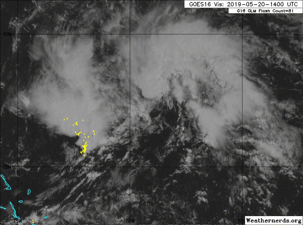
ATL: ANDREA - Remnants

Moderator: S2k Moderators

Message
Author
User avatar
chaser1
S2K Supporter
S2K Supporter
Posts: 4681
Age: 63
Joined: Sat Oct 15, 2005 5:59 pm
Location: Longwood, Fl

Re: ATL: INVEST 90L - Discussion

#21 Postby chaser1 » Mon May 20, 2019 10:47 am

wxman57 wrote:
NDG wrote:This looks to be main area of broad low pressure, over an area of better UL divergence, becoming better defined and has that subtropical look to it.

https://i.imgur.com/q8VcK9Q.gif


Looks like a dissipating eddy in that loop. Good chance that if the NHC wants to upgrade it then it will be TD One this afternoon or this evening. I don't think it qualifies yet. Isn't recon heading out there soon?


Right? LLC certainly way less then "established". In spite of the far improved UL divergence over the past 36 hours, opportunity and time for a LLC to functionally develop is still being hampered by stout upper level winds. The northward tugging MLC isn't helping to establish much vertical integrity either. I'd be curious to know how broad the pressure gradient still is south and west of center
1 likes   
Personal Forecast Disclaimer:
The posts in this forum are NOT official forecast and should not be used as such. They are just the opinion of the poster and may or may not be backed by sound meteorological data. They are NOT endorsed by any professional institution or storm2k.org. For official information, please refer to the NHC and NWS products.


plasticup
S2K Supporter
S2K Supporter
Posts: 1295
Joined: Thu Aug 05, 2010 5:49 pm
Location: Bermuda

Re: ATL: INVEST 90L - Discussion

#22 Postby plasticup » Mon May 20, 2019 11:17 am

wxman57 wrote:
NDG wrote:This looks to be main area of broad low pressure, over an area of better UL divergence, becoming better defined and has that subtropical look to it.

https://i.imgur.com/q8VcK9Q.gif


Looks like a dissipating eddy in that loop. Good chance that if the NHC wants to upgrade it then it will be TD One this afternoon or this evening. I don't think it qualifies yet. Isn't recon heading out there soon?


I don't think they've made the call on whether it's actually flying or not. If they do, it will be soon.
0 likes   
Eyes: Emily '86, Dean '89, Felix '95, Gert '99, Fabian '03, Humberto '19, Paulette '20

User avatar
weathaguyry
Category 5
Category 5
Posts: 1272
Age: 20
Joined: Wed Jun 15, 2016 5:16 am
Location: Long Island, NY

Re: ATL: INVEST 90L - Discussion

#23 Postby weathaguyry » Mon May 20, 2019 12:08 pm

Recon is currently en route, surprisingly, maybe the NHC sees something in this system that we don't
0 likes   
My posts are only my opinions and NOT official forecasts. For official forecasts, consult the National Hurricane Center or the National Weather Service.

Irene 11', Sandy 12', Fay 20’, Isaias 20’, Elsa 21’, Henri 21’, Ida 21’

User avatar
Extratropical94
Professional-Met
Professional-Met
Posts: 3535
Age: 29
Joined: Wed Oct 20, 2010 6:36 am
Location: Hamburg, Germany
Contact:

Re: ATL: INVEST 90L - Discussion

#24 Postby Extratropical94 » Mon May 20, 2019 12:31 pm

Special Tropical Weather Outlook
NWS National Hurricane Center Miami FL
130 PM EDT Mon May 20 2019

For the North Atlantic...Caribbean Sea and the Gulf of Mexico:

Showers and thunderstorms associated with a broad area of low
pressure located several hundred miles southwest of Bermuda are
showing signs of organization. Although recent satellite wind data
suggest that the system currently lacks a well-defined center of
circulation, environmental conditions are expected to be conducive
for the formation of a short-lived subtropical or tropical cyclone
later today or tonight. Conditions are forecast to become
unfavorable for further development by late Tuesday, and the
disturbance is expected to merge with a cold front on Wednesday.
An Air Force Reserve reconnaissance aircraft is currently en route
to investigate the disturbance. Interests in Bermuda should
monitor the progress of this system. The next Special Tropical
Weather Outlook will be issued by 8 PM EDT today.
* Formation chance through 48 hours...high...70 percent.
* Formation chance through 5 days...high...70 percent.
1 likes   
54° 11' 59'' N, 9° 9' 20'' E
Boomer Sooner!
Go Broncos! Go Cards! Go Niners!
- Daniel

Sciencerocks
Category 5
Category 5
Posts: 7283
Age: 38
Joined: Thu Jul 06, 2017 1:51 am

Re: ATL: INVEST 90L - Discussion

#25 Postby Sciencerocks » Mon May 20, 2019 12:35 pm

The nhc is right as this has a elongated LLC and probably will be a depression within the next 12-18 hours if current trends keep up.

Image
0 likes   

plasticup
S2K Supporter
S2K Supporter
Posts: 1295
Joined: Thu Aug 05, 2010 5:49 pm
Location: Bermuda

Re: ATL: INVEST 90L - Discussion

#26 Postby plasticup » Mon May 20, 2019 12:48 pm

weathaguyry wrote:maybe the NHC sees something in this system that we don't

Wouldn't be the first time :roll:

Definitely rotating more than yesterday. Doesn't look closed to me, but hard to see in the NW quadrant. I guess that's part of what the recon will tell us.
1 likes   
Eyes: Emily '86, Dean '89, Felix '95, Gert '99, Fabian '03, Humberto '19, Paulette '20

Sciencerocks
Category 5
Category 5
Posts: 7283
Age: 38
Joined: Thu Jul 06, 2017 1:51 am

Re: ATL: INVEST 90L - Discussion

#27 Postby Sciencerocks » Mon May 20, 2019 1:17 pm

Looks closed based on ascat
Image
2 likes   

User avatar
wxman57
Moderator-Pro Met
Moderator-Pro Met
Posts: 22480
Age: 66
Joined: Sat Jun 21, 2003 8:06 pm
Location: Houston, TX (southwest)

Re: ATL: INVEST 90L - Discussion

#28 Postby wxman57 » Mon May 20, 2019 1:44 pm

Looks like a trof on this 14Z ASCAT image. Sat loop looks like it has two low centers and two curved bands of squalls. Don't think it qualifies for upgrade.

Image
1 likes   

User avatar
tailgater
S2K Supporter
S2K Supporter
Posts: 3339
Joined: Sun Jul 11, 2004 9:13 pm
Location: St. Amant La.

Re: ATL: INVEST 90L - Discussion

#29 Postby tailgater » Mon May 20, 2019 1:44 pm

Looks decent on Ascat but the winds are still only in the 15 to20 knot range. It won’t take much to disrupt the LLC.
0 likes   
The following post is NOT an official forecast and should not be used as such. It is just the opinion of the poster and may or may not be backed by sound meteorological data. It is NOT endorsed by any professional institution including storm2k.org For Official Information please refer to the NHC and NWS products.

User avatar
gfsperpendicular
Category 1
Category 1
Posts: 383
Age: 19
Joined: Mon Jun 19, 2017 3:04 pm
Location: Northern Virginia

Re: ATL: INVEST 90L - Discussion

#30 Postby gfsperpendicular » Mon May 20, 2019 2:52 pm

Recon's in the storm now. It looks like they're about to try a pass over the little swirl at the center.
0 likes   
I'm not sleeping, I'm waiting for the 0900 UTC advisory!

#1 CMC stan

Sciencerocks
Category 5
Category 5
Posts: 7283
Age: 38
Joined: Thu Jul 06, 2017 1:51 am

Re: ATL: INVEST 90L - Discussion

#31 Postby Sciencerocks » Mon May 20, 2019 3:08 pm

Quite a bit of westerly winds

205
URNT15 KNHC 201959
AF302 01AAA INVEST HDOB 30 20190520
195100 2755N 06940W 9841 00273 0155 +210 +190 328014 014 010 001 00
195130 2754N 06941W 9843 00270 0155 +205 +197 323010 013 010 001 00
195200 2752N 06942W 9843 00268 0153 +205 +196 322009 010 006 002 03
195230 2751N 06941W 9841 00270 0153 +205 +197 301007 009 /// /// 03
195300 2751N 06939W 9846 00268 0155 +205 +195 290008 008 007 003 00
195330 2751N 06937W 9840 00270 0151 +205 +194 289010 011 010 001 00
195400 2751N 06935W 9842 00266 0148 +207 +191 286010 011 009 001 00
195430 2751N 06933W 9842 00267 0149 +205 +194 283011 012 011 001 00
195500 2751N 06931W 9842 00267 0150 +207 +189 292012 012 010 002 00
195530 2751N 06929W 9843 00266 0149 +211 +182 298013 013 010 001 00
195600 2751N 06927W 9842 00267 0149 +211 +180 302014 014 009 002 00
195630 2751N 06925W 9842 00267 0149 +210 +176 301016 016 009 001 00
195700 2751N 06923W 9842 00266 0148 +206 +185 290017 017 012 000 00
195730 2751N 06921W 9831 00277 0151 +202 +187 285018 019 011 000 00
195800 2751N 06919W 9842 00269 0153 +201 +190 279019 019 012 001 00
195830 2751N 06916W 9841 00268 0152 +200 +190 279019 019 012 001 00
195900 2751N 06914W 9842 00268 0152 +200 +190 278018 019 011 001 00
195930 2751N 06911W 9842 00268 0152 +200 +190 275018 019 013 001 00
200000 2751N 06909W 9841 00269 0152 +199 +190 272018 019 015 001 00
200030 2751N 06907W 9844 00266 0152 +199 +191 272019 019 014 001 00
$$
2 likes   

User avatar
wxman57
Moderator-Pro Met
Moderator-Pro Met
Posts: 22480
Age: 66
Joined: Sat Jun 21, 2003 8:06 pm
Location: Houston, TX (southwest)

Re: ATL: INVEST 90L - Discussion

#32 Postby wxman57 » Mon May 20, 2019 3:11 pm

I don't doubt that it has a weak low-level circulation, but I don't think it qualifies as a TD with organized convection around a well-defined center.
0 likes   

Sciencerocks
Category 5
Category 5
Posts: 7283
Age: 38
Joined: Thu Jul 06, 2017 1:51 am

Re: ATL: INVEST 90L - Discussion

#33 Postby Sciencerocks » Mon May 20, 2019 3:28 pm

Image
0 likes   

User avatar
NotSparta
Professional-Met
Professional-Met
Posts: 1647
Age: 22
Joined: Fri Aug 18, 2017 8:24 am
Location: Naples, FL
Contact:

Re: ATL: INVEST 90L - Discussion

#34 Postby NotSparta » Mon May 20, 2019 3:44 pm

wxman57 wrote:I don't doubt that it has a weak low-level circulation, but I don't think it qualifies as a TD with organized convection around a well-defined center.


Well, it's more subtropical
1 likes   
This post was probably an opinion of mine, and in no way is official. Please refer to http://www.hurricanes.gov for official tropical analysis and advisories.

My website, with lots of tropical wx graphics, including satellite and recon: http://cyclonicwx.com

User avatar
cycloneye
Admin
Admin
Posts: 139051
Age: 67
Joined: Thu Oct 10, 2002 10:54 am
Location: San Juan, Puerto Rico

Re: ATL: INVEST 90L - Discussion

#35 Postby cycloneye » Mon May 20, 2019 3:47 pm

1 likes   
Visit the Caribbean-Central America Weather Thread where you can find at first post web cams,radars
and observations from Caribbean basin members Click Here

Aric Dunn
Category 5
Category 5
Posts: 21228
Age: 41
Joined: Sun Sep 19, 2004 9:58 pm
Location: Ready for the Chase.
Contact:

Re: ATL: INVEST 90L - Discussion

#36 Postby Aric Dunn » Mon May 20, 2019 3:47 pm

Looks like we should have our First name system shortly.....
1 likes   
Note: If I make a post that is brief. Please refer back to previous posts for the analysis or reasoning. I do not re-write/qoute what my initial post said each time.
If there is nothing before... then just ask :)

Space & Atmospheric Physicist, Embry-Riddle Aeronautical University,
I believe the sky is falling...

User avatar
wxman57
Moderator-Pro Met
Moderator-Pro Met
Posts: 22480
Age: 66
Joined: Sat Jun 21, 2003 8:06 pm
Location: Houston, TX (southwest)

Re: ATL: INVEST 90L - Discussion

#37 Postby wxman57 » Mon May 20, 2019 3:52 pm

Aric Dunn wrote:Looks like we should have our First name system shortly.....


There's that matter of having "organized convection" around a well-defined LLC. Plus, peak SFMR sub-30 kts. I don't question that it has a broad, elongated LLC. But it lacks organized convection. I guess it will come down to who's working the NHC desk this evening.
1 likes   

Aric Dunn
Category 5
Category 5
Posts: 21228
Age: 41
Joined: Sun Sep 19, 2004 9:58 pm
Location: Ready for the Chase.
Contact:

Re: ATL: INVEST 90L - Discussion

#38 Postby Aric Dunn » Mon May 20, 2019 3:54 pm

wxman57 wrote:
Aric Dunn wrote:Looks like we should have our First name system shortly.....


There's that matter of having "organized convection" around a well-defined LLC. Plus, peak SFMR sub-30 kts. I don't question that it has a broad, elongated LLC. But it lacks organized convection. I guess it will come down to who's working the NHC desk this evening.


We will know shortly with this next recon pass. 1km hi res shows a well defined circ.

a lot of organization has happened in the last 2 hours. especially since recons first missed pass.
1 likes   
Note: If I make a post that is brief. Please refer back to previous posts for the analysis or reasoning. I do not re-write/qoute what my initial post said each time.
If there is nothing before... then just ask :)

Space & Atmospheric Physicist, Embry-Riddle Aeronautical University,
I believe the sky is falling...

User avatar
wxman57
Moderator-Pro Met
Moderator-Pro Met
Posts: 22480
Age: 66
Joined: Sat Jun 21, 2003 8:06 pm
Location: Houston, TX (southwest)

Re: ATL: INVEST 90L - Discussion

#39 Postby wxman57 » Mon May 20, 2019 3:59 pm

Looks pathetic and LESS organized past 2 hours, to me. Time to head home...
0 likes   

Aric Dunn
Category 5
Category 5
Posts: 21228
Age: 41
Joined: Sun Sep 19, 2004 9:58 pm
Location: Ready for the Chase.
Contact:

Re: ATL: INVEST 90L - Discussion

#40 Postby Aric Dunn » Mon May 20, 2019 4:01 pm

wxman57 wrote:Looks pathetic and LESS organized past 2 hours, to me. Time to head home...


what do you expect for mid may lol.
1 likes   
Note: If I make a post that is brief. Please refer back to previous posts for the analysis or reasoning. I do not re-write/qoute what my initial post said each time.
If there is nothing before... then just ask :)

Space & Atmospheric Physicist, Embry-Riddle Aeronautical University,
I believe the sky is falling...


Return to “2019”

Who is online

Users browsing this forum: No registered users and 27 guests