
EPAC: BARBARA - Remnants
Moderator: S2k Moderators
-
cycloneye

- Admin

- Posts: 139052
- Age: 67
- Joined: Thu Oct 10, 2002 10:54 am
- Location: San Juan, Puerto Rico
Re: EPAC: INVEST 94E
00z Euro again does the crossover but more south than GFS.
0 likes
Visit the Caribbean-Central America Weather Thread where you can find at first post web cams,radars
and observations from Caribbean basin members Click Here
and observations from Caribbean basin members Click Here
-
cycloneye
- Admin
- Posts: 139052
- Age: 67
- Joined: Thu Oct 10, 2002 10:54 am
- Location: San Juan, Puerto Rico
Re: EPAC: INVEST 94E
80%/90%
A broad area of showers and thunderstorms located well to the
southwest of the southern coast of Mexico is associated with a
tropical wave. Environmental conditions are expected to be
conducive for development of this system, and a tropical depression
is likely to form late this weekend or early next week while the
disturbance moves westward to west-northwestward at about 15 mph.
* Formation chance through 48 hours...high...80 percent.
* Formation chance through 5 days...high...90 percent.
1 likes
Visit the Caribbean-Central America Weather Thread where you can find at first post web cams,radars
and observations from Caribbean basin members Click Here
and observations from Caribbean basin members Click Here
-
NotSparta

- Professional-Met

- Posts: 1647
- Age: 22
- Joined: Fri Aug 18, 2017 8:24 am
- Location: Naples, FL
- Contact:
Re: EPAC: INVEST 94E
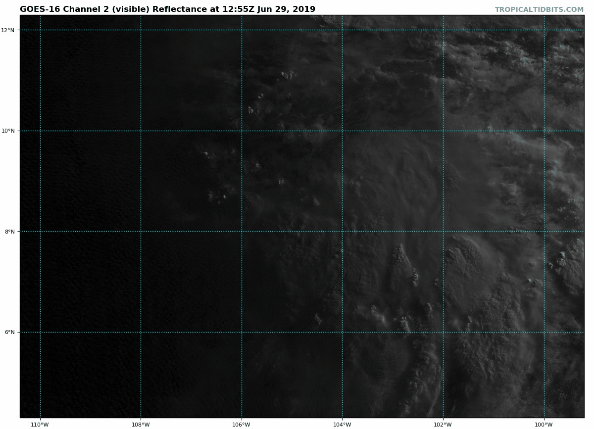
Definitely appears to be organizing
3 likes
This post was probably an opinion of mine, and in no way is official. Please refer to http://www.hurricanes.gov for official tropical analysis and advisories.
My website, with lots of tropical wx graphics, including satellite and recon: http://cyclonicwx.com
My website, with lots of tropical wx graphics, including satellite and recon: http://cyclonicwx.com
-
cycloneye
- Admin
- Posts: 139052
- Age: 67
- Joined: Thu Oct 10, 2002 10:54 am
- Location: San Juan, Puerto Rico
Re: EPAC: INVEST 94E
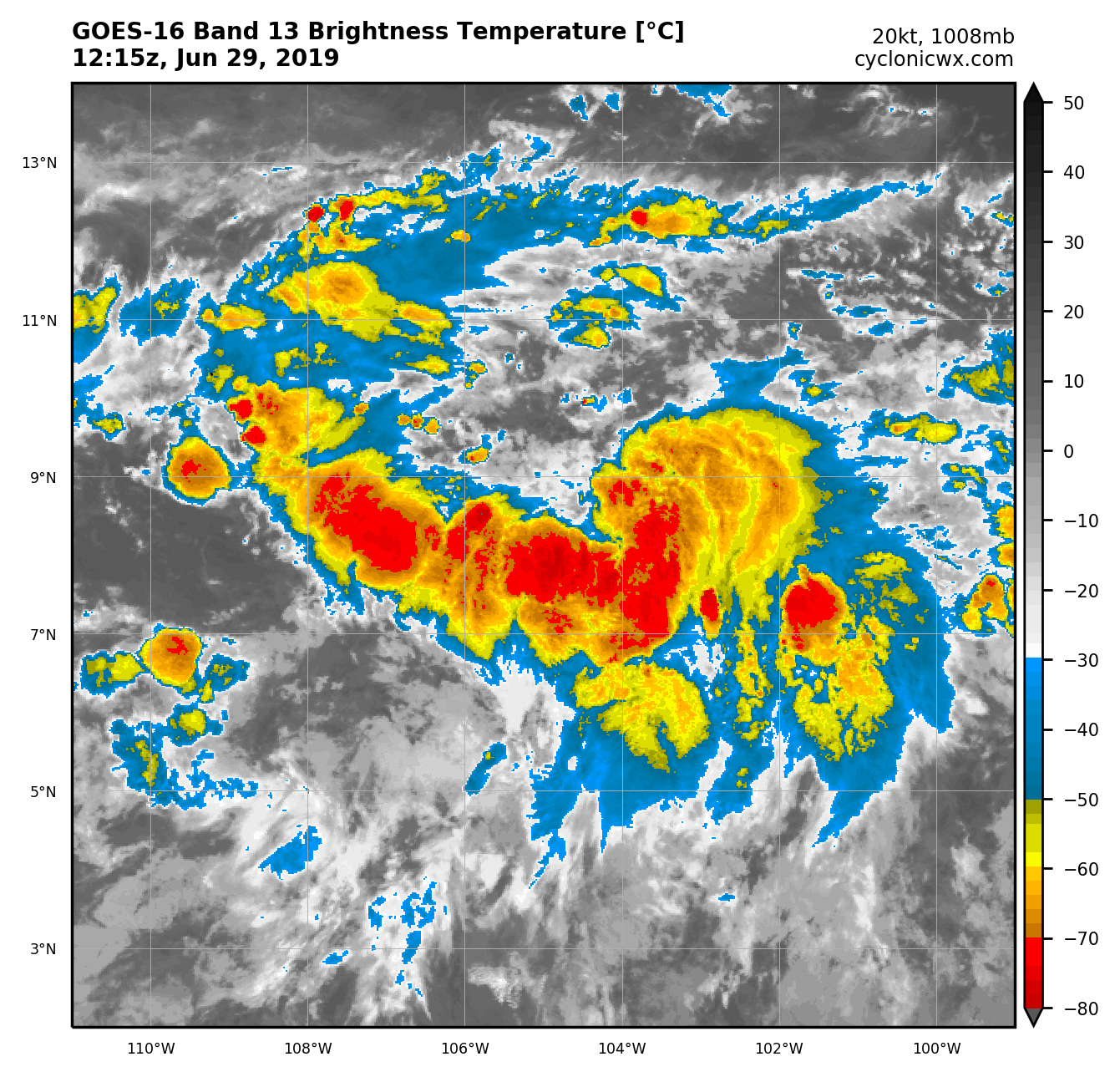
12z Best Track:
Location: 8.3°N 104.8°W
Maximum Winds: 20 kt Gusts: N/A
Minimum Central Pressure: 1008 mb
Environmental Pressure: 1010 mb
Radius of Circulation: 200 NM
Radius of Maximum Wind: 90 NM
Maximum Winds: 20 kt Gusts: N/A
Minimum Central Pressure: 1008 mb
Environmental Pressure: 1010 mb
Radius of Circulation: 200 NM
Radius of Maximum Wind: 90 NM
2 likes
Visit the Caribbean-Central America Weather Thread where you can find at first post web cams,radars
and observations from Caribbean basin members Click Here
and observations from Caribbean basin members Click Here

Re: EPAC: INVEST 94E
Looking great. Well on its way.
2 likes
The above post and any post by Ntxw is NOT an official forecast and should not be used as such. It is just the opinion of the poster and may or may not be backed by sound meteorological data. It is NOT endorsed by any professional institution including Storm2k. For official information, please refer to NWS products.
Help support Storm2K!

-
cycloneye
- Admin
- Posts: 139052
- Age: 67
- Joined: Thu Oct 10, 2002 10:54 am
- Location: San Juan, Puerto Rico
Re: EPAC: INVEST 94E
4 likes
Visit the Caribbean-Central America Weather Thread where you can find at first post web cams,radars
and observations from Caribbean basin members Click Here
and observations from Caribbean basin members Click Here
-
Kingarabian

- S2K Supporter

- Posts: 15434
- Joined: Sat Aug 08, 2009 3:06 am
- Location: Honolulu, Hawaii
Re: EPAC: INVEST 94E
NotSparta wrote:Definitely appears to be organizing
[url]https://uploads.disquscdn.com/images/c1953bd1a516cc9ef957548b6fce0fe3e0c2e28ccb69d73850ba57e8caca9b94.png[url]
Nice snapshot of it . Looks like a WPAC invest with very healthy blossoming convection.
2 likes
RIP Kobe Bryant
-
Kingarabian
- S2K Supporter
- Posts: 15434
- Joined: Sat Aug 08, 2009 3:06 am
- Location: Honolulu, Hawaii
Re: EPAC: INVEST 94E
cycloneye wrote::uarrow: If this trend continues,I will not be surprised if they go to TD this afternoon or tonight.
At this rate, its developing sooner than what the models are indicating.
0 likes
RIP Kobe Bryant
-
1900hurricane

- Category 5

- Posts: 6044
- Age: 32
- Joined: Fri Feb 06, 2015 12:04 pm
- Location: Houston, TX
- Contact:
Re: EPAC: INVEST 94E
5 likes
Contract Meteorologist. TAMU & MSST. Fiercely authentic, one of a kind. We are all given free will, so choose a life meant to be lived. We are the Masters of our own Stories.
Opinions expressed are mine alone.
Follow me on Twitter at @1900hurricane : Read blogs at https://1900hurricane.wordpress.com/
Opinions expressed are mine alone.
Follow me on Twitter at @1900hurricane : Read blogs at https://1900hurricane.wordpress.com/
-
cycloneye
- Admin
- Posts: 139052
- Age: 67
- Joined: Thu Oct 10, 2002 10:54 am
- Location: San Juan, Puerto Rico
Re: EPAC: INVEST 94E
Yikes! Quickly Is almost a TD. Any ASCAT pass to see how is the windfield?
1 likes
Visit the Caribbean-Central America Weather Thread where you can find at first post web cams,radars
and observations from Caribbean basin members Click Here
and observations from Caribbean basin members Click Here
-
1900hurricane
- Category 5
- Posts: 6044
- Age: 32
- Joined: Fri Feb 06, 2015 12:04 pm
- Location: Houston, TX
- Contact:
Re: EPAC: INVEST 94E
3 likes
Contract Meteorologist. TAMU & MSST. Fiercely authentic, one of a kind. We are all given free will, so choose a life meant to be lived. We are the Masters of our own Stories.
Opinions expressed are mine alone.
Follow me on Twitter at @1900hurricane : Read blogs at https://1900hurricane.wordpress.com/
Opinions expressed are mine alone.
Follow me on Twitter at @1900hurricane : Read blogs at https://1900hurricane.wordpress.com/
-
NotSparta
- Professional-Met
- Posts: 1647
- Age: 22
- Joined: Fri Aug 18, 2017 8:24 am
- Location: Naples, FL
- Contact:
Re: EPAC: INVEST 94E
Strong easterlies exist north of 94E, in contrast w/ the monsoon westerlies. This is acting to enhance its vorticity, which will allow it to organize at an accelerated pace

3 likes
This post was probably an opinion of mine, and in no way is official. Please refer to http://www.hurricanes.gov for official tropical analysis and advisories.
My website, with lots of tropical wx graphics, including satellite and recon: http://cyclonicwx.com
My website, with lots of tropical wx graphics, including satellite and recon: http://cyclonicwx.com
-
cycloneye
- Admin
- Posts: 139052
- Age: 67
- Joined: Thu Oct 10, 2002 10:54 am
- Location: San Juan, Puerto Rico
Re: EPAC: INVEST 94E
I noticed Kingarabian that 12z GFS has competing low that cause it to not develop fast as we are seeing in real time.

0 likes
Visit the Caribbean-Central America Weather Thread where you can find at first post web cams,radars
and observations from Caribbean basin members Click Here
and observations from Caribbean basin members Click Here
-
cycloneye
- Admin
- Posts: 139052
- Age: 67
- Joined: Thu Oct 10, 2002 10:54 am
- Location: San Juan, Puerto Rico
Re: EPAC: INVEST 94E
12z GFS is now with Euro and goes south of Hilo as it weakens.

0 likes
Visit the Caribbean-Central America Weather Thread where you can find at first post web cams,radars
and observations from Caribbean basin members Click Here
and observations from Caribbean basin members Click Here
-
cycloneye
- Admin
- Posts: 139052
- Age: 67
- Joined: Thu Oct 10, 2002 10:54 am
- Location: San Juan, Puerto Rico
Re: EPAC: INVEST 94E
90%/90%
A broad area of low pressure has developed well to the southwest of
the southern coast of Mexico. The associated showers and
thunderstorms are gradually becoming better organized, and a
tropical depression is likely to form in the next day or two while
the disturbance moves westward to west-northwestward at about 15
mph.
* Formation chance through 48 hours...high...90 percent.
* Formation chance through 5 days...high...90 percent.
0 likes
Visit the Caribbean-Central America Weather Thread where you can find at first post web cams,radars
and observations from Caribbean basin members Click Here
and observations from Caribbean basin members Click Here
-
Kingarabian
- S2K Supporter
- Posts: 15434
- Joined: Sat Aug 08, 2009 3:06 am
- Location: Honolulu, Hawaii
Re: EPAC: INVEST 94E
cycloneye wrote:12z GFS is now with Euro and goes south of Hilo as it weakens.
[url]https://i.imgur.com/aldlS0l.png[/rl]
Still about 10 days so plenty iof changes are in store out but nearly all the models are in agreement for a track south of Hawaii. Hopefully no recurves.
3 likes
RIP Kobe Bryant
-
cycloneye
- Admin
- Posts: 139052
- Age: 67
- Joined: Thu Oct 10, 2002 10:54 am
- Location: San Juan, Puerto Rico
Re: EPAC: INVEST 94E
Strongest run yet from euro.(966 mbs in 120 hours)
0 likes
Visit the Caribbean-Central America Weather Thread where you can find at first post web cams,radars
and observations from Caribbean basin members Click Here
and observations from Caribbean basin members Click Here
-
cycloneye
- Admin
- Posts: 139052
- Age: 67
- Joined: Thu Oct 10, 2002 10:54 am
- Location: San Juan, Puerto Rico
Re: EPAC: INVEST 94E
First classification from SSD.
29/1800 UTC 8.8N 105.2W T1.0/1.0 94E -- East Pacific
TXPZ21 KNES 291819
TCSENP
A. TROPICAL DISTURBANCE (94E)
B. 29/1800Z
C. 8.8N
D. 105.2W
E. FIVE/GOES-W
F. T1.0/1.0/D1.0/24HRS
G. IR/EIR/VIS
H. REMARKS...GREATER THAN 2/10 BANDING RESULTS IN DT OF 1.0. MET AND
PT AGREE. FT IS BASED ON DT.
I. ADDL POSITIONS
NIL
...TURK
TXPZ21 KNES 291819
TCSENP
A. TROPICAL DISTURBANCE (94E)
B. 29/1800Z
C. 8.8N
D. 105.2W
E. FIVE/GOES-W
F. T1.0/1.0/D1.0/24HRS
G. IR/EIR/VIS
H. REMARKS...GREATER THAN 2/10 BANDING RESULTS IN DT OF 1.0. MET AND
PT AGREE. FT IS BASED ON DT.
I. ADDL POSITIONS
NIL
...TURK
3 likes
Visit the Caribbean-Central America Weather Thread where you can find at first post web cams,radars
and observations from Caribbean basin members Click Here
and observations from Caribbean basin members Click Here
-
cycloneye
- Admin
- Posts: 139052
- Age: 67
- Joined: Thu Oct 10, 2002 10:54 am
- Location: San Juan, Puerto Rico
Re: EPAC: INVEST 94E
12z Euro ends with this strong Barbara not far from Hilo.

0 likes
Visit the Caribbean-Central America Weather Thread where you can find at first post web cams,radars
and observations from Caribbean basin members Click Here
and observations from Caribbean basin members Click Here
-
cycloneye
- Admin
- Posts: 139052
- Age: 67
- Joined: Thu Oct 10, 2002 10:54 am
- Location: San Juan, Puerto Rico
Re: EPAC: INVEST 94E
18z Best Track:
Location: 9.2°N 105.7°W
Maximum Winds: 25 kt Gusts: N/A
Minimum Central Pressure: 1007 mb
Environmental Pressure: 1010 mb
Radius of Circulation: 200 NM
Radius of Maximum Wind: 90 NM
Maximum Winds: 25 kt Gusts: N/A
Minimum Central Pressure: 1007 mb
Environmental Pressure: 1010 mb
Radius of Circulation: 200 NM
Radius of Maximum Wind: 90 NM
0 likes
Visit the Caribbean-Central America Weather Thread where you can find at first post web cams,radars
and observations from Caribbean basin members Click Here
and observations from Caribbean basin members Click Here
Who is online
Users browsing this forum: Stormybajan and 28 guests