Interesting nuggetts by Levi Cowan.
https://twitter.com/TropicalTidbits/status/1148234438821777408
https://twitter.com/TropicalTidbits/status/1148239919481012224
ATL: BARRY - Post-Tropical - Discussion
Moderator: S2k Moderators
-
cycloneye

- Admin

- Posts: 139041
- Age: 67
- Joined: Thu Oct 10, 2002 10:54 am
- Location: San Juan, Puerto Rico
Re: ATL: INVEST 92L - Discussion
2 likes
Visit the Caribbean-Central America Weather Thread where you can find at first post web cams,radars
and observations from Caribbean basin members Click Here
and observations from Caribbean basin members Click Here

Re: ATL: INVEST 92L - Discussion
When is this system forecast to be over water? And is it forecast to ever be completely over water, being that the area of development is so close to land in the graphics?
0 likes

Re: ATL: INVEST 92L - Discussion
Senobia wrote:When is this system forecast to be over water? And is it forecast to ever be completely over water, being that the area of development is so close to land in the graphics?
Tuesday morning
0 likes
Re: ATL: INVEST 92L - Discussion
facemane wrote:Senobia wrote:When is this system forecast to be over water? And is it forecast to ever be completely over water, being that the area of development is so close to land in the graphics?
Tuesday morning
0 likes
-
cycloneye
- Admin
- Posts: 139041
- Age: 67
- Joined: Thu Oct 10, 2002 10:54 am
- Location: San Juan, Puerto Rico
Re: ATL: INVEST 92L - Discussion
FYI: It looks like the squadron will be very busy in the next few days.The 92L Recon Thread is up.
0 likes
Visit the Caribbean-Central America Weather Thread where you can find at first post web cams,radars
and observations from Caribbean basin members Click Here
and observations from Caribbean basin members Click Here
-
Aric Dunn
- Category 5

- Posts: 21228
- Age: 41
- Joined: Sun Sep 19, 2004 9:58 pm
- Location: Ready for the Chase.
- Contact:
Re: ATL: INVEST 92L - Discussion
cycloneye wrote:Interesting nuggetts by Levi Cowan.
https://twitter.com/TropicalTidbits/status/1148234438821777408
https://twitter.com/TropicalTidbits/status/1148239919481012224
Exactly ... as mentioned previously... have to watch where the convection develops.
1 likes
Note: If I make a post that is brief. Please refer back to previous posts for the analysis or reasoning. I do not re-write/qoute what my initial post said each time.
If there is nothing before... then just ask
Space & Atmospheric Physicist, Embry-Riddle Aeronautical University,
I believe the sky is falling...
If there is nothing before... then just ask
Space & Atmospheric Physicist, Embry-Riddle Aeronautical University,
I believe the sky is falling...
-
tropicwatch

- Category 5
- Posts: 3205
- Age: 60
- Joined: Sat Jun 02, 2007 10:01 am
- Location: Panama City Florida
- Contact:
Re: ATL: INVEST 92L - Discussion
Might take a little while for convection to build. Quite a bit of dry air around.
1 likes
Tropicwatch
Agnes 72', Eloise 75, Elena 85', Kate 85', Charley 86', Florence 88', Beryl 94', Dean 95', Erin 95', Opal 95', Earl 98', Georges 98', Ivan 2004', Arlene 2005', Dennis 2005', Ida 2009' Debby 2012' Irma 2017' Michael 2018'
Agnes 72', Eloise 75, Elena 85', Kate 85', Charley 86', Florence 88', Beryl 94', Dean 95', Erin 95', Opal 95', Earl 98', Georges 98', Ivan 2004', Arlene 2005', Dennis 2005', Ida 2009' Debby 2012' Irma 2017' Michael 2018'
-
cycloneye
- Admin
- Posts: 139041
- Age: 67
- Joined: Thu Oct 10, 2002 10:54 am
- Location: San Juan, Puerto Rico
Re: ATL: INVEST 92L - Discussion
From Crown Weather Services,here is Rob's discussion.
https://twitter.com/crownweather/status/1148242360222003200
https://twitter.com/crownweather/status/1148242360222003200
0 likes
Visit the Caribbean-Central America Weather Thread where you can find at first post web cams,radars
and observations from Caribbean basin members Click Here
and observations from Caribbean basin members Click Here
-
Hurricaneman

- Category 5
- Posts: 7280
- Age: 43
- Joined: Tue Aug 31, 2004 3:24 pm
- Location: central florida
Re: ATL: INVEST 92L - Discussion
There seems to be feeder bands moving through parts of the Florida peninsula but not much around the low, may quickly develop once over the GOM depending how or if a core develops
0 likes

Re: ATL: INVEST 92L - Discussion
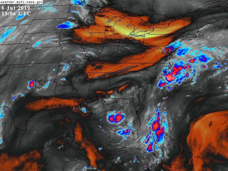
panamatropicwatch wrote:Might take a little while for convection to build. Quite a bit of dry air around.
http://tropicwatch.info/watervapor92l070820191014.jpg
Might be the only thing that could help keep it in check, at least temporarily.
0 likes
Personal Forecast Disclaimer:
The posts in this forum are NOT official forecast and should not be used as such. They are just the opinion of the poster and may or may not be backed by sound meteorological data. They are NOT endorsed by any professional institution or storm2k.org. For official information, please refer to the NHC and NWS products.
The posts in this forum are NOT official forecast and should not be used as such. They are just the opinion of the poster and may or may not be backed by sound meteorological data. They are NOT endorsed by any professional institution or storm2k.org. For official information, please refer to the NHC and NWS products.
-
Aric Dunn
- Category 5
- Posts: 21228
- Age: 41
- Joined: Sun Sep 19, 2004 9:58 pm
- Location: Ready for the Chase.
- Contact:
Re: ATL: INVEST 92L - Discussion
Very interesting to see the 12z gfs coverting the vorticity/low over central GA very quickly sw in 12 hours. A lobe to the sw develops and by tomorrow morning the vorticty is nearly offshore..
0 likes
Note: If I make a post that is brief. Please refer back to previous posts for the analysis or reasoning. I do not re-write/qoute what my initial post said each time.
If there is nothing before... then just ask
Space & Atmospheric Physicist, Embry-Riddle Aeronautical University,
I believe the sky is falling...
If there is nothing before... then just ask
Space & Atmospheric Physicist, Embry-Riddle Aeronautical University,
I believe the sky is falling...
-
vbhoutex

- Storm2k Executive
- Posts: 28974
- Age: 72
- Joined: Wed Oct 09, 2002 11:31 pm
- Location: Spring Branch area, Houston, TX
- Contact:
Re: ATL: INVEST 92L - Discussion
This is Jeff Lindner's take on our 92L
Tropical cyclone likely to develop in the Gulf of Mexico this week.
Threat has increased westward overnight along the LA and TX coasts.
Discussion:
Mid level (850mb) disturbance over GA is continuing to move SSE/S this morning and will be moving into N FL and eventually the extreme NE Gulf of Mexico over the next 24 hours. Global models are now in good agreement that this feature will work its wat from the 850mb level to the surface resulting in the formation of a tropical depression over the NE Gulf of Mexico. Upper air conditions appear favorable for a tropical system to form and then intensify with a large 200mb high pressure ridge over much of the US Gulf coast and northern Gulf.
Track:
While there was much spread and disagreement yesterday, starting yesterday afternoon and continuing overnight, that spread has decreased into a solution where any Gulf system would tend to track more westward. The GFS has abandoned the idea of the system remaining close to the FL coast and is now in fair agreement with the ECMWF of a slow westward track across the Gulf of Mexico. Most models now indicate a threat westward along the US Gulf coast toward TX and LA. As mentioned yesterday, both the westward and eastward track solution were viable, and it appears we are starting to see a trend toward the westward solution being the more favored. This more westward solution is likely due to a more WSW movement of the system in the Gulf of Mexico and the formation and building of a mid level high pressure ridge over the southern US mid to late week which would prevent any trough near the Great Lakes from pulling the system northward.
Intensity:
While there is better agreement on the track this morning there remains a lot of spread on the intensity with the ECWMF model continuing to be the strongest. Looking at the upper air and surface features for a moment suggest that any storm in the Gulf will likely intensify. Upper level winds are forecast to be light with the surface feature located under a 200mb anticyclone which will help vent the surface low and provide good upper level outflow. Additionally, the system would appear to move over the warm Gulf waters with temperatures in the 84-86 degree range and per latest oceanic heat content there is plenty of heat content for development. Models also show the system slowing its westward movement allowing a longer time over those warm Gulf waters. A tropical storm is likely and a hurricane is not out of the question.
Impacts:
For now will not make any changes to the ongoing forecast for late this week/weekend. If forecast models continue to show the westward motion and potential threat to the NW Gulf…significant forecast changes will be required over the next 24-48 hours.
Residents along the US Gulf coast should closely monitor the progress of this system. Check hurricane preparation kits and plans and be ready to enact those plans this week. Monitor weather forecast closely.
https://www.nhc.noaa.gov/xgtwo/two_atl_5d0.png
3 likes
Skywarn, C.E.R.T.
Please click below to donate to STORM2K to help with the expenses of keeping the site going:

Please click below to donate to STORM2K to help with the expenses of keeping the site going:
-
gatorcane

- S2K Supporter

- Posts: 23499
- Age: 46
- Joined: Sun Mar 13, 2005 3:54 pm
- Location: Boca Raton, FL
Re: ATL: INVEST 92L - Discussion
Aric Dunn wrote:Very interesting to see the 12z gfs coverting the vorticity/low over central GA very quickly sw in 12 hours. A lobe to the sw develops and by tomorrow morning the vorticty is nearly offshore..
The GFS continues to insist the low won’t have enough time to really organize before moving inland. Reminds me a lot of the one system from 2017 I believe that hugged the Gulf coast and was a tremendous rain maker. Had that system been 100 miles further south, would have made a huge difference.
Last edited by gatorcane on Mon Jul 08, 2019 11:00 am, edited 2 times in total.
0 likes

Re: ATL: INVEST 92L - Discussion
Following. Hoping SW Florida gets in on some of the rain
0 likes
Taffy-SW Florida
Re: ATL: INVEST 92L - Discussion
gatorcane wrote:Aric Dunn wrote:Very interesting to see the 12z gfs coverting the vorticity/low over central GA very quickly sw in 12 hours. A lobe to the sw develops and by tomorrow morning the vorticty is nearly offshore..
The GFS continues to insist the low won’t have enough time to really organize before moving inland.
And this is where I begin my cheerleading campaign for the GFS.
I really hope this doesn't have an Allison type setup, though both the Euro and GFS tend to move it quicker in and out of here.
0 likes
Personal Forecast Disclaimer:
The posts in this forum are NOT official forecast and should not be used as such. They are just the opinion of the poster and may or may not be backed by sound meteorological data. They are NOT endorsed by any professional institution or storm2k.org. For official information, please refer to the NHC and NWS products.
The posts in this forum are NOT official forecast and should not be used as such. They are just the opinion of the poster and may or may not be backed by sound meteorological data. They are NOT endorsed by any professional institution or storm2k.org. For official information, please refer to the NHC and NWS products.
-
Hypercane_Kyle

- Category 5
- Posts: 2899
- Joined: Sat Mar 07, 2015 7:58 pm
- Location: Cape Canaveral, FL
Re: ATL: INVEST 92L - Discussion
Not necessarily related to 92L, but I wouldn't be surprised if the area of thunderstorms off the coast of North Carolina tries something too.
0 likes
My posts are my own personal opinion, defer to the National Hurricane Center (NHC) and other NOAA products for decision making during hurricane season.
-
Aric Dunn
- Category 5
- Posts: 21228
- Age: 41
- Joined: Sun Sep 19, 2004 9:58 pm
- Location: Ready for the Chase.
- Contact:
Re: ATL: INVEST 92L - Discussion
gatorcane wrote:Aric Dunn wrote:Very interesting to see the 12z gfs coverting the vorticity/low over central GA very quickly sw in 12 hours. A lobe to the sw develops and by tomorrow morning the vorticty is nearly offshore..
The GFS continues to insist the low won’t have enough time to really organize before moving inland.
I am not even looking at the gfs for intensity right now. Just the short term progress of the vorticity the next 24 hours. And it shows it getting tugged sw in the next 12 hours.. likely do to convection building over the northern gulf/panhandle. That is key.
0 likes
Note: If I make a post that is brief. Please refer back to previous posts for the analysis or reasoning. I do not re-write/qoute what my initial post said each time.
If there is nothing before... then just ask
Space & Atmospheric Physicist, Embry-Riddle Aeronautical University,
I believe the sky is falling...
If there is nothing before... then just ask
Space & Atmospheric Physicist, Embry-Riddle Aeronautical University,
I believe the sky is falling...
-
tropicwatch
- Category 5
- Posts: 3205
- Age: 60
- Joined: Sat Jun 02, 2007 10:01 am
- Location: Panama City Florida
- Contact:
Re: ATL: INVEST 92L - Discussion
0 likes
Tropicwatch
Agnes 72', Eloise 75, Elena 85', Kate 85', Charley 86', Florence 88', Beryl 94', Dean 95', Erin 95', Opal 95', Earl 98', Georges 98', Ivan 2004', Arlene 2005', Dennis 2005', Ida 2009' Debby 2012' Irma 2017' Michael 2018'
Agnes 72', Eloise 75, Elena 85', Kate 85', Charley 86', Florence 88', Beryl 94', Dean 95', Erin 95', Opal 95', Earl 98', Georges 98', Ivan 2004', Arlene 2005', Dennis 2005', Ida 2009' Debby 2012' Irma 2017' Michael 2018'
-
gatorcane
- S2K Supporter
- Posts: 23499
- Age: 46
- Joined: Sun Mar 13, 2005 3:54 pm
- Location: Boca Raton, FL
Re: ATL: INVEST 92L - Discussion
Aric Dunn wrote:gatorcane wrote:Aric Dunn wrote:Very interesting to see the 12z gfs coverting the vorticity/low over central GA very quickly sw in 12 hours. A lobe to the sw develops and by tomorrow morning the vorticty is nearly offshore..
The GFS continues to insist the low won’t have enough time to really organize before moving inland.
I am not even looking at the gfs for intensity right now. Just the short term progress of the vorticity the next 24 hours. And it shows it getting tugged sw in the next 12 hours.. likely do to convection building over the northern gulf/panhandle. That is key.
I noticed the UKMET is coming in stronger. That is interesting. Perhaps the GFS is too weak here.
0 likes
-
Aric Dunn
- Category 5
- Posts: 21228
- Age: 41
- Joined: Sun Sep 19, 2004 9:58 pm
- Location: Ready for the Chase.
- Contact:
Re: ATL: INVEST 92L - Discussion
12z icon looks extremely plausible. Check out how the convection that develops over northern gulf later today and tonight rapidly pull/develops the low/vorticity offshore by tomorrow midday. Watching the convective pattern today is very key https://www.tropicaltidbits.com/analysi ... 812&fh=-42
0 likes
Note: If I make a post that is brief. Please refer back to previous posts for the analysis or reasoning. I do not re-write/qoute what my initial post said each time.
If there is nothing before... then just ask
Space & Atmospheric Physicist, Embry-Riddle Aeronautical University,
I believe the sky is falling...
If there is nothing before... then just ask
Space & Atmospheric Physicist, Embry-Riddle Aeronautical University,
I believe the sky is falling...
Who is online
Users browsing this forum: No registered users and 28 guests