


ATL: BARRY - Models
Moderator: S2k Moderators
Re: ATL: BARRY - Models
UKMET still a bit west of most but much more in line with other guidance finally:
1 likes

Re: ATL: BARRY - Models
CMC shows the band of heaviest precipitation slightly east of the GFS but worse for the City of New Orleans. It landfalls a bit east of the NHC.

1 likes
Re: ATL: BARRY - Models
12z EURO has the pressure at 993 in 24 hours... Barry is already at 993mb... does that mean it isn't expected to strengthen anymore for the next 24 hours or EURO is off... initialized at 996 mb
0 likes
Re: ATL: BARRY - Models
Frank P wrote:12z EURO has the pressure at 993 in 24 hours... Barry is already at 993mb... does that mean it isn't expected to strengthen anymore for the next 24 hours or EURO is off... initialized at 996 mb
I think it’s off and that the resolution is too broad. I’m thinking mid 980s
2 likes
-
PTrackerLA

- Category 5

- Posts: 5248
- Age: 40
- Joined: Thu Oct 10, 2002 8:40 pm
- Location: Lafayette, LA


Re: ATL: BARRY - Models
I read elsewhere the center is reforming. Does anyone know if that’s correct?
0 likes
Re: ATL: BARRY - Models
Sambucol wrote:I read elsewhere the center is reforming. Does anyone know if that’s correct?
Reorganizing is probably a better term for what it’s doing.
1 likes
Re: ATL: BARRY - Models
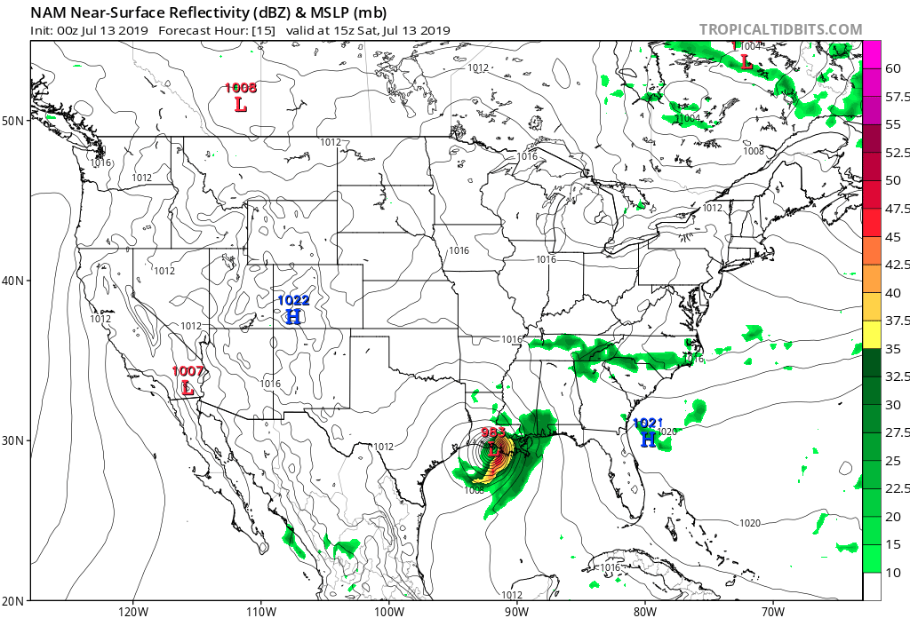
both 18Z 3K and 12K Nam models are slightly weaker and a tad to the east of the 12Z runs..
1 likes
-
Kingarabian

- S2K Supporter

- Posts: 15434
- Joined: Sat Aug 08, 2009 3:06 am
- Location: Honolulu, Hawaii
Re: ATL: BARRY - Models
Steve wrote:Frank P wrote:12z EURO has the pressure at 993 in 24 hours... Barry is already at 993mb... does that mean it isn't expected to strengthen anymore for the next 24 hours or EURO is off... initialized at 996 mb
I think it’s off and that the resolution is too broad. I’m thinking mid 980s
I think there's a good chance that the original landfall intensity forecasts (Between 980-985) from the Euro and GFS will verify.
2 likes
RIP Kobe Bryant
Re: ATL: BARRY - Models
Kingarabian wrote:Steve wrote:Frank P wrote:12z EURO has the pressure at 993 in 24 hours... Barry is already at 993mb... does that mean it isn't expected to strengthen anymore for the next 24 hours or EURO is off... initialized at 996 mb
I think it’s off and that the resolution is too broad. I’m thinking mid 980s
I think there's a good chance that the original landfall intensity forecasts (Between 980-985) from the Euro and GFS will verify.
Yeah I mean that’s legit. 975 probably isn’t even completely out of the question, but it’s going to need more time probably than it had. Joe B thinks in this case there should be about 12 hours of limited degradation after landfall.
0 likes
-
StormPyrate
- Tropical Storm

- Posts: 180
- Joined: Sun May 27, 2018 8:41 pm
- Location: Clearwater, FL
Re: ATL: BARRY - Models
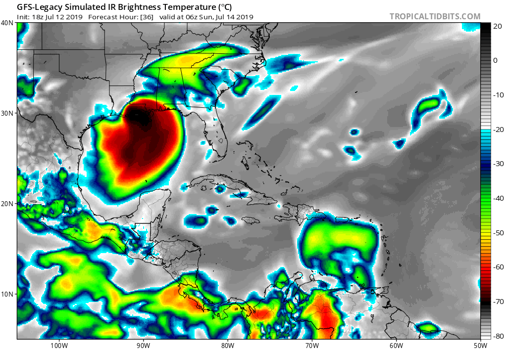
Seeing what satellite is showing now, those odd loops on the GFS models a couple days ago make sense
3 likes
St Petersburg Florida
-
TheProfessor

- Professional-Met

- Posts: 3505
- Age: 27
- Joined: Tue Dec 03, 2013 10:56 am
- Location: Wichita, Kansas
Re: ATL: BARRY - Models
The Rain shield to east of the storm on the HWRF is pretty big. There would definitely be widespread problems if that were to occur.
0 likes
An alumnus of The Ohio State University.
Your local National Weather Service office is your best source for weather information.
Your local National Weather Service office is your best source for weather information.
-
stormlover2013
- Category 5
- Posts: 2312
- Joined: Thu Aug 22, 2013 12:06 pm
- Location: Lumberton, Texas
-
ColdFusion

- S2K Supporter
- Posts: 406
- Joined: Wed Feb 13, 2008 3:46 pm
- Location: Addison, TX
Re: ATL: BARRY - Models
MS River @ Nola decreasing over the last 4 hours:
07/12 22:00 16.89ft
07/12 21:00 16.90ft
07/12 20:00 16.92ft
07/12 19:00 16.93ft
07/12 22:00 16.89ft
07/12 21:00 16.90ft
07/12 20:00 16.92ft
07/12 19:00 16.93ft
0 likes

Re: ATL: BARRY - Models
stormlover2013 wrote:Time to followed the hrr, did really well for harvey!!!
So far is not doing too well.

1 likes


Re: ATL: BARRY - Models
boca wrote:Is the GFS Legacy the old GFS model?
yes
0 likes
Personal Forecast Disclaimer:
The posts in this forum are NOT official forecast and should not be used as such. They are just the opinion of the poster and may or may not be backed by sound meteorological data. They are NOT endorsed by any professional institution or storm2k.org. For official information, please refer to the NHC and NWS products.
The posts in this forum are NOT official forecast and should not be used as such. They are just the opinion of the poster and may or may not be backed by sound meteorological data. They are NOT endorsed by any professional institution or storm2k.org. For official information, please refer to the NHC and NWS products.
Who is online
Users browsing this forum: No registered users and 90 guests