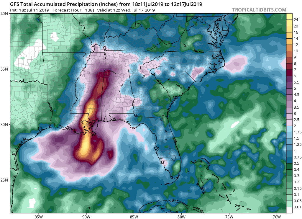
https://www.tropicaltidbits.com/analysi ... 1200&fh=36NAM 3km landfall is early morning Saturday. Rainfall is east of center for roughly 35 or 40 (?) miles. All models from the EC, GFS, NAM, Canadian, HWRF, etc. have shown that the eastern side for the 24 or so hours after landfall is going to be where the psycho rainfall is and where people are going to get rocked. As the models hone in, I'm thinking the worst case for us in the city is for a landfall anywhere between Cocodrie and Grand Isle or so. Anything east of there, it's going to be Slidell or the MS Gulf Coast that gets it. Anything west, and then it could be Bayou, RIver Parishes, Basin, Lafayette, etc. People need to know that if the models have that aspect correct, and I think they do based on how they've handled and shown the current state yesterday and Tuesday, you could be under literally a day of deluge. Water will come up quickly no matter if it's a city with drainage or if you're near rivers or bayous.