ATL: NESTOR - Post-Tropical - Discussion
Moderator: S2k Moderators

Re: ATL: INVEST 96L - Discussion
Overall, looks like it's slowly developing. Still, any broad circulation appears to me to be stretched NNW to SSE. Yeah Aric, I was thinking that it was already drifting generally northward too. No doubt that conditions in general way down in the SW BOC seem pretty favorable but that begins to change as the system gains latitude. You can see that dry air over the NW Gulf punch southward, not to mention the increased Westerlies with the increase in latitude. My guess is that it'll start out looking fully tropical and then begin to get stretched out before reorganizing a day or two later much closer to the N. Gulf coastline
4 likes
Personal Forecast Disclaimer:
The posts in this forum are NOT official forecast and should not be used as such. They are just the opinion of the poster and may or may not be backed by sound meteorological data. They are NOT endorsed by any professional institution or storm2k.org. For official information, please refer to the NHC and NWS products.
The posts in this forum are NOT official forecast and should not be used as such. They are just the opinion of the poster and may or may not be backed by sound meteorological data. They are NOT endorsed by any professional institution or storm2k.org. For official information, please refer to the NHC and NWS products.
Re: ATL: INVEST 96L - Discussion
CyclonicFury wrote:I'm thinking a mid-grade heavily sheared tropical storm is likely, similar to the sloppy storms we often see in June. I don't think it's likely this gets anywhere near Michael in strength. But a 50-60 kt storm would not be too surprising.
I agree. Hurricane seasons often begin and end with the same type of storm in the same region (NE GOM). sheared, right loaded, with a semi tropical look. Would not be a shock if the system had a squall line configuration tailing to the south with some svr wx risk. With very dry antecedent conditions in the likely path, for most the system will likely be a net benefit. What a change from a year ago when the southeast US was swamp of a wet mess..
1 likes
-
cycloneye

- Admin

- Posts: 139087
- Age: 67
- Joined: Thu Oct 10, 2002 10:54 am
- Location: San Juan, Puerto Rico
Re: ATL: INVEST 96L - Discussion
1 likes
Visit the Caribbean-Central America Weather Thread where you can find at first post web cams,radars
and observations from Caribbean basin members Click Here
and observations from Caribbean basin members Click Here
-
DestinHurricane

- Category 4

- Posts: 930
- Joined: Tue May 01, 2018 8:05 am
- Location: Columbus, OH... need to get back in the action
Re: ATL: INVEST 96L - Discussion
This will be similar to subtropical storm Alberto last year
0 likes
Destin/Santa Rosa Beach, Florida: Ivan 2004, Dennis 2005, Michael 2018, Sally 2020
Fort Lauderdale, Florida Eta 2020, Many future storms!
THE Ohio State University:
Fort Lauderdale, Florida Eta 2020, Many future storms!
THE Ohio State University:
-
TheStormExpert

- Category 5

- Posts: 8487
- Age: 30
- Joined: Wed Feb 16, 2011 5:38 pm
- Location: Palm Beach Gardens, FL
Re: ATL: INVEST 96L - Discussion
DestinHurricane wrote:This will be similar to subtropical storm Alberto last year
Likely nothing worth getting too excited about. Fortunately we won't be seeing another monster like Michael from last October this year!
2 likes
The following post is NOT an official forecast and should not be used as such. It is just the opinion of the poster and may or may not be backed by sound meteorological data. It is NOT endorsed by storm2k.org.
Re: ATL: INVEST 96L - Discussion
Overall shape right now has gotten a bit weird. I don't think there's any sensible MLC or LLC quite yet. Seems that it's best near-term shot at reasonable development would be co-located with that new small area of bursting farthest to the south. Otherwise, this is still looking quite linear at the moment.
0 likes
Personal Forecast Disclaimer:
The posts in this forum are NOT official forecast and should not be used as such. They are just the opinion of the poster and may or may not be backed by sound meteorological data. They are NOT endorsed by any professional institution or storm2k.org. For official information, please refer to the NHC and NWS products.
The posts in this forum are NOT official forecast and should not be used as such. They are just the opinion of the poster and may or may not be backed by sound meteorological data. They are NOT endorsed by any professional institution or storm2k.org. For official information, please refer to the NHC and NWS products.

-
Dean4Storms
- S2K Supporter

- Posts: 6355
- Age: 61
- Joined: Sun Aug 31, 2003 1:01 pm
- Location: Miramar Bch. FL
-
cycloneye
- Admin
- Posts: 139087
- Age: 67
- Joined: Thu Oct 10, 2002 10:54 am
- Location: San Juan, Puerto Rico
Re: ATL: INVEST 96L - Discussion
Dean4Storms wrote:Is Recon still heading down there today?
Not today.They will go on Thursday afternoon.
0 likes
Visit the Caribbean-Central America Weather Thread where you can find at first post web cams,radars
and observations from Caribbean basin members Click Here
and observations from Caribbean basin members Click Here
-
tropicwatch

- Category 5
- Posts: 3205
- Age: 60
- Joined: Sat Jun 02, 2007 10:01 am
- Location: Panama City Florida
- Contact:
Re: ATL: INVEST 96L - Discussion
TheStormExpert wrote:DestinHurricane wrote:This will be similar to subtropical storm Alberto last year
Likely nothing worth getting too excited about. Fortunately we won't be seeing another monster like Michael from last October this year!
Unfortunately if we get any sustained tropical storm force winds in the Panhandle. A lot of people will get more water damage due to them still having tarps on there roofs.
4 likes
Tropicwatch
Agnes 72', Eloise 75, Elena 85', Kate 85', Charley 86', Florence 88', Beryl 94', Dean 95', Erin 95', Opal 95', Earl 98', Georges 98', Ivan 2004', Arlene 2005', Dennis 2005', Ida 2009' Debby 2012' Irma 2017' Michael 2018'
Agnes 72', Eloise 75, Elena 85', Kate 85', Charley 86', Florence 88', Beryl 94', Dean 95', Erin 95', Opal 95', Earl 98', Georges 98', Ivan 2004', Arlene 2005', Dennis 2005', Ida 2009' Debby 2012' Irma 2017' Michael 2018'
-
HurricaneAndre2008

- Category 1

- Posts: 250
- Age: 26
- Joined: Wed Jul 31, 2019 9:51 pm
- Contact:
Re: ATL: INVEST 96L - Discussion
1 likes
Cindy(2005), Katrina(2005), Rita(2005), Erin(2007), Isaac(2012)
-
Aric Dunn
- Category 5
- Posts: 21228
- Age: 41
- Joined: Sun Sep 19, 2004 9:58 pm
- Location: Ready for the Chase.
- Contact:
Re: ATL: INVEST 96L - Discussion
HurricaneAndre2008 wrote:https://mobile.twitter.com/pppapin/status/1184589670367334400
For once you dont really need ascat ..
But yeah likely closed
Which would make it a td.
2 likes
Note: If I make a post that is brief. Please refer back to previous posts for the analysis or reasoning. I do not re-write/qoute what my initial post said each time.
If there is nothing before... then just ask
Space & Atmospheric Physicist, Embry-Riddle Aeronautical University,
I believe the sky is falling...
If there is nothing before... then just ask
Space & Atmospheric Physicist, Embry-Riddle Aeronautical University,
I believe the sky is falling...
-
Aric Dunn
- Category 5
- Posts: 21228
- Age: 41
- Joined: Sun Sep 19, 2004 9:58 pm
- Location: Ready for the Chase.
- Contact:
Re: ATL: INVEST 96L - Discussion
At this rate.. by the time recon gets there tomorrow it will already be a ts
2 likes
Note: If I make a post that is brief. Please refer back to previous posts for the analysis or reasoning. I do not re-write/qoute what my initial post said each time.
If there is nothing before... then just ask
Space & Atmospheric Physicist, Embry-Riddle Aeronautical University,
I believe the sky is falling...
If there is nothing before... then just ask
Space & Atmospheric Physicist, Embry-Riddle Aeronautical University,
I believe the sky is falling...
-
wxman57

- Moderator-Pro Met

- Posts: 22482
- Age: 66
- Joined: Sat Jun 21, 2003 8:06 pm
- Location: Houston, TX (southwest)
Re: ATL: INVEST 96L - Discussion
FYI, I have it moving at a forward speed of around 25-28 mph at landfall near Pensacola on Saturday. It won't be hanging around like Harvey or Imelda to produce really heavy rain. Maybe 1-3 inches right of the track with some spots possibly seeing 4-6 inches.
6 likes
-
Sciencerocks
- Category 5
- Posts: 7286
- Age: 38
- Joined: Thu Jul 06, 2017 1:51 am
Re: ATL: INVEST 96L - Discussion
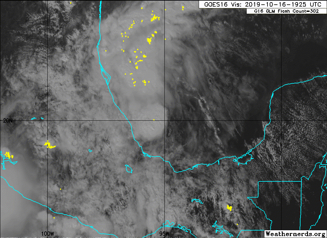
Looks good. Probably a depression based on this satellite loop and the ascat above.
5 likes
Re: ATL: INVEST 96L - Discussion
Our formative system is looking rather healthy. I'd imagine those odds at 8 pm will be going up
2 likes

Re: ATL: INVEST 96L - Discussion
See what the models think about shear, could have a pretty strong surge coming east like that if it were a very deep system.
0 likes
-
northjaxpro

- S2K Supporter
- Posts: 8900
- Joined: Mon Sep 27, 2010 11:21 am
- Location: Jacksonville, FL
Re: ATL: INVEST 96L - Discussion
3 likes
NEVER, EVER SAY NEVER in the tropics and weather in general, and most importantly, with life itself!!
________________________________________________________________________________________
Fay 2008 Beryl 2012 Debby 2012 Colin 2016 Hermine 2016 Julia 2016 Matthew 2016 Irma 2017 Dorian 2019
________________________________________________________________________________________
Fay 2008 Beryl 2012 Debby 2012 Colin 2016 Hermine 2016 Julia 2016 Matthew 2016 Irma 2017 Dorian 2019

Re: ATL: INVEST 96L - Discussion
I haven’t been paying attention other than seeing models for the last few weeks wanting to eventually bring a system up NNE in the Gulf. So you figured it would happen. It’s more now the nature of what it is. Almost zero investigation tells me to look out for a decent looking, mid-grade October, Gulf system moving pretty fast NNE-NE. Some of the models are fairly tight with the circulation, but others depict a broader center up toward the Coast. We look to get fringe elements here, so some breezes and maybe some fast moving clouds. Any rain looks concentrated east, which is what you’d expect with this setup. I’m not sure what the ceiling is, maybe 60-65 offshore and 40ish inland? Loop current should give it a boost for a bit. Landfall should be somewhere between Escambia and Bay Counties, but it might get close enough to the AL coast for some strong conditions there. Trajectory should be based on how fast the front is coming down and at what angle. Looks like more of a downed tree, power outage type storm with some tidal issues farther east. Hopefully it just blows through. What isn’t clear to me is if this is it for the Western Basin. I kind of think not in that a couple of cold highs will build down after Nestor pulls up.
Last edited by Steve on Wed Oct 16, 2019 6:33 pm, edited 1 time in total.
3 likes
-
gatorcane

- S2K Supporter
- Posts: 23499
- Age: 46
- Joined: Sun Mar 13, 2005 3:54 pm
- Location: Boca Raton, FL
Re: ATL: INVEST 96L - Discussion
If that blowup in the Southern BoC is indeed where the center is, looks like it is already a good bit east of the Euro and GFS forecasts. In this case stronger means more east which may put peninsula Florida in play.
4 likes
Who is online
Users browsing this forum: No registered users and 77 guests