EPAC: BORIS - Remnants
Moderator: S2k Moderators
-
Sciencerocks
- Category 5

- Posts: 7286
- Age: 38
- Joined: Thu Jul 06, 2017 1:51 am
-
cycloneye

- Admin

- Posts: 139068
- Age: 67
- Joined: Thu Oct 10, 2002 10:54 am
- Location: San Juan, Puerto Rico
Re: EPAC: BORIS - Tropical Storm
BULLETIN
Tropical Storm Boris Advisory Number 6
NWS National Hurricane Center Miami FL EP032020
1100 AM HST Thu Jun 25 2020
...DEPRESSION BECOMES TROPICAL STORM BORIS...
SUMMARY OF 1100 AM HST...2100 UTC...INFORMATION
-----------------------------------------------
LOCATION...11.2N 137.1W
ABOUT 1330 MI...2145 KM ESE OF HILO HAWAII
ABOUT 1965 MI...3160 KM WSW OF THE SOUTHERN TIP OF BAJA CALIFORNIA
MAXIMUM SUSTAINED WINDS...40 MPH...65 KM/H
PRESENT MOVEMENT...WNW OR 285 DEGREES AT 9 MPH...15 KM/H
MINIMUM CENTRAL PRESSURE...1005 MB...29.68 INCHES
WATCHES AND WARNINGS
--------------------
There are no coastal watches or warnings in effect.
DISCUSSION AND OUTLOOK
----------------------
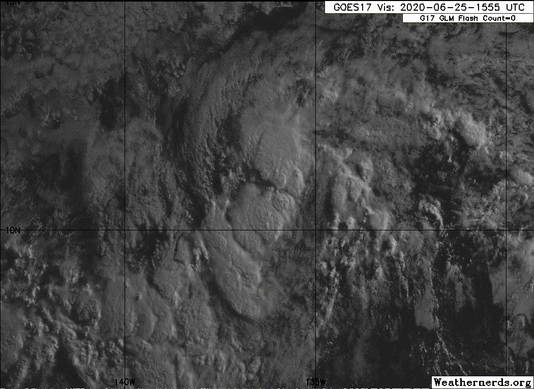
At 1100 AM HST (2100 UTC), the center of Tropical Storm Boris was
located near latitude 11.2 North, longitude 137.1 West. Boris is
moving toward the west-northwest near 9 mph (15 km/h) and this
motion is expected to continue tonight. A turn toward the west is
forecast Friday or Friday night, with this motion continuing
through Saturday.
Recent satellite wind data indicate that maximum sustained winds
have increased to near 40 mph (65 km/h) with higher gusts. Little
change in strength is expected tonight. After that, Boris is
forecast to weaken back to a depression Friday or Friday night.
Tropical-storm-force winds extend outward up to 45 miles (75 km)
from the center.
The estimated minimum central pressure is 1005 mb (29.68 inches).
HAZARDS AFFECTING LAND
----------------------
None.
NEXT ADVISORY
-------------
Next complete advisory at 500 PM HST.
$$
Forecaster Beven
NNNN
Tropical Storm Boris Discussion Number 6
NWS National Hurricane Center Miami FL EP032020
1100 AM HST Thu Jun 25 2020
Convection has increased further in association with the tropical
cyclone, with the center now under a poorly-organized band or dense
overcast. A just-received ASCAT-A overpass indicates that 35-kt
winds are occurring over an area about 40 n mi from the center in
the southeastern semicircle and based on this, the depression is
upgraded to Tropical Storm Boris.
While conditions appear to be favorable for some additional
strengthening for the next 12 h or so, none of the intensity
guidance forecasts significant intensification during that time.
Thus, the intensity forecast holds the intensity at 35 kt through 12
h. After that time, increasing vertical wind shear and dry air
entrainment should cause Boris to weaken, leading to the system
degenerating to a remnant low by 60 h and dissipating completely
after 72 h. The new intensity forecast has been adjusted downward,
but it still is a little above the intensity consensus.
The initial motion is now west-northwestward or 285/8. This motion
should continue for the next 24 h or so as Boris moves along the
south side of a low- to mid-level ridge. After that, a turn toward
the west and west-southwest is forecast as the cyclone weakens and
the low-level trade winds become the dominant steering mechanism.
The new forecast track has only minor changes from the previous
forecast, and it again lies the near consensus models.
FORECAST POSITIONS AND MAX WINDS
INIT 25/2100Z 11.2N 137.1W 35 KT 40 MPH
12H 26/0600Z 11.5N 138.0W 35 KT 40 MPH
24H 26/1800Z 11.9N 139.1W 30 KT 35 MPH
36H 27/0600Z 12.2N 140.3W 30 KT 35 MPH
48H 27/1800Z 12.3N 141.6W 25 KT 30 MPH
60H 28/0600Z 12.2N 143.3W 25 KT 30 MPH...POST-TROP/REMNT LOW
72H 28/1800Z 12.0N 145.5W 20 KT 25 MPH...POST-TROP/REMNT LOW
96H 29/1800Z...DISSIPATED
$$
Forecaster Beven
Tropical Storm Boris Advisory Number 6
NWS National Hurricane Center Miami FL EP032020
1100 AM HST Thu Jun 25 2020
...DEPRESSION BECOMES TROPICAL STORM BORIS...
SUMMARY OF 1100 AM HST...2100 UTC...INFORMATION
-----------------------------------------------
LOCATION...11.2N 137.1W
ABOUT 1330 MI...2145 KM ESE OF HILO HAWAII
ABOUT 1965 MI...3160 KM WSW OF THE SOUTHERN TIP OF BAJA CALIFORNIA
MAXIMUM SUSTAINED WINDS...40 MPH...65 KM/H
PRESENT MOVEMENT...WNW OR 285 DEGREES AT 9 MPH...15 KM/H
MINIMUM CENTRAL PRESSURE...1005 MB...29.68 INCHES
WATCHES AND WARNINGS
--------------------
There are no coastal watches or warnings in effect.
DISCUSSION AND OUTLOOK
----------------------
At 1100 AM HST (2100 UTC), the center of Tropical Storm Boris was
located near latitude 11.2 North, longitude 137.1 West. Boris is
moving toward the west-northwest near 9 mph (15 km/h) and this
motion is expected to continue tonight. A turn toward the west is
forecast Friday or Friday night, with this motion continuing
through Saturday.
Recent satellite wind data indicate that maximum sustained winds
have increased to near 40 mph (65 km/h) with higher gusts. Little
change in strength is expected tonight. After that, Boris is
forecast to weaken back to a depression Friday or Friday night.
Tropical-storm-force winds extend outward up to 45 miles (75 km)
from the center.
The estimated minimum central pressure is 1005 mb (29.68 inches).
HAZARDS AFFECTING LAND
----------------------
None.
NEXT ADVISORY
-------------
Next complete advisory at 500 PM HST.
$$
Forecaster Beven
NNNN
Tropical Storm Boris Discussion Number 6
NWS National Hurricane Center Miami FL EP032020
1100 AM HST Thu Jun 25 2020
Convection has increased further in association with the tropical
cyclone, with the center now under a poorly-organized band or dense
overcast. A just-received ASCAT-A overpass indicates that 35-kt
winds are occurring over an area about 40 n mi from the center in
the southeastern semicircle and based on this, the depression is
upgraded to Tropical Storm Boris.
While conditions appear to be favorable for some additional
strengthening for the next 12 h or so, none of the intensity
guidance forecasts significant intensification during that time.
Thus, the intensity forecast holds the intensity at 35 kt through 12
h. After that time, increasing vertical wind shear and dry air
entrainment should cause Boris to weaken, leading to the system
degenerating to a remnant low by 60 h and dissipating completely
after 72 h. The new intensity forecast has been adjusted downward,
but it still is a little above the intensity consensus.
The initial motion is now west-northwestward or 285/8. This motion
should continue for the next 24 h or so as Boris moves along the
south side of a low- to mid-level ridge. After that, a turn toward
the west and west-southwest is forecast as the cyclone weakens and
the low-level trade winds become the dominant steering mechanism.
The new forecast track has only minor changes from the previous
forecast, and it again lies the near consensus models.
FORECAST POSITIONS AND MAX WINDS
INIT 25/2100Z 11.2N 137.1W 35 KT 40 MPH
12H 26/0600Z 11.5N 138.0W 35 KT 40 MPH
24H 26/1800Z 11.9N 139.1W 30 KT 35 MPH
36H 27/0600Z 12.2N 140.3W 30 KT 35 MPH
48H 27/1800Z 12.3N 141.6W 25 KT 30 MPH
60H 28/0600Z 12.2N 143.3W 25 KT 30 MPH...POST-TROP/REMNT LOW
72H 28/1800Z 12.0N 145.5W 20 KT 25 MPH...POST-TROP/REMNT LOW
96H 29/1800Z...DISSIPATED
$$
Forecaster Beven
0 likes
Visit the Caribbean-Central America Weather Thread where you can find at first post web cams,radars
and observations from Caribbean basin members Click Here
and observations from Caribbean basin members Click Here


Re: EPAC: BORIS - Tropical Storm
Hey, he made it! EPac is finally up to two (absolutely pathetic) named storms.
This EPac season is going to be really boring if this is any sign...
This EPac season is going to be really boring if this is any sign...
0 likes
Irene '11 Sandy '12 Hermine '16 5/15/2018 Derecho Fay '20 Isaias '20 Elsa '21 Henri '21 Ida '21
I am only a meteorology enthusiast who knows a decent amount about tropical cyclones. Look to the professional mets, the NHC, or your local weather office for the best information.
I am only a meteorology enthusiast who knows a decent amount about tropical cyclones. Look to the professional mets, the NHC, or your local weather office for the best information.
-
Kingarabian

- S2K Supporter

- Posts: 15434
- Joined: Sat Aug 08, 2009 3:06 am
- Location: Honolulu, Hawaii
Re: EPAC: BORIS - Tropical Storm
aspen wrote:Hey, he made it! EPac is finally up to two (absolutely pathetic) named storms.
This EPac season is going to be really boring if this is any sign...
It might 1-up 2019 at this point.
1 likes
RIP Kobe Bryant
Re: EPAC: BORIS - Tropical Storm
Kingarabian wrote:aspen wrote:Hey, he made it! EPac is finally up to two (absolutely pathetic) named storms.
This EPac season is going to be really boring if this is any sign...
It might 1-up 2019 at this point.
It’ll be a miracle if the EPac pumps out anything like Barbara this year. Maybe a few rather long-tracking majors, possibly with one high-end Cat 4, but that’s probably the most we’d get.
0 likes
Irene '11 Sandy '12 Hermine '16 5/15/2018 Derecho Fay '20 Isaias '20 Elsa '21 Henri '21 Ida '21
I am only a meteorology enthusiast who knows a decent amount about tropical cyclones. Look to the professional mets, the NHC, or your local weather office for the best information.
I am only a meteorology enthusiast who knows a decent amount about tropical cyclones. Look to the professional mets, the NHC, or your local weather office for the best information.
-
cycloneye
- Admin
- Posts: 139068
- Age: 67
- Joined: Thu Oct 10, 2002 10:54 am
- Location: San Juan, Puerto Rico
Re: EPAC: BORIS - Tropical Storm
Tropical Storm Boris Discussion Number 7
NWS National Hurricane Center Miami FL EP032020
500 PM HST Thu Jun 25 2020
Deep convection associated with Boris has decreased in coverage
since the previous advisory, however a new band of convection has
recently developed over the eastern semicircle of the cyclone. The
initial wind speed remains 35 kt and is based on the earlier ASCAT
data and a Dvorak current intensity (CI) number of T2.5 or 35 kt
from SAB. Boris remains within an area of low vertical wind shear
and over warm sea surface temperatures, however dry mid-level air
just to the north and northwest of the storm continues to be
entrained into the circulation. As a result, little change in
strength is anticipated over the next 12 h or so, and after that
time, Boris will be moving into the drier and more stable air
mass which should cause gradual weakening. The new NHC intensity
forecast is unchanged from the previous advisory, and calls for
Boris to degenerate into a remnant low by 60 h, and dissipate
between 72 and 96 h.
The initial motion estimate is west-northwestward or 290 at 8 kt.
The track forecast reasoning remains unchanged from the previous
advisory. Boris should move west-northwestward during the next 24
hours while it remains to the south of a low- to mid-level ridge.
After that time, the cyclone should turn westward, then west-
southwestward later in the forecast period as the cyclone weakens
and is steered by the low-level trade wind flow. The updated NHC
forecast track is very close to the previous official forecast, and
along the southern side of the guidance envelope.
FORECAST POSITIONS AND MAX WINDS
INIT 26/0300Z 11.4N 137.9W 35 KT 40 MPH
12H 26/1200Z 11.8N 138.9W 35 KT 40 MPH
24H 27/0000Z 12.1N 140.0W 30 KT 35 MPH
36H 27/1200Z 12.3N 141.2W 30 KT 35 MPH
48H 28/0000Z 12.3N 142.8W 25 KT 30 MPH
60H 28/1200Z 12.1N 144.7W 25 KT 30 MPH...POST-TROP/REMNT LOW
72H 29/0000Z 11.8N 146.7W 20 KT 25 MPH...POST-TROP/REMNT LOW
96H 30/0000Z...DISSIPATED
$$
Forecaster Brown
0 likes
Visit the Caribbean-Central America Weather Thread where you can find at first post web cams,radars
and observations from Caribbean basin members Click Here
and observations from Caribbean basin members Click Here
-
storminabox
- Category 1

- Posts: 260
- Joined: Sun Jul 09, 2017 10:50 pm
Re: EPAC: BORIS - Tropical Storm
aspen wrote:Kingarabian wrote:aspen wrote:Hey, he made it! EPac is finally up to two (absolutely pathetic) named storms.
This EPac season is going to be really boring if this is any sign...
It might 1-up 2019 at this point.
It’ll be a miracle if the EPac pumps out anything like Barbara this year. Maybe a few rather long-tracking majors, possibly with one high-end Cat 4, but that’s probably the most we’d get.
I kinda doubt we'll even get that in the EPAC this year.
0 likes

Re: EPAC: BORIS - Tropical Storm
storminabox wrote:aspen wrote:Kingarabian wrote:It might 1-up 2019 at this point.
It’ll be a miracle if the EPac pumps out anything like Barbara this year. Maybe a few rather long-tracking majors, possibly with one high-end Cat 4, but that’s probably the most we’d get.
I kinda doubt we'll even get that in the EPAC this year.
In inactive seasons, the EPAC usually pumps out at least one impressive-looking storm. Even the dead 2010 season pumped out C5 Celia.
3 likes
Kendall -> SLO -> PBC
Memorable Storms: Katrina (for its Florida landfall...) Wilma Matthew Irma
Memorable Storms: Katrina (for its Florida landfall...) Wilma Matthew Irma
-
Extratropical94

- Professional-Met

- Posts: 3535
- Age: 29
- Joined: Wed Oct 20, 2010 6:36 am
- Location: Hamburg, Germany
- Contact:
Re: EPAC: BORIS - Tropical Depression
Tropical Depression Boris Advisory Number 8
NWS National Hurricane Center Miami FL EP032020
1100 PM HST Thu Jun 25 2020
...BORIS WEAKENS TO A DEPRESSION WHILE MAINTAINING A
WEST-NORTHWESTWARD MOTION...
SUMMARY OF 1100 PM HST...0900 UTC...INFORMATION
-----------------------------------------------
LOCATION...11.6N 138.5W
ABOUT 1235 MI...1990 KM ESE OF HILO HAWAII
ABOUT 2035 MI...3275 KM WSW OF THE SOUTHERN TIP OF BAJA CALIFORNIA
MAXIMUM SUSTAINED WINDS...35 MPH...55 KM/H
PRESENT MOVEMENT...WNW OR 290 DEGREES AT 8 MPH...13 KM/H
MINIMUM CENTRAL PRESSURE...1006 MB...29.71 INCHES
0 likes
54° 11' 59'' N, 9° 9' 20'' E
Boomer Sooner!
Go Broncos! Go Cards! Go Niners!
- Daniel
Boomer Sooner!
Go Broncos! Go Cards! Go Niners!
- Daniel

-
cycloneye
- Admin
- Posts: 139068
- Age: 67
- Joined: Thu Oct 10, 2002 10:54 am
- Location: San Juan, Puerto Rico
Re: EPAC: BORIS - Tropical Depression
Tropical Depression Boris Discussion Number 10
NWS National Hurricane Center Miami FL EP032020
1100 AM HST Fri Jun 26 2020
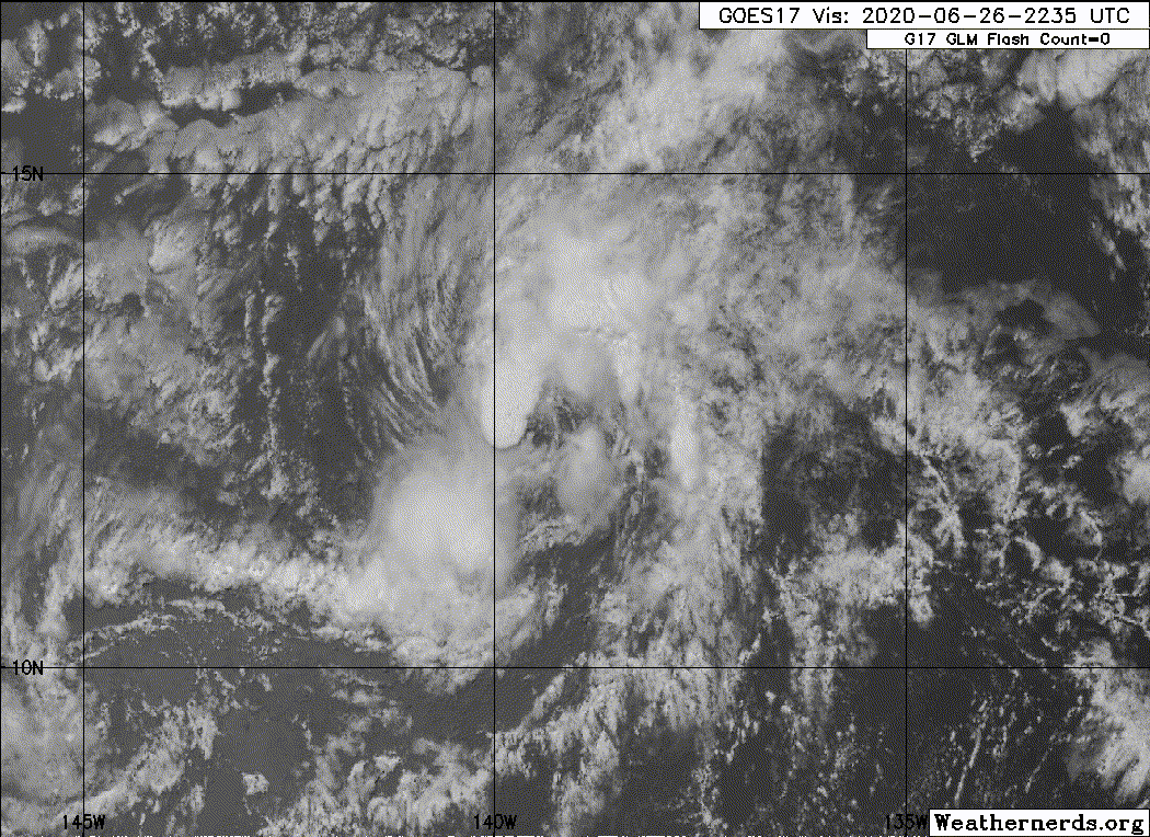
Visible satellite imagery shows that the center of Boris is a
little farther to the north than indicated in the previous
advisory. The cyclone has a good low-level circulation, but the
associated convection is currently disorganized due to a
combination of southerly vertical wind shear and mid-level dry air
entrainment. The initial intensity is held at 30 kt as a blend of
various satellite intensity estimates. A combination of shear, dry
mid-level air, and marginal sea-surface temperatures is expected to
cause slow weakening, with the cyclone now forecast to degenerate
to a remnant low by 48 h and dissipate completely after 60 h. The
new intensity forecast is little changed from the previous forecast
and lies near the intensity consensus.
The initial motion is a little uncertain, with the best estimate
315/6. Boris should turn west-northwestward during the next 12 h
or so while the small cyclone remains to the south of a low- to
mid-level ridge. Subsequently, the weakening cyclone is forecast
to turn westward and west-southwestward with some increase in
forward speed in the low-level trade wind flow. The new official
track forecast follows the general direction of the previous
one, but with some adjustments from the previous forecast due
to the more northward initial position.
FORECAST POSITIONS AND MAX WINDS
INIT 26/2100Z 12.5N 139.1W 30 KT 35 MPH
12H 27/0600Z 12.7N 139.8W 30 KT 35 MPH
24H 27/1800Z 12.9N 140.9W 25 KT 30 MPH
36H 28/0600Z 12.9N 142.5W 25 KT 30 MPH
48H 28/1800Z 12.7N 144.6W 20 KT 25 MPH...POST-TROP/REMNT LOW
60H 29/0600Z 12.3N 146.7W 20 KT 25 MPH...POST-TROP/REMNT LOW
72H 29/1800Z...DISSIPATED
$$
Forecaster Beven
NWS National Hurricane Center Miami FL EP032020
1100 AM HST Fri Jun 26 2020
Visible satellite imagery shows that the center of Boris is a
little farther to the north than indicated in the previous
advisory. The cyclone has a good low-level circulation, but the
associated convection is currently disorganized due to a
combination of southerly vertical wind shear and mid-level dry air
entrainment. The initial intensity is held at 30 kt as a blend of
various satellite intensity estimates. A combination of shear, dry
mid-level air, and marginal sea-surface temperatures is expected to
cause slow weakening, with the cyclone now forecast to degenerate
to a remnant low by 48 h and dissipate completely after 60 h. The
new intensity forecast is little changed from the previous forecast
and lies near the intensity consensus.
The initial motion is a little uncertain, with the best estimate
315/6. Boris should turn west-northwestward during the next 12 h
or so while the small cyclone remains to the south of a low- to
mid-level ridge. Subsequently, the weakening cyclone is forecast
to turn westward and west-southwestward with some increase in
forward speed in the low-level trade wind flow. The new official
track forecast follows the general direction of the previous
one, but with some adjustments from the previous forecast due
to the more northward initial position.
FORECAST POSITIONS AND MAX WINDS
INIT 26/2100Z 12.5N 139.1W 30 KT 35 MPH
12H 27/0600Z 12.7N 139.8W 30 KT 35 MPH
24H 27/1800Z 12.9N 140.9W 25 KT 30 MPH
36H 28/0600Z 12.9N 142.5W 25 KT 30 MPH
48H 28/1800Z 12.7N 144.6W 20 KT 25 MPH...POST-TROP/REMNT LOW
60H 29/0600Z 12.3N 146.7W 20 KT 25 MPH...POST-TROP/REMNT LOW
72H 29/1800Z...DISSIPATED
$$
Forecaster Beven
0 likes
Visit the Caribbean-Central America Weather Thread where you can find at first post web cams,radars
and observations from Caribbean basin members Click Here
and observations from Caribbean basin members Click Here
-
Sciencerocks
- Category 5
- Posts: 7286
- Age: 38
- Joined: Thu Jul 06, 2017 1:51 am
-
cycloneye
- Admin
- Posts: 139068
- Age: 67
- Joined: Thu Oct 10, 2002 10:54 am
- Location: San Juan, Puerto Rico
Re: EPAC: BORIS - Tropical Depression
Tropical Depression Boris Discussion Number 11
NWS National Hurricane Center Miami FL EP032020
500 PM HST Fri Jun 26 2020
There was a brief burst of deep convection over the estimated
center of Boris but, overall, the system is not very well
organized. The cloud pattern is elongated from southwest to
northeast which is indicative of significant shear over the
cyclone. The current intensity estimate remains 30 kt in agreement
with a Dvorak classification from TAFB. Boris will be moving
through an environment of south-southwesterly shear associated with
a large upper-level low and associated trough near and to the west
of 140W. This shear, along with relatively dry mid-level air,
should cause gradual weakening and Boris will likely degenerate into
a remnant low over the weekend. The official intensity forecast is
the same as the previous one, and similar to the latest DSHIPS and
LGEM guidance.
Boris appears to have turned back toward a west-northwesterly
heading and the motion estimate is 290/6 kt. The cyclone is
expected to turn westward within the next 12 to 24 hours in
response to a mid-level ridge to its north. Thereafter, the
weakening low should begin to move a little south of west while
embedded in the low-level trade wind flow. The official track
forecast is in reasonable agreement with the latest model consensus.
Since Boris is about to cross 140W longitude, it will be moving
into the Central Pacific Hurricane Center's area of responsibility,
and this is the last NHC advisory on this system. Future
information on this system can be found in Public Advisories issued
by the Central Pacific Hurricane Center beginning at 11 PM HST,
under AWIPS header HFOTCPCP1, WMO header WTPA31 PHFO, and on the web
at http://hurricanes.gov/cphc.
FORECAST POSITIONS AND MAX WINDS
INIT 27/0300Z 12.7N 139.9W 30 KT 35 MPH
12H 27/1200Z 12.8N 140.6W 30 KT 35 MPH
24H 28/0000Z 12.9N 141.9W 25 KT 30 MPH
36H 28/1200Z 12.7N 143.6W 25 KT 30 MPH
48H 29/0000Z 12.4N 145.6W 20 KT 25 MPH...POST-TROP/REMNT LOW
60H 29/1200Z 11.7N 147.8W 20 KT 25 MPH...POST-TROP/REMNT LOW
72H 30/0000Z...DISSIPATED
$$
Forecaster Pasch
0 likes
Visit the Caribbean-Central America Weather Thread where you can find at first post web cams,radars
and observations from Caribbean basin members Click Here
and observations from Caribbean basin members Click Here
-
cycloneye
- Admin
- Posts: 139068
- Age: 67
- Joined: Thu Oct 10, 2002 10:54 am
- Location: San Juan, Puerto Rico
Re: EPAC: BORIS - Tropical Depression
Tropical Depression Boris Discussion Number 12
NWS Central Pacific Hurricane Center Honolulu HI EP032020
1100 PM HST Fri Jun 26 2020
After a brief burst of deep convection earlier this afternoon,
thunderstorms associated with Boris have since waned. Lingering mid-
and high-level clouds are obscuring the low-level circulation
center (LLCC) in latest infrared satellite images, reducing
confidence as to its exact location. Microwave passes at 0313Z and
0419Z were helpful in locating the center, and we are fairly
confident that poorly-organized Boris has entered the central
Pacific. Boris is the first June tropical cyclone in the
basin since Barbara in 2001, and only the second on record, dating
back to 1966. The current intensity estimate remains 30 kt, in
relative agreement with latest intensity estimates from SAB, PHFO,
UW-CIMSS and CIRA.
Boris is estimated to be moving 270/06 kt through an environment
characterized by debilitating southerly wind shear, and an
increasingly dry low- to mid-level air mass. These factors should
prevent significant convection from persisting over the LLCC, and
Boris will likely degenerate into a remnant low over the weekend.
The updated official intensity forecast is very close to the
previous one, and close to the statistical and dynamical guidance.
As Boris weakens, it will be increasingly steered by the low-level
trade wind flow, with reliable guidance indicating a turn toward
the west-southwest before dissipating. The official track forecast
follows suit, in reasonable agreement with the latest model
consensus.
FORECAST POSITIONS AND MAX WINDS
INIT 27/0900Z 12.4N 140.5W 30 KT 35 MPH
12H 27/1800Z 12.4N 141.3W 30 KT 35 MPH
24H 28/0600Z 12.4N 142.6W 25 KT 30 MPH
36H 28/1800Z 12.1N 144.3W 25 KT 30 MPH...POST-TROP/REMNT LOW
48H 29/0600Z 11.6N 146.3W 20 KT 25 MPH...POST-TROP/REMNT LOW
60H 29/1800Z...DISSIPATED
$$
Forecaster Birchard
0 likes
Visit the Caribbean-Central America Weather Thread where you can find at first post web cams,radars
and observations from Caribbean basin members Click Here
and observations from Caribbean basin members Click Here
Re: EPAC: BORIS - Tropical Depression
There’s almost nothing left to this. NEXT!
0 likes
Irene '11 Sandy '12 Hermine '16 5/15/2018 Derecho Fay '20 Isaias '20 Elsa '21 Henri '21 Ida '21
I am only a meteorology enthusiast who knows a decent amount about tropical cyclones. Look to the professional mets, the NHC, or your local weather office for the best information.
I am only a meteorology enthusiast who knows a decent amount about tropical cyclones. Look to the professional mets, the NHC, or your local weather office for the best information.
-
Sciencerocks
- Category 5
- Posts: 7286
- Age: 38
- Joined: Thu Jul 06, 2017 1:51 am
-
cycloneye
- Admin
- Posts: 139068
- Age: 67
- Joined: Thu Oct 10, 2002 10:54 am
- Location: San Juan, Puerto Rico
Re: EPAC: BORIS - Tropical Depression
Still hanging there.
Tropical Depression Boris Discussion Number 13
NWS Central Pacific Hurricane Center Honolulu HI EP032020
500 AM HST Sat Jun 27 2020
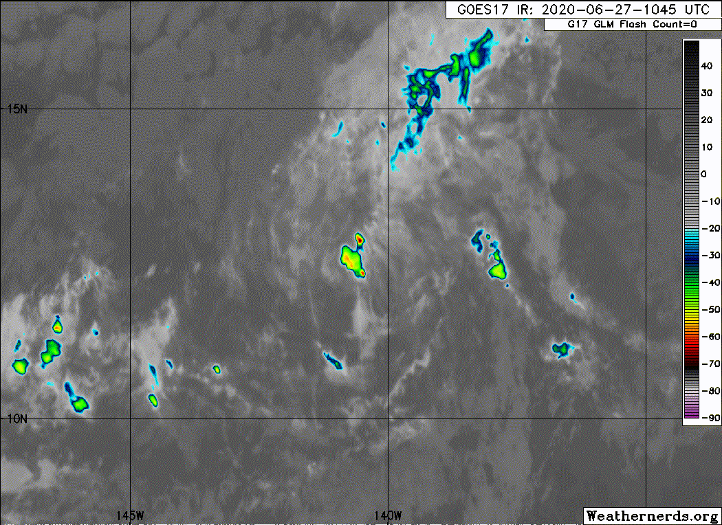
Mid- and high-level clouds that had been obscuring Boris' low-level
circulation center (LLCC) have cleared, leaving it nearly
completely exposed, despite a recent short-lived burst of
thunderstorms in the northwest quadrant. A 0710Z ASCAT-C pass and a
1110Z VIIRS image (nighttime visible) were helpful in center-
locating, adding confidence to the initial motion estimate of 270/06
kt. A blend of available analyses and intensity estimates supports
maintaining the initial intensity at 30 kt.
Boris is moving through an environment characterized by
debilitating southerly wind shear, and dry low- to mid-level
air, which should prevent significant convection from persisting
over the LLCC. Therefore, Boris will likely degenerate into a
remnant low by tomorrow, and the updated official intensity
forecast offers little change, and is in line with the intensity
consensus. As Boris weakens, guidance indicates it will be
increasingly steered by a surface high to the distant north, with a
subtle turn toward the west-southwest anticipated before dissipation
occurs early next week.
FORECAST POSITIONS AND MAX WINDS
INIT 27/1500Z 12.3N 140.7W 30 KT 35 MPH
12H 28/0000Z 12.3N 141.6W 30 KT 35 MPH
24H 28/1200Z 12.0N 143.1W 25 KT 30 MPH
36H 29/0000Z 11.5N 145.0W 25 KT 30 MPH...POST-TROP/REMNT LOW
48H 29/1200Z 10.8N 147.0W 20 KT 25 MPH...POST-TROP/REMNT LOW
60H 30/0000Z...DISSIPATED
$$
Forecaster Birchard
NWS Central Pacific Hurricane Center Honolulu HI EP032020
500 AM HST Sat Jun 27 2020
Mid- and high-level clouds that had been obscuring Boris' low-level
circulation center (LLCC) have cleared, leaving it nearly
completely exposed, despite a recent short-lived burst of
thunderstorms in the northwest quadrant. A 0710Z ASCAT-C pass and a
1110Z VIIRS image (nighttime visible) were helpful in center-
locating, adding confidence to the initial motion estimate of 270/06
kt. A blend of available analyses and intensity estimates supports
maintaining the initial intensity at 30 kt.
Boris is moving through an environment characterized by
debilitating southerly wind shear, and dry low- to mid-level
air, which should prevent significant convection from persisting
over the LLCC. Therefore, Boris will likely degenerate into a
remnant low by tomorrow, and the updated official intensity
forecast offers little change, and is in line with the intensity
consensus. As Boris weakens, guidance indicates it will be
increasingly steered by a surface high to the distant north, with a
subtle turn toward the west-southwest anticipated before dissipation
occurs early next week.
FORECAST POSITIONS AND MAX WINDS
INIT 27/1500Z 12.3N 140.7W 30 KT 35 MPH
12H 28/0000Z 12.3N 141.6W 30 KT 35 MPH
24H 28/1200Z 12.0N 143.1W 25 KT 30 MPH
36H 29/0000Z 11.5N 145.0W 25 KT 30 MPH...POST-TROP/REMNT LOW
48H 29/1200Z 10.8N 147.0W 20 KT 25 MPH...POST-TROP/REMNT LOW
60H 30/0000Z...DISSIPATED
$$
Forecaster Birchard
0 likes
Visit the Caribbean-Central America Weather Thread where you can find at first post web cams,radars
and observations from Caribbean basin members Click Here
and observations from Caribbean basin members Click Here
-
CyclonicFury

- Category 5
- Posts: 1975
- Age: 25
- Joined: Sun Jul 02, 2017 12:32 pm
- Location: NC
- Contact:
Re: EPAC: BORIS - Tropical Depression
Wow, it actually entered the CPAC in June as a decaying TD. Only the second on record for the month that is supposedly part of hurricane season for the CPAC. 
4 likes
NCSU B.S. in Meteorology Class of 2021. Tropical weather blogger at http://www.cyclonicfury.com. My forecasts and thoughts are NOT official, for official forecasts please consult the National Hurricane Center.
-
hurricanes1234
- Category 5
- Posts: 2903
- Joined: Sat Jul 28, 2012 6:19 pm
- Location: Trinidad and Tobago
Re: EPAC: BORIS - Tropical Depression
Sciencerocks wrote:https://imagizer.imageshack.com/img923/3377/elBECQ.gif
Tropical Thunderstorm Boris
1 likes
PLEASE NOTE: With the exception of information from weather agencies that I may copy and paste here, my posts will NEVER be official, since I am NOT a meteorologist. They are solely my amateur opinion, and may or may not be accurate. Therefore, please DO NOT use them as official details, particularly when making important decisions. Thank you.
Who is online
Users browsing this forum: No registered users and 63 guests